Sunday, January 30, 2011

Robledo Mountains Wilderness - Indian Springs Canyon


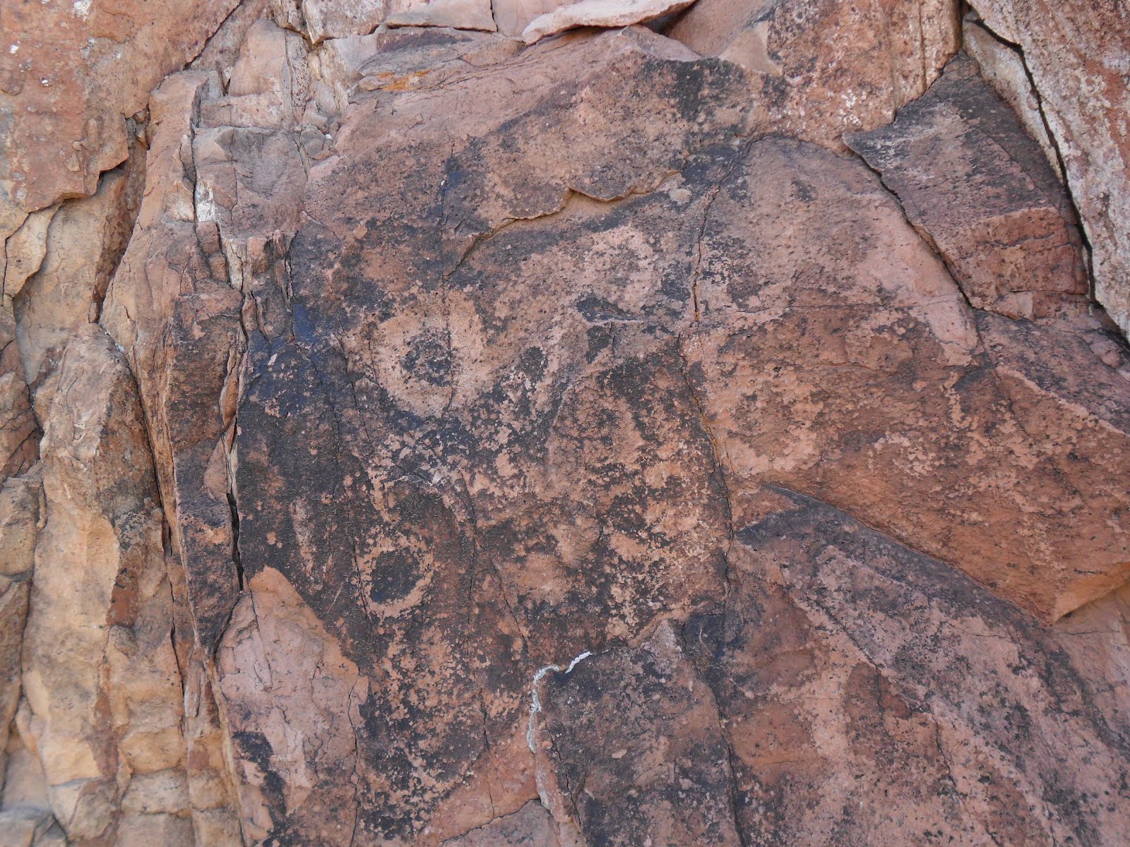
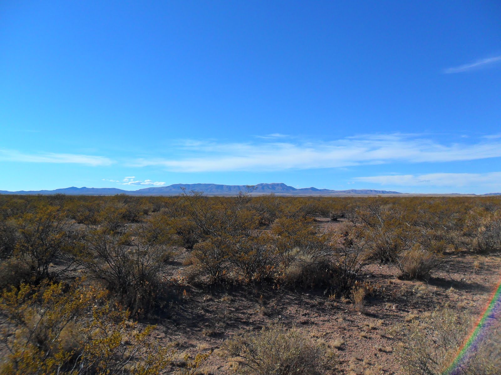
I had been wanting to do a hike to Indian Springs Canyon on the west side of the Robledos ever since my last visit to the nearby Iron Hill mines. This is probably the second largest canyon/arroyo system on the west side. There is a rock shelter with grinding holes and closely associated pictographs at Iron Hill, so I thought this large canyon so close by could contain similar evidence of earlier cultures. The last time I came here the gate at the crumbling concrete house was locked, so I had to take a six or seven mile journey on very rough road through the Rough and Ready Hills to end up about a mile further down the road I had been on. Miraculously the gate was open. I ended up parking back on the county road after having a change of heart while driving down the the very rough road to the mines. I probably could have made it,but what the hell, we( my Scottie Seamus and I) were there for the walking anyway. There was a horse trailer there and off in the distance I could see a group of folks on horseback heading toward the cave( rock shelter) and the red blotches on the hillsides that mark the hematite deposits( hence the name Iron Hill). I found an old motorcycle path. At least, I think it was created by old dirt bikes. It didn't have any recent cow or horse prints and was too narrow for anything else. It could have been an old footpath I suppose as well. It led right to Indian Springs Canyon, which is quite narrow where it leaves the mountains but soon turns into a large arroyo. I found both pictographs and petroglyphs( some so old they were barely visible) as well as grinding holes a short ways up the canyon. There were large junipers.Canyon wrens and towhees flitted about. The rough walled canyon eventually leveled out, to become a gravel wash in an area of low hills. It was a beautiful warm winter day, although the west wind became very persistent on the return walk to our truck.
Update: The road to the Iron Hill mines is in horrible condition and you must have high clearance to drive it at all. My pick-up would not have made it, but on more recent trip, a friend's super high Super Duty did. Update: The gate is always open now and you need four wheel drive once you turn off the county road.

Labels: , , , ,

Monday, January 17, 2011

Sierra de las Uvas-Organ Mountains Desert Peaks National Monument


I've hiked in these mountains many times. I've visited the well known petroglyph sites in Valles and Broad Canyons on several occasions . I've also visited a lesser known site at Apache Flats, and another one that I happened upon by accident, that I'm sure very few people know about. I've done the hike to Big White Gap a couple of times and even found one of the few remaining pinons on the southeast end of Pine Canyon.On Monday I did one of the nicest hikes I've ever done here. I started at the end of the paved road,walked a short ways to the Choases Tank and then headed west up Choases Canyon. At the saddle I picked the almost indistinguishable remains of a road that heads down to Kerr Tank. I originally planned to summit the alternative highpoint(peak 6601, only 25 feet lower than the off limits Magdalena Peak),but it looked impossibly steep from this vantage point at it's very base, so I decided I didn't have time for the seven or eight hundred foot trudge up the peak. Instead I hiked down the mostly wooded ,Kerr canyon on some good cowpaths eventually making a short ascent to the huge grassy plateau between the Mesa Azur and Sugarloaf Peak. I walked to the edge of the plateau to look into Pine Canyon,the largest valley in these mountains. There are good views here to Cookes Peak and the Florida Mountains. On the way back I found an alternate cowpath that stays out of the canyon all the way back to the tank. From there I followed the "road" I took earlier up over northwest side of Mesa Azur, where I picked up the paved road back to my truck. Beautiful day. Awesome scenery.Except for the obvious cattle gathering places,and the roads,this range is in a remarkably natural state and should be protected.

Labels: ,

Sunday, January 9, 2011

El Camino Real Trail


We hiked the two interpretative trails the BLM has installed along this section of the old Camino Real.These trails are accessed by good county roads that run between the Caballo and San Andres Mountains.This area has been known since the early colonial period as the Jornada del Muerto. The first site is about 10 miles from the Upham exit on the wide, well maintained gravel county road. There is no sign indicating the turn-off, I just happened to notice the red kiosk roof near where the powerlines cross the road. This is the Point of Rocks trail. We hiked along a rocky ridge which overlooks a large ephemeral lake bed . We extended the hike a little bit by walking down the powerline road to the lake bed itself. Another 10 miles down the road is the Yost Escarpment trail. This longer trail took us past a cattle tank up on the low escarpment to an original section of the El Camino Real. It ends at an overlook with the view towards the Spaceport ( still under construction). Note to any rockhounds: Carnelian agate can always be found in this area. Most pieces are small but sometimes chunks over 1 inch can be found. UPDATE (12/31/22): The road is completely paved now. A few petroglyphs and grinding mortars can be found in the Point of Rocks area by leaving the trail and exploring the rocky ridge and the boulders that have tumbled off of it.

Labels: ,

Broad Canyon Ranch


I went to the Broad Canyon Ranch back in November to remove barbed wire fencing as part of the ongoing restoration of this now state owned property. Eventually this former ranch along a very scenic stretch of the Rio Grande known as Selden Canyon will become a New Mexico State Park. The ranch looks like it was used pretty hard over the years,so it will be awhile before it takes on anything resembling a natural state. Still this is a beginning. In February thousands of willows are scheduled to be planted and other projects are planned throughout the year.

Wednesday, January 5, 2011

Directions to Grant Creek

Check the comments for the Grant Creek Blog for directions.