IMPORTANT UPDATE ( June, 2022): This hike is within the Black Fire burn scar and may be altered from what is pictured here.
I've been wanting to see Taylor Creek/Whitewater Canyon for many years. Once, back '04 I think, we drove over to Wall Lake ( which is fed by Taylor and Hoyt Creeks). There was a chain link fence keeping people out of an area that had once been used for camping. I guess by that time the lease agreement, allowing people to fish and camp there, between New Mexico Game and Fish and the property owner was no longer in effect. I remember the lake being very shallow and climbing down to Taylor Creek below the dam where there were thousands of huge tadpoles in the water. We drove past the area heading home from camping at Black Canyon on another trip from the pre-blog days. Fast forward to 2020, and I can't tell you exactly why this place was on my mind, except maybe seeing some beautiful photos on Facebook from another outdoor loving friend who had visited the Wall Lake area on a day trip, put the place back on my radar. I looked over the area on Google Earth soon afterward and put Taylor and Hoyt Creeks on my list of Gila places to visit. Hiking in both these canyons figured into my choosing Corduroy Canyon as a camping destination, as both creeks were relatively short drives away.


Before heading out on our camping trip ( see previous blog), I decided I needed to take the guesswork out of how best to access the creek and canyon. The private property around Wall Lake was still private and had new owners who ran a guest ranch that featured horse riding trips into the Gila National Forest with one of the premier destinations being Taylor Creek. It seemed unlikely that they were giving people access on the road through the property, but I thought I 'd call the Black Range District to see what I could find out. Nothing definite, as it turns out, although the implication was the Forest Service did not have a right of way. So I devised a route that would bypass the private property and get to the canyon bottom entirely on Gila National Forest land.
Now as it turns out definitive information had come in, right after we left. So we still didn't know for sure when we headed out on Friday (10/16/20) morning. Driving through the dappled shade of the pines along the endlessly twisting FR 150 we got to the locked gate with the private property sign about a half hour after departing the campsite in Corduroy Canyon. Now we had to backtrack to put my route into place. Back up the hill, at a deep U-shaped curve in the gray gravel road, there was enough room for parking and we set out on foot onto the piñon and juniper covered mesa. At a high point with a clearing, we could look down into the canyon.

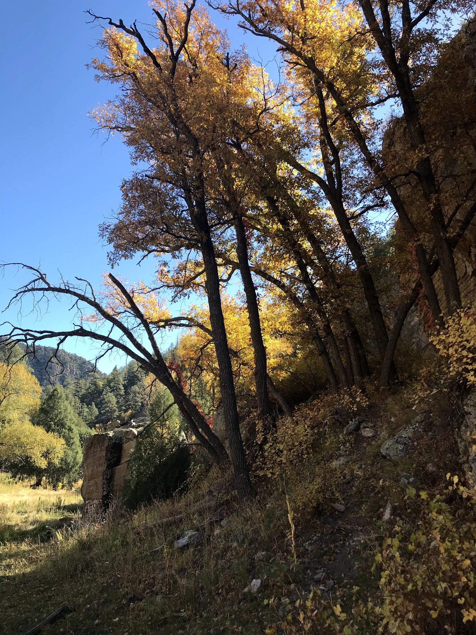
I didn't feel like it was going at all well with the first side canyon being way too rugged to descend, but we stuck with it and found a cow path ( and some cows) that took us around the upper end of that drainage and then back onto a second hill where we soon were looking down into a second side canyon. This one, I knew contained some old mining prospects and a road (!) that had serviced them that went all the way down to Taylor Creek, intersecting it at a point beyond the private property boundary. Once we caught sight of the old mining adits we headed downhill. It was a steep pitch for sure, and rocky to boot, through patches of brown grass between the conifers, but we made it down to the road and then it was easy walking to the creek. I was a little uneasy when we had to pass through an open gate in a fence line, even though I knew, using 4 different maps and my On-X app that we were at least 1000 feet away from the property line. Before reaching the bottom we could see a tall precarious looking wall built into a cave with some pine timbers lodged in the opening above it. At the bottom, I saw a man walking off to the west. There a were old corrals and cabin nearby too. None of which helped my anxiety. Even though I knew I was on the Gila NF, I was not looking for any confrontation and so I was happy to get moving to the east and leave this part of the hike behind.
The tiny spring fed meadow creek is absolute miracle in this dry country. Running clear, maybe two feet wide, and almost that deep in many places, we began to make the first of many muddy and wet crossings. The water isn't all that cold though. I saw gray forms, tadpoles and tiny fish, scurry about in the pools. Our dogs hilariously leaped for all they were worth to get across. Several times later, though, they found themselves performing a short swim.

Huge cottonwoods, plus the occasional ash, willow, and box elder provided the glowing yellows, while five leaf ivy vines winding around trunks burned a vivid red. Oaks, with their orange and gold leaves beginning to take to the air, were here and there along banks and hidden in cool recesses against the cliffs. Early on, a large alcove/cave appeared in vast cliff of crumbling conglomerate on the north side, the first of many recesses we spied. Some had still standing walls built inside them, others didn't.


It was warm as we moseyed on, but the hike was mostly in shade past the initial long meadows. The trail was easy to follow, and there were a few alternate routes that provided variety on the return walk. We looked up to rock towers high, high above the tallest pines, and looked down to the dusty ground for any artifacts left from the time of the ancient peoples who surely utilized this valley.


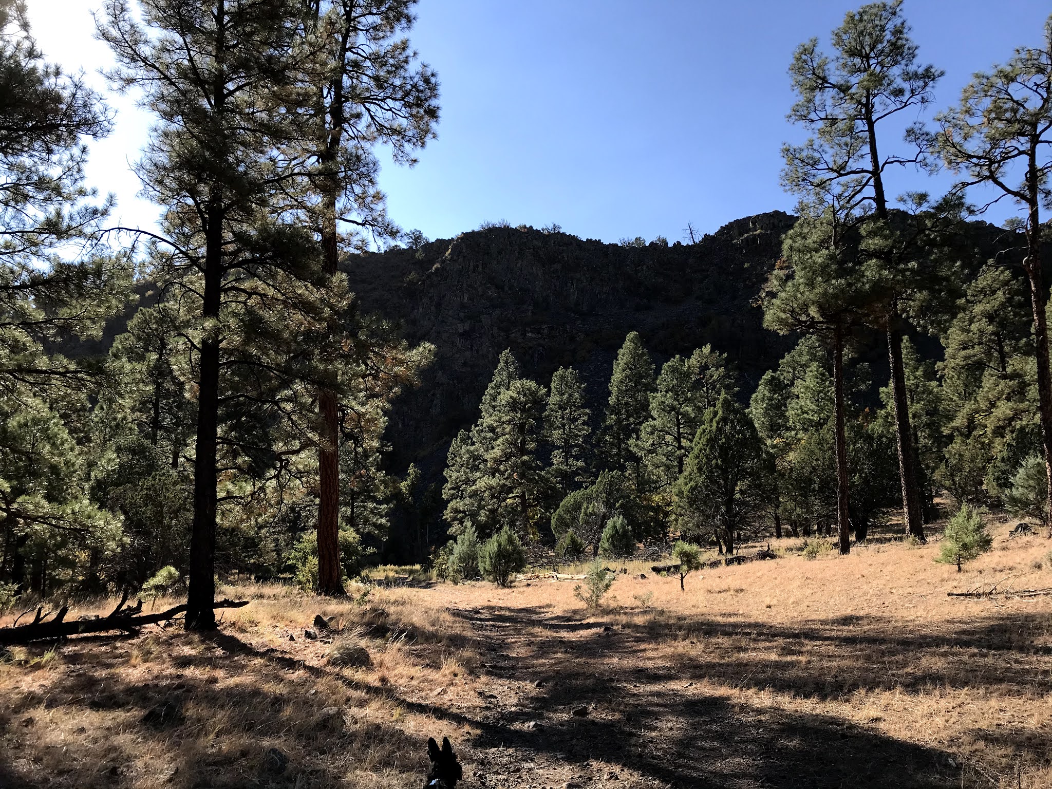
After going around several bends in the 700 foot deep canyon, we noticed the once babbling stream had become a shallow, wider slough where the water's movement was barely perceptible. Further on from there, the water disappeared altogether, replaced by bleached cobbles. The riparian species were no more as well, and we found ourselves in a more typical hot and dry Gila woodland dominated by desert junipers. We turned around.


On the return we met trail riding excursion from the guest ranch, whose horses got a bit spooked by our little group. The wrangler was sure enough surprised to see anyone in this canyon. He may have had his doubts as to how we accessed the canyon, even as I explained, but remained diplomatic, perhaps knowing that there was little to say given that we were all on public land at the moment.
We rested in the shade of a cliff and some oaks and ate our bars. We wet our shirts and I, my cap, and filled water bottles from the stream for our dogs, all in preparation for the long hot climb back to the mesa top. We made frequent stops in the meager shade of scrub oaks, piñons and junipers as we went up and up.


Overshooting our original trajectory by using the road too long, we easily corrected using On-X and found ourselves back on the cow path that had originally assisted us.We found the cows too, for which I am grateful, as running into them put a quick halt, to a jackrabbit pursuit by the Scotties that had briefly put us in a panic. Back at the 4Runner everything was good.

Early in the morning we had seen a bull elk crossing the FR 150 on our drive over. In the canyon of Taylor Creek in the heat of the day, there were only jays, juncos, and woodpeckers to liven up the scene. On ground however was evidence that this is a lively place at other times. Tracks and scat of elk, deer, bear, fox and coyote were all visible.
This place is most definitely worth trouble we took to get to it. If you are not so inclined, you can always ask the property owners for permission to pass through, the worst that will happen is they will say no, or if you like to ride horses, staying with them for few nights is an option too.


 Getting to the first horseshoe bend we entered a beautiful forest of tall pines with the colorful oaks as the understory. An actual rocky creek channel appeared in this section as well with the bright yellows of willows and boxelders along its banks. We ambled on, constantly looking up at the towering walls of the canyon with evergreens mixed in with the display of deciduous shrubs and trees. We passed gigantic talus fields made up of boulder-sized rocks. At the base of one, near the apex of an ox-bow, where it stays dark and cool most of the time, there were even a few aspens.

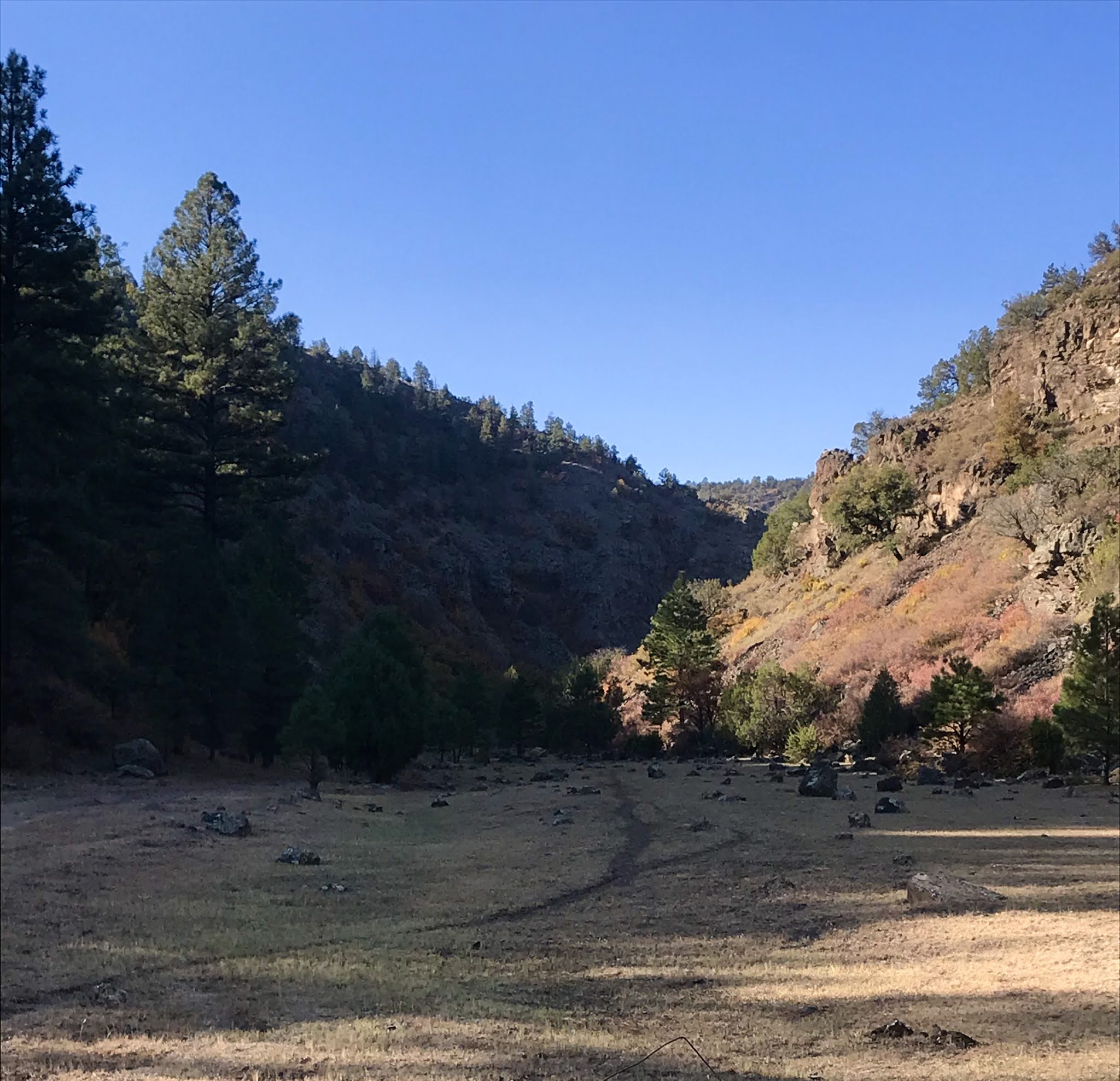
 On we walked, at times using the livestock/ wildlife path when the road got rocky. Eventually, the pines gave way to junipers and the canyon opened up, and warmed up. Just past where the road goes over a narrow finger of rock that descends low enough to surmount, cutting across a bend rather than following it, the canyon opened and flattened out into a meadow area big enough for a football stadium, we rested in the shade against the cliffs.
  I knew I did not want ruin this pleasant outing by crossing this sun- baked stretch ahead of us ( twice ), as it was getting very warm with the noon hour having arrived, so we headed back. We met one group of people, a family, out scouting for elk, but that was it, and this was a Saturday.