Wednesday, January 31, 2024

Silva Canyon - Organ Mountains-Desert Peaks National Monument

River of grass

Sierra de las Uvas in the distance

One of several rock dikes the canyon has cut through


Golden river


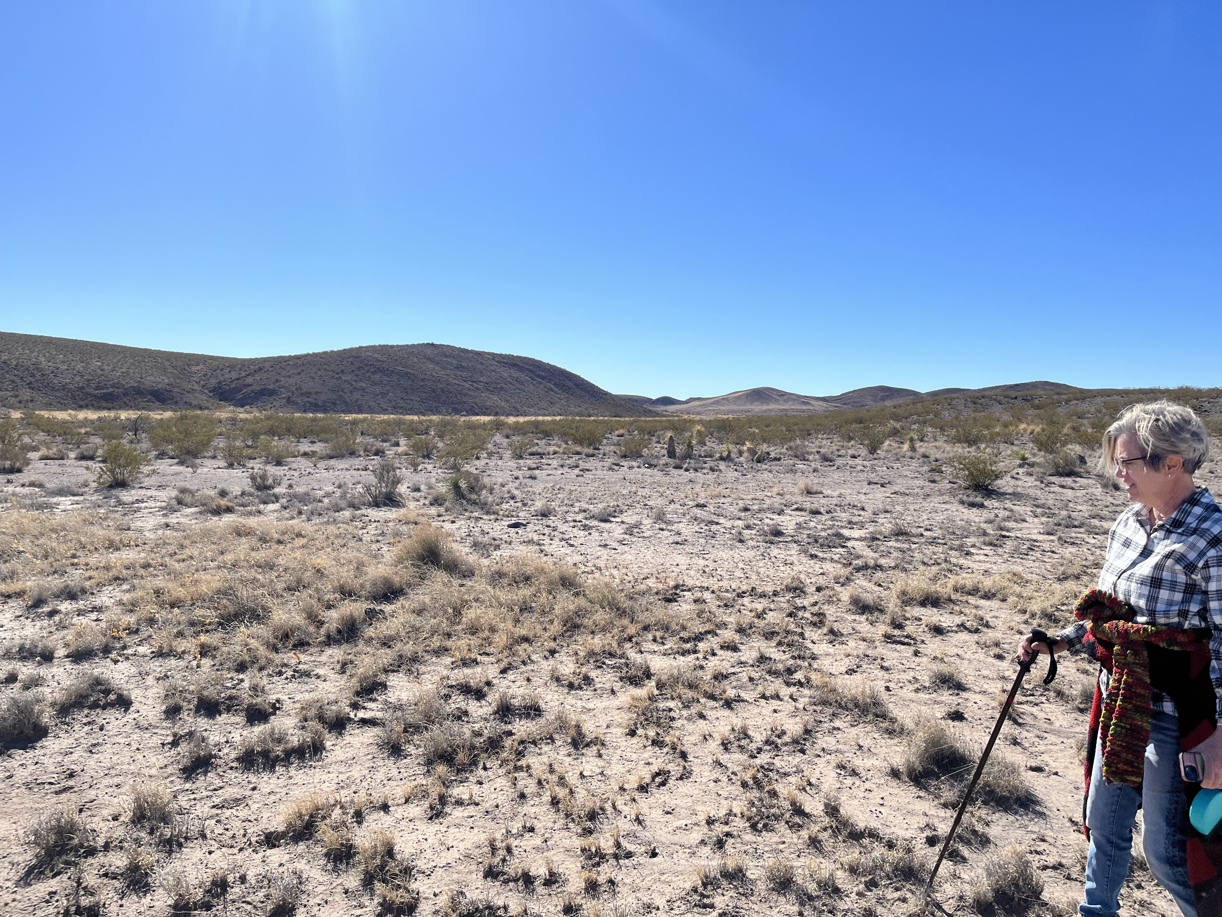
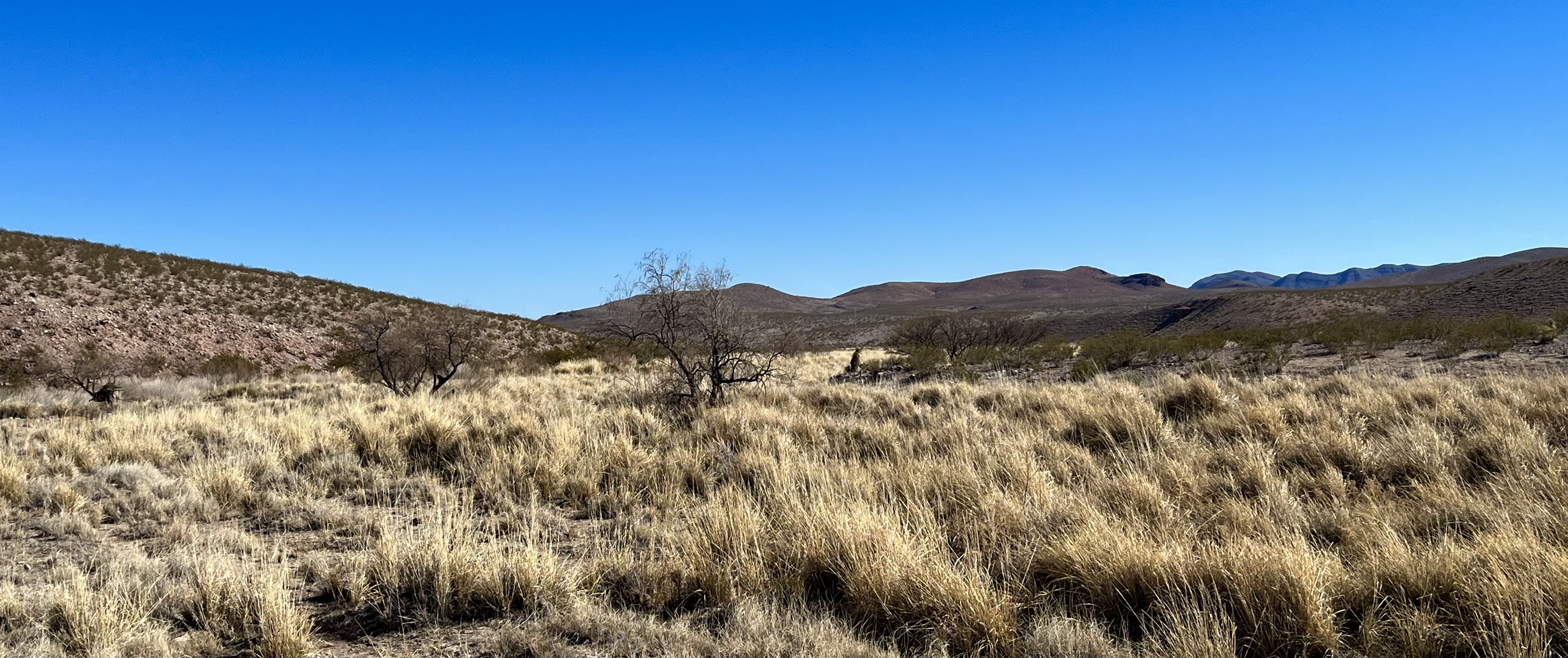
We hiked down Silva Canyon starting near the old blown out dam at Coyote Tank just off of the Corralitos Road. Silva Canyon starts out as a narrow defile cut into the bedrock higher up in the mountains, but where we were walking it is one of several wide " rivers" of grass in the Sierra de las Uvas. I'm assuming the high water table in these arroyos  allows for these tall thickets of grass to flourish. It also puts in mind, that in earlier times, these washes had even more water still, which leads me to think that they are great places to scout for signs of ancient people who traveled, camped, gathered, hunted and perhaps even farmed fertile soils along these currently ephemeral, but perhaps more reliable in the past, tributaries to the Rio Grande.

Metal pipe that ran under the dam
Bell Top Mountain in the distance

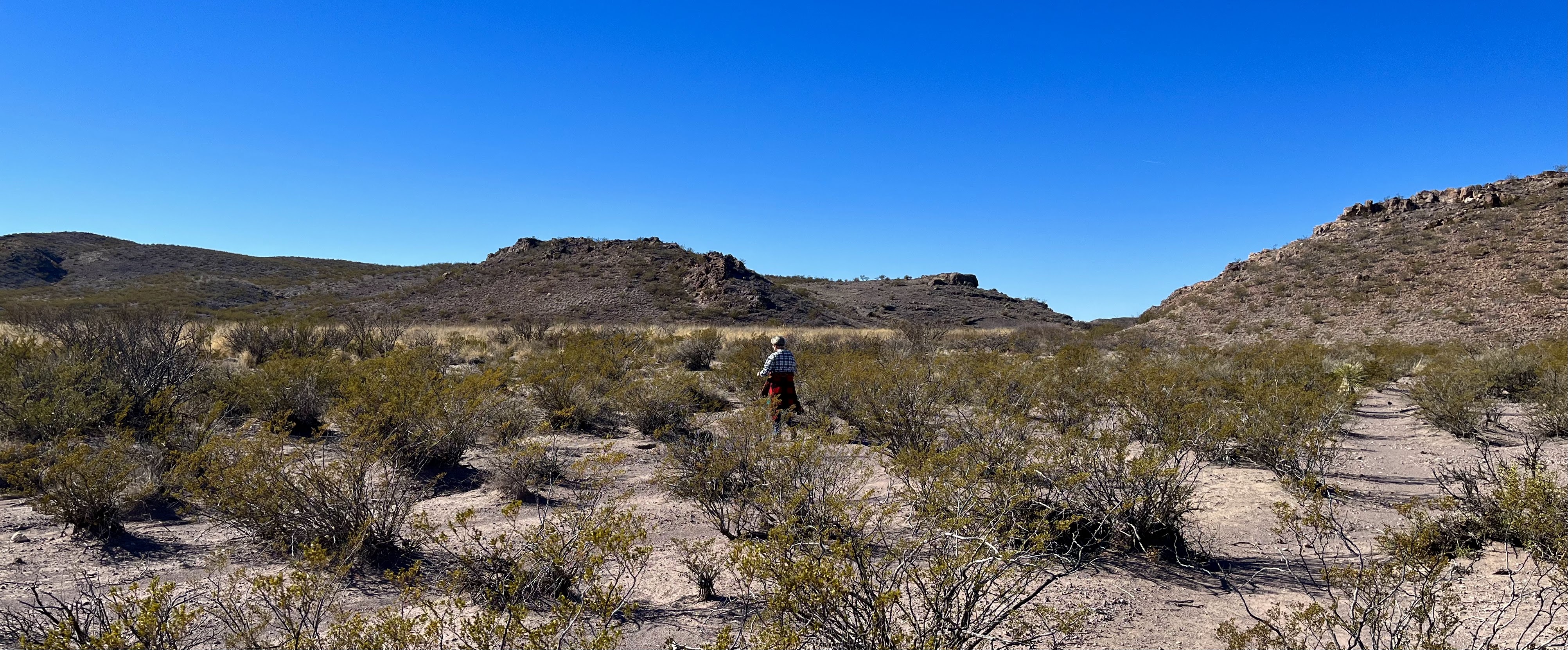
 There was a bit of wind when we got out of the car, but we soon were shedding our jackets in the warm winter sun. Near the dam are the deep erosional channels that come about when there are virtually no shrubs, trees or even grass to hold the soils in place when the occasional flash flood comes through. It was ugly, but the rest of our hike wasn't. Below the dam things become more natural. We walked down stream in the winding sand channels and tussocks of golden grass. Unfortunately, this area receives enough water to grow cockle burrs  which is not good when you have dogs. We dodged them as best we good for a while, but then came where the really thick growing grass dominates the entire channel for several miles. There is only two choices here: find the main continuous channel or skirt the edges. We did the latter. 

Just downstream of the dam

We found an alcove, that may have had a protective wall ( it was hard to tell) along the way where there was a mano and what I'm pretty sure was broken pestle, but there was little else in the way of artifacts. No sherds, no lithic flakes. 

We continued along the edges, but then we decided the dogs needed some shade which was in very short supply. We went for the main channel in the deep grass as our only option. It was alright for the dogs, but we had the long dried blades right in our faces. We decided to exit after only short ways, but getting out was kind of tough. There are so many hidden channels to get in and out of just to walk  twenty feet. We did it and then I realized, we had gotten out on the wrong side for continuing along the edges as the edge we were on quickly ran out at a narrow section of the canyon bed ahead. My wife didn't want to cross the grass again, and I didn't blame her. It's not fun. 

In the main channel

 After having our picnic, she stayed back with one dog and I continued on with other. I hadn't gotten very far when the wind really picked up . I called it day when I would have had to make yet another grass  crossing to continue.

 The wind was pretty steady and cool on the way back, but we managed okay. It was a pretty day.

Labels: ,

Saturday, January 13, 2024

Pueblo Ruins Hike - New Mexico State Trust Lands, Catron County


 We did this little hike back on December 30th, 2023. It was a warm winter day (50 degrees) and the wind was mercifully light. I have scoped out many ruins sites  within a reasonable trip from our cabin at Horse Mountain. Most are on private lands and are off limits, but some, like this one, are on State Trust Lands and a few are on BLM and Forest Service lands as well. It was a bit muddy with the snow that had been falling earlier in the week now melting in the lowlands, but we got to our destination with little problem. I had read that this was a pithouse site, but I don't think it is.  The rubble is definitely built up from what may have been more than one story of stonework and  I could definitely make out the lines of room blocks in the abundant fallen cobbles. Sherds and lithics are everywhere and it seemed that this pueblo was a similar size to the one at Gallinas Spring. I had a very strong flash, struck with the presence of the people who lived here while looking at the very human imperfections of lines painted on one sherd. It made me smile to the bottom of my soul oh so briefly and for a second or two I felt connected to something I couldn't express, nor will I ever be able to correctly express, but I will keep on trying. NOTE: visiting State Trust Lands requires a recreational permit that is available online from the State Land Commissioner. SECOND NOTE: We do not collect sherds or other artifacts. Not only is it illegal, it is wrong.


Labels: , ,

Monday, January 1, 2024

Organ Mountains-Desert Peaks National Monument- Sierra de las Uvas


Brilliant yellow lichen

 My scotties think about getting a drink


This was another hike on the long branch (arm?, tail?) that extends south for several miles from the main body of the Sierra de las Uvas. It is sometimes referred to as Magdalena Ridge probably because of Magdalena Gap, a pass where the Butterfield Trail went through.  We started at theApache Flats valley on the west side of the ridge near a windmill and cattle tank and began hiking up an old very un-maintained road. It was a little chilly at first but soon turned into a beautiful, warm and mostly windless winter day. Once on top of the ridge we left the road and crossed over to the lip of little canyon rimmed with large boulders. I had been wanting to take a look at these rocks for  awhile now, as many similar areas that border Apache Flats have petroglyphs and other archaeological evidence of past peoples.

 Massacre Peak and Florida Mountains in the distance

 Well I didn't find any of that, but the boulders were fun to explore anyway. Next we got down off the ridge to  hike part ways up a long tributary valley to the Flats. Nothing in the way of petroglyphs or artifacts was forthcoming in this area either, but we did find one oddity.  It was natural pool of water, not created by any kind of dam that I could see. We've had quite a bit of rain lately, and since the pool, didn't appear to be leaking into the arroyo bed, I assume it normally dries up solely through evaporation, which might take little while. It was hard to tell because of the murky water, but it had to be over a foot deep, maybe closer to two in some places.

The pool

 We did find a few metal artifacts along the way that were the same as ones we have found at another WW II bombing target. We didn't walk through a target area but there is one visible on Google Earth just to south of the old road we were on.

 I still want to explore the rest of that little valley and maybe  crossover to the other side and back to do a little lollipop loop, but that will have to wait for another day.

Labels: ,