North Percha Creek (FT 757) - Aldo Leopold Wilderness( Gila NF)


It's probably been close to 10 years since we hiked here last and this was either the third or fourth time we've done this trail. The last time we tried, there was no place to park past the private property and before the first creek crossing which we did not attempt in our two wheel drive truck. There was much unhappiness backing up the narrow road and turning around that day( read about it in this blog's entry for April 21, 2014 " Black Range East Side"). The first part of road was clear this past Sunday( April 17,2017) and there was enough room to park a hundred yards in or so,but I had forgotten completely about the treacherous first crossing and even though I had four wheel drive this time, I ended up doing the backing up trick again. I might've gone for it at the crossing, if my wife hadn't been with me. There is a fairly large camping and parking area on the other side, which would be the main advantage,because shortly afterward there is the second crossing which no one appears to be crossing at all, so hiking time added round trip amounts to something less than 10 minutes.
Off we went with Seamus and Nessie. The creek was flowing nicely still, which was great for Seamus who loves to get right in, but bad for little Nessie who would rather not get even her feet wet.
The streamside was delightfully overgrown with bright green bunches of willows and alder saplings, so sometimes it was easier to just step from rock to rock in the stream rather than look for a trail that wasn't there. The Silver Fire did not touch the first couple of miles. It was nice to see all the firs and pines doing well on the steep hillsides. Along the stream besides the willows and alders were fully leafed out chokecherry, box elder and walnut. At the big horseshoe bend where you realize you're in canyon about a 1,000 feet deep there is small waterfall and every pool above it, as elsewhere in the stream, was alive with insects both on and below the surface of the crystal clear water.


Past the Virginia Mine the old road becomes easier to follow on the benches in the much widened stream valley. It was easy walking on rapidly disappearing tread that continued through grassy clearings and beneath shady conifers.

There is nothing left of the large wooden building that I photographed almost 15 years ago, except for the sheets of tin that were once its roof and parts of an old woodstove. It had collapsed on subsequent trip, and now there's not even a a trace of old dried lumber which was surely instantly turned to ash and blown on the breeze as stringers from the Silver Fire made their way down the mountain.Another nearby building that's built into the hillside and still had its glass window and tin roof back then is just the cobblestone walls now.

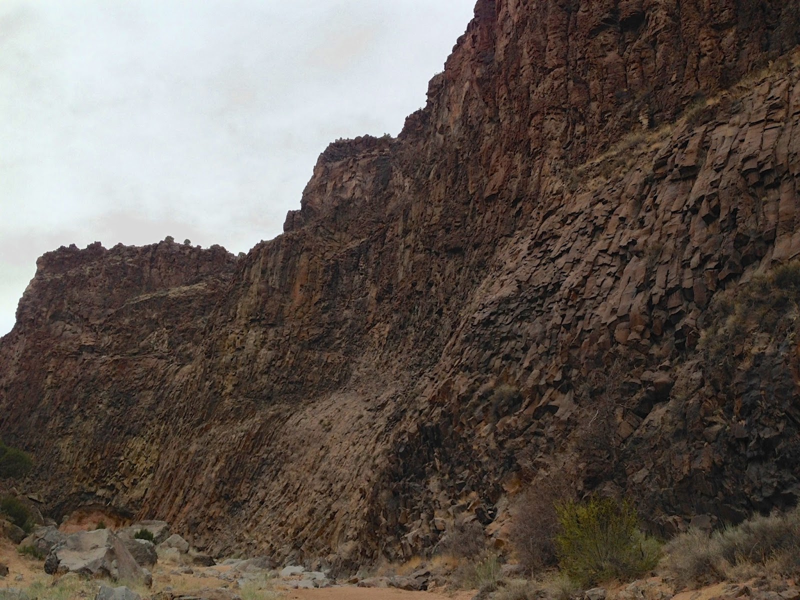
Effects of the fire are most obvious as we approached the gorge. Where once a lush forest concealed all but the tops of the 500 foot high cliffs of bare igneous rock from view, now the entire buttress of stone that is the north wall is visible from quite a ways back. There are surviving trees however, so the view isn't entirely bleak ( see my blog " North Percha Creek" from 5/26/10 to compare images).


The gorge is one of the most spectacular places that I know of in the Black Range,and making it even better, as if in confirmation of how special this place is, are ancient pictographs below overhanging walls at the base of the cliffs.


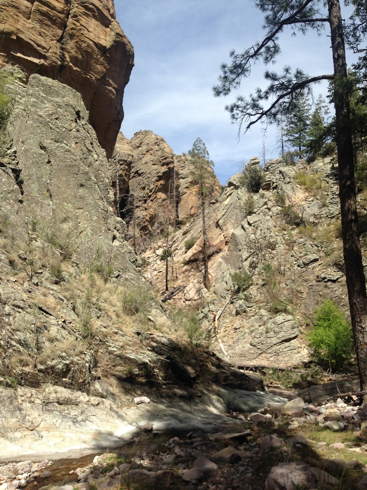
As we walked further up the narrow canyon, I spied a tom turkey walking up the steep hillside on my left. Seamus clued in, and even as I tried to discourage him, went in pursuit. Well, we were all more than a bit surprised when this huge bird took to the air and flew over our heads back down the canyon. The stream runs over bedrock through most of this section and I was hoping to see a little cascade further upstream I remembered from years ago but, we turned around before finding it. Walking back, with our necks craning at the immense rock towers on either side of the canyon, we took many photographs, but I knew that none would really do this place justice. You would need much better photography equipment, but really it's better to just be there.


There is nothing left of the large wooden building that I photographed almost 15 years ago, except for the sheets of tin that were once its roof and parts of an old woodstove. It had collapsed on subsequent trip, and now there's not even a a trace of old dried lumber which was surely instantly turned to ash and blown on the breeze as stringers from the Silver Fire made their way down the mountain.Another nearby building that's built into the hillside and still had its glass window and tin roof back then is just the cobblestone walls now.

Effects of the fire are most obvious as we approached the gorge. Where once a lush forest concealed all but the tops of the 500 foot high cliffs of bare igneous rock from view, now the entire buttress of stone that is the north wall is visible from quite a ways back. There are surviving trees however, so the view isn't entirely bleak ( see my blog " North Percha Creek" from 5/26/10 to compare images).


The gorge is one of the most spectacular places that I know of in the Black Range,and making it even better, as if in confirmation of how special this place is, are ancient pictographs below overhanging walls at the base of the cliffs.


As we walked further up the narrow canyon, I spied a tom turkey walking up the steep hillside on my left. Seamus clued in, and even as I tried to discourage him, went in pursuit. Well, we were all more than a bit surprised when this huge bird took to the air and flew over our heads back down the canyon. The stream runs over bedrock through most of this section and I was hoping to see a little cascade further upstream I remembered from years ago but, we turned around before finding it. Walking back, with our necks craning at the immense rock towers on either side of the canyon, we took many photographs, but I knew that none would really do this place justice. You would need much better photography equipment, but really it's better to just be there.


Labels: ghost towns, hiking, pictographs
posted by Devon Fletcher at
4:43 PM
7 Comments
![]()
![]()