Cleofas Canyon- Doña Ana Mountains


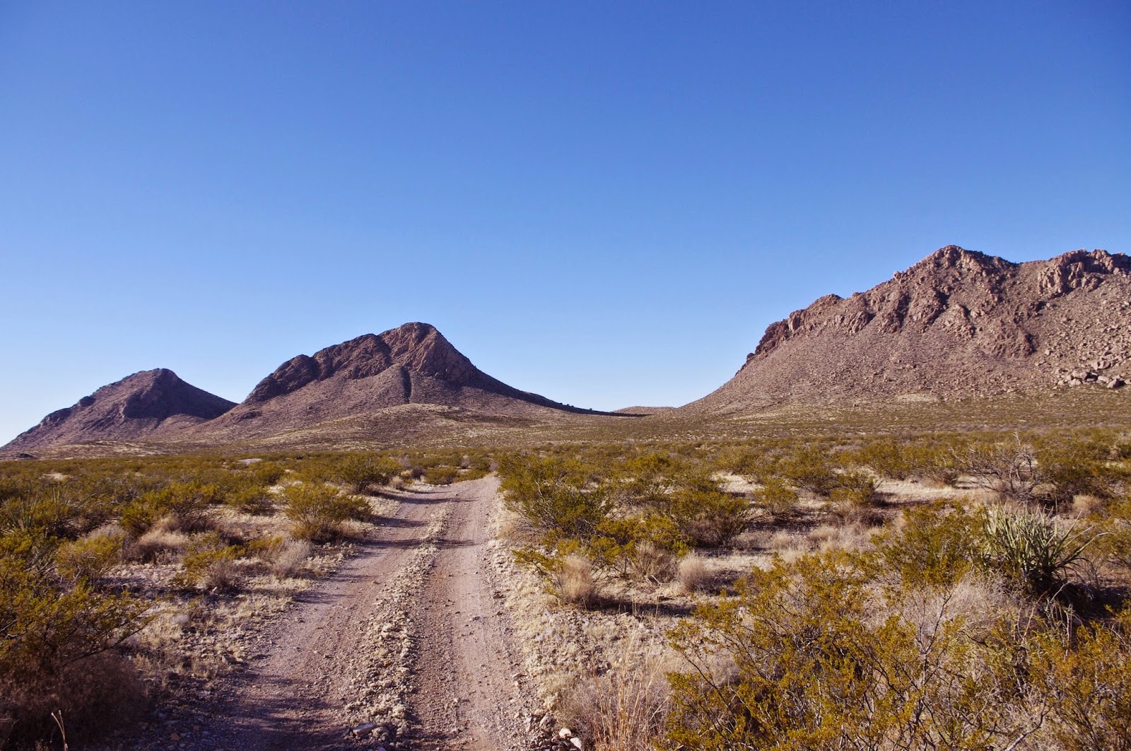
After my experience on the east side of the Dona Anas, I decided I would try to access Cleofas Canyon from its lower end on the west side of the range.
I thought I had the vehicle access all worked out using topo maps and Google Earth. Of course on the ground things always look different. I drove up one road that dead- ended at a power line tower. I turned around at another where the gravel looked very deep and loose. Another road seemed like it could be okay but someone in a blue truck was parked on it (most of these roads out here barely qualify as one lane). What they were doing, or preparing to do, I don't know, but I didn't want to interrupt. So I parked the truck and headed out on foot.


 Finally arriving near the top of both canyons, I cut over to the north into what I knew from my previous week's hike, to be the top end of Cleofas. Now time was of the essence. We moved quickly, while still stopping to investigate the few likely looking spots for rock art. There are many boxy sections in Cleofas Canyon,with many rocky cliffs, however, most of the rock is of grayish andesitic type where there has been little or no build up of the brownish patina of desert varnish. Much of it is simply too rough as well, lacking flat or smooth surfaces to work upon.
Near the old well site. I found one small panel with three heavily re-patinated glyphs. There was an old water trough( perhaps at one time containing water fed from a spring) built in 1935 by CCC labor, and an old foundation on the other side of the arroyo here as well. A little further on was the windmill( now on its side and mostly concealed by brush) and the water storage tank.


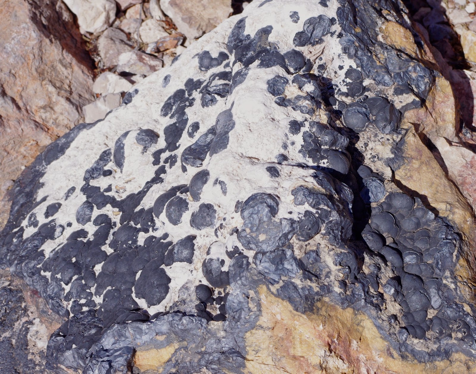
On we went, investigating the cliffs, bedrock( for mortars) and boulders as much as our now hurried circumstances would allow. Along the way there was what appears to be at least one active seep with wet sand and icy puddles in the bedrock,although I suppose the water could just be lingering from storms from the previous week.
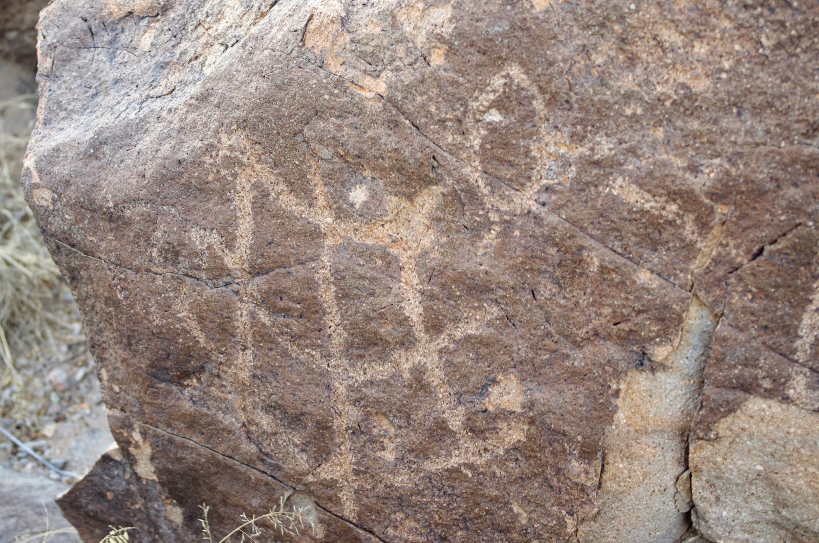
I despaired of finding anything more in the way of rock art, when I turned my head, looking slightly behind me, an afterthought really, to some reddish looking bedrock and boulders partially concealed by brush,that sat in the middle of the wide arroyo. There I saw the first petroglyph clear as could be. I photographed at length in the fading light. Knowing now that I would be trudging back to the truck in the dark. Also knowing that had I gone up the right canyon in the first place this would have been a much less lengthy excursion by far. Still I was happy to have found this ancient art. It's an easy one to miss. People visit here, as evidenced by the skeet shooting debris, but they may very well have overlooked the rock art, such is the nature of this site.

I leashed up Seamus, after seeing a coyote up ahead. We found the road leading out of the canyon,that I originally intended to take, and hiked it all the way back to the truck. To my partial chagrin, it was quite drivable the entire way. It had been a long walk,but it felt good to be exploring the Doña Anas again. Two canyons for the price of one. Note: this entire hike is on NMSU property.While it is obvious from recent trash and tread marks that this area receives use from the public, it may be advisable to check with NMSU regarding their policy for this area.
UPDATE: I passed through this area again on 2/23/19 and got chance to photograph a few more petroglyphs, some in the stream course bedrock and boulders and and some on boulders on a small hill just to south. There has been quite a bit of digging up on the hill, and one hole gave me the impression that a boulder( perhaps with rock art) had been removed.


I despaired of finding anything more in the way of rock art, when I turned my head, looking slightly behind me, an afterthought really, to some reddish looking bedrock and boulders partially concealed by brush,that sat in the middle of the wide arroyo. There I saw the first petroglyph clear as could be. I photographed at length in the fading light. Knowing now that I would be trudging back to the truck in the dark. Also knowing that had I gone up the right canyon in the first place this would have been a much less lengthy excursion by far. Still I was happy to have found this ancient art. It's an easy one to miss. People visit here, as evidenced by the skeet shooting debris, but they may very well have overlooked the rock art, such is the nature of this site.
I leashed up Seamus, after seeing a coyote up ahead. We found the road leading out of the canyon,that I originally intended to take, and hiked it all the way back to the truck. To my partial chagrin, it was quite drivable the entire way. It had been a long walk,but it felt good to be exploring the Doña Anas again. Two canyons for the price of one. Note: this entire hike is on NMSU property.While it is obvious from recent trash and tread marks that this area receives use from the public, it may be advisable to check with NMSU regarding their policy for this area.
UPDATE: I passed through this area again on 2/23/19 and got chance to photograph a few more petroglyphs, some in the stream course bedrock and boulders and and some on boulders on a small hill just to south. There has been quite a bit of digging up on the hill, and one hole gave me the impression that a boulder( perhaps with rock art) had been removed.


Labels: hiking, petroglyphs
posted by Devon Fletcher at
3:45 PM
2 Comments
![]()
![]()