Tuesday, November 24, 2020

Broad Canyon Ranch ( NM State Parks property)


Last winter, I walked through this little remnant of bosque, with its cottonwoods, netleaf hackberries and screwbean mesquite, on my way to a hike on the other side of the river. I thought it would be nice to return here in the fall, and so that's what we  did on a very warm November afternoon a little over a week ago. We parked at the gate across from the Broad Canyon Dam and then walked down the road, which is the boundary between private lands and the NM State Parks property which, although acquired around 10 years ago is still not a state park, although it would make lovely  one. Someday.


 One new thing of note came into  view shortly after the road goes up on the levee. A sign posted by the International Boundary and Water Commission declares the area closed to all uses.  Put off, we stopped. While we were standing there, contemplating our next move, a jogger passed us, then a woman who had been frog gigging. Down by the river, ATVs were heading up the outlet of Buckle Bar Canyon and then over the railroad tracks and up the canyon itself. Hmm. . . not too many people paying attention to the sign. If you are worried about it though, just turn to south before the roads goes on the levee and then follow the foot of the mesa where you will pick up the remains of another road, or go up on the mesa itself where there are ravines to work your back down to the bottom. In either case you will avoid trespassing on that mean old International Boundary and Water Commission's sliver of property.

We walked on the old road/path through heavy vegetation, admiring the cliffs along river and the fall colors close at hand. 

As we got closer to the old ranch entrance and the highway, we abruptly turned back northwestward deciding to go over  a couple of hills of dark volcanic rock to return to our car. Not much to report from up there. We found one little rectangular enclosure someone had built with the loose rock that seemed to be of a fairly recent vintage.

 Close at hand was another square enclosure of rock that was definitely much older.  The land ownership switches to BLM through here, as walked down a small arroyo and then back up the taller hill. On top  there was the usual rock pile. We had to descend to the little mesa on the east from where we carefully made our down a steep ravine of loose rock, to keep on a direct line back to the 4Runner. Worse ways to spend lazy Fall Sunday.

Labels: ,

Tuesday, November 10, 2020

Gila National Forest - Upper Bull Trap Canyon


A stupidly steep and slippery section of trail
 my wife found particularly daunting.


In the summer ( 8/20 ) I had intended to carry out a plan to visit the upstream portion of Bull Trap Canyon that I had been thinking of ever since I hiked a couple of miles of the canyon downstream to the Silver Creek confluence back in 2017.  Accidentally, at first, I went in not on the more well-established trail I had used back then. Instead, I bushwhacked my over the ridge and ended up exploring the length of a separate branch of Bull Trap but not the main canyon itself. Since I've covered most of this hike already twice. There isn't too much new to report, except that the trail that begins in Lower Gallinas Campground ( still closed) appears to be getting some use now, by both foot travelers and folks on horseback. It also appears that they may be removing the vault toilets from the campground. Heavy machinery had been used to dig a trench around the one furthest from NM 152, exposing the huge concrete base it sits on.

 As I've mentioned before this once rustic camping area is slowly, but surely, be reclaimed by the forest since its closing in 2013 and is a lovely place to walk a couple of miles for a short outing. It is my hope now that they never re-open it, unless perhaps as some sort of hike-in, or ride( horses) in facility with very limited capacity.

 Upper Bull Trap was nice enough. Early on, after some easy walking in the widest section of the canyon, where widely spaced ponderosa pines grow on low banks, we had to climb a small hill to go around a narrow, rocky section with a concrete dam. 

 There was even bit of water oozing through the grass and onto the rocks below it. It was then easy walking again,  criss-crossing the grassy benches, weaving through the alligator junipers and the oaks for a short ways until the canyon constricted again at another bedrock section with a couple of potholes filled with water several feet deep.

  A mountain chickadee flitted from branch to branch above us as we enjoyed our picnic in this cool recess. Afterwards, my wife and dogs opted out of  scrambling through the pothole section ( there was no other way around), while I explored further upstream.  Above the narrow passage, the stream channel was much smaller,  only slightly bigger than the tributary I'd explored in the summer, although considerably  deeper with massive lichen crusted bedrock walls on the north facing canyon sides. On the steep hills above, leading up to the top of Haystack Mountain, low growing, but colorful oaks  grew beneath skinny pines.

 Along the stream there was an  abundance of willow growth, which told me this section holds water for long periods. I bounced along in the much rockier dry creek for little while, but the tight passage was requiring more maneuvering than I had expected and slowing me down. I had planned to walk quite a bit farther, but now with the rest of my crew waiting, and after perhaps only a half mile of solo scrambling, I turned around where a good sized side canyon comes in from the north.

 My new plan is now to get to the middle section of Silver Creek from Bull Trap lower down where the trail comes in, go upstream and then cross back over somewhere in the vicinity of the Mineral Mountain Mine.

Labels: ,

Monday, November 2, 2020

Cibola National Forest - San Mateo Mountains, Cold Spring Canyon


My original plan three years ago was to do a loop hike to cover the deepest box canyon sections of East Red, Deep and Cold Spring Canyon on the east side of the San Mateo Mountains. Well the first obstacle to that, I found out quickly enough, was the lower section of Cold Spring almost to its confluence with East Red is in the midst of a quarter section of private property, which would necessitate climbing out of the canyon to avoid, and really defeat the whole purpose of the loop idea.

Next I thought about doing an out and back of East Red and Deep, but the first time I went, I parked a little too far back, and it was July, so all I ended up doing was East Red's box. A year later I parked closer and went through East Red again and then turned to explore a couple of miles up Deep Canyon. It was the summer again, but it was tolerable.

 On Saturday ( 10/24/20 ), I went to Cold Spring Canyon which is also a tributary of East Red and is just to the east of Deep Canyon. I hiked a 2 and a half mile segment of the box section in between two private inholdings, and left the upstream segment, which is where the actual Cold Spring Trail ( FT 87 ) is, for another day.

 I got to my trailhead,  by turning off of FR 332 onto a nearly hidden two track, which used be FR 972, most of which is closed to vehicles now.  I parked after less than a 1/4 mile beyond on a level bench where there was an old metal livestock drinking tank and a huge, riveted molasses container. It was about 9:45 when I began walking down the hill past the "Road Closed" gate down to a second level bench where the road then continues on all the way down to the bottom of the canyon. 


Only I didn't see it. The continuation of the road that is. I looked all around, but didn't find it. Plan B. I scrambled down a  rough ravine, weaving through the piñons and got to the bottom anyway. There was a remnant of the road when I got there, and I began to follow it, until I realized it was taking me the wrong way. I turned back and soon found a green 50 gallon drum with some rubber hose going in and out of it. The whole scene, once part of a water delivery system, was bone dry. 

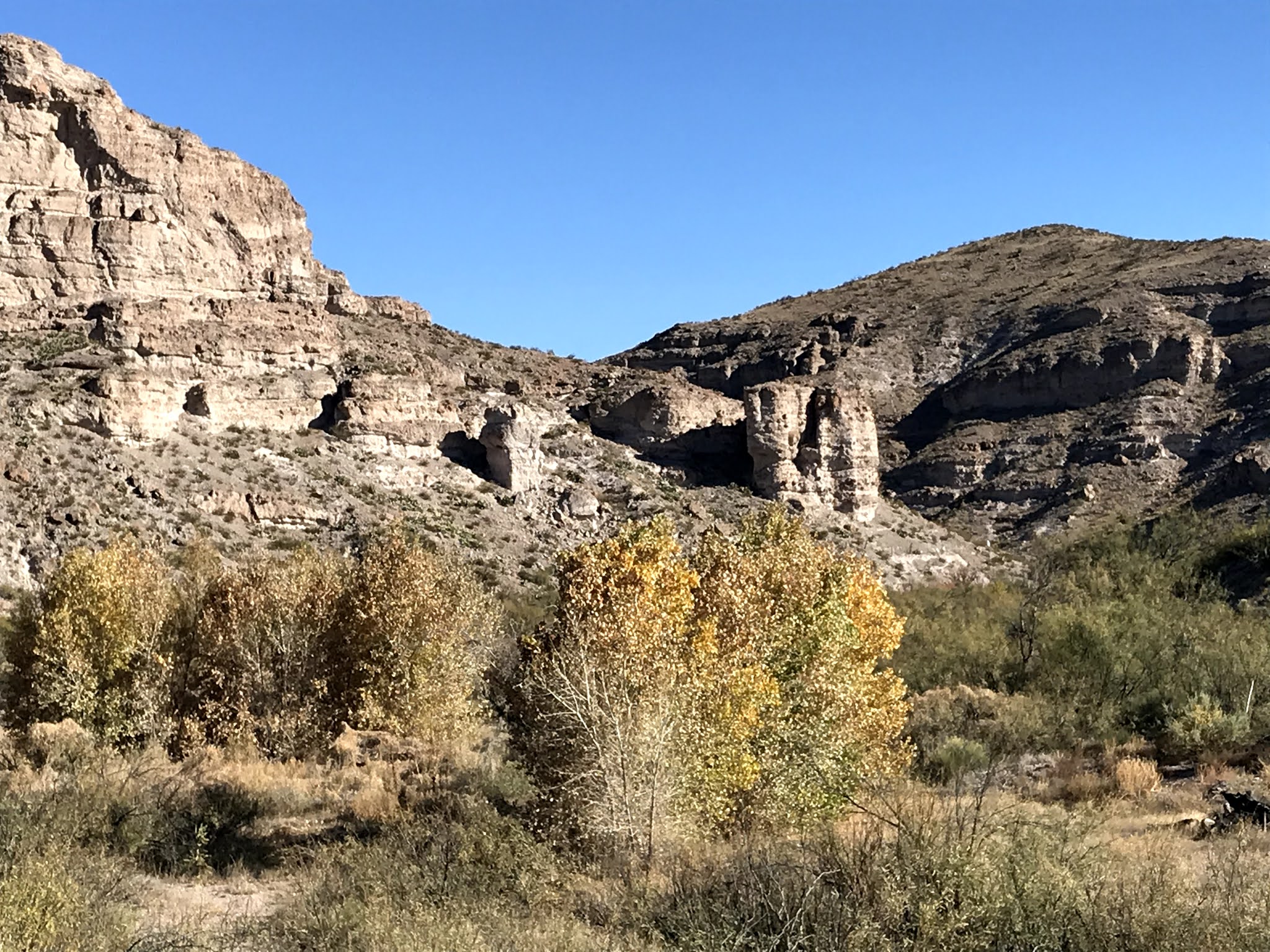
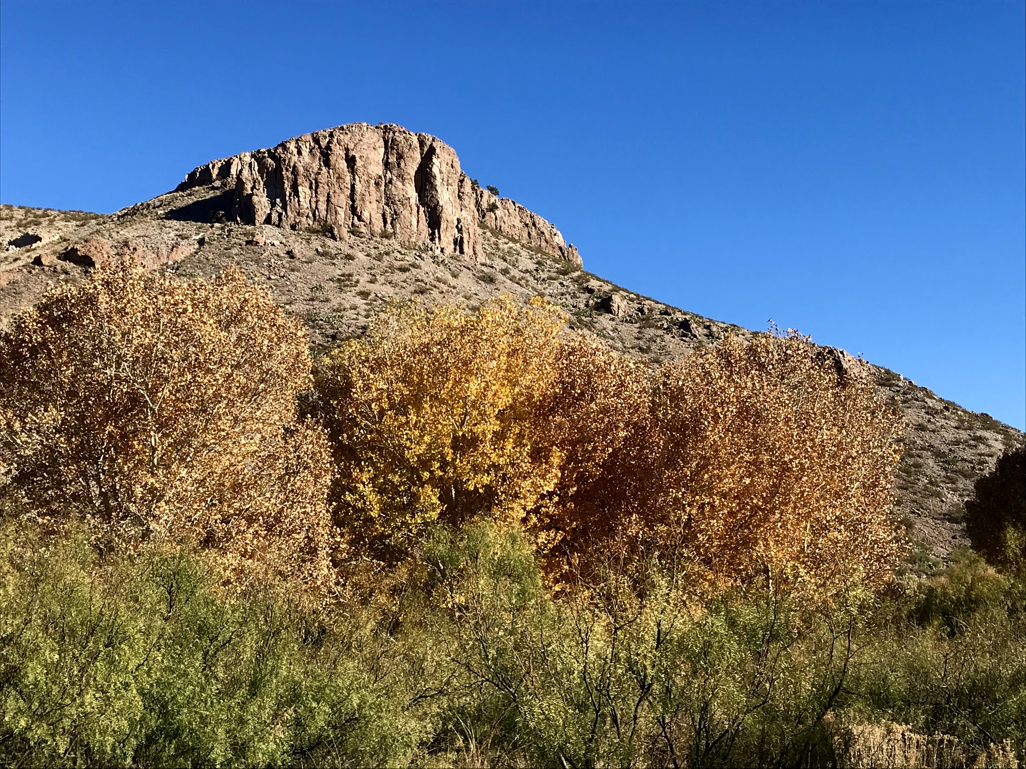
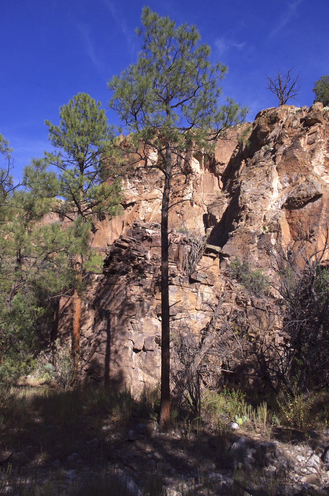
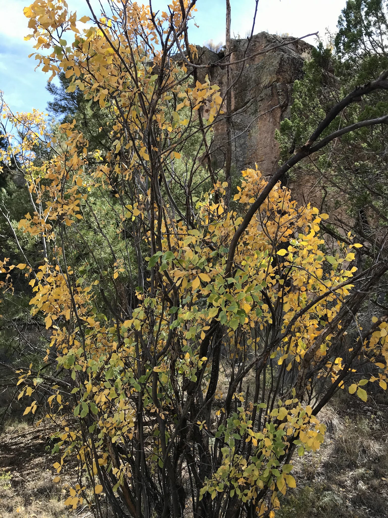
One thing that was immediately different about Cold Spring Canyon is that  it is more like a lower elevation forest environment. There were tall ponderosas, alligator junipers  and even a few deciduous oaks. East Red and Deep Canyon's more sparse and low growing vegetation made them feel more like the desert( of course the fact that I hiked both of those in the summer may have something to do with it also). Cold Spring Canyon has many springs both upstream and downstream, although none in the stretch that I hiked, so there may be an unseen underground flow, which could account for the greater plant diversity. 

 I walked on down a livestock/wildlife path, with the wildlife users being mainly bears it would seem, as their scat was frequently encountered on the trail. 

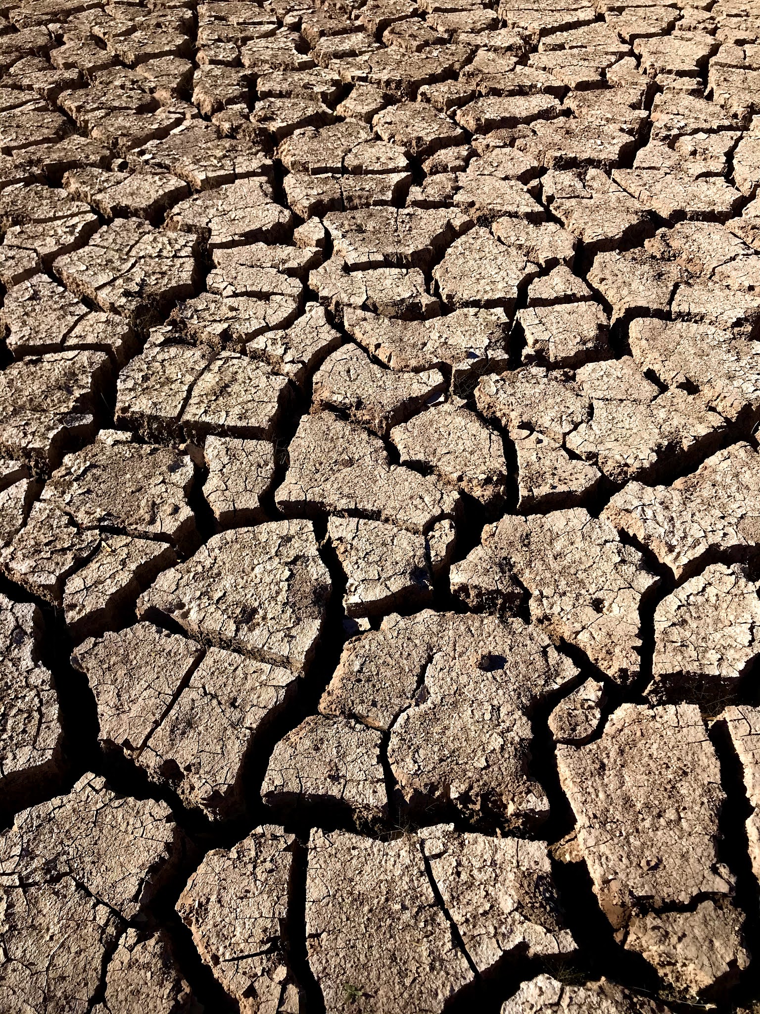
The cliffs in browns and tans rose up two hundred feet above me. Talus fields of boulders sloped down to the innermost channel, a sort of mini- canyon thirty feet deep that would appear intermittently. 

Walnut trees, most in sad shape, a very few cottonwoods and sumac provided a small splash of fall color here and there. I ambled on mostly on the path  through the dried grass and weeds, but occasionally bushwhacking through the shrubbery.

 Unlike East Red, but similar to Deep Canyon, I found no artifacts on ground, and the alcoves I investigated turned up nothing as well. I've heard there is at least one cave in Cold Spring that does have evidence of ancient inhabitants, but it is further downstream on the private property.

Still, this was a very pleasant autumn trek. The canyon, although less deep, and perhaps less impressive than Deep or East Red, had steady views of beautiful  canyon sides for nearly the entire length of the hike I did, with the fall light and shadow show making magic even in the middle of the day.

 I began to use the tracker on my On-X app so I would know when I reached the private property inholding boundary. It worked well. Just past where some huge boulders had calved from the cliffs, and precisely where my app showed me to be reaching the red line used to indicate private land, I came to a wire fence with green wooden posts that was to be my turnaround point.

 On the way back, since I was making good time, I decided I would find the segment of the road I couldn't in the morning. I walked past where I had reached the bottom earlier, and soon found a very faint two track. Shortly, after a crossing or two of the dry streambed, I looked to left and there was the rocky road segment, clear as can be, cutting up the hillside.

 I walked on just little farther to the boundary with the upper section of private property ( where there is no fence) and backtracked and climbed out on the recently found road. When I got to the top of that first bench, I still couldn't figure out how exactly I missed it in the morning.

Labels: , ,