Friday, February 26, 2021

Good Sight Mountains Walkabout


 David Soules
1957-2021


The explorer at a corner marker placed by the USGS survey


This hike mostly covered ground I've been over from a hike back in December (see Goodsight Well Canyon blog), and another hike I did several years ago (see Good Sight Mountains blog January 2018). As always there were new things to find even in familiar places, but we hiked up a new (for all of us) canyon as well. It was short but sweet. I explored  a huge alcove in its lower reaches right before it empties out into the vast flatlands on the west side of the range. Upstream were cliffs and the enormous boulders they've calved, and on these same north facing slopes were pockets of small soapberry trees.

Yours truly is the tiny figure between the boulders
Clumps of soapberry trees beneath the cliffs

We headed toward a very narrow, rocky passage and found a little water from last week's snows in a small pool and then climbed through, up to a saddle in the hills.

 After splitting up with my companions I ended up having a hard fall on the loose cobbles weathering out of the cement-like matrix of the conglomerate rock. I had wanted to explore an alcove I had left for another day back in 2017, but when I met up with the very stoutly constructed metal-posted barbed wire fence, which even had fence posts strung along the bottom, my desire cooled rapidly. Tired and bruised as I was, I couldn't wrap mind around the added degree of difficulty this fence was presenting. I've gotten through it before but that was at the beginning of a hike and on relatively flat ground, which I guess I could've backtracked to. I was done. It will be left again for another day, or never. 

MUCH THANKS to  David and Nancy Soules for the photos for this blog. I left camera at home and phone in the truck.

NOTE: As always be respectful when passing through any parcels of private land in the Good Sight Mountains. Also, it's a nice idea to have a New Mexico State Trust Lands recreation permit as there is quite a bit of state land mixed in with the BLM out here.

Labels: , , , ,

Tuesday, February 23, 2021

Doña Ana Mountains - Organ Mountains-Desert Peaks National Monument


I did a short outing to the Doña Ana Mountains unit of OMDPNM on Saturday morning. Not a whole lot to report, except for some garish graffiti on some boulders along the powerline road, and, once I had gotten away from that sight, I was happy to find another very scenic nook in what I always find is a very scenic little group of desert mountains.

Climbing up a steep ravine to  a pass that overlooks the Rio Grande valley, there were twisted ancient junipers and mule deer trails tucked beneath the shadows of towers and cliffs. Sliding back down  while using  the two sticks  that had aided me  in my ascent , I realized it was even steeper than I had thought, and nearly had sit down and scoot to manage on the slippery gravel. As it turns out it was about a 400 foot elevation change in less than a 1/2 mile.

Along the way up and on the way back down, I wandered around the boulders and  inspected the ground fruitlessly for some artifact, grinding hole or petroglyph in my quest to find some significant evidence of ancient peoples on the national monument lands of the Doña Anas. I've been thinking, the rest of the  range is blessed with so much,  so there's bound to be something to find on the BLM lands, but so far not a lot.

 One frustrating aspect of looking for artifacts here is that there are several rock types that are dead ringers for common types of plain pottery sherds found in our region. After reaching down and picking them up for about the 20th time, only to be fooled again, I just stopped looking.

 It was nice to be out in the blue skies and warm breezes.

Labels: , ,

Tuesday, February 16, 2021

Buckle Bar Canyon 2021 - Selden Hills


The first time we went to Buckle Bar Canyon was quite a few years ago, long before the blog, and long before I even cared about taking photos of the places I went in the desert. We parked on the east side of I-25 near Selden Well and, walking under the highway made our way on through the deep sand onto the old roads that lead down the canyon to the large excavation site in the side of a hill. That was it, we returned and left the lower miles of the canyon for another day.

If you read this blog,  you may know that several times since then I've explored the lower 1/2 mile of Buckle Bar,  the north and south side canyons there, and have used the first parallel arroyo on the south side to access other trips into the Selden Hills, but I've never have looked at the middle reaches of Buckle Bar itself. I have gone up and down the lengths( or nearly so) of other nameless side canyons all along the Selden Canyon stretch of the Rio Grande, but left a mile and a half of largest of them ( Buckle Bar) unexplored.

Saturday afternoon, I went out with friends to remedy this situation and see what we could find. We parked in my usual spot for starting hikes in this area right at the yellow gate across from Broad Canyon Dam, but I'm recommending from now on, due to hastily posted No Trespassing signs on the nearby fence ( similar to the ones posted at the Slot Canyon gate in 2019) and International Boundary Waters Commission's hostile signage as well that it might be better to park further south and climb over the hills on BLM land or use the old Broad Canyon Ranch entrance ( NM State Parks Land) to get to the mouth of Buckle Bar.

 After putting hundreds of  ducks to flight, we rock-hopped across a flowing stretch of the very, very shallow river ( as it always is in Winter) and then began our march up the sand and gravel. The cliffs of bouldery conglomerate of the lower canyon are always wonderful to see, but soon we were in the monotony of a " canyon" that is more like what they call in other parts of the west "a wash."

 We finally got to where the canyon narrowed considerably and and a variety of rock outcroppings began to appear again. There were volcanics,  a bit of very sharp silicified limestone, and more conglomerate. Some of the rock  was cinders heavily coated by what appeared to either  dark iron or manganese mineral ( or both). I found a dry waterfall through shifting rock types with many small alcoves (some with nests). I investigated another alcove ( or maybe a mining prospect) that was more than a little treacherous getting to, only find it replete with predator scat and little else. I found a few other obvious prospects with one having some nice mineral samples of hematite (limonite) and perhaps more manganese oxides as well.

 Though the day had warmed nicely and sun finally appeared, it was getting late and wind was  picking up so I  decided to head back.  I had  been right below the excavation we had visited years ago, I decided this was not the day to visit it again. The walk back was mostly uneventful. Although for some reason I looked back at the just the right moment and decided I was seeing a petroglyph on boulder we had dismissed earlier on the walk out. On closer inspection, it was most definitely a petroglyph, the first one I've found in Buckle Bar where I've searched many a time fruitlessly. So, that was nice. 

Sparrows ( white crowned, I think) flitted in the mesquite along the levee, and I marveled ( if that can be) at the variety of scat in this tiny sliver of bosque protected by the NM EMNRD purchase of the Broad Canyon Ranch.  A nice winter hike that felt more like spring ( before winter returned the very next day).

NOTE: It's easy to stay on the State Parks land  and not trespass along the road from the yellow gate, but then to stay on State Parks, and not walk onto International Boundary Waters land requires bushwhacking through a thick growth of brush along a usually dry slough. In addition to cross over into Buckle Bar, another sliver of IBWC land must be crossed. All these questions may be moot in terms of how scrupulous you want to be, because the hike from that point is on NMSU's Chihuahuan Desert Research Center property where it may be necessary to have permission to access. You make up your own mind, but don't say I didn't warn ya.


Labels: , , ,

Wednesday, February 10, 2021

Mcleod Draw/Arroyo - Caballo Mountains


Continuing my survey of canyons that drain to the Rio Grande from the Caballos, Redhouse Mountain, and the Rincon Hills, this past week we got to Mcleod Draw/ Arroyo ( on maps it starts out as "Draw" upstream and ends up as " Arroyo" further down). Despite the spelling it's pronounced like Mic- cloud or Mac-cloud except if you're a  Scotsman you'll say that "c" more like we say the "ch" in Bach ( according to the online pronunciation guide).

 Anyway, the road( EO 94,95) all the way to the corral downstream from Mcleod Tank is  good county maintained gravel and dirt . On the con side we had to drive a bit on the un-maintained jeep trail to the northwest in order to park off of the section of private property. That road itself wasn't too bad, but there really wasn't anywhere to park, so we made a spot  crunching over the brittle desert bushes( not the best idea as it will turn out, but more on that later).

 Down we all went ( Andrea and I, plus dogs Seamus and Nessie) off the little hill we were parked on to immediately start negotiating the benches that are deeply cut by tributary crevices to the main arroyo.  Sometimes we would get "stranded" and then have search around for the best way down. The cow paths weren't always reliable in helping us either, but after about a half mile we were in Mcleod Draw proper.

 It had been windy and cold on the little hill where we had parked but we soon found our selves shedding layers as we discovered that the sweatshirts and jackets were not going be necessary. I had on my little winter beanie and had unintentionally left my cap behind, which made for a nice sunburn on my nose by the end of the day. Oh well.

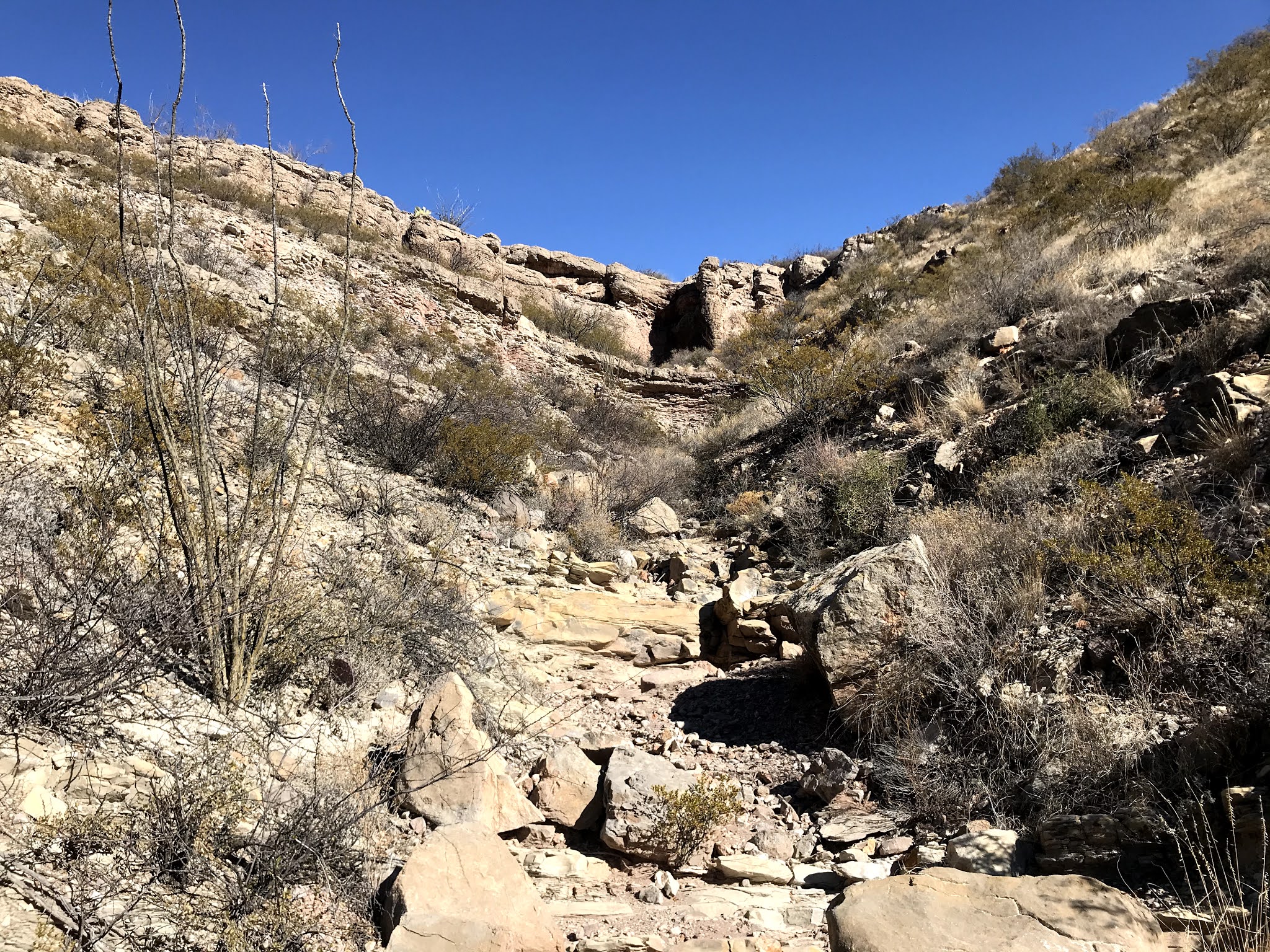
 On our way down to the box section, we mixed it up between the benches ( which amazingly still had some grass on them)  and the sandy stream channel itself. There were willows that had kept their leaves, and desert willows which hadn't, down there  and when we finally got to the box, a few small hackberry trees as well in the shade against the cliffs.

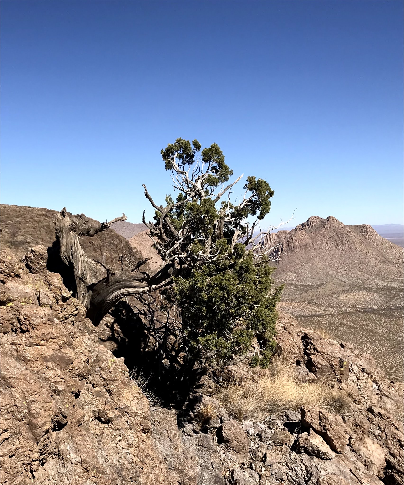
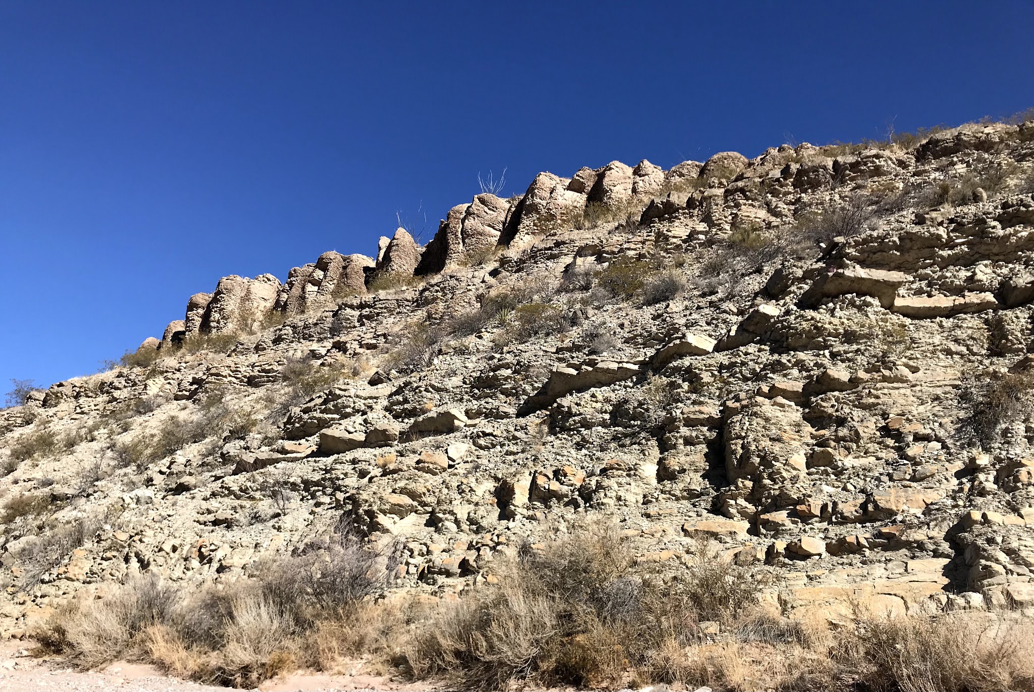
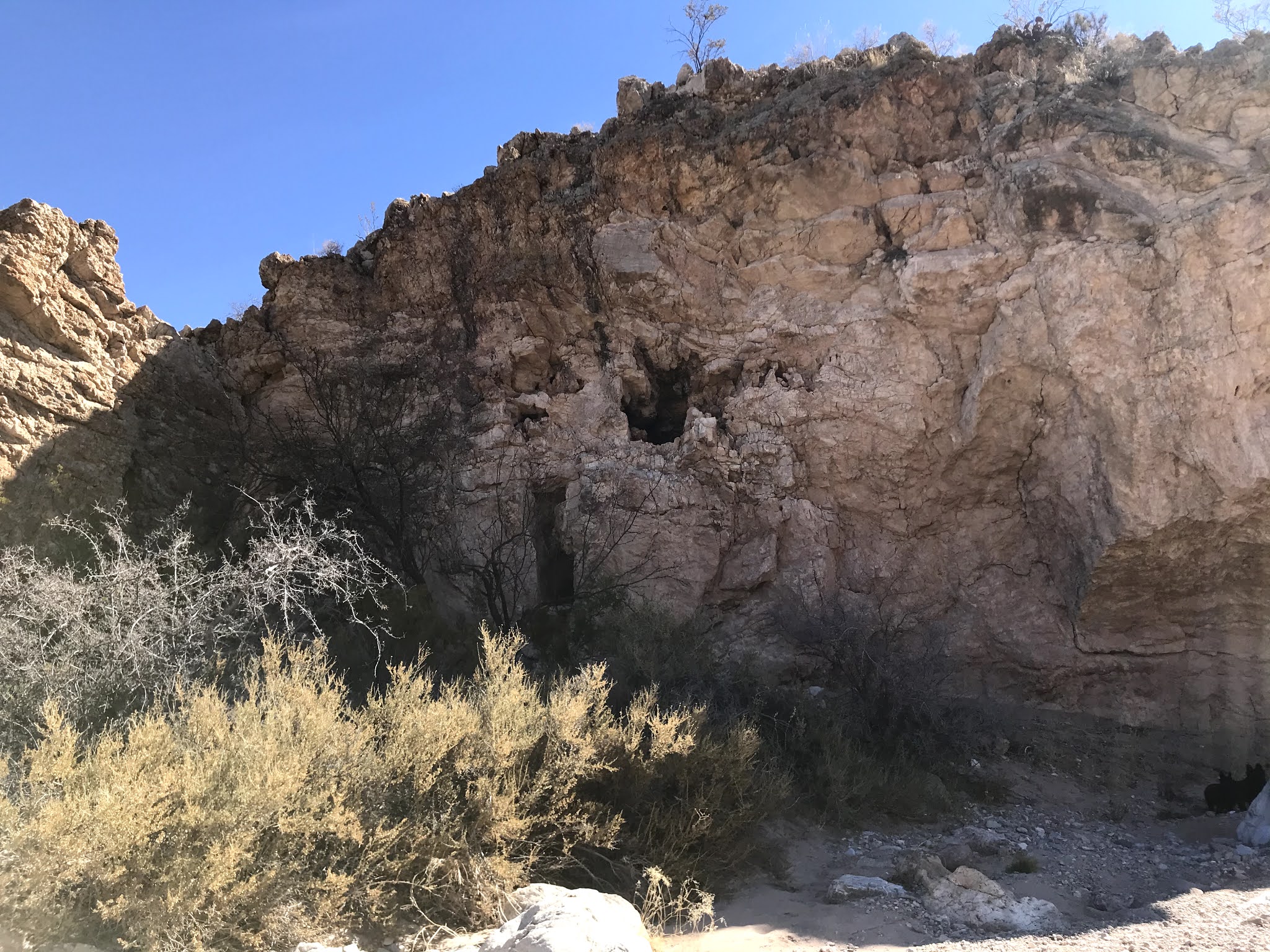
The terrain of the box was more interesting,  though not spectacular, with its tilted beds of limestone, sandstone and shale occasionally shot through with some volcanics. Boulders blocked up the channel in places, which was now given over to stretches of bumpy gray bedrock. 

 It had been quite warm walking in the open terrain, especially for our shaggy black dogs ( grooming appointments are at premium during the pandemic) with the only shade pressed up against the vertical banks of dirt on each side of the draw. At the first bend in the box we took a leisurely lunch in the shadow of the cliffs where it was cooler, so much so, that my wife sat on the sunny side of the edge of the shade to stay warm.

About half-way through I noticed a hole in the cliffs with a blackened ceiling, so I went to investigate. The hole was pretty small it turned out, and had no  easy way up to it. I surmised that the blackening of the yellow rock was probably from birds or bats and not from fires, but then, beneath a nearby overhang was a panel of petroglyphs. Hard to see and undoubtedly very old, they were still an unmistakable highlight of the trip.

Further on the canyon opened up. We went under fence across the arroyo but later found out that there was a gate  up on bank. I went and explored  near the old windmill( just back over the Doña Ana County line) while my wife and the dogs took another shade break. I found a fairly clear section of the old road that threads through this canyon ( I had seen a few lengths of it earlier), partly on the banks partly in the stream bed itself. It  sees zero use these days, although we used parts of it to hike on the way back. There does seem to be some ATV use coming from the lower and upper ends of the canyon but none of it seemed to penetrate the middle section in the box.

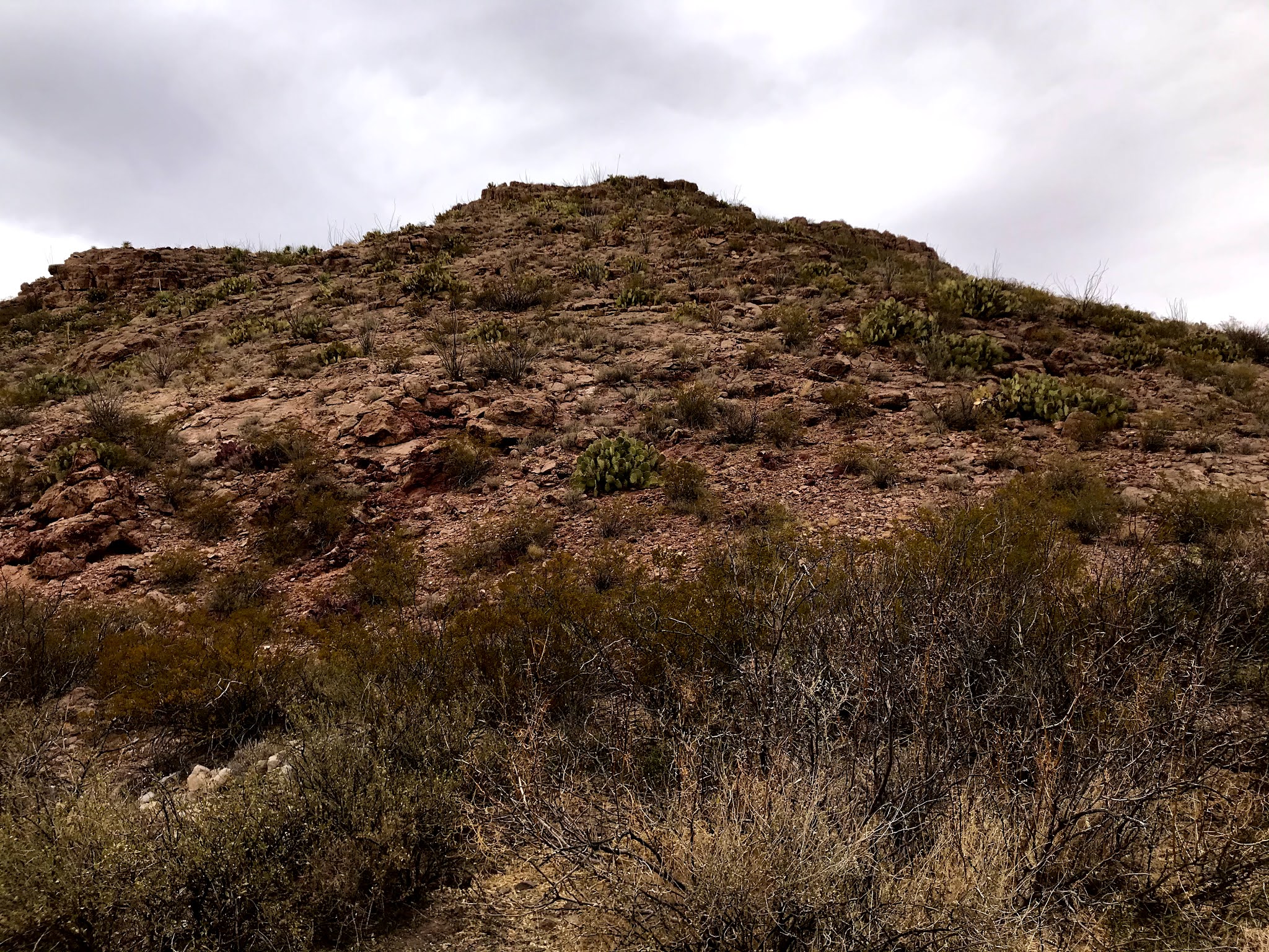
 I like long days of hiking like this. Even though the terrain close at hand wasn't that exciting, we did have nice views of the rugged north side of Redhouse Mountain. The return had many breaks from the warm winter sun for Scotties to rest, snack and drink.

Backing out of our non parking spot we immediately got a flat from a stick stuck in the side of the tire, the third this winter, and the fourth this year, after going at least 10 years without getting even one. It was changed in good time and we were soon enjoying the shadows  among the hills at the close of day.

Labels: , ,