Tuesday, January 23, 2018

Good Sight (Goodsight) Mountains


Amazing dam that's over 80 years old


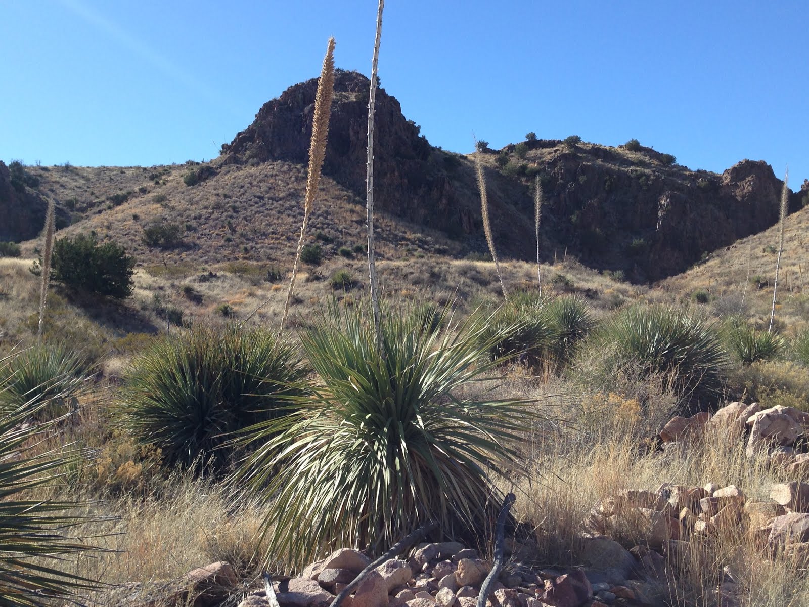
The Good Sight Mountains. The" mountains"part may be a bit of  a misnomer. With the exception of the range's only two named summits, Nutt Mountain and Good Sight Peak, most of the Good Sight uplift is made up of low, dome-like hills sparsely covered with bunch grasses and creosote. Approaching from the east on Luna County AO -21, the rise is only a few hundred feet over about 4 miles. The western face however, is quite steep in places along the ridge's 25 or so miles and a few choice canyons worthy of a look await the explorer.
 I've been out to the range just three other times. Once to climb Good Sight Peak, a second  time the next day to try and find a jacket left behind, and a third time when we did a walk down the road to Stinson Well for a couple of miles before the wind forced us to do the rest of our exploring in our vehicle.
This time I was driving down the road to Stinson Well, and parked about a 1/2 mile east of the well with it's abandoned cattle chute, empty water tank, broken refrigerator, but still working solar panels  running a pump pouring a trickle of water on the ground. I hiked southwest past it  up the east flowing shallow wash. At the top I crossed over into a much more rugged watercourse carved into the volcanic bedrock. Down and down I went, around a few dry falls, and through a couple of narrow passages until I found myself among some willows at the back of a dam.


 Although the dam was only about 10 feet high on the side of the mostly silted in tank, when I climbed to the top, I was looking down a  vertigo inducing straight drop of at least 50 feet, and out to a spectacular jagged slot  which opened up  to distant cliffs  rimming a large desert mountain valley.


Like, my hike to the Rattlesnake Hills the week before the scenery was already exceeding my expectations. Now, I decided to climb up and around on the hill to my right, which had fairly easy way up, but after I'd walked along  awhile I realized had no quick or easy way down. I eventually found a steep, rocky, but not undoable passage  to the canyon bottom, where I immediately began making my way upstream through the boulders.  I was stopped by deep pool of black water a short ways below the dam I had just been standing on.

 There were  sheltering ledges and alcoves along both sides of the narrowest part of the canyon. I explored a couple but the largest one seemed a little bit too dicey for someone on a solo hike.  I hiked downstream now passing a few soapberry trees, heading for the confluence with the narrow canyon that comes in from east. On more or less level ground, my toe caught a root or branch and I  fell forward, landing hard on my knees on two very hard rocks. It really, really hurt, but nothing, thankfully, had been broken or torn.
 I had to go under a fence which is most likely the demarcation between private and BLM land, and shortly thereafter I was at the confluence. There were good sized scrub oak and junipers along the banks as I walked downstream just far enough to where the main stem of canyon opened up for a distant view of the Florida Mountains.

I turned around began heading up the eastern branch. As always I'm keeping look out for  ancient pottery, stone tools, flint flakes etc.,but except for a very few flakes of locally derived agate, there wasn't much to report. I did notice a couple of more alcoves high up on canyon's north hillside, but it seemed like a lot of effort and a long detour for an investigation that would probably yield nothing. I wished I had a teenager or college student I could just dispatch with a " go see what's up there."

 As the canyon constricted the juniper and oak got bigger and thicker. I came upon a concrete watering trough  and storage cistern, both in good repair and then I noticed the sections of heavy iron pipe that once led to them, broken and strewn about the dry creek bed below me.
Watering trough no longer used

 I got a glimpse of another large dam, that once backed up a small pond, that supplied water to the pipe.  I scrambled among the boulders to get a better look and a picture  of the beautifully constucted dam.
Second dam

I had just put the i-phone back in the front pocket when a golden eagle flew out, from where I'm not exactly sure, passed over about 15 feet from the top of my head. This was my second close encounter with one of these gigantic birds, and  the second time it took my breath away. But wait, there's more. I continued to scramble up closer to the dam, when I see a second one on a natural cliff just below the dam and about 25 feet in front of me. I got the phone out  to try and snap a photo, when I just gotten to the position where I was around some juniper branches that were blocking my shot, it took to the air, and all I got was a distant pic of its backside and wings.
 Oh well. Photo or not it was still the highlight of a hike that had gone beyond my expectations. I retreated back to the concrete trough and ate my lunch, somehow hoping they would return if  I waited quietly and calmly. Afterwards, I gathered my stuff and headed up a  small side canyon on the south to get  around the dam. At the top were the barely visible remnants of an abandoned road that had been  built just for construction of the dam. There were also wonderful views down the zigs and zags of the canyon walls and beyond all the way to Cooke's Peak.
 
The dry pond behind this dam was almost entirely filled with gravel and sand, and there was no easy way to get down to it, so I continued along until I could safely make my way down into the canyon again. As I backtracked once I did, I quickly came upon second smaller dam, and that was all she wrote. It was too high, and the natural pool of water below in the shadows was too deep and too cold, so I headed upstream.

Along the way I continued to look for rock art as I always do, but truth be told the rock throughout the hike had been all  wrong. It was volcanic breccia and conglomerate welded with a grayish ash that  closely resembled concrete. Only the occasional large boulder within the matrix would have provided a decent surface. I did find a couple of images along  banks above the creek eventually, though they were hardly a bonanza.


I turned back to the northeast as  canyon shallowed up and went cross country through the low rising hills. Crossing a swale, with a gentle wind blowing( that would turn into a gale the next day), I thought  about what an utterly peaceful place this was on this warm winter afternoon. It wasn't always so.  Several canyons to the south of where I stood, back in the year 1880, a battle took place between the forces of  Apache chief Victorio and U.S. Army
 I  walked over a low saddle, and then picked up an old road that led back to Stinson Well. I spotted a good sized buck and a smaller deer, that had most likely just availed themselves of the puddle of water there. They gave me a long look before traveling on.
NOTE: Although not posted,  portions of this hike cross inholdings of private property. Also, it's a nice idea to have a New Mexico State Trust Lands recreation permit as there is quite a bit of state land mixed in with the BLM out here.

Labels: ,

Wednesday, January 17, 2018

Broad Canyon Wilderness-Rattlesnake Hills, Organ Mountains Desert Peaks National Monument


 We drove out to Kimball Place along Broad Canyon again on Sunday where we started out on our Coyote Canyon hike a few weeks ago. This time though we headed west up a nameless arroyo that runs through the Rattlesnake Hills, a small collection of hills and side canyons that sits in a wide section of the Broad Canyon basin. It was pleasant walking up the sandy wash, where soon the steep hillsides shielded us from the morning wind.

We explored a long, flat bench on the southside for any evidence of ancient peoples. All we could find were a very few flakes of jasper and chert, and a couple of larger chunks of obsidian that had appearance of being transported from another location.
 At the narrowest part of canyon, fantastic conglomerate boulders collected, and we speculated how great they would  look cut and polished as our new patio.  A very few hackberry trees welcomed us to our picnic spot between two outsized boulders on either side of stream bed.  I climbed around a bit exploring alcoves where critters live, keeping an eye out for a stray bit of ancient pottery but finding none.


 Moving on we came to the only exposure of Paleozoic sedimentary rocks for miles around, an unusual site for sure in the sea of volcanic rock that composes the Cedar Hills and the Sierra de las Uvas. Near the western contact the beds are nearly vertical. On the north hillside above the canyon was a jagged volcanic wall, and I thought how the scenery of this little canyon far exceeded my expectations.

Fault line


Eventually the canyon opened up completely into a flatland of meandering washes punctuated with a few isolated cuesta hills. Now we cut back to the southeast over purple blue andesite gravels, where only creosote seemed to want to grow, toward Broad Canyon, using cow paths on the banks to avoid the rough walking in the arroyo itself. The day had gotten quite warm for mid- January and we welcomed the shade of the cliffs and boulders of the mini red rock box, while we admired the many nests and resting spots of birds of prey. Underneath one were many, many tiny bones of their meals.

 We explored up  a  hidden side canyon that ran up into the main body of the hills, rested among the boulders and then headed back out to Broad Canyon, the Kimball Place and our 4Runner.


Labels: , , ,

Tuesday, January 9, 2018

Robledo Mountains Wilderness, West Fork Robledo Canyon- Organ Mountains Desert Peaks National Monument


 Believe or not  I was already on the road by 7:00 AM on New Year's Day heading out to the Prehistoric Trackways National Monument. I was going out to meet friends David and Nancy Soules who were doing an overnight backpack/ through hike of the Robledos. They had been dropped off near Robledo Cave and had hiked up Indian Springs Canyon. I was going to provide their ride back and to do the last leg of their hike with them.
 The sun wasn't quite up yet when Seamus and I got out of the 4Runner. It was clear and cold, maybe low to mid twenties. I was sufficiently layered up,but my gloves were thin and my hands quickly chilled down and would not warm up as we began our hike on the mesa. I was walking in a headwind as well, and I was hoping it wasn't going to last all day. It brought to mind childhood times when out sleigh riding or playing football in the snow when my hands and feet would be nearly numb despite heavy exertion. In the present day, all it took was climbing a couple of steep hills to really get the blood flowing  and freezing hands were no longer a problem.
We took the old road toward Split Rock Canyon, just as I had done with my LCPS hiking group a few weeks earlier. When we got to the crossing, I took the north branch of the canyon instead of continuing on the barely visible road. Eventually, we went up on the ridge to the north and very steeply down a rough tributary that was entirely in the shade and still quite cold. Near the bottom were some dry pools and falls carved in the bedrock that we had to hike around. Soon thereafter we were in huge  Robledo Canyon just downstream from where it splits into its two major forks.
The plan was  I would meet David and Nancy somewhere along in the west fork. So, Seamus and I began  a light-hearted march through the first of the curves  that twist at the bottom of this deep canyon, inspecting limestone walls and  admiring massive junipers both dead and alive.

Seamus had chased a couple of jackrabbits earlier on with no great enthusiasm, but when three deer materialized at the edge of the canyon ahead of us, it was off to the races. Two went up the very steep hill on our left and Seamus pursued. They were long gone in seconds, but my Scottie had a hard time giving up, going higher and higher still, even as I called repeatedly after him, breaking the near complete silence of the winter morning. He did negotiate his way back down for a treat and drink. My tired, but exhilirated companion only rested momentarily before we continued on.
In a wide section of stream with a row of trees and brush in the middle, I was going up one side when I realized David, Nancy and their dog Hank were coming down the other.
They told me about their long winter night in a tent as we began to walk downstream. We checked out a couple of little alcoves in the cliffs and then continued on as we both expressed admiration for the beautiful little canyon we were in, and  a bit of disappointment at its lack of rock art, or other evidences of ancient peoples.

David did find a very old trap, and I found the same evergreen sumac  bush that had puzzled me( due to its full green foliage in January) on a similar winter day many years ago.  I couldn't interest them in going down to the box section of Robledo Canyon, so we took the almost completely invisible old road out of the canyon, a steep 250 foot climb and began follow it as best we could on the hilltop.
Hank went after a jackrabbit up there and got very close to catching it. The abrasive limestone he was running on was tough on his pads though, and he seemed a little tender footed for awhile afterwards.
 I did convince Nancy and David to at least go down to the dry waterfall in Split Rock Canyon. We all snacked and rested there a bit, with the incredible views laid out before us. I was glad when they both told me it was definitely a worthwhile side trip.


 Now all that was left was the trudge up and down a few more steep hills on the Ridgeline Trail to get back to the trailhead. Seamus was dog- tired. This was the longest hike he had been on in awhile, and I'm sure chasing deer up that hill didn't help much either.
Somewhere along the way I left my REI binoculars on the trail. I'm not really a binoculars person. I rarely bother to get them out of the backpack, and I don't really want to wear them around my neck , so it didn't seem like too big of a loss,but if you are out hiking somewhere between Split Rock Canyon and the Discovery Site Trail( Trackways) and you find them in their little cloth sling. They are mine.

Labels: , , , , ,

Friday, January 5, 2018

Robledo Mountains Wilderness - A+B Canyon


I wanted to do a short hike( 2 to 3 hours) with relatively quick access. In the past few months this has meant  a hike beginning right off the Corralitos  Road, or a trailhead a short ways down one of the many gravel roads that branch off of it. I was little less than excited because the last few hikes using  this approach,although pleasant enough, had not been the most scintillating.
Then I remembered a little canyon on the northern edge of the Robledos, that always gets a spark of interest going in me whenever I glimpse it from I-25. The problem with getting a good look at it was the private property along the Rio Grande which appears to block access for starting at its mouth.
 I very quickly figured out it would be very easy to connect with the canyon further upstream by going overland and heading back southeast after parking about a mile in on the Faulkner Canyon Road.
 There was the plan and off I went. I first headed up a side canyon of the Lower Faulkner Box and then up over  some hills and a ridge, and then it was down very steeply into what I would end up calling A+B Canyon. Most of the area's geology is composed of basalts, andesites, and ash deposits. At the bottom I  found this boulder with deep crisscrossing crevices which reminded me of turtle shell. I headed upstream and soon encountered a large dry waterfall which had carved many channels in the soft pale rock.


As always I looked around for grinding mortars and rock art, but neither was forthcoming. The waterfall was easily climbed around and I continued upstream. It was wonderfully sunny and peaceful in this little valley as I marched along on this late December morning. I soon realized the canyon was going box up in the dark brown varnish of the cliffs ahead of me.
 
  As I climbed up the first of several smaller waterfalls I realized this canyon was like a mirror image of Lower Faulkner Box Canyon, which I had hiked a little over year ago, and whose high waterfall was only a stone's throw away. A + B Canyon's last waterfall was not  nearly as high, and after I had climbed around it,  I saw petroglyphs in the rock. These were pecked in for sure, but they were letters which relegated them to a fairly recent vintage. They did give me the name for the canyon, though.


 After that  I wandered up the shallow upper wash cut into the slopes of golden grass. I was tempted to go find the precipice of the other waterfall, but instead steeply climbed up the ridge on the west and began heading north. It was very rocky indeed up top and even rockier still as I descended a steep slope to a saddle where I picked up section of trail that headed more directly back to my vehicle. It faded quickly but soon after it did, amongst the tufted gray grass I spotted sherd after sherd of ancient brown pottery. There were many pieces,but they seemed to concentrated in one small area, which made me wonder if this was just a place where someone had dropped one pot.  As I ventured out short distances in each direction  in search of more,but finding none, I decided to go back to my original discovery. I panicked a bit when I realized,even though I had walked no more than 20 feet from it, how hard it was to find again. I did find it,but decided to build a little cairn that rose just a bit above the grass to aid me if I should return.
 I continued along this mostly flat, mostly cleared mesa with my eyes to the ground, and thought of how when I'm looking for something small I ( like sherds or fossils) I might miss something big( like a mano or metate) or when I'm looking for something big like rock art, a mine,or grind holes I might miss many small things. It began to seem like destiny that I find anything at all,but the happy part is that I do and it keeps me coming back to our desert for more.
NOTE: Although most of this hike is on Organ Mountains Desert Peaks National Monument, it  begins and ends on State Trust Lands where a recreational permit is required.

Labels: ,