Magdalena Mountains, Cibola National Forest - East Fork Sawmill Creek ( FT 93 )


I downloaded a trail guide written in the 90's for the San Mateo Mountains, when I had been planning my trip to either Indian Creek Canyon or Cold Spring Canyon a few weeks ago. For some reason, probably because it had been a suggestion from the rangers I met when my San Mateos hike got detoured by the Roberts Fire, my mind wandered over to ideas of doing something in the nearby Magdalena Mountains soon, so I downloaded a similar trail guide (also written back in the 90's) for that range.
I've only visited the Magdalenas three times before. In fact, the very first time I camped in New Mexico was at a dispersed space just off the Water Canyon Road way back in 1988. It was spring break and the next day, I was going to visit New Mexico Tech. Overnight the water in the dog's dish outside froze solid. In the morning we wandered around the hillsides where we found an old mine, and I collected a nice piece of botyroidal manganese ore that I still have.
Another trip we briefly looked at the Water Canyon Campground, but it's walk-in, close-set spaces didn't really fit our style. I'm not sure why we didn't look at some dispersed spaces especially since I had utilized one all those years ago.
Last year we did hike in Sixmile Canyon which I documented in this blog. Without going into detail, I'll just say that hike still left me with the desire to do something really nice in the Magdalenas.
Well, my desire was fulfilled this past Wednesday (7/31/19) even if things got off to a bit of a wonky start.
Past the Water Canyon Campground and picnic areas, FR 235 turns to gravel and begins to twist, turn and wind its way to the top of the mountains. While it does become narrow enough to induce anxiety when negotiating curves with very steep and long drop-offs, the road is well maintained and could be driven carefully with sedan under dry conditions. I kept wondering what would happen if someone was coming the other way through one of those long single lane stretches. Luckily, no one did. Closer to the summit ridge, I began passing the many signed trailheads. I also met up with road grader at work, but fortunately it was in a section that had sufficient room to pass.
Well, every single trailhead was signed except the one I wanted. I drove all the way up to the gate, turned around, drove past all the signs again and still didn't see it.

I finally just parked at the North Baldy trailhead and started heading down the steep, grassy hillside through the wildflowers and past the firs and spruces into what I was pretty sure was uppermost East Fork Sawmill Creek. I was hoping to stumble across the trail but didn't. I knew I could always follow the creek bottom.

Among the aspens I found a ruined cabin, and nearby, what I found out later was Baldy Spring, piped and flowing into circular metal tank.


Among the aspens I found a ruined cabin, and nearby, what I found out later was Baldy Spring, piped and flowing into circular metal tank.


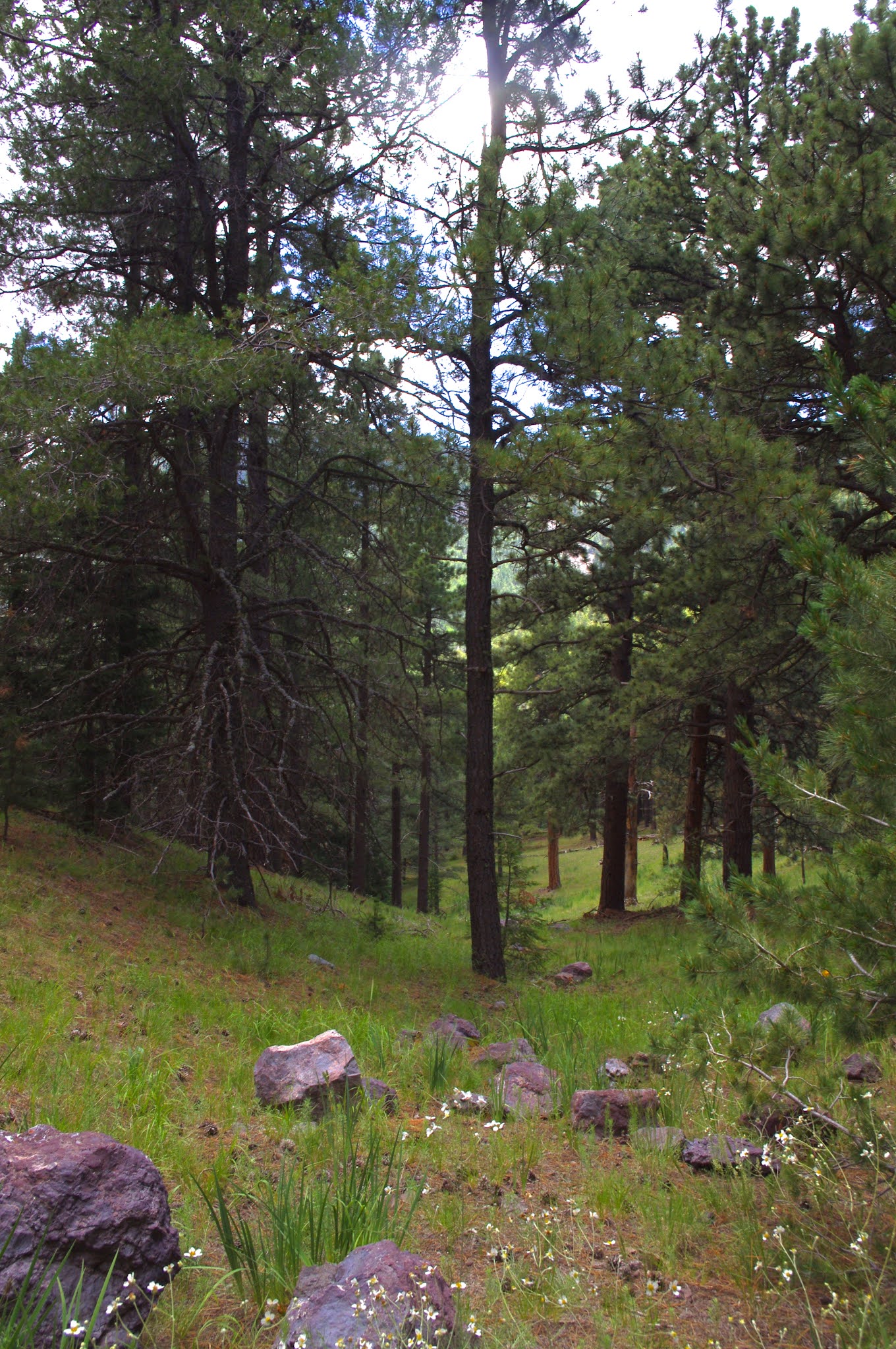
Past the spring area, the stream flowed almost the entire way of my descent. There was big timber, mainly Douglas firs, as I bushwhacked steeply through this section. I was little discouraged, wanting to find some kind of trail, wildlife or human, to make the walking a little easier, but found none. Still, I continued, down and down so steeply that gravity seemed to be pulling me at a faster pace than I desired.

I had a minor tinge of worry I was in the wrong canyon as I made my way through the thick growth of young trees down to the creek, but I as crossed to a clear area on the other side, I saw the trail and my first blaze. On my left it was going up the hill steeply and on my right it headed down the canyon. Shortly afterwards I came upon an old metal trough, a pile of plumbing fittings on the ground, and an aluminum box strapped to a tree. I realized I was standing on top of an old dam that had filled in behind. Below me were two pipes that emerged from the stonework. One had steady flow of clear cold water that splashed on the bedrock and tumbled down into lush area of green.


I had a minor tinge of worry I was in the wrong canyon as I made my way through the thick growth of young trees down to the creek, but I as crossed to a clear area on the other side, I saw the trail and my first blaze. On my left it was going up the hill steeply and on my right it headed down the canyon. Shortly afterwards I came upon an old metal trough, a pile of plumbing fittings on the ground, and an aluminum box strapped to a tree. I realized I was standing on top of an old dam that had filled in behind. Below me were two pipes that emerged from the stonework. One had steady flow of clear cold water that splashed on the bedrock and tumbled down into lush area of green.


I hiked further and further down, with the sound of stream to keep me company as I walked. There were Stellar's jays, wrens, nuthatches to add to the music. A large hawk glided through the tall pines. A long tailed weasel padded about silently, crossing the trail very closely in front of me, but paying me no mind as it disappeared among the fallen logs. There was occasional bear and elk scat, and this canyon seemed so little used and remote that I felt certain I would see both, but didn't. The stream flow only went underground briefly for a few hundred feet, and then came back only slightly weaker than before. Lower down I began to see more big timber especially ponderosa pines, but the middle reaches had mostly second growth trees, tall but with less impressive diameters.


There were few deep pools (well, deep enough maybe for fish to hold) although there were many places where it looked like former pools had silted in, still I wondered what kind of work could be done to make this place hospitable to Rio Grande cutthroats. Boxelders began showing up, shining electric green, lighting up the dark forest, but really there were very few broadleaf trees. I expect they would start showing up in greater numbers past where I turned around.


Eventually I sat and ate part of my lunch on the bank of the creek. Then I walked for another 20 minutes or so and decided to head back. I had been monitoring the skies throughout the hike, and saw mostly blue. It just didn't seem like the day for a storm, even it was a mountain where there is laboratory set up to study lightning because of the frequent summer thunderstorms.
I now took the trail all the way back, but stopping first to wet my head and shirt under the cold water coming from the pipe at the dam. The path headed up a dry side branch and took some long switchbacks across the steep hillsides on the east side of the creek. Obvious blazes were in abundance, but the tread is very faint for the most part. I did quite a bit of resting on the climb out.


I now took the trail all the way back, but stopping first to wet my head and shirt under the cold water coming from the pipe at the dam. The path headed up a dry side branch and took some long switchbacks across the steep hillsides on the east side of the creek. Obvious blazes were in abundance, but the tread is very faint for the most part. I did quite a bit of resting on the climb out.


When I got near the trailhead there was tiny FT 93 sign and when I got close to the road, there was a big orange and white sign " East Fork Sawmill Creek".


The problems were as follows: one leg was broken so it was leaning down on one side; it was partially concealed by pine branches; it was well below the level of the road; and it was not exactly directly across from the South Baldy sign. It wasn't any wonder I hadn't been able to see it earlier in the day. Now I had to complete another inadvertent loop hike by walking back 3/4 mile on the road to my truck with another 400 feet of elevation gain to go. It was an uneventful, if slightly warm, last leg. I took more photos of the crest area. Then drove back down a bit and ate the rest of my lunch at one of the very few areas wide enough for camping off of FR 235.


Labels: backpacking, camping., fall colors, hiking
posted by Devon Fletcher at
11:25 AM
0 Comments
![]()
![]()

