 |
| Forest Trail 762 |

I'm going to get all my caveats out there here at the beginning just so everyone knows what they might be getting into. First, the road you need turn on from NM 12 just has a small green street sign that says Higgins Flat Rd. I passed it quite easily thinking that couldn't be it and drove all the way to the outskirts of Reserve before knowing for sure that I had done something wrong. Then I drove back and turned off at Higgins Flat Rd. and saw a larger sign but nothing on it to indicate which way to go for the road I wanted to get to the trailhead. I left, frustrated, thinking somehow I had it wrong. Drove close enough to Reserve to get a signal and check my On-X. I knew exactly what to do now. So, do get off at Higgins Flat, hook to the left at the first intersection after crossing the dry stream (there is a forest service kiosk here) and then stay with the well maintained road all the way to the San Francisco River. That all wasted about 20 or more minutes of precious morning hiking time (it was going to be hot for sure) but it was my fault for thinking there would some kind of signage to help.
Next, there were 6 stream crossings once I got down in the valley. It was no problem in mid-June after several months of drought, but they definitely could be a problem at other times of the year.
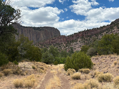
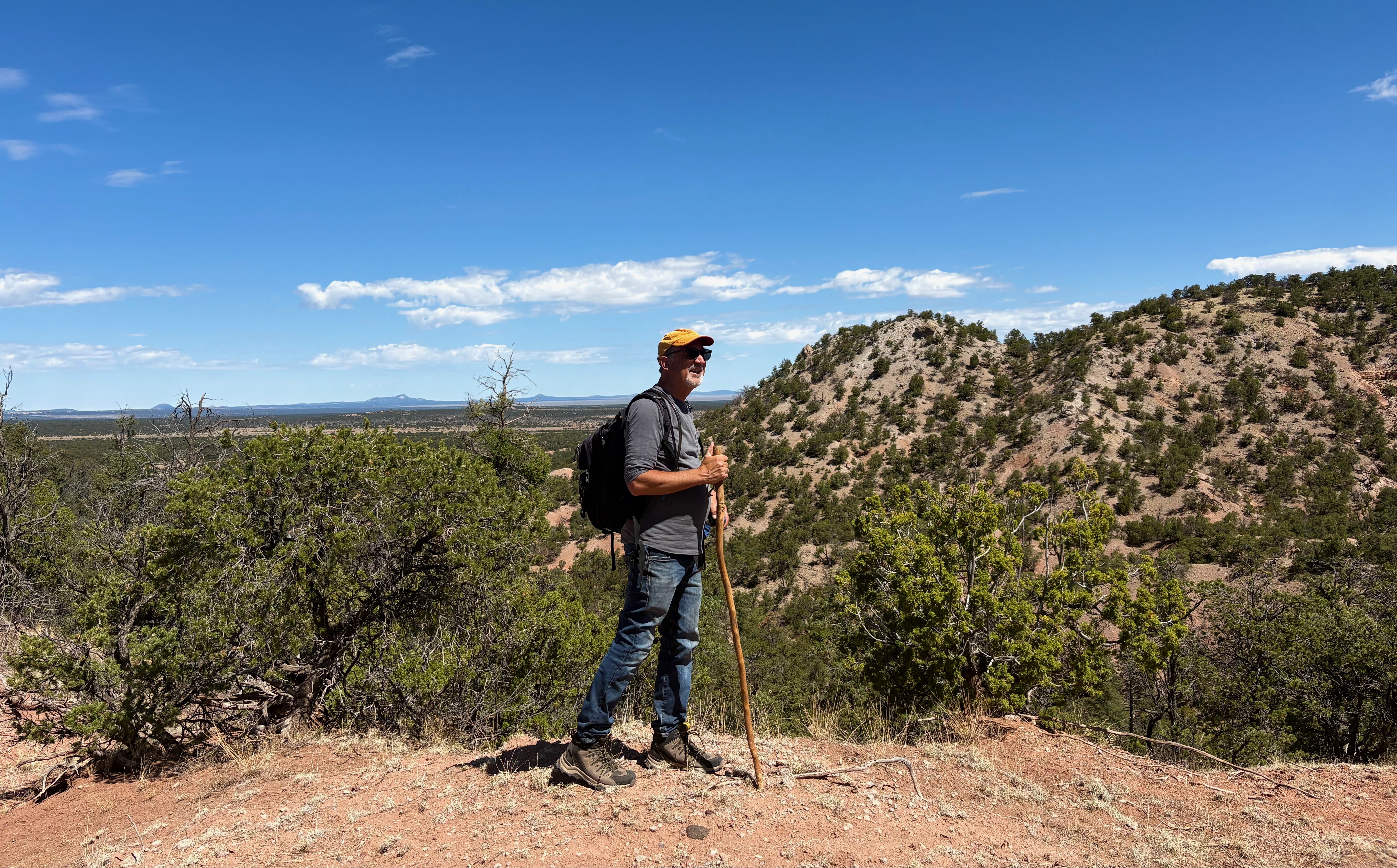
I parked and began hustling my way up the switchbacks at the beginning of the trail. Once on top, I spied a tent pitched in the grass a little further up valley, and thought, maybe that's where the trail comes back down. Once again, my fault and my stupidity for thinking this. I had done all my research for this hike months ago and had not bothered to refresh my memory. If I had, I would have understood what the 4 miles to "The Box" on the wooden trail sign had meant. It meant 3 hot, dry, mostly shadeless miles climbing up, over, around and then finally down a scrubby, dusty mesa just to circumvent a mile long inholding of private property along the river. For some reason I thought this section of the trail was only about 1.5 miles, and I was getting more and more put out as I marched with my back toward the river on and on up the hill.
.jpeg)
.jpeg)
Which brings me to my next point. You can't carry enough water when doing this as a day hike (especially in the warmer months) so bring a LifeStraw or a Steripen purifying system or both, like I did.
If I were do to this again I would probably spend the night at the trailhead. I left the cabin at 7:15 but could have and should have left an hour earlier. It took about an hour and 45 minutes from by cabin and I got started a little after nine. Even if I were to subtract the time spent on my driving mishaps, I probably would have been there at 8:40 - 8:45, which is already late for June anyway. You may ask " Why go in June?" Well, that's when the water is at its lowest and warmest and if the water is not low you really shouldn't go at all, not only because the river hiking will be that much harder but more importantly when you get to the box proper, the danger will become obvious. I haven't backpacked in many years but the thought of backpacking on that monotonous, miserable trail on the mesa would just be indulging the sadist who designed it. To each his own though. There is room for camping (I even found some benches made of planks and stones and an old fire ring) on the east side of the river before the first major bend toward the northwest.
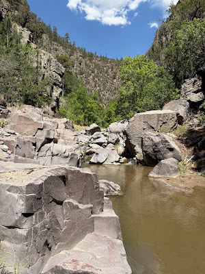
At the bottom is the last remnant of the road, two dusty tracks in the pale grass, now no longer open to vehicles. I trudged on, finally reaching some large diameter rusty pipes set into the bed rock at the first stream crossing. At the second crossing I was finally in the shade of the alder trees. I stayed with the gurgling, murky stream watching it fall through gaps in the boulders, while I edged around on the gravel along the deep green pools. The enormous cliffs on my right could only be seen through the leaves, if at all. Tiny fish visible in the shallow water gave me a little hope that a few trout could be lurking.
.jpeg)
.jpeg)
.jpeg)
.jpeg)
.jpeg)
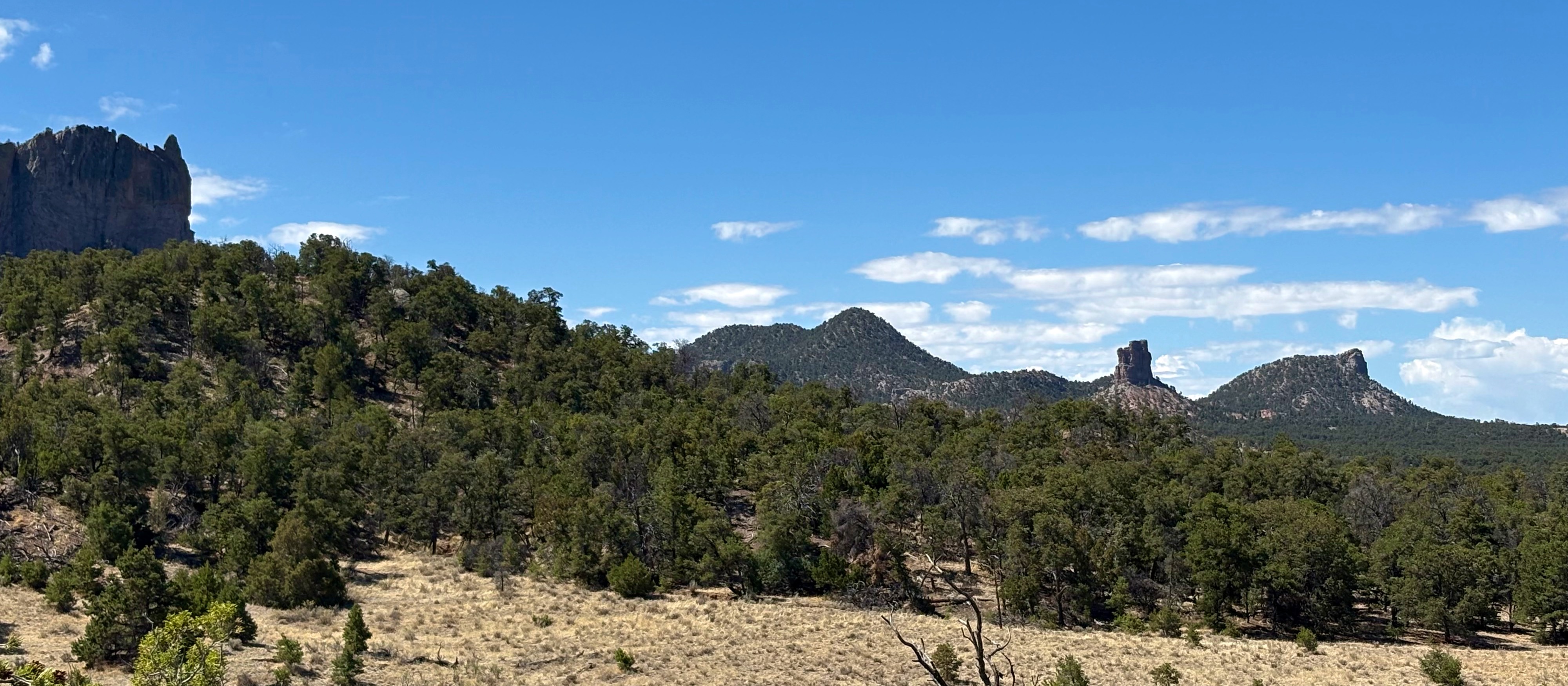
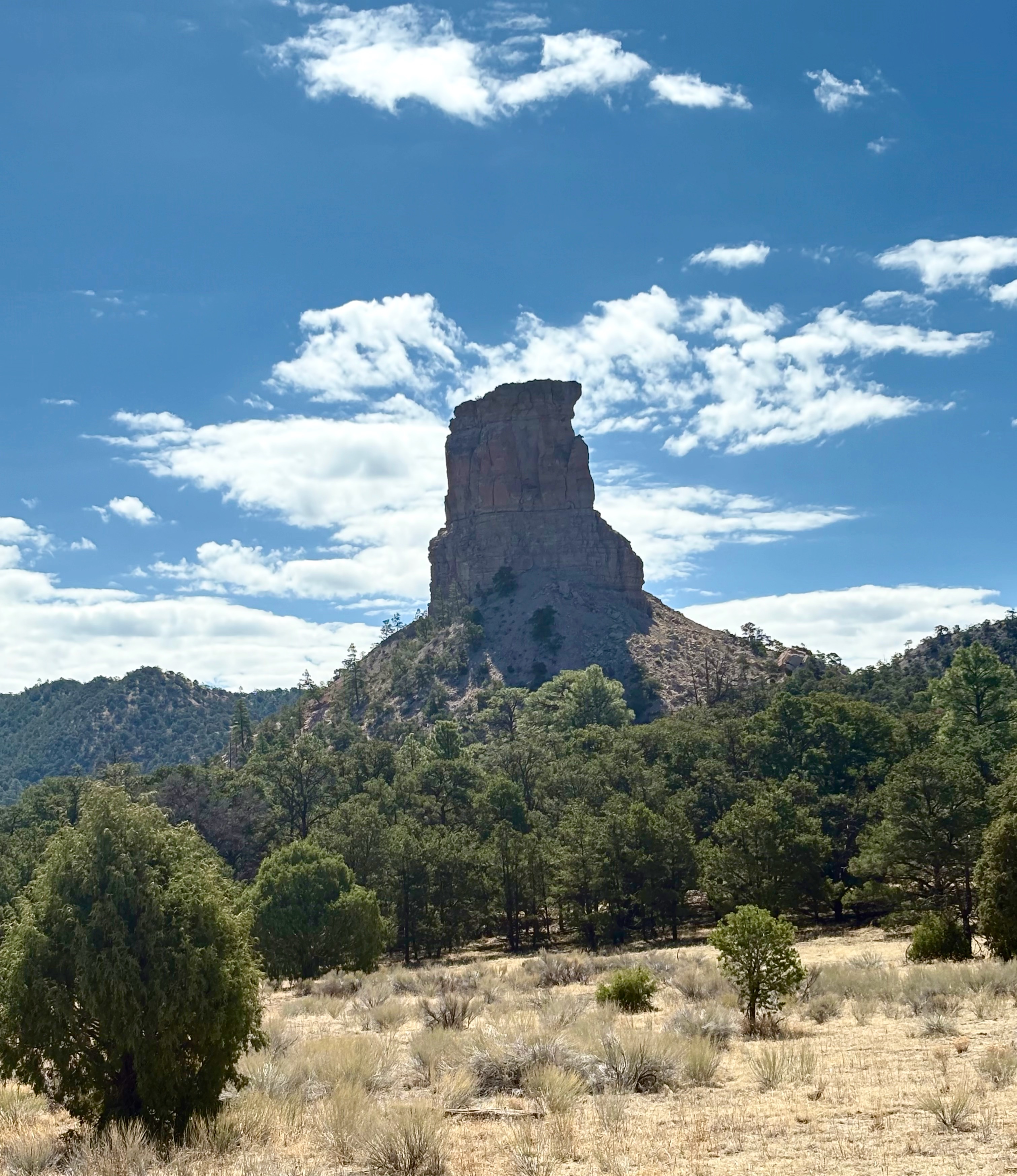
Eventually I emerged from this cool, dark zone of overhanging trees into the bright morning sun again. But now there were the cliffs, striated, pink and gray, in full view towering 800 feet above me on my left. On my right two enormous humpbacked towers were visible through the tall, skinny pines and the cypresses(?) with their straight furrowed trunks. The stream ran briskly through the gray boulders. Box elder and grapevine brightened up the banks, while further up, on the talus below the cliffs, were the deciduous oaks. The wonderful rushing sound of small waterfalls was an almost constant companion. In a quieter part of the stream, a heavy splash, much heavier than the frogs that had given me a jump, startled me, and seconds later a lone elk appeared on the bank opposite. There was still quite a bit of trail to follow on the east bank, but eventually it was no more as the cliffs began to pinch in when I approached the first bend. Once I felt I was in the bend proper, I rested. I had a decision to make. I could go further into the box (really I was only at the mouth of the downstream end) or I could try some fishing. I didn't have time for both (even casual fishing eats up the clock at an astonishing rate). It was near midday and hot. All the rock around me seemed to be radiating heat like a giant stone oven. I opted for fishing my way back downstream, and truth be told, I now regret it. There was no action to be had at all with the various nymphs I was casting into the opaque pools, and I believe, especially after I "tested" a few of these by dropping in some large rocks, that there were no trout to be caught on this day in this stretch. I could be wrong. So I never even got a glimpse of the deeper, darker recesses of the backward "S" of the inner box. I had brought my waterproof backpack and everything but it was not to be. Nor would I lift a healthy rainbow from the depths. I was happy though. What I had seen in my few hours on the river was more than enough for one trip.
Note: I call this Gila National Forest even though technically it is Apache National Forest. All parts of the Apache National Forest in New Mexico are administered by the Gila National Forest and have been for many years. It's kind of a useless designation at this point.
.jpeg)
.jpeg)

.jpeg)
.jpeg)
 |
| In the first bend. |
I ate lunch at an old campsite. Further down just before leaving the water, I wet down my shirt and hat. I drank and then filled up my LifeStraw, filled and purified my bigger water bottle with my Steripen. I took a few more photos of the cliffs and then began climbing out of the canyon on the wretched trail. I rested often. I ate the food I had left at one stop. It was a long walk. I realized I'd probably spent more time in this sickly terrain on the mesa than in the beautiful green river canyon, alas. I was buoyed up in my journey though, knowing I will not come to the river this way ever again (or at least not coming unprepared mentally). A few last photos of the magnificent gates of the box from up on the mesa were taken and then I descended to my vehicle. I'm already planning my return(s) though, using three routes available from the upstream side.
.jpeg)
.jpeg)
.jpeg)
Labels: flyfishing, hiking, waterfalling


.jpeg)


.jpeg)
.jpeg)
.jpeg)
.jpeg)
.jpeg)

.jpeg)

.jpeg)
.jpeg)

.jpeg)

.jpeg)
.jpeg)
.jpeg)
.jpeg)
.jpeg)

.jpeg)

.jpeg)
.jpeg)

.jpeg)
.jpeg)
.jpeg)


.jpeg)
.jpeg)
.jpeg)
.jpeg)
.jpeg)
.jpeg)
.jpeg)
.jpeg)
.jpeg)

.jpeg)
.jpeg)
.jpeg)
.jpeg)
.jpeg)
.jpeg)

