Outlaw Rock, Faulkner Canyon - Organ Mountains Desert Peaks National Monument


 |
| Outlaw Rock |
I first visited Outlaw Rock when an article about it appeared in New Mexico Magazine. My wife and I drove out to Faulkner Canyon, where finding the " Rock" was pretty easy, but finding where the names of Billy the Kid and his compadres were etched wasn't. We did eventually, and then I didn't think too much about, or bother to visit the Faulkner Canyon area for many years.
I set out on this trip hoping to find the road that leaves off of Faulkner Canyon to ascend and traverse the mesa on the west side of the Robledos. We used it several times years ago to get us to a reasonable starting point for climbing Robledo Peak. Well, years ago there was an old windmill that was nearby that served to as a beacon for finding the turn-off. It appears to be gone, or merely laying down in brush now. With the thick green growth of desert willows that line Faulkner, I couldn't see the opening for the the road either. After I turned around in the mushy sand, I did catch a glimpse of the road up on a hill, and realized the entrance must be in a little side channel. I would find it the next day, but for the present I was off to do other things.
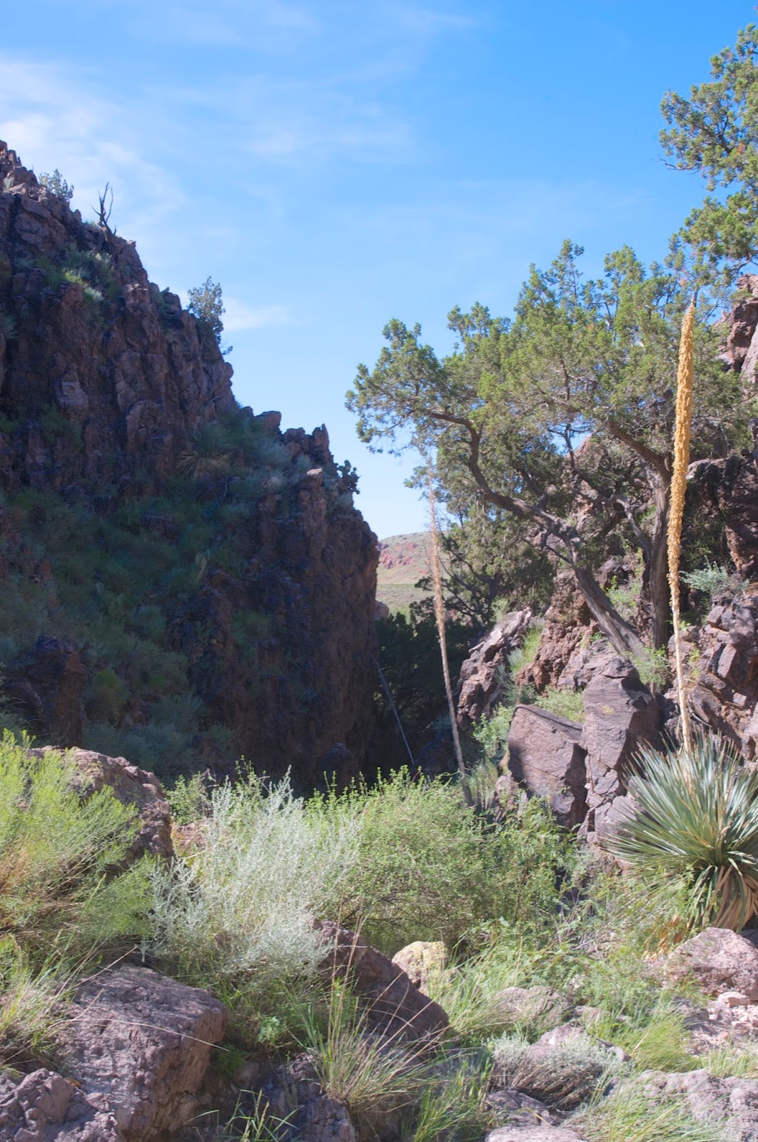
First, I decided to walk up the bottom half of the Upper Faulkner Box Canyon (a tributary on the north side). We had hiked down from the top two winters ago and were stopped by the substantial dry waterfall which is barrier to a continuous walk in the canyon to its mouth. We didn't explore the lower section that day, so I've been wanting to get out there to see it close up, and thought this was my chance. I parked my car just off of the section of Faulkner Canyon Road that leaves the arroyo completely to go around Faulkner's own dry waterfall. I began walking upstream admiring some mature hackberry trees as I went. This canyon is wide and the walking was pretty easy in the clear channel of the stream bottom. This is doubly nice as it provided an avenue where getting a visual on a rattler would come well before the arrival of your feet. Slabs of orange volcanic rock form bluffs on the both sides of the canyon, but it did not appear to have any rock art.

After a little over half a mile the canyon narrowed and pools of rainwater appeared and soon I was standing in the dark little recesses below the dry waterfall that stopped our progress. I backtracked a bit and went up and around to look down on the canyon and saw there was steep passage on the south side that could be used to go around the waterfall.


Now, I headed back, but I wasn't quite satisfied. I got in the car and drove east and when I saw Outlaw Rock, I parked and decided to climb it. That was quickly accomplished via an only slightly sketchy route on the southeast side. I tested the theory that this prominence on which I stood was useful to outlaws and perhaps Apaches as well for watching the movements of the soldiers at Old Fort Selden. Indeed, I could see the fort's crumbling abode walls several miles in the distance. After coming down, I did a little more wandering on top of some ridges and down in some canyons for 45 minutes or so, and was on bare hilltop when I heard my first thunder of the day. The storms that were off to the east all morning seemed to be backing to the west now, so I though it best to return to my vehicle.
This is an interesting and scenic area, but be forewarned, Faulkner Canyon Road ends at the iron gate. After that you will be driving almost entirely in the sandy, occasionally rocky wash itself. In dry winter conditions, it can be handled by two wheel drive vehicles with reasonable clearance all the way to the natural weir of gray basalt. In wet conditions, as we have currently, 4 wheel drive is necessary.
 |
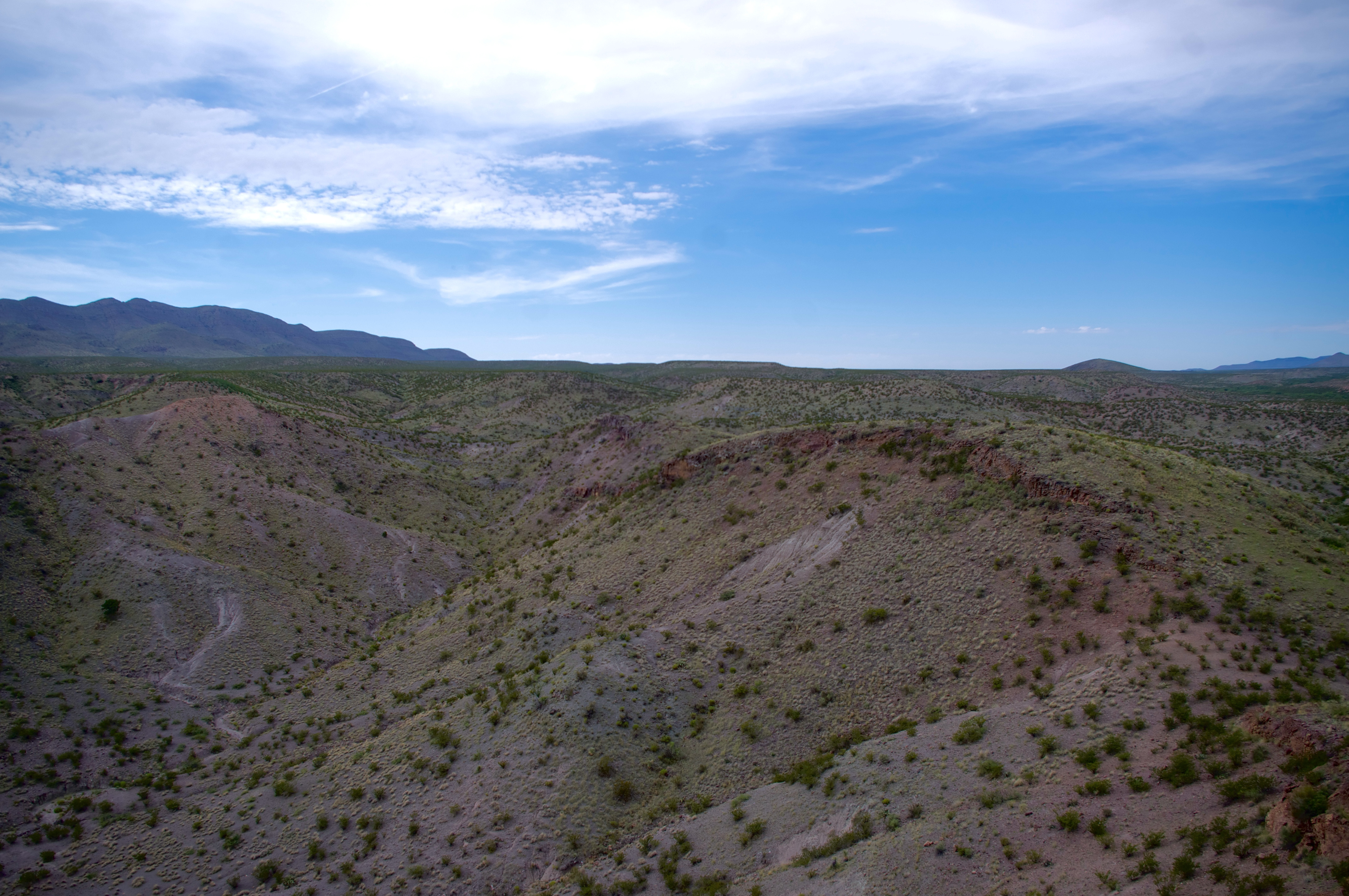
| Looking toward the Robledos |
 |
| Faulkner Canyon from atop Outlaw Rock |
 |
| Outlaw Rock |
This is an interesting and scenic area, but be forewarned, Faulkner Canyon Road ends at the iron gate. After that you will be driving almost entirely in the sandy, occasionally rocky wash itself. In dry winter conditions, it can be handled by two wheel drive vehicles with reasonable clearance all the way to the natural weir of gray basalt. In wet conditions, as we have currently, 4 wheel drive is necessary.


Labels: hiking, Organ Mountains/Desert Peaks National Monument
posted by Devon Fletcher at
2:52 PM
0 Comments
![]()
![]()