Tuesday, April 30, 2019

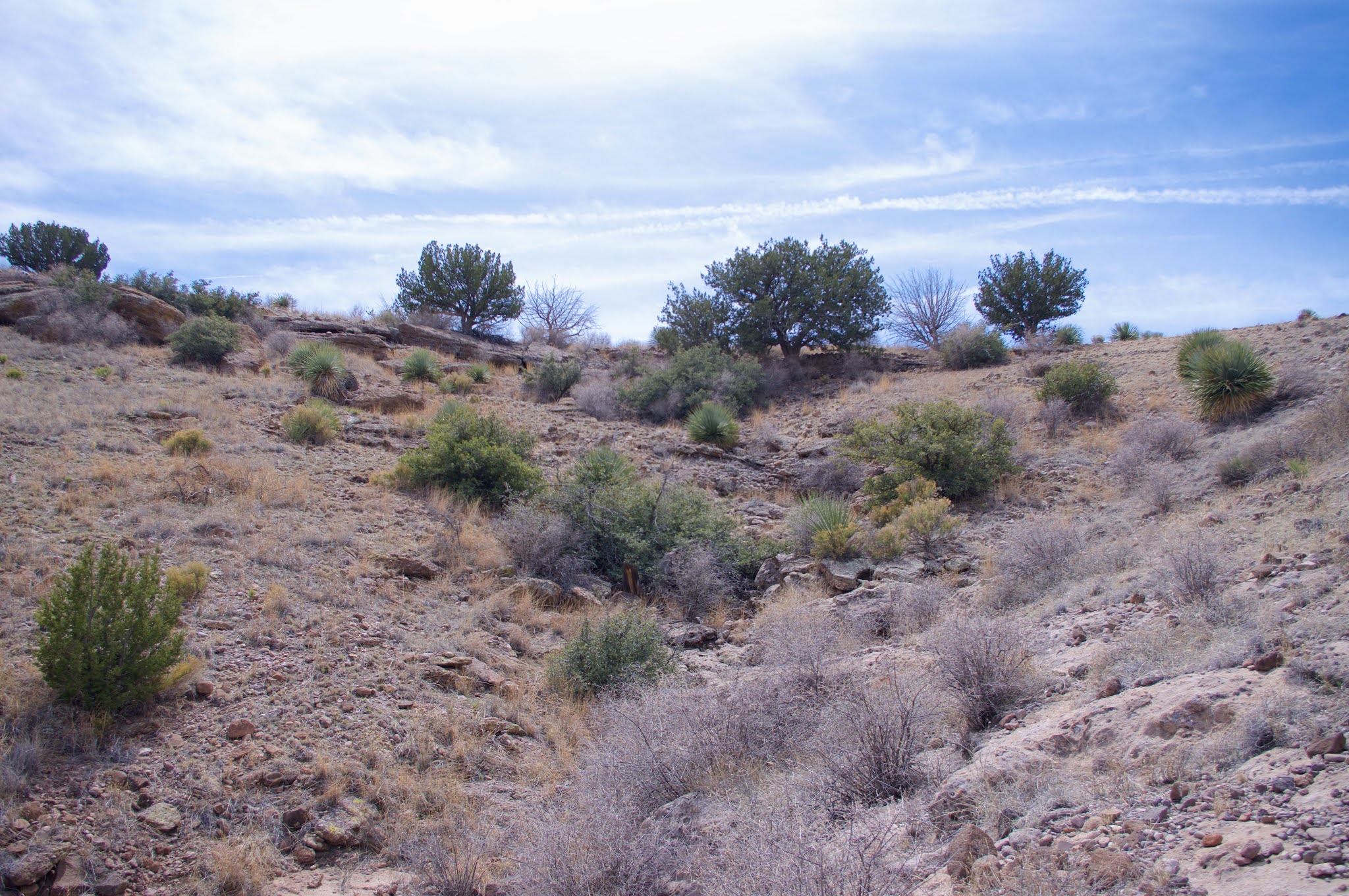
Winsor Trail (FT 254), Chamisa Trail ( FT 183), - Santa Fe National Forest


 I hiked the Chamisa Trail ( FT 183) several years ago in the wintertime, There was ice where the trail turned back into the drainages. When I got to the saddle I elected to just return on the alternate trail which follows the main stream bed ( at times very steeply) where a little water flowed, back to the trailhead with its namesake and very tall chamisa plants.
This time out we ( Andrea, myself and our two Scotties, Seamus and Nessie) marched up the trail with good speed on a cool spring morning. We passed many people and dogs along the way, which was a little difficult for the shy and anxious Nessie, but she did alright. I always joke that I see more people in one day on the trails near Santa Fe than I do in several years on hiking around  my haunts in the Gila and Lincoln National Forest and the Organ Mountains Desert Peaks National Monument closer to my home.
At the top of the ridge we decided to head down to Big Tesuque Creek on the remainder of the trail. It's very steep at first, but then continues more moderately downhill, along a small tributary creek in a deeply shaded north-facing hillside. Water burbled up in several places and even flowed down the trail for good stretch as well.
Since this is not the wilderness we encountered several bicyclists on the descent.  I'm not sure how I feel about bicycles on narrow foot trails, but I will give credit to  all the riders as being unfailingly polite about the encounters.
 When we hit the Winsor Trail we headed east where the forest immediately opened up into a large beautiful meadow. We sat by the tea colored stream that was positively rushing with snowmelt and contemplated our next move.


We decided  to keep walking east and upstream. Along the way we came across a few lingering snow banks, and a large earthen dam that had once impounded the stream to divert water into an irrigation ditch. This section also contained many bare aspens, so it would definitely be worth a revisit in the fall. We crossed a well constructed  bridge over the creek, a definite luxury for those of us who hike the forests of the southern half of the state. Thereafter the trail began to climb more taking us well above the stream at times. Eventually we came to bench made of a half of a log ( another creature comfort not frequently see down south) at the junction of the Winsor Trail and the Bear Wallow Trail ( FT 182). We had our lunch while a few more bike riders and hikers passed us by.

 I had been to this spot years ago, when I did a loop in early spring using  the Borrego, Winsor, and  Bear Wallow trails.
 As we headed back I began to check out any slack areas in the stream for trout and eventually spotted a few small ones. These are browns and I'm thinking about coming back in a month or so with a fishing rod.
When  we got back to the saddle on the  ridge, after a good long rest before the ascent, we decided to go back on the alternate route, which I believe is the original trail. There is a bit of water down there which was good for the dogs, but there are few slippery, steep, badly eroded stretches which are not a lot of fun for hikers. A nice  seven mile out and back, we try another the next day.

Labels: , , ,

Thursday, April 18, 2019

Rabb Canyon Box-Gila National Forest


Back in October, I visited the beautiful Noonday Canyon Box, but on my way I took a longing look at Rabb Canyon wanting to explore its little box canyon as well. Well, on Sunday (4/14/19) we did just that. This time we didn't start by hiking down Noonday, but used an old, narrow and steep road which starts at a pullout right where NM 152 crosses into the Gila National Forest. It was pleasant walking in the piñons, junipers and ponderosa pines and in about a mile we were in the canyon bottom right at the Rabb and Noonday confluence. We ate our lunch and then began walking up the wide and open valley of lower Rabb Canyon.
There's more to this mostly treeless section that lasts for over a mile than one might think given the elevation(6,400f feet) and  the location in the very dry Black Range. I noticed that surface flow was limited to a shallow  channel a few feet wide, but the ground was soggy over a wider area and was green with moss and other clipped greenery. There was an occasional bit of bunch grass that had escaped bovine teeth and had grown up high, and if the summer rains go well the "stream" itself is  invisible amidst four foot high grasses come the Fall as it was in October. I speculated that the lack of trees along the stream might have as much to do with the saturated ground as with persistent heavy grazing.

Further on we found a small wet meadow area, much abused but still green and surviving. Soon after that we came upon many seeping springs coming out of the low the cliffs on the west side of the stream and trickling waterfall from a side canyon ( most likely spring fed as well) that filled a deep pool. We had already seen  several deep pools (2- 4 feet deep) fed by subsurface flow in the slow moving creek, and as we moved into the  box canyon carved into the bedrock the pools got deeper still.


 There were little falls that we had scramble around as we listened to their music in the previously nearly silent stream. Eventually we came to boulder strewn area that's was an obstacle to continuing with our short legged dogs, plus there was little room to maneuver on the stream sides that didn't involve hopping from rock to rock. Willows now grew and the grasses were thick in this stretch that is difficult for cattle to enter and the still pools looked to be over my head. It was warm, and had it been a little hotter we might have been tempted to get right in one of them. Seamus who tried to follow me as I scouted up ahead,  appeared to have done just that. I knew we were going to have to turn around before my hoped for destination: where the Rabb Park Trail (FT 747) comes down to meet the stream.


 On the return trip, walking on the banks which are nothing but dust and parched conifers, I began to get a little angry about the situation with this stream, where there has been zero attempt at conservation by both the Forest Service and whoever runs their cattle on this allotment. This stream and Noonday could be accessible little treasures of the Gila, instead  they are just more of the sacrifice zone at the interface between private and public lands.

Labels: , , ,

Sunday, April 7, 2019

Forest Trail 71 to Goat Spring- Lincoln National Forest


 After lunch, to get out of the heat and the wind we headed up to the Lincoln National Forest to do a short hike on FT 71.  Be forewarned, Forest Road 441 gets very rough, very quickly after leaving the O-Bar-O Ranch and entering National Forest land. It does smooth over and level out at the beautiful upland meadow where trail FT 71 and FT 74 ( Johnnie Canyon) both begin. We did the Johnnie Canyon hike a few years ago, having to turn around short of making it to the top of Carrizo Mountain.

 It was little difficult finding the Trail 71 continuation after leaving the clearing. But it is there, across the creek,  and once we did, it was easy to follow the entire way despite seeing very little use and with  the occasional downfall to contend with. There was a little  water in the stream early on just below a rocky, but currently dry waterfall. Wetter than average years it would be a sweet sight.
 The trail then climbs steeply above the creek bed. It  eventually comes back down to the stream and then follows along, crossing back forth a few times. Intermittent water cropped up in a few spots. Doug firs covered the north facing hillsides, while on the south facing sides were alligator junipers and piñons.
 Gambel oaks, yet to leaf out, lined the trail as we went higher.  I reached out to greet the few grandaddy ponderosas and white pines that we met along the way. There was running water right where the trail left to go high above the creek again, and I thought if I just stayed in the now boulder filled water course, it would be a shortcut to Goat Spring, our destination. It was a little too rough for everyone to follow, so we backtracked. Seamus and I did follow the trail to the spring and then quickly turned around.

 We had seen bear scat and tracks in the  dried mud, so we were conscious of getting back before the sun got too low in the sky. There are some interesting alcoves and overhangs in the gold colored cliffs on the north side of the trail, that I looked longingly at, wanting to investigate, but there just wasn't enough daylight. This was a nice little hike, which we devised using the first leg of the Tucson Mountain hike in Laurence Parent's Hiking New Mexico. It certainly accomplished getting us out of the wind and heat in a lovely setting.

Labels: , ,

Thursday, April 4, 2019

Valley of Fires, Chupadera Mesa


We camped at Valley of Fires for the third time. We were lucky to nab the number 1 spot on Thursday afternoon, because there were plenty of folks coming and going over the next 2 days. We like this spot and the number 2 because they have some tree cover, which is in short supply. It was pretty warm, but not unbearable and we did a couple of walks on the Lava Flow trail before the sunset. It was a night full of stars coming after a beautiful sunset.

 The next morning we set out for Chupadera Mesa, which is really an extension of the Oscura Mountains on the north side of US 380. I had seen on Google Earth an intriguing wrinkle of a canyon that cuts through mesa that looked like it might have interesting geology. It also appeared to have a good number of trees and might be narrow enough to hold a little water. Well, I couldn't find the road that was about 25 miles west of the campground, so I had to backtrack to the road that was 2 miles  to the east. Even though we only had around 6 or 7 miles to our starting point,  the driving took close to an hour. The route is not only  circuitous, but rough as well.We finally parked near  Wash Hale Well, where there were ruins of an old homestead.
We took off cross-country and soon hooked up with the road that heads into Wash Hale Canyon. We quickly realized it was warmer than we wanted for ourselves and our very black dogs, but we persevered, at least for awhile. In the center of canyon was a long "rib" a hundred feet high, of what I believe was a granitic gneiss, and on the sides of canyon were places where the sedimentary rocks had been altered. I wish I had been able to read up on or see a geological map of the area so I could've better understood what I was looking at. If you are someone in the know, clue me in.


 Unfortunately the trees were all low growing piñons and junipers and didn't provide much shade. We had gotten late start to our walking so the noon hour was also rapidly upon us. We tried getting off the road and into a couple a little canyons, but they were too small to negotiate. As we continued on the road to where it left the canyon and began to  level out, we realized that without shade, there was little point in continuing, so we turned around. Oh well. You never know until you go, and if you do, save this one for much cooler weather.

Labels: , ,

Monday, April 1, 2019

Uvas South Canyons - Organ Mountains-Desert Peaks National Monument


 I had been planning this hike since early winter but didn't get out there until the first week of spring, which might not have been the best idea because the temperature had been skirting the 80 degree mark the previous few days and indeed it hit 80 the day of my hike ( 3/26/19). I set out to the northeast from the locked gate on County Road D-01 as I had last year on my spring break walkabout in the canyons feeding Tajanio Pinto Tank.This year I was headed to a promising looking canyon for finding grinding mortars, petroglyphs and who knows what else.
When the road turned back toward the east, I got off and started walking cross-country in the low bunch grass. Soon I was finding ancient pottery, black, brown and gray, in a series of bare stretches of sand. I crossed the East Tank arroyo and then climbed a low rise covered by cobble sized boulders of black basalt. I had to maneuver past a fence and in and out of deeply channelized arroyo as I continued toward the canyon full of junipers, scrub oaks and bedrock. Along the way I found what I think had to be a " core" of pale gray volcanic rock.It was dense enough for point or tool making and covered with fluted markings where I think it had been chipped at in pre-historic times. I could be wrong but the appearance was not one that would arise from just rolling and tumbling in the desert.


 I came into the canyon I was seeking just north of a property fence. Full of pale boulders, it was rough going at first.
I came across the carcass  of a seven or eight point buck tangled in limbs of a dead shrub. Nearby was wide diameter scat that could only belong to mountain lion. The upper part of the canyon was clean bedrock with a few pools of lingering water, as I predicted ( to myself) it would be and very similar to upper Silva Canyon where there are grinding mortars and petroglyphs.


While I was figuring out  getting around a large juniper, I could hear the wing beats of something large flying out of its branches. Turning around as it flew overhead and down the canyon, I'll be damned if it wasn't another encounter with a golden eagle. Now last year I had encountered a pair one after another at a dam in the Goodsight Mountains, but, temporarily dumbfounded as usual when encountering large birds, it didn't occur me that it may be happening again. But, a few moments later, after getting around the tree, there the second one stood having just drunk from a shallow pool in the rock. We locked eyes, and then it was off over my head as well. Since  dam in the Goodsights is only dozen or so miles to the west, I couldn't help but think that this was the same couple, whose territory I was invading again.
 After finding no evidence of ancient peoples, I climbed up onto the plateau where views to east expanded with Sugarloaf, Mesa Azur and Magdalena Peak on display.


Now I opted to explore a canyon to the northeast that feeds the valley that was in front of me. I followed it back and back. The flat benches on either side were easy walking. Large junipers were scattered throughout, as well as few scrub oaks on the north facing slopes among the cliffs. It was a nice secluded little valley, and it was obvious that the cattle enjoyed the environs. I turned around at a fork, where the  green of the trees was at its thickest. My eyes had been down to the ground looking for something to indicate pre-historic peoples had been in this spot, and I was bolstered by finding a single piece of pottery on my return, but then found no more.
 I was hot in this open terrain as I now began the return leg of my loop. Off in the distance I saw what I thought was an alcove or cave in the lower slopes of  the south half of Saddle Mountain. As I stumbled upwards I saw a petroglyph on a blackened boulder. Soon after I discovered the "alcove" was nothing at all, but now I was tasked with investigating the many boulders that lay on the hillside.


 Tired, I began to hatch a plan for going after each one and then proceeded. Tripped and a took one hard fall but somehow managed to not damage my Pentax which was in hand. Finally found one faint, but for real panel of 5 or so images and one isolated goggle-eyed image.


 I was glad as always to find a few, but truth be told, the bright light of the noon hour and my creeping exhaustion might mean there's a few more to be found out there.  I continued to check out more boulders as I went down hill and toward the southeast across the wide upland valley. I saw another alcove or cave on the north slope of Uvas South Mountain. I looked up at the  junipers that lined the  steep arroyo formed by soil collapse below the ledge, from the little gravel fan at its base and rightly concluded  that whatever is was, it was too high up there, and would have to wait for another day.
 I sat down in the shade of boulder and ate my lunch, Next up was the canyon that runs up the north side of Uvas South Mountain essentially splitting into two buttes. The lower end is filled with likely looking boulders, but I found no rock art. The last bits of new territory to cover, had me going up over a low ridge on the mountain's west side and heading down into East Tank Canyon.


 A few boulders to investigate were there, but with no reward.The heat, wind, rough terrain and the distance were taking their toll. I sat down in the shade of a juniper and ate my orange. Afterwards I trudged up and over a saddle and went looking in more more boulder strewn arroyo, again with no results. I could  see my truck and made a bearing, but it would still close to a half and hour of walking to get there. Long day.


Labels: , ,