Monday, April 25, 2022

Pecos National Historical Park - Glorieta Battlefield Trail


We went out on Easter Sunday morning and did this hike.  It's trailhead was very close to the vacation rental we were staying at near Pecos, New Mexico. Entrance is free but you will need a gate code and driving directions available at the visitor center at Pecos National Historical Park. Don't even think about parking anywhere else, as this little property( which is part of Pecos NHP) is completely surrounded by private property owners who would surely frown ( or worse) upon tourist encroachment of this sort.

There was one other vehicle at the parking lot when we started and several more when we finished, but we never saw anyone during our entire hike. The walking is on a wide gravel path, with several fiber glass bridges built over gullies. 

There are informative plaques at several locations and numbered signs that correspond to a  small guidebook ( also available at Pecos NHP visitor center, but I don't think it's free. There happened to be one at our Vrbo house). The trail winds around between I-25 and US 50, so it's definitely not a quiet walk in the woods. There is  also bit of up and down which could prove  tiring for some  young, old or inexperienced hikers, but the short distance, (2.3 miles) and the fact that it is a loop would make it a great choice for introducing forest hiking to families with smaller children. Our dogs liked it too. The forest is mostly mature piñon and juniper with a few ponderosa pines. Views are very limited until the very last park of the hike.  The understory is very sparse. We were both wandering how any kind of battle could be fought in such closed in conditions, but as in turns out, in 1862, when the battle was fought, the entire area had been cleared for fuel wood, building and farming for more than a generation, so it more resembled a hilly meadow. What we see now is regrowth from the last 80 years or more.

                                                                                                                                                                          
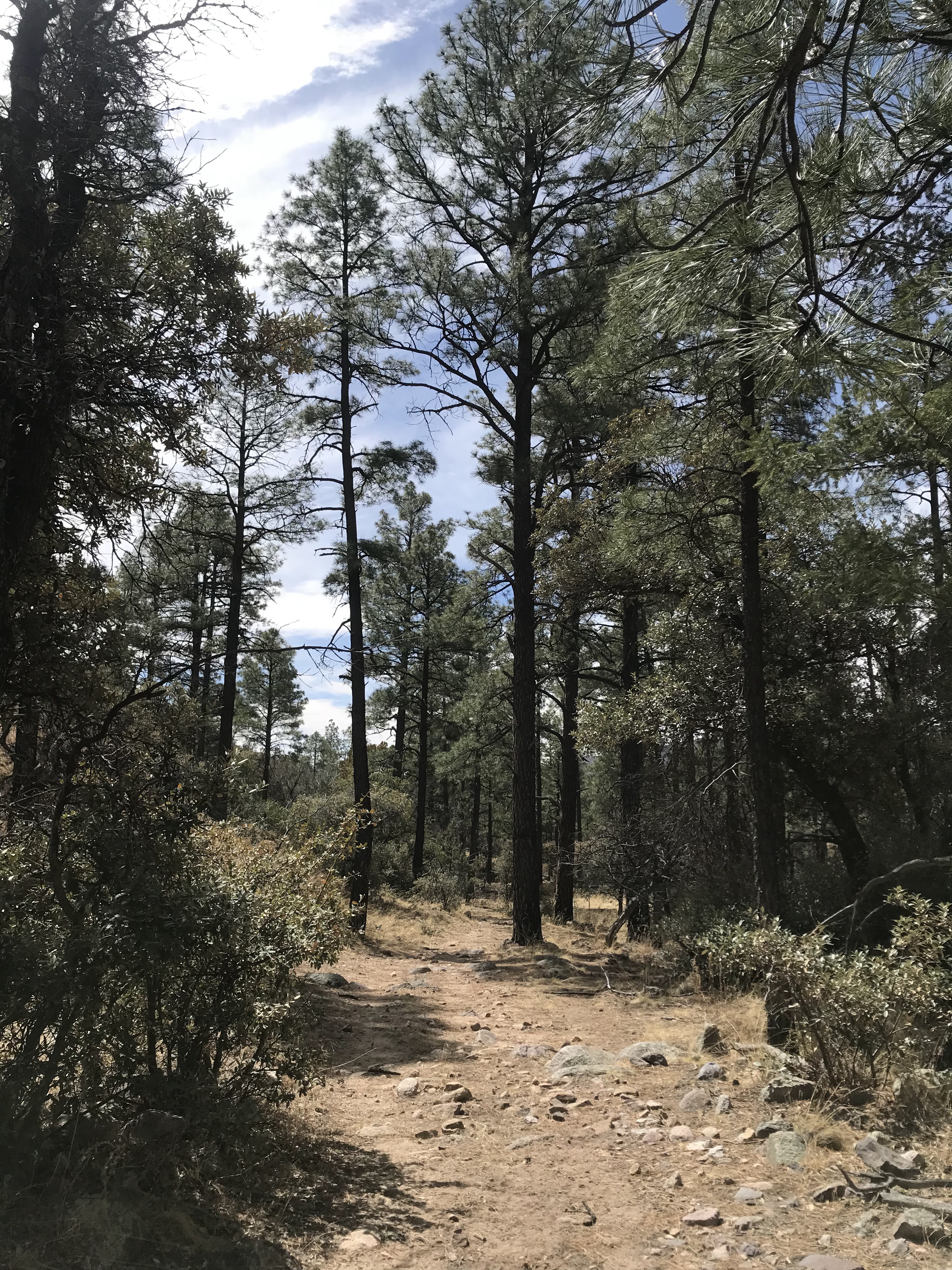
Glorieta Baldy through the branches


 It was pleasant walking and interesting reading and I do recommend it especially if you have any interest in  New Mexico's role in the Civil War. We mostly did it because it was so close by and was unlikely to be overrun with crowds on the holiday weekend.

Labels: ,

Wednesday, April 6, 2022

Aldo Leopold Wilderness - Bald Hill Trail 4081C, Gila National Forest


A couple of years ago, we parked at this same intersection ( FR 157 and FR 4081C) and hiked down the lower part of Dumm Canyon. The stream was flowing under blue skies and it was beautiful day. Back then, I made a mental note  to one day hike upstream from the same spot to see what we could see. This past Sunday ( 4/3/2022) we did just that. Conditions were a little different though. It has been brutally dry once again. The only real water we saw was crossing North Percha Creek. When I got out of the truck, I was immediately hit by how warm it was,  which made me think that now even the early Spring might not be  great time to visit anywhere but the highest elevations in Black Range.

 The trail is really an old road. A short way in we saw some walls and pieces of tin roofing, and then a side road that went steeply up a hillside to a mine. This, plus the cabin ruins to the east are all that is left of the tiny settlement of Danville, which is mentioned several times in James Mckenna's famous memoir "Black Range Tales."

 Metal headframe to the right of the pine


 We found a built up gravel platform which had stone foundations on the other side of the creek as well. There may have been some ore processing done here, but there were no artifacts to be found to confirm this. We continued on. It was actually a pretty little forested hike for about a mile that would have seemed much more pleasant but for the frighteningly dry state of the forest.

As we walked I kept looking up to the north side of the road for any sign of Bald Hill Spring. I was hoping to see an unusual density of vegetation, or perhaps some deciduous trees or shrubs just budding out, but I really saw nothing that gave it away. If it hadn't been so warm, and that given the conditions the spring might not even have any flow, I might've trudged up the hillside to find it. Another day.

 Eventually, the road ended and we followed a faint wildlife trail which quickly entered an area of dead trees and burnt snags. We could see green forest again about 1/3 of mile away, but from this point on it seemed that along the  boulders in the creek bed was probably  the only reasonable way of continuing on  given the density of low growing brush, coupled with the many unstable ravines on its rugged banks.  Too rough and too warm to tackle that day, especially with the dogs.

We stopped when we had gotten to a point with unobstructed views of a pointed mountain of brilliant white rock shimmering a half mile in the distance. We walked back and then went a short distance east and visited the cabin ruins we had found a couple of a years ago.

Found- 1 vintage Michelob bottle. 1 vintage Heineken bottle. 1 more recent can from the Bosque Brewery. Little else, which shows either the lack of visitors, or the general environmental awareness of those who do, or both.

 NOTE :  After about .60 miles the trail enters the Aldo Leopold Wilderness where vehicles of any kind are prohibited.

Labels: , , ,