Thursday, January 20, 2022

Broadhurst Arroyo - Caballo Mountains


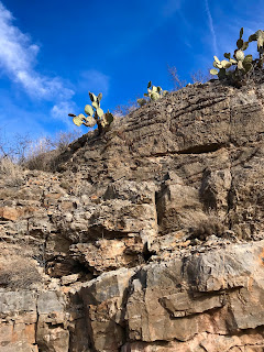
Juniper on its last legs


Six years ago, I made a plan to hike all the major arroyos that cut through the southern end of the Caballo Mountains. We started with Green Canyon, which is the largest and most scenic, and then a couple of years later we hiked Garfield Canyon. Last year, we went to Mcleod Draw/Arroyo and just this past Sunday (1/16/2022) I went out to Broadhurst Arroyo which lies in between Mcleod and Garfield.

 Broadhurst is probably the smallest of all, but it does have a nice little box that was the focus of my hike. I decided to come at it cross-country by starting off from a primitive road about a one mile west of Mcleod Tank and then heading southwest toward Mountain Tank.  The jumbled-up topography, and geology visible after first leaving the truck had me a bit disoriented. After a quick descent from the hill I was parked on, I kept my bearing as best I could, traveling across large upper branches of Green Canyon. Climbing a ridge, I spied a half-dozen deer, including at least one buck, crossing the hilltop in front of me. On the other side I descended a rocky ravine, narrow enough to have a few scrub live oak growing in it. Coming out of it I got back on my bearing with the help of my On-X which was mostly working. Soon I was descending a second rocky defile that directly fed into Mountain Tank. 

The livestock pond was dry, of course, with gnarly old salt cedars on its edge that look more than a little forlorn in this gray, dry and over-grazed little corner of  Chihuahuan Desert.

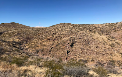
 I made my way around  and soon entered the box canyon of Broadhurst Arroyo. Along the way, there were manganese and calcite veins, chert nodules, and many indistinct fossil in the limestone bedrock of the stream bottom. The layered cliffs of sedimentary rock above that seem to tilt to the southwest were cut crosswise and lengthwise by the zig-zagging canyon. I could see vehicle tracks ever since leaving Mountain Tank, but let me tell you there is no road in Broadhurst Arroyo, at least not in the box section. 

There are old mining roads all around it, but whatever was making these tracks had to be one of those super high clearance rock crawling things as there is a natural dike of rock that crosses the canyon about a half mile downstream from Mountain Tank, never mind the boulders, and extremely tilted sheets of bedrock and the fact that the  box is barely wide enough for any kind of vehicle at all.

To the west the sun was filtered by clouds and it never really got above the mid 50's in temperature. Still I was glad I left my jacket in the car and got along fine with a tee-shirt with a long sleeve shirt over it. The clouds kept the gray and brown winter landscape looking even grayer and browner, so with little contrast and only fleeting blue skies, it wasn't the best day for photography. I didn't make it quite as far downstream as I wanted. Leaving the last bit of rockiness a mystery as I decided to investigate an alcove, which turned out to be a mining prospect, at the top of the cliffs.


I had been hoping for some petroglyphs, like those we found in Mcleod Draw last year, but really there was no evidence of ancient people forthcoming through the entire hike. Later, as usual, I lamented not continuing a bit farther, and also not returning via a different route to cover more ground. As it was, time was limited, and I could already feel a bit of the cold as the sun slid down quickly in the west. I did stop on a hilltop to eat, drink and rest though. Admiring the views to the high ridge of the Caballos and even to the distant Florida Mountains was a side perk.


 My energy so was depleted by my pace ( close to top speed for me using two hiking poles) and the rough terrain, that I was feeling a little lightheaded, which is not good when negotiating steep arroyo banks and the slippery gravel of the hillsides. Round trip, this hike was close to six miles. Other than a few scratches from the thorns that penetrated my lightweight hiking pants, I was no worse for wear.

Labels: , ,

Wednesday, January 12, 2022

Tonuco Mesa - BLM Lands, Doña Ana County


pottery sherd

 Tonuco Mountain

Looking northwest  toward the Caballos


About a year ago I came out to this mesa edge with David and Nancy Soules. David and I had both thought it highly probable that we would find evidence of ancient use. It's really not much of stretch to think that, given all the other sites nearby. We parked just on the west side of the exit 32 on I-25 and proceeded south, sometimes staying on the mesa, sometimes dropping to the broken up hill, ridge and ravine country below.  Nancy had said David had commented before they came out that he was sure that pottery would be found today. Well, it wasn't. We did find an animal carcass that was a little difficult to identify, some shell casings, and other twentieth century flotsam and jetsam that had been dug up when the good road had been put in.

 Shell casing from the Peters Cartridge Company of Ohio

 I returned on 1/3/22 to cover some more ground of the 5 or so miles from the exit to where the road turns down into the big arroyo north of Tonuco Mountain. First I went north from where I parked and then went south and southwest exploring out onto the " arms " that extend toward the Rio Grande. Eventually, I came to the outskirts of a sandy area that rose up slightly from the baked caliche flats. There, I thought, is where I will find pottery. Over the last few years, these soft sandy areas seem to be winning out  as places where ceramics and other artifacts will be found. Sure enough after just a few footprints, I found one sherd and then another and then another still. They were gray, brown, orange, red. Some rough, some glazed smooth. One was a rim piece. None were painted, but I wonder now if sites like this one, close to roads, have had all the painted pieces picked out of them. I wandered back and forth and around and around.  It was easy to see where I had been and where I hadn't by the paths of my bootprints.The bright winter sun filtered through thin clouds, making things warm enough for me to be happy I was out, but not so warm that I ever took off even one of my layers.

Pottery sherds and lithic flake

Pottery and lithic flake

rim piece

 I thought of my friend David who has passed on, and how happy it would have made him to be out here finding  this place with me. I thought this site is probably known and in the database, but that didn't matter much at the time, because it certainly wasn't known to me. I came to a road that was just beyond the rise. It ended at the very point of the "arm." I could've driven right up to the site, had I known it was there.

Returning in the late afternoon, I crossed a large rectangular pit that was dug a long time ago in effort to collect water on this flat terrain. After rousting a few jackrabbits and getting back to my truck, I drove around on some of the roads I had found and almost got into a tight spot where I had to back up and turn around (with little room to maneuver) rather than encounter a place where the mesa's edge had retreated through the road.

Labels: ,

Saturday, January 1, 2022

Potrillo Mountains Wilderness - Brock Tank Arroyo, Organ Mountains-Desert Peaks National Monument


 Mount Riley and Cox Peak to the south


 Aden Crater in the distance

Yucca near Aden Crater


This little hike turned out to be much nicer than I expected. The day before (12/28/21) we had attempted to do a hike over in the Good Sight Mountains, but the wind and the cold, as well as our dogs getting one thing after another stuck in their feet convinced us to turn back only a short distance from our vehicle and  save it for another day.                                                                                                                                      

The next day promised more of the same, but I went out anyway, slightly earlier, this time headed for the West Potrillo Wilderness. I had checked the weather map and realized (a bit late for our Good Sight hike) that the areas north of I- 10 and further west of town were getting stiffer winds and colder temperatures. I was hoping for better conditions south of the highway and substantially east of where we had been. It didn't appear that promising after about 40 minutes of driving and nearing Aden Crater, when I looked out the window to see the creosote being batted around by the wind. I continued on anyway, rounding the volcano and then heading southwest after opening and shutting a gate near a corral area. The road, after reaching the dry Brock Tank is bordered on both sides by wilderness and I was glad to see there were several signs indicating such. 

It's the longest "cherry-stem" penetrating the West Potrillo Wilderness, and I wasn't really sure why it was needed until I got to the end. Here, was an old line cabin along with windmill, solar panel, and water storage tanks (all now defunct).

 I started off to the west, initially following the arroyo channel, but then just headed on a line towards the box section after catching a glimpse of it in the distance. After cresting and descending a small rise, I was close enough  to begin walking in the gray gravel and boulders of the arroyo. Soon after where I entered,  the stream channel cuts through the a cinder cone.  There were leafless hackberry trees lining the sides of the now much narrower dry creek bed and the cliffs above alternated between blocky gray basalt and rusty red consolidated cinders where electric yellow lichen always seems to  grow. This particular canyon didn't seem to have enough flow to have carved out any significant tinajas or even to have  smoothed down the basalt to any great degree, unlike one I visited just a few miles to the southwest a few years ago. There wasn't much scrambling to be done either. I spied alcoves above, but opted not to climb up on the slippery cinders.  I did look into one that was eye-level, without much to report.

The depth of the  little box is between 25 and 70 feet and extends for about a mile or so before shallowing up after rounding a second cinder cone. Shortly after that is the head of the arroyo. I got up out of the canyon and could see a couple of low  cinder cones about a mile and a half off to the west. 

The wind up on top was surprisingly mild, so I headed south across the mesa to look at the next arroyo over. It wasn't much and I wished I had headed north instead. It was just warm enough for the wind not to be problem and I walked along through the pale dry grass, which appeared to have had some good growth this past summer. 

Cholla and barrel cactus were there and here. Flocks of sparrow-sized  and slightly larger birds flew from bush to bush at my approach throughout much of my walk. I even took a few breaks and got out my binoculars to get a closer look at some of them (a rarity). I had never seen this many birds in this part of the Monument before in any season. Unfortunately I'm not much for identification on the fly. I just don't practice enough. There were definitely some black throated sparrows, some species of the flycatcher and of course I flushed out some quail several times (probably scaled, definitely not Gambel's).

 It was a very mellow return trip.  In the canyon the wind was barely a factor, but now at times the wind even stopped altogether as I kept walking through areas of just dried grass and gravel with only the occasional lone mesquite or yucca rising up with room to grow. 

This harsh desert seemed quite benign at least for a few winter hours from late morning to early afternoon. Back where I parked I investigated the old cabin and environs. Inside the stucco and chicken wire dwelling, there was charcoal written graffiti on the walls, and animal tracks in the accumulated dust. Forgotten places like this always give me pause. I imagined  moments in the past: the day the cabin was built, then some cold night when cowboys took shelter inside,  and then the last day it provided any useful function to anyone ( if you are someone out there who knows anything about this cabin, please let me hear your story in the comment box).

Labels: , , , ,