South Fork Palomas Creek - Aldo Leopold Wilderness, Gila National Forest


Places like this in the Gila, especially in the Black Range are the essence of the ineffable for me. Still, I try to find the words, and I diligently take the photographs that I know will never transmit the feeling that I have when I am at the bottom of this deep lonely canyon with the obviously majestic thousand foot cliffs crowned with a myriad of rock formations rising above, while beneath my feet moss growing thickly on the gray bedrock gives way to a plush quilt of fallen bigtooth maple leaves in tan, yellow and red on the banks.

I hear what turns out to be a deer stumbling on the rock glacier, in answer to my own stumbling. I think this is place so rugged that even the deer have difficulty now and then. I think, I don't belong here, and yet I am here and that creates a giddy sort of dissonance.
This spot came on to my radar because of my friend, that most intrepid of New Mexico explorers; Doug Scott. We were supposed come up here together to look for waterfalls about a year and half ago. Doug ended up going that spring and if you want to see the waterfalls he found look here: http://www.dougscottart.com/hobbies/waterfalls/Palomas.htm . I would have to wait until last Saturday(10/23/17). I decided a while ago that I would visit in the fall, because of the canyon of bigtooth maples that Doug and Nate Bartnick had discovered. I am a total sucker for the magic of maple trees in October, so off I went hoping to find them at peak color.
I had been in South Palomas once before when we had been camping at either Circle Seven or Morgan Creek quite a few years ago. We only hiked on the trail along the creek briefly before heading off into Marshall Creek to find the springs to cool off our overheated dogs on a warm September morning.

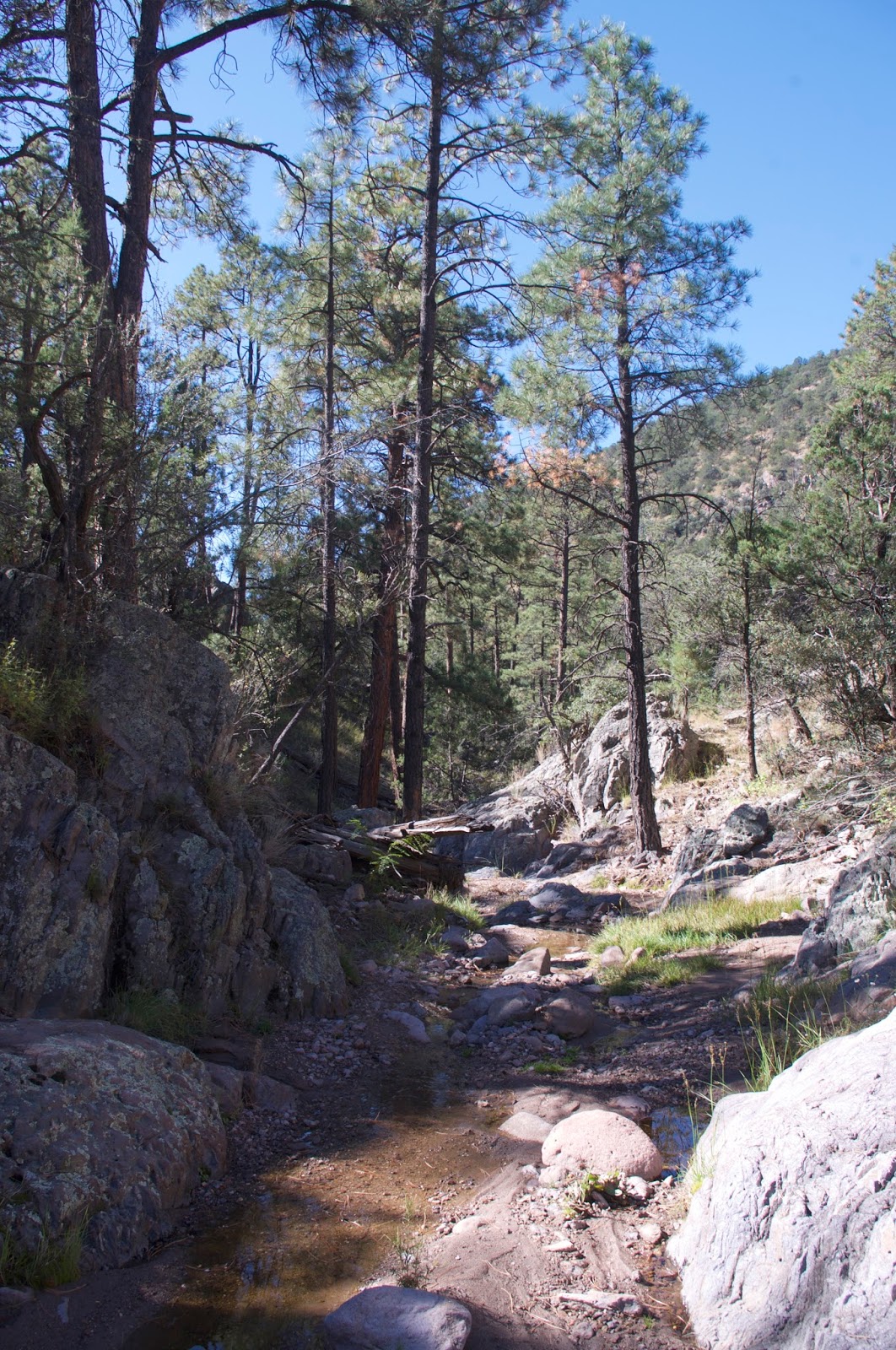
It's a long drive to get there for a day hike: 2 hours and 47 minutes. The last mile or so on some tracks barely visible in dry grass only increased my anxiety about the feasibility of the whole enterprise. But the morning was pleasantly warm and the skies devoid of clouds as I started hiking out past the old lower corral. In a short distance the good trail I was following headed up Marshall Creek, while the remnants of the Palomas trail became invisible in the tall grass along the creek. I experienced some low grade panic, wondering if I was on the right track, until I found the upper corral of wire and wood and I knew now it was all good.

Somewhere early in this trip I left my aluminum hiking pole on the ground as I took photos of oaks and boxelders in full turn. I picked up several sticks along the way that served well as substitutes. I never did retrieve the pole which I've been trying to lose for some time and now had finally succeeded. I kept a good pace, knowing my time was limited.


An owl flew from its perch and turkeys trotted up the trail in front me. As I walked on and as the canyon narrowed I caught a glimpse through the trees of a patch of blue at the base of a rock tower. It was a natural arch formation which would have been so easy to miss had I not looked up at just the right moment.


I hear what turns out to be a deer stumbling on the rock glacier, in answer to my own stumbling. I think this is place so rugged that even the deer have difficulty now and then. I think, I don't belong here, and yet I am here and that creates a giddy sort of dissonance.
This spot came on to my radar because of my friend, that most intrepid of New Mexico explorers; Doug Scott. We were supposed come up here together to look for waterfalls about a year and half ago. Doug ended up going that spring and if you want to see the waterfalls he found look here: http://www.dougscottart.com/hobbies/waterfalls/Palomas.htm . I would have to wait until last Saturday(10/23/17). I decided a while ago that I would visit in the fall, because of the canyon of bigtooth maples that Doug and Nate Bartnick had discovered. I am a total sucker for the magic of maple trees in October, so off I went hoping to find them at peak color.
I had been in South Palomas once before when we had been camping at either Circle Seven or Morgan Creek quite a few years ago. We only hiked on the trail along the creek briefly before heading off into Marshall Creek to find the springs to cool off our overheated dogs on a warm September morning.

It's a long drive to get there for a day hike: 2 hours and 47 minutes. The last mile or so on some tracks barely visible in dry grass only increased my anxiety about the feasibility of the whole enterprise. But the morning was pleasantly warm and the skies devoid of clouds as I started hiking out past the old lower corral. In a short distance the good trail I was following headed up Marshall Creek, while the remnants of the Palomas trail became invisible in the tall grass along the creek. I experienced some low grade panic, wondering if I was on the right track, until I found the upper corral of wire and wood and I knew now it was all good.

Somewhere early in this trip I left my aluminum hiking pole on the ground as I took photos of oaks and boxelders in full turn. I picked up several sticks along the way that served well as substitutes. I never did retrieve the pole which I've been trying to lose for some time and now had finally succeeded. I kept a good pace, knowing my time was limited.


An owl flew from its perch and turkeys trotted up the trail in front me. As I walked on and as the canyon narrowed I caught a glimpse through the trees of a patch of blue at the base of a rock tower. It was a natural arch formation which would have been so easy to miss had I not looked up at just the right moment.

Puddles lingered in scoured out pools in the bedrock as the creek bed became the clearest avenue of travel. Immense cliffs towered above the north side of the creek strikingly similar to those seen over in the gorge of North Percha, but these were even higher.


I finally arrived a the mouth of the canyon with the bigtooth maples that Doug and Nate had named (you guessed it) Maple Canyon. To my disappointment the leaves on the first tree I encountered were entirely green. Color was found as I continued up the canyon, which at least for some of the way had lovely open channel with a smooth bedrock bottom that would have contained many small falls cascading toward the confluence with South Palomas had water been flowing, as it was, water lingered in the discreet pools surrounded by spongy green moss and sprinkled with pale, fallen maple leaves.

The many theories I have on the fickle nature of fall colors, and perhaps a few new ones began to dance in my brain, as I made my way clumsily upstream, still hoping there would be a more spectacular display onward. There never was. A few pretty patches and a couple nice little trees would have to do for today.

I finally stopped to rest. I had forgotten my phone and watch, which had had me hiking at a blistering pace as a kind of insurance in case my estimate of 4.5 hours for the round trip hike was way off.
I drank another bottle of water. Took a photo of myself nestled in the glen, and then headed upstream just bit farther to where the canyon got extremely narrow, very thick with willows and a few walnut trees, and the maples ended.


I turned around and for the first time, really took it all in as I gazed down Maple Canyon to the nearly 1000 foot cliffs on South Palomas crowned with towers and spires.

It was the only place for me to be in the world at that time, on that day. I slowed down as I made my legs and feet carry me back to South Palomas heading little bit farther west before turning back. I glimpsed a second deer. Disturbed the same owl. Saw the turkeys again too. Touched the biggest ponderosa pine I have ever touched, and contemplated the upright cones of a true fir for the first time it seemed.
I did my best to follow the the bits and pieces of trail, but didn't really to do any better than on my way in. Where the valley widened, I waded through the high grass and felt a sadness to be leaving. I took a couple more photos with the yellow tops of narrow leaf cottonwoods along the creek and the shadow of Lake Mountain in the distance. Back at the car I realized I had overshot my time by a little more than hour. I thought about returning some day, camping nearby, getting an early start and doing it all over again, but just a bit more slowly.

Labels: fall colors, hiking, natural arches, waterfalling
posted by Devon Fletcher at
5:38 PM
2 Comments
![]()
![]()