Thursday, January 24, 2019

Cedar Hills Walkabout - Organ Mountains-Desert Peaks National Monument


 Andrea and I, plus Seamus and Nessie went on this hike on a perfect winter day. The road along the ridge above Foster Canyon continues to deteriorate. Four-wheel drive and high clearance are strongly recommended if you go.
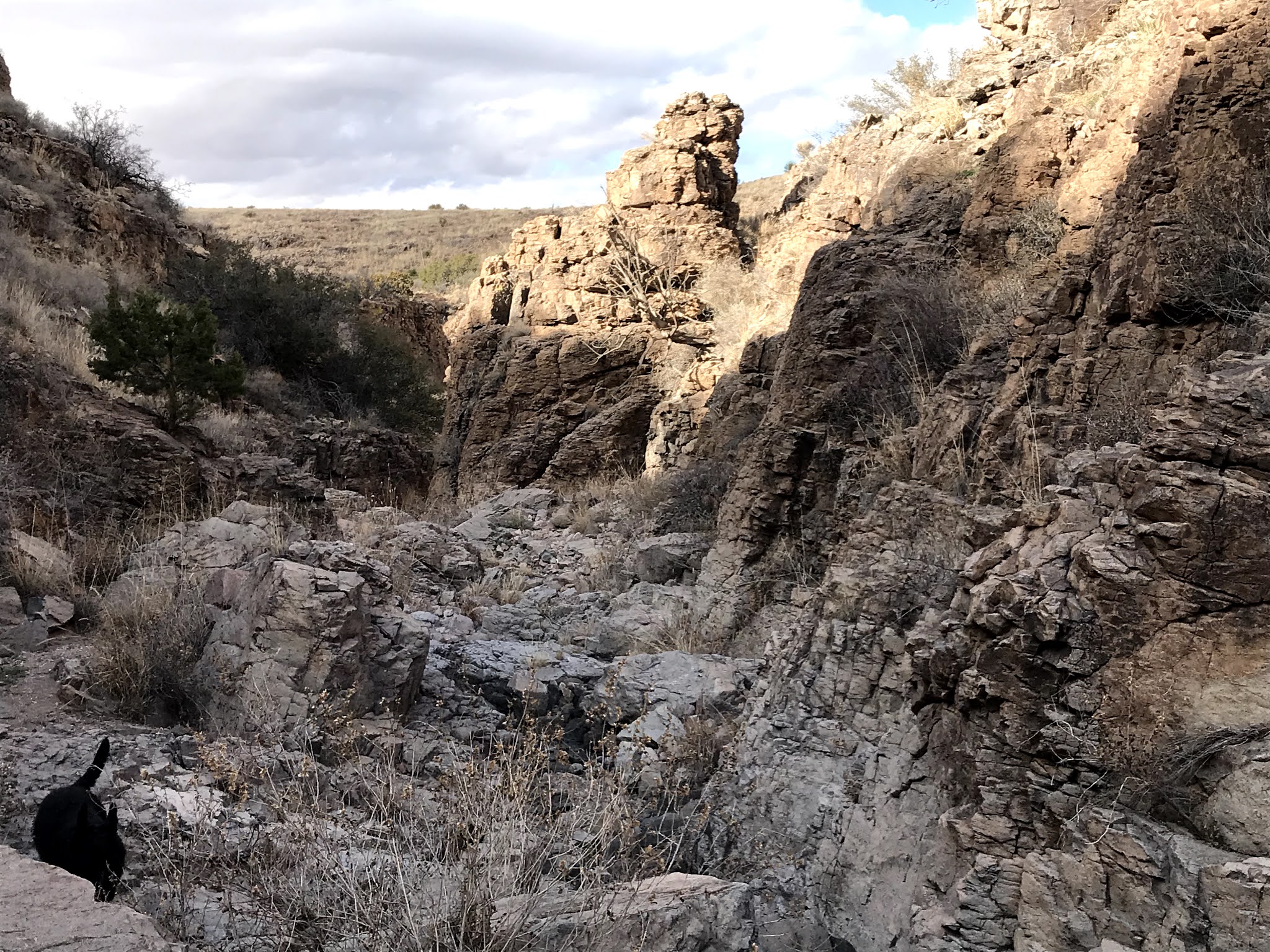
 We drove down off the ridge and parked just above the main arroyo of Foster Canyon. I took everyone through a little canyon on the north side that I explored a year and a half ago. We had our lunch in the narrows where large junipers grow and then continued upstream. We had to cross under a fairly new( all metal green and white posts and yet to rust barbed wire) fence to get up to the divide. We quickly came to the top of a second canyon with very scenic 100 foot sentinel cliffs on either side.
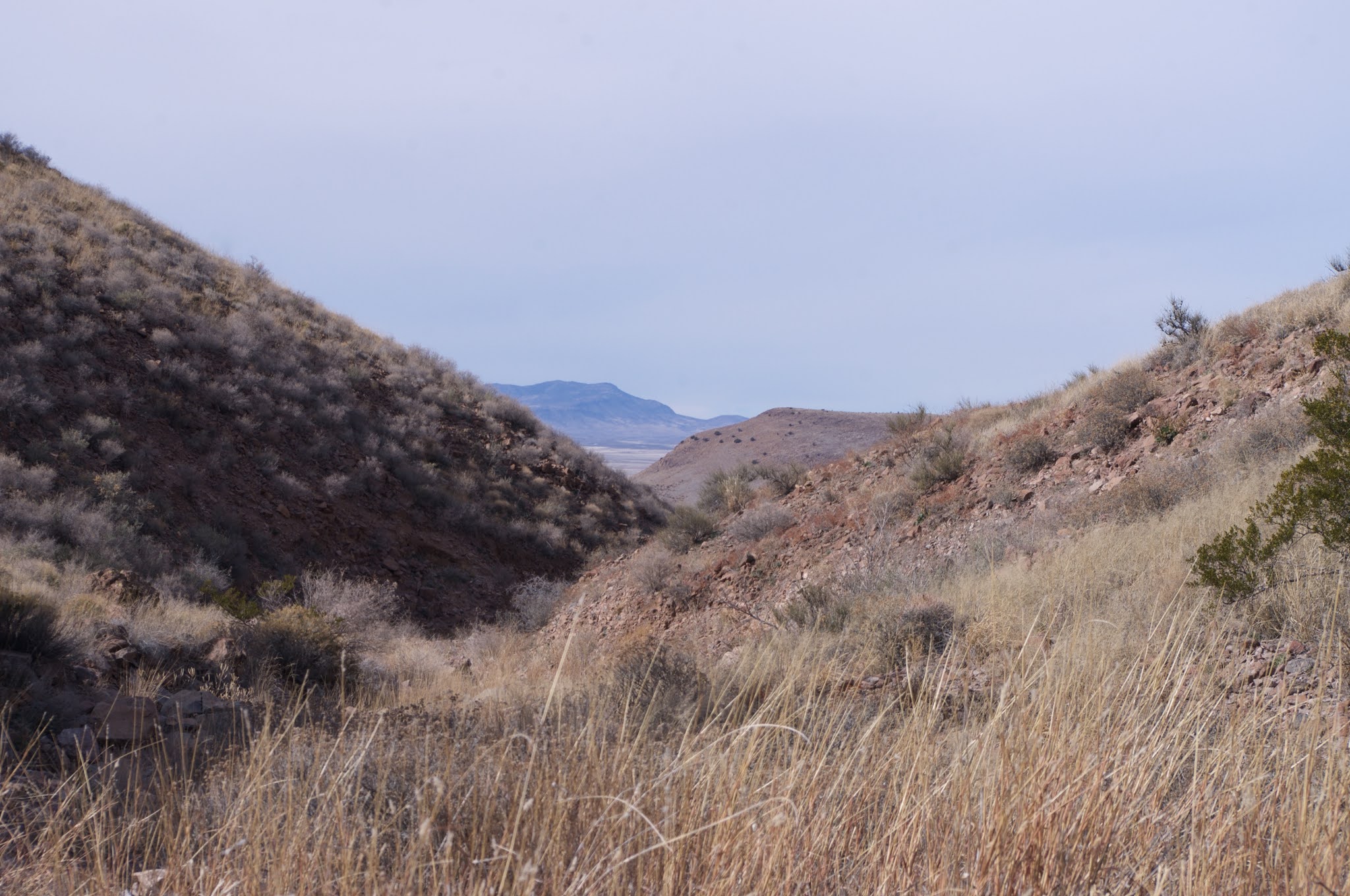
I scouted out if the very steep defile was navigable, and determined that with the dogs, it was not. It may not be without them either, as it  appeared to consist entirely of large boulders and steep drop-offs with nary a level step in between. Still we lingered at its top for awhile, just to admire  the unexpected, but truly impressive  views that were available. Dark Mountain loomed on our right and flat-topped Tonuco Peak stood tall in the distance.

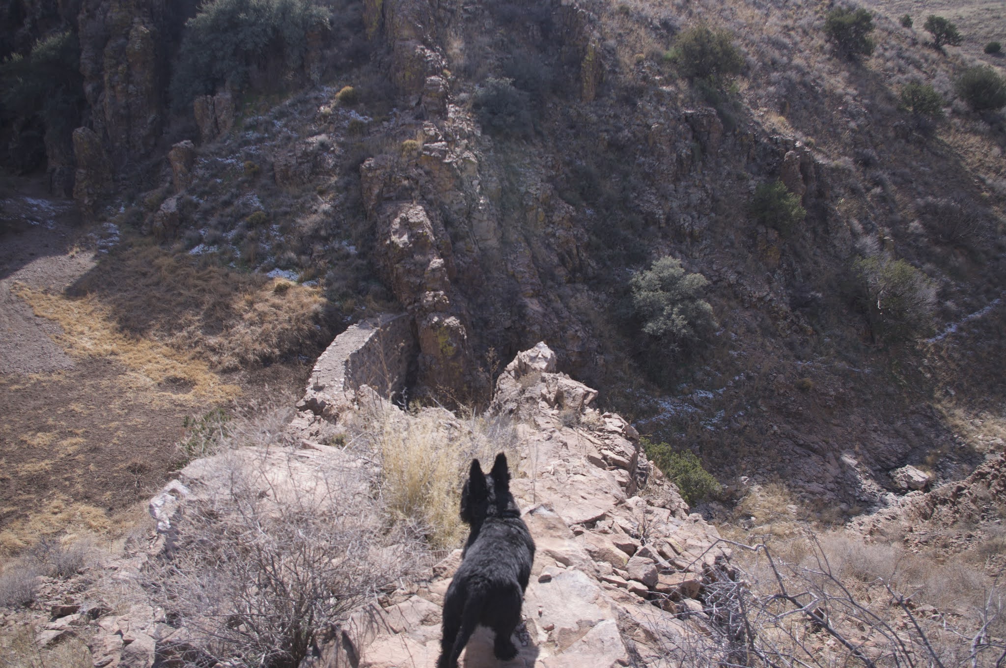
 At first we tried going around on the right side but soon determined that we were liable to be stopped by some cliffs( we were correct as it turned out). So we went down, mostly gradually on the left. At the bottom we took in some good views of the " gate" of cliffs we had enjoyed from the top end and then moved along in the winding little canyon that emerged from it.
 We got out of the stream bottom and began rounding the mountain that was edged with cliffs and punctuated with small towers.

On the back side we were heading for a saddle through the dried grass and widely spaced yuccas when we came upon the steep upper reaches of another ravine that was surrounded by red rock cliffs, interspersed with conical towers.

We had to backtrack rather ford the steep canyon, and then headed on to the next saddle over. On the way we passed by  a rocky ridge, and saw some massive chunks of red jasper lying on the ground. Andrea didn't like the prospect of the steep, rilled hillside that awaited on the other side of this saddle, so we backtracked again, taking the easier way down the ridge we were on down and walked across several small feeder branches and then into Foster Canyon itself and back toward the truck.
This is a very scenic, but overlooked corner of Organ Mountains - Desert Peaks National Monument. The poor condition of the road to access it certainly limits the number of visitors, but if you have a vehicle that can make it out there, it's certainly worth your time.

Labels: , ,

Thursday, January 10, 2019

Good Sight Mountains- Two More Canyons


I was back in the Good Sight Mountains again this past weekend. It's been about a year since I investigated two fantastic little canyons in a little loop hike, and now I was back to do another loop through two canyons just to north. The primitive road that heads south from the good county road (  Luna A0 21) seems to have gotten even more primitive, but at least I wasn't driving quite as far this time.The outing got off to an auspicious start even before we got out of the truck. A herd of about 30 antelope ran back and forth across the road at full tilt kicking up a cloud of dust as they went. I had never seen them run like that before. Amazing.
We found a parking spot just big enough to accommodate our truck and then we were off to the west over the rocky grassland and soon were in the even rockier shallow upper reaches of the first canyon. There wasn't much sand or gravel just bigger rocks and bedrock to walk on.


Then the canyon was dropping more steeply with iced over pools of water tucked in the recesses beneath drop-offs.  Along the way I stirred up a couple of owls as  I  frequently do. One was larger, probably a barn owl, and the other was smaller about half the size, that I won't even speculate as to the species. Across from the first dry waterfall of significance  that had to be negotiated with a bit more care, I spied a few petroglyphs on the darkened canyon walls. I looked around for more  on the most likely rock faces, but came up empty, although I did come across a rock fall that had some boulder placements that seemed to defy randomness.


The canyon deepened even more from this point with cliffs and towers of volcanic rock that had a regular foliation which when eroded  gave the appearance of  ruins made of brick or stone work. Scrub oaks grew in the bottom and clung to the canyon sides. A short , slot of a side canyon appeared on north, which we investigated up to an icy pool that lay below a blackened dry waterfall.


Shortly after that we came up to the back of the stone dam which is still in excellent repair. There was no way down at the dam so we had to back up a bit and go around up high on the north side. The pool of icy water at the bottom was larger that I would have guessed, but this is the narrowest and deepest part of this little canyon.  I stepped along the bedrock ledge to the back of the pool and front of the dam looking for more rock art but finding none.


Walking just bit further downstream I came to a large two tiered ephemeral waterfall. We couldn't climb down the blocky, gray cliffs  easily here either, but we found a quick way up and around and before we were even all the way down, I could see petroglyphs on the black rock face.
To get a closer look required I walk along the edges of a frozen, snow covered pool and then climb on fairly narrow ledge, all the while admonishing Seamus not to walk out on the ice. There were two nice panels and there may be a few more glyphs in the in-between area below the first drop and the second drop.


David Soules finding petroglyphs

Looking toward the Sierra de las Uvas
We walked on now and soon began the cross-over heading south to the second canyon. It was open territory and even a little bit warm for January. Not much to report from the second, except that it was even more narrow than the first  and the  going got a little thick for us towards the top getting through the branches of some very old junipers. We saw a few deer but luckily I saw them first and was able to get a leash on Seamus so he wasn't taking off in a futile pursuit.


We walked to the top of a small hill past  rodent mounds and the bare ground around them setting off the jackrabbits and bunnies that hid behind mormon tea bushes as we went. At the top we looked down at the blue Tacoma just a short distance away, waiting for us as the afternoon clouds settled in on what had been a wonderfully sunny day.
 I returned a week later, bringing David and Nancy Soules. This time we followed a road that led to a large parking/ dispersed camping area that was directly above the dam on the south side. There is actually remnants of the road right down to the dam site which we  walked on to come in and out of the canyon. After looking at the dam and the little slot canyon, a handy cowpath with some slippery loose rock got us quickly to the main rock art panels. We found a few more petroglyphs there than I found the first time. Downstream, where the canyon levels out, we spied some stone grinding tools and a few bits of pottery at our feet. Later, after looping around in the hills and coming back down the canyon from the east  I saw several more barn owls. 
NOTE: As always be respectful when passing through any parcels of private land in the Good Sight Mountains. Also, it's a nice idea to have a New Mexico State Trust Lands recreation permit as there is quite a bit of state land ( which much of this hike was on) mixed in with the BLM out here.


Labels: , ,