Lower San Andres Canyon ( FT 2094)-Lincoln National Forest


There is this idea, and maybe a single image somewhere on the web to confirm it, that when the stars and planets align and the prayers to Tlaloc are sufficiently sincere, along with good spring snowmelt or abundant summer rains, the normally dry waterfall in South San Andres Canyon flows. It must be a wonderful show when it does; leaping off the top of a sheer 200 foot cliff and plunging down the steep boulder filled stream bed below. This is what put the San Andres hike on my radar. I have seen the many falls in nearby Dog Canyon running at a good tilt, so I knew it wasn't out of the realm of possibility. It just wasn't meant to be this particular visit. It's just been too damn dry.
But I really didn't need seeing the waterfall as the only reason to get out there. It turns out I had a perfectly wonderful day exploring the often overlooked but spectacular canyon country on the west side of the Sacramentos. Many people have heard of, and quite a few have hiked the aforementioned Dog Canyon's National Recreation Trail. San Andres Canyon appears to have very light usage. While there is evidence that ATVers penetrate a short ways into the canyon, on a pleasant cool spring Saturday, there were no other vehicles at the trailhead and I saw no other hikers for the six or so hours I was there. A couple of observations that may explain this situation are probably in order.
While most folks in the region are familiar with the Lincoln National Forest's high elevation destinations as cool summertime retreats from the desert's blazing heat, or as fall and winter hunting grounds, I would bet that many people don't realize that the Forest's boundary extends all the way down to the city of Alamogordo and the Tularosa Valley. Secondly, getting to the access points at the mouths of many of these majestic canyons, is problematic due to inholdings of private property or as is the case with getting to San Andres Canyon roads of very poor quality. This was not impassable or even a scary route, just ridiculously bumpy and very slow.
I parked just before the fence and gate up on the hill.Walking along the last bit of road beyond in the cool morning breezes, I never saw the trail splitting off on left side, so soon I was down in the canyon.Warning: if you drive past the gate, park at the loop, there will be no place to turn around for a large vehicle beyond there.
Down in the canyon I walked along, spying a rusty old water pipe as I went.


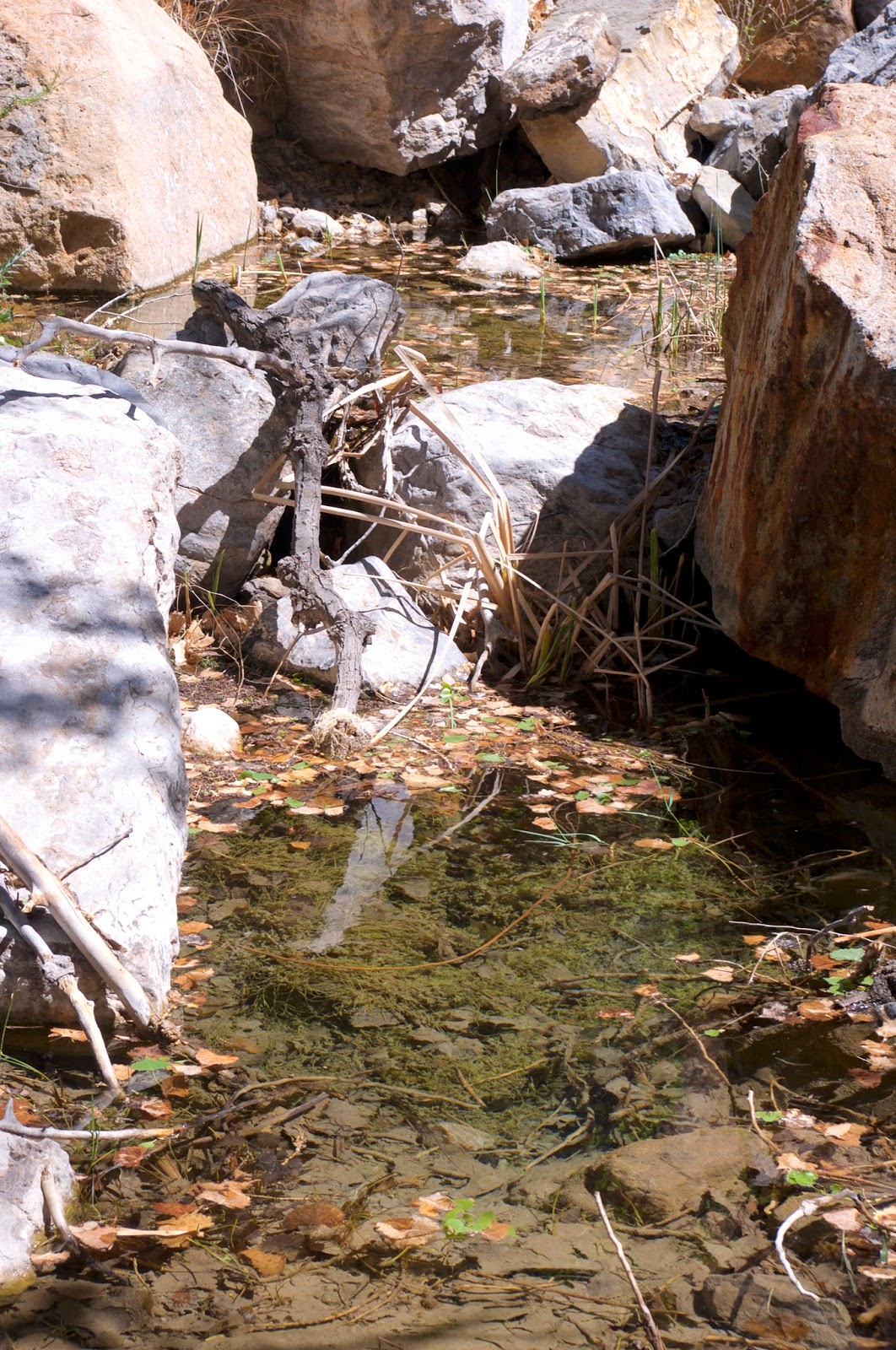
It was quite a lot of rock hopping and a few spots of climbing lower dry waterfalls,until I reached one that had me climbing up onto the hillside, where I quickly found the trail. Shortly thereafter I encountered a small puddle of green water and some large, but dead hackberry trunks emerging from the thick brush at Hackberry Spring.


From there the trail went up onto the bench lands high above the creek. Awe inspiring views of both San Andres and South San Andres where they cut through the cliffs kept my eyes and camera at attention.


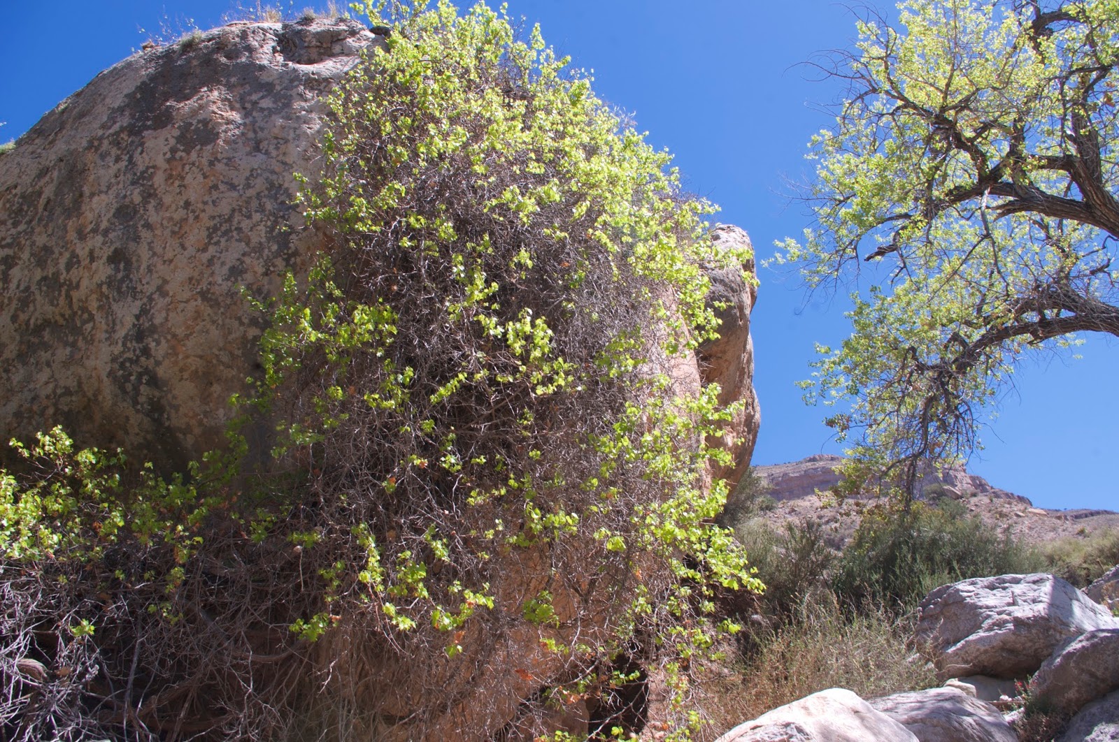
Seeing that the South San Andres waterfall was dry, my alternate plan kicked into action. I would visit the springs up the main San Andres. It was easy enough to see where they were. Huge cottonwoods with their electric green spring leaves marked the location.
Sources will tell you that the trail ends on bench about 50 feet above the creek, but it actually does continue, nearly invisibly, down towards a big alligator juniper, where there were several cowboy petroglyphs inscribed on a boulder.
I didn't know at the time but there are cairns, but no real tread, marking the continuation of the trail onto the south side of the stream where it most likely continued steeply up to a higher bench and further on perhaps at one time all the way to the Upper San Andres Trail ( FT 125) on the east side of the West Side Road ( FR 90).
After resting in the shade of the juniper, I started the very tough scramble up to the spring, sometimes in the boulder filled creek, and sometimes battling the thick vegetation on the banks when climbing around a couple of larger dry waterfalls. Once I was in the canyon I could no longer see the trees and greenery that were my obvious destination, so it was welcome small joy when I maneuvered around a few more boulders to have them finally come into view at close range. There was precious water, fresh elk scat, grapevines growing on an enormous boulder and even a few cherry trees. It's a lovely place and I stayed awhile, exploring and then deciding to eat my small orange in the shade of one of the big cottonwoods.


Above Cottonwood Spring, maps indicate a Dripping Spring a short distance upstream. I thought about going up there as well, but then contemplating another potentially rough climb, and the fact that the small orange had been and would be my only food until I got back to Alamogordo, I decided not to extend the trip.
On the way back I got into the canyon again, climbing down some falls just above the confluence with South San Andres. It's very rough throughout this section, but the narrowest part of the canyon with vertical cliffs of layered limestone hundreds of feet high is not to be missed.

I fell hard once during the scramble, but not in the middle of any tricky or sketchy moves, but rather catching a toe on a low branch of an improbable desert willow growing leggy and intertwined among the boulders. I got back on the trail right in the vicinity of Hackberry Spring and now it was good trail walking on the balance that I had not used on the way in. I took many photos to help preserve the memories of this day: the contrasting cliffs south side and north, cactus and ocotillo flowers, and whimsical rock formations were among the subjects, plus a few of yours truly with the aid of a boulder and my shutter timer.


At a barbed wire fence with gate on the hill, an old FT 125 sign was propped up. Making me think since this is number of the Upper San Andres Trail miles, and a few thousand feet of elevation gain away, that this was once a through trail from the desert to the top of the mountain range. From there I switchbacked down to the road and contemplated why it was so easy to have missed the trail entrance. Soon I was back at the 4 Runner.


Labels: fossils, hiking, waterfalling
posted by Devon Fletcher at
7:03 PM
0 Comments
![]()
![]()


