Wednesday, August 15, 2012

Rosedale, Potato Canyon - Cibola National Forest

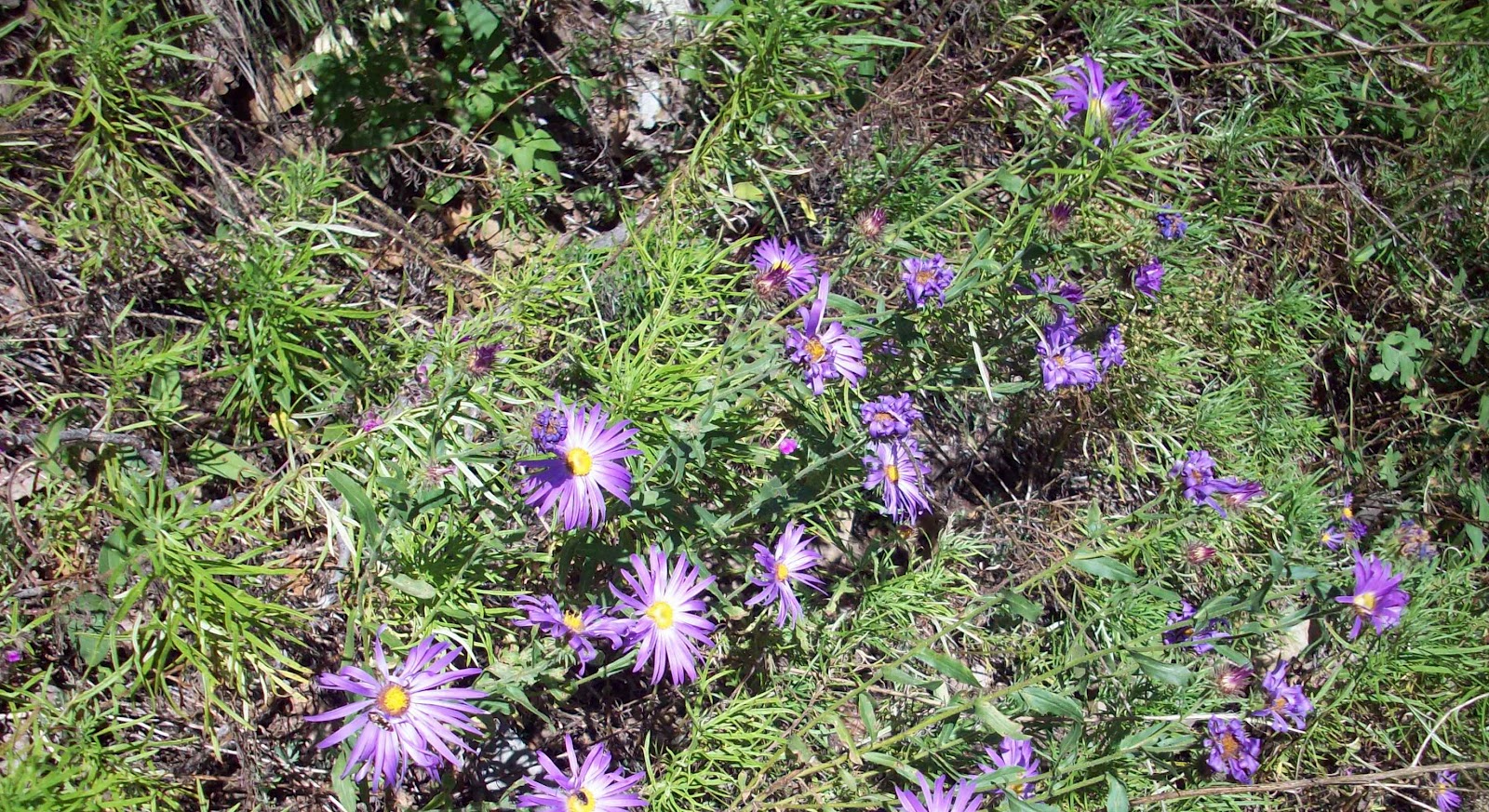
 Tailings from cyanide leaching process still bare after 60 years 
 
On a spring break camping trip, I think it was in '03 or '04, we had a malfunctioning camp stove. We packed up our camp on Circle Seven Creek and headed north on NM 52. This state highway is not paved past NM 59 about 10 miles north of Winston.  Much of the 50 or so miles to Magdalena has the the dreaded " washboard" surface you hear so much about. No luck in getting a stove  in Magdalena, so we headed toward Socorro. On the way we looked at the Water Canyon Campground which is on the northeast side of the Magdalena Mountains, and the only designated campground in the range. The canyon is beautiful, but the campground is the old timey, meet your neighbor, paved parking lot,  walk-in type set up that we go to lengths to avoid. So we went on to Socorro and bought a little propane stove.
   I'm not sure why I had Rosedale, on the east side of the San Mateos, in mind, other than all ghost towns hold some interest for me. It had been small gold mining settlement, centered around a single mine, that persisted for  30 years or so in the late 19th and early 20th  centuries. We took FR 330 from NM 107 and set up camp right in the old mining area. There was what appeared to me to be the remains of an old sluicing set-up ( actually a flume that brought water to the processing ponds as I found out later) nearby.  I believe this mine used a cyanide leaching process. There were two large mounds of completely bare fine dirt, which we steered clear of as we walked around the surroundings.  A visit in 2020 showed the flume is gone, and the tailings mounds are now fenced but have been reclaimed and have grasses growing where before not a single weed dared to live. 
It was very cold that night, but we got a pretty good fire going. The next morning I lit our catalytic Coleman heater,  and tried to get some breakfast started in the 30 degree temperatures.
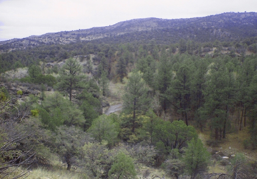
   Later that morning, we packed a picnic and drove over to Potato Canyon,  a few miles to the north, accessed by Forest Roads 52 and 56. I had read about this hike in three different guidebooks, so I was more than little dismayed and embarrassed when the lower mile of the trail was replete with bovine fecal matter. I'm not talking about a few cow pies here. The herd had chosen this spot to hunker down for awhile because of the small intermittent stream, and it definitely showed. Besides the abundance of crap, there didn't seem to stitch of green vegetation, except for evergreens, below the level of a cow's reach. All this is not meant to be a diatribe against cattle ranching in the forest. It's just that this place had been touted as an attraction, a highlight, if you will, of the Withington Wilderness which we had entered as soon as the trail began.There are interesting rock formations and sometimes waterfalls further upstream. We never made it. It was hot and this place was doing nothing for us so we left. We ended up driving back on FR 330. We went past an old chimney ( the only remnant of the Rosedale Lodge that burnt in 1943)and foundations near Rosedale and then up, up, up to the top of the mountain. We tried out the 4 wheel drive through a few snowy patches. We also tested our reserve of nerves on some very narrow, very rough sections that had the added attraction of nice views of the several hundred foot plunge our truck would take if we didn't manage to stay on the road. We stopped here and there, but eventually made it to the top.
    For some reason, we started down the Hudson Canyon Road (FR 96) but when the snow got pretty deep we thought better of the whole enterprise. It was a little dicey getting the truck out of there, but we did. There are some  open meadows at the top that would make perfect camping spots - at a warmer time of year.
   We drove back down and headed out for the highway, but not before stopping for dinner on the tailgate of our truck. That's when we were set upon by ever growing herd of cattle who must have thought we were bringing them food, water or kaopectate. The leader was an ornery looking cuss with a six inch piece of cholla stuck to its lip, which made it look even meaner. We packed and cleaned up our stuff in record time and were out of there just in time to have ol' cholla-lip eat our dust. As we headed home we could see that winter was getting in one more blast on the San Mateos and the Black Range. If you want to learn a lot more about Rosedale please visit the Socorro County Historical Society pages about the town here;

Labels: , ,

Monday, August 13, 2012

Iron Creek Road( Black Range)-Gila National Forest


We hiked down this old road,which starts a few hundred yards west of Wright's Cabin where we had eaten a picnic lunch. There is an entrance on the south side of NM152 and room to park. It can be driven down a short way to a good sized campsite,where there is room to turnaround. Beyond there the road doesn't appear to be driven at all and it's not advisable. This was nice walk with tall oaks, gnarled boxelders, and some of the largest New Mexico( Arizona) alders you'll see providing ample shade. Iron Creek had water here and there this year, but sometimes it can be an ample stream. A little more than a half mile down we saw the remains of an old bridge( with a steel frame, so not real, real old), and an outhhouse. I surmised this was an old camping area. Later when I looked on the topo map, I could see that I was correct; this had been a campground. It's about a half mile east of the current campground at Iron Creek. We continued exploring up a side canyon immediately to the south and found some old rusty grates, 50 gallon fuel cans,  and corrugated steel lying around. There were s mine shafts and tunnels on either side of the drainage continuing uphill for several hundred feet. I'm thinking  the grates were either platforms or were  for  keeping people out of the mines and have since been removed. Please don't enter the mines if you come here to have a look. It was pretty humid and about 80 degrees, so we were working up a sweat as we climbed upward. We rested for bit on top of an old tailings pile, and then went back down. Before turning  back toward our starting point, I scouted around to see if there was any sign of a road or trail that would take us all the way down to  Iron Creek Campground,but I saw nothing. On our way back to our truck, I thought about how this abandoned camping area and road have a wilderness feel to  them even though the highway is only about 20 feet over and 30 feet up from where we were walking.IMPORTANT NOTE: This hike is within the Silver Fire burn area which is currently closed( June, 2013).

Labels:

Friday, August 10, 2012

First Trip to Wolf Hollow- Gila National Forest


Beaver Creek
 We  first came out here  right after school let out in early June, 2005. The campground was simple enough: five sites with fire rings  and picnic tables around a small loop with a vault toilet in the center.There is no water. Juniper and ponderosa pine cover the uplands here, but much of the area is open grassland. We were dismayed to discover the bones, with some flesh still attached, of at least one elk scattered about within a few feet of  our campsite. Not the kind of thing one wants when camping at a place called Wolf Hollow. Most likely they were left there by hunters during the previous winter.That first day we did a hike up the Black Mountain Trail (FT 773). This  pleasant forested hike that follows Wolf Hollow Creek.  It has a pretty easy grade initially, but steepens once it leaves canyon. The stream had water intermittently. We made it up to a saddle that had views to the south. A man on horseback warned us that he had seen wolves in the vicinity. We probably wouldn't have  thought too much of it, but we had  our dogs with us, and as it was late in afternoon anyway, we forewent climbing to the peak with it's fire lookout and headed back down. Every evening we heard coyotes singing as the sun went down. We would walk down the gravel entrance  road and see elk in the grasses. 
The second day we drove out on FR 150, parked, and took an off trail route down a side canyon to Beaver Creek.  Initially, the only water we saw was collected in pools in the bends of the creek, but eventually as the stream straightened out a bit there was a continuous flow. We walked the serpentine canyon down to the spring, where tiny bass scurried about. The private property boundary starts almost immediately after, so we turned and headed back. Beaver Creek, and nearby Taylor Creek have both carved substantial canyons that seem out of proportion to their meager perennial flow. Our last day we did a hike along a road and trail in Christie Canyon (FT 206). It was a pretty, if unremarkable, area with springs and livestock ponds in a grassy semi-open valley. The highlight of the day was actually seeing a wolf  in the road on the way there. We stopped the truck. The wolf stopped.We watched it and it watched us and then it was on its way. While doing our hike, we were a little paranoid about seeing it again, and we did see a coyote, but the wolf appeared to be long gone. This was a great introductory trip to this part of the Gila.

Labels: ,

Thursday, August 9, 2012

Bear Trap Canyon- Cibola National Forest


IMPORTANT UPDATE (June, 2022): Much of the this area has burned in the Bear Trap Fire.
We set out on a cold, misty October morning from our  camp on West Red Canyon to check out two( of four total)  of the " official" campgrounds of the San Mateo Mountains in Bear Trap Canyon: Hughes Mill and Bear Trap. We were still on FR 478 not far from its intersection with NM 52, when we saw small,old, tan pickup  headed the other direction, stopped and pouring steam out from under the hood. We stopped and I got out and talked  to the old couple( at least in their 70's and maybe a bit more) inside the truck. They had been on their way to church in Winston( about 20 miles to the south) when the truck started over heating- so they decided to head back to their  ranch( a couple of miles back on FR 478). Looking under the hood,we may have added some of our water to the radiator.I talked a bit to them about what might be wrong( it was over heating,but the heater was blowing cold) and then let them go on their way, and we went on ours.
  I hadn't driven very far, probably just to the end of FR 478, when my wife and I looked at each other and I knew we both thought they weren't  going to make it. We turned  around, and sure enough about a mile from where we left them  they were stopped. The truck had given up on a little hill. We loaded our big dog in the  way back of our truck . Put the couple in the back seat. Put the little dog in the front seat and we went on our way back to their ranch house. It  wasn't very far, probably only a mile or two, and  if they had been younger and and the wife not so obviously infirm, and if it hadn't have been  raining and in upper 30's- they might have been able to walk it. At the ranch their many dogs came out to greet us (and our dogs). Their son came out  to help them and hear their story.I looked around the property which had many vehicles on it, and I wondered to myself if the old pickup  was the best possible choice to make the 50 mile round trip to Winston.Well, it was good that we went back. They didn't have a cell phone. There probably wasn't service out there at that time anyway. They wouldn't have been missed for awhile, it was quite cold and raining, and very,very few people come down  that road.There was a huge a rainbow in the sky as we headed  for our original destination.
 FR 549 is a well maintained road,but as it descends into Bear Trap Canyon it is very narrow. So much so that it gave us pause to the idea of ever bringing the trailer down there, at least via this route. It  could be done, but it might be best to station someone at the bottom to make sure no one was  trying to come up when you're coming down. The canyon  is very scenic with aspens growing  among jagged rocks. There are nice places for dispersed camping among the tall pines along the creek bed. Hughes Mill has big oak trees  and a couple of camping sites and a vault toilet.
Hughes Mill Campground
 FR 549

Upper Bear Trap Canyon
    A little ways up the road is Bear Trap in a grassy area where there are several springs  and a few campsites. We decided to hike along an old road heading east out of Bear Trap Camp. It soon turned in to an indistinct trail, but we continued east and up.We eventually made the ridgeline and FR 138 a short ways north of Mount Withington. The weather had improved and we enjoyed our lunch looking over the east side of the range and  beyond. We started to walk down an old road that seemed to be heading back down hill  and in the direction we had come, but when the weather turned again just as quickly as it had cleared, we headed back for the way we came. It was a good thing we did too , when I later looked at the topo I saw that the road we had tried meandered around on the ridge then headed south and would have brought us out far from where we parked. The rain started, then turned to hail, then to freezing rain, and then finally into a bit of snow as we went steeply down hill. It all blew through fairly quickly and we were able to calm down and make it back to the truck in good spirits.


Labels: ,

Wednesday, August 8, 2012

Pennsylvania Canyon- Lincoln National Forest

 On Forest Trail 51

Our camp in Pennsylvania Canyon, June,1999
 After the less than auspicious start  to that camping trip many years ago( see Springtime Campground blog) we drove over  to Pennsylvania Canyon in the Lincoln National Forest. Pennsylvania Canyon is a tributary of Nogal Canyon( not to be confused with Philadelphia Canyon- some early pioneers must have been from the Keystone State- which is tributary of nearby Bonito Creek).  After passing through Carrizozo we ended up taking NM 37 through the small village of Nogal, then on to FR 400  for two or so miles. There wasn't then, but now there shoud be a sign saying " Pennsylvania Canyon."  Head west on the primitive FR 5628 to reach the camping area right on the edge of the White Mountain Wilderness. Even though this area was  at about the same elevation as Springtime Campground in the San Mateos- it was much cooler. It's tucked away in a small canyon surrounded  by lush forested ridges and didn't have long exposure to either afternoon or morning sun. I don't think  the small stream in the canyon was running,but nearby Nogal Canyon was. We were able to spread out a bit here. There weren't any other  campers real close by, although there was a vacation house(at the time vacant) just down the the road. There were many mice and chipmunks about which made our dogs crazy and the kids nervous. We tried hiking on FT 51 which started right out of the camping area, but our dogs, crazed with hunting fever( for the abundant rodents) soon exhausted themselves. One day we drove up to the ridgeline on  the switchbacking FR 400, did a little hiking on the Crest Trail(FT 25), enjoyed  the tremendous views, and then continued down the many twists and turns on the other side. For some reason this road changes its name from FR 400 to FR 108, it is also called the Tanbark Road,because on the Bonito side it begins in Tanbark Canyon. I was fascinated by all the old mines with many of their headframes still intact, and abundant rusting machinery lying everywhere.  One night, a kid road his dirt bike up and down the  road  near our campsite for a long time. We couldn't really see him, but we sure could hear him. The Lincoln is not known for solitude.We checked out this area again a few years ago while camping on Bonito Creek. It was still the pretty much the same, except the road into Pennsylvania Canyon was worse, and more people were using it for dispersed camping. It still could be an okay place to camp mid week,  or perhaps on a weekend, just not during one of the peak usage times.

Labels:

Tuesday, August 7, 2012

Springtime Campground- Cibola National Forest

Springtime Campground, June 1999,
Only photo I could find from that ill- fated trip.

Springtime Campground, on the southeast edge of the Apache Kid Wilderness,was our first forest camping destination after moving to New Mexico. After exiting I 25  followed by a brief leg on NM 85, it was long rough drive on FR 225 to finally get there. The campground seemed nice enough, a walk in set-up with a few Adirondack shelters and  some other sites, beyond a small parking area. There was a corral a short distance away as well. School had just let out, so it had to have been late May or early June. It was hot. We were at 7400 feet. The campground was  shady, but it was hot. It was humid as well,but seemed unlikely to rain. There wasn't a hint of  breeze either. Then there were the flies. They covered everything while we tried to eat. They covered us as well. The number of flies in that campground was truly astounding.Nothing we tried had any effect on deterring them, although they were easy enough to kill .  We hiked a short ways up FT 43, and played on the huge boulders,but our dogs were soon exhausted in the heat and the stream that ran along side the trail was dry of course.
   That night it was almost impossible to sleep in the still air inside our tents. The next day we opted for a drive to kill time during the heat of the day. We drove south on  FR 225 first to Luna Park and then on  to FR 139 down to  Monticello.  It's hard to explain what these  roads are like. They are more than enough to make flatlanders, city folk, and my mom( who wasn't with us and who has more than small problem with heights) weep. We drove on  from Monticello to Cuchillo,buying ice, eating ice cream and looking around the old store( which is no longer there). We must've headed back to the highway  making the drive into  a big loop.
    We were back on FR 225 heading toward our camp when it happened- a flat. This wouldn't have been that big of a deal except for the fact that when we found the hiding place of the jack, we discovered there was no lug wrench. We had just bought the Isuzu Rodeo( used) we were driving a few weeks before and hadn't bothered to check for this essential little piece of equipment, and really who would? Well, I do now, even  when buying a new vehicle, I check to see where everything is stored and that everything is there. We ended up using the fix a flat, even though the tire was really too far gone, turned around and began driving to  T or C to buy a new tire and a lug wrench. We could tell the tire was  running too low, but we were determined to make it anyway. While driving along on NM 85, parallel and within sight of I 25, a man on the interstate, obviously seeing  the danger of our extremely low tire, began signalling to us. He met us at the next exit, and with his lug wrench and jack, helped us change the tire. In T or C we had a new tire put on the only slightly bent rim,bought an extra jack and lug wrench and stayed the night at the Los Arcos Motel with it's wrought iron  70's swag decor. We called the Magdalena Ranger to explain that we had  left our stuff  at the campsite,but weren't there. I'm not sure what we were worried about- no one  goes out there anyway. I'm sure he was puzzled too.
     The next day we drove out to Springtime packed our stuff and were on our way to the second leg of our trip: Pennsylvania Canyon over in the Lincoln National Forest.  We got to pay back  the kindness showed to us by that man on the highway within the year when we gave a  jumpstart to a  couple  that we just happened upon, stranded on a side road.  They were a long walk from anywhere out on the Rim Road about 10 miles  south of High Rolls in the Sacramentos. Other lessons learned:  If you're going to camp from May to September in New Mexico either head for the northern half of the state or make sure you're up high, like 8,500 feet and above, or be near some water.

Labels:

Monday, August 6, 2012

Jicarilla Mountains- Lincoln National Forest


 We camped out here one September weekend  back in  '05. Initially we had gone to the Three Rivers forest campground. There was some kind of boy scout outing going and the place was packed. We took the last spot, spent the night, and then vamoosed right after breakfast in search of less populated environs. We drove north on US 54 past Carrizozo , eventually turning to the east on NM 462 which turns into FR 72, the main thoroughfare of the Jicarilla Range. We found a side road, not far from the old Jicarilla Mine and set up camp. The Jicarillas are more like hills than mountains, especially when compared to nearby ranges like the Capitans and the Sacramentos. A few isolated peaks like Jack's Peak and Jicarilla Peak stand above,but  don't even reach 8,000 feet in elevation. The grasses were high and wildflowers  abundant in between ridge tops covered in  juniper and pinon. Along the creeks or in the north facing shadows grew the occasional ponderosa pine.  The cattle tank near our campsite  was  full of muddy water.We walked on an old road west toward Jack's Peak, but returned without climbing it. It's very easy to use up a lot of water on your dogs when there's no live stream for them to drink from and cool off in. Later, we explored around the old mine. A few trucks went by now and then,but for the most part we were splendidly alone in this expansive landscape. This was a nice place to camp,but we were there a little too early as it was still a bit too hot to be camping and hiking in such open terrain. On the way back we drove through the mostly abandoned town of Jicarilla and then through the once prospering gold mining town of White Oaks.

Labels: ,

Sunday, August 5, 2012

Coffee Pot Trail (FT 69) - Apache Kid Wilderness, Cibola National Forest


I'd read about this hike in the old  50 Hikes in New Mexico by Harry Evans. When that book was written it was possible to drive up the road( off of FR 478)  a mile or so to the trail head,but we parked much sooner, and most vehicles will need to as well.This lower end of the hike is in a beautiful little valley where we listened to an almost continuous chorus of elk calls as we hiked on a damp fall morning. There was some water in the stream that day, but don't count on it.The trail then abruptly took us up several hundred feet in a few switch backs, from that point on it stays up high on the hill tops and canyon sides as it makes it way to West Blue Mountain- the high point of the San Mateo Range.There have been many fires in here over the years, so much of this section of the hike is in  open pine forest  with a  brushy undergrowth of gambel oak.

Along the way there were good views looking back toward Mount Withington and the northern end of the range. We lunched among some boulders and a Clark's Nutcracker, not known for their shyness, begged from us the entire time. High on the side of a ridge with views of the low growing aspens on the flanks of West Blue Mountain before us, but with the peak( and the trail's end) still almost 2 miles away and the trail increasingly harder to discern, we turned around.

I would like to return  one day and make it to the peak, but this was beautiful walk on a beautiful day. Note: Forest Road 478( West Red Canyon) does not appear to be maintained a short distance past the Red John Box. There are many steep stream crossings where a less than high clearance vehicle could easily bottom out. There are also washouts where the road takes improvised detours, so that last  few miles before it dead ends at Tool Box Spring take on the aspect of a "use" route rather than an official forest road.


Labels: ,

Red John Box- Cibola National Forest


 We did this walk through the box section of West Red Canyon in the San Mateo Mountains back in '05 when we first camped there. We drove down FR 478 from our campsite until we found a place to pull off within sight of the box canyon's mouth. We hiked down to the stream bottom, and after having to make our way through a couple of fences, found a trail that led us upstream into the high walled box. It was October and had been a rainy late summer and early fall that year( and was intermittently rainy during our trip), so not only was the valley unusually lush,but the creek was actually flowing through this section( don't count on it if you go though). We continued on, looking up at the red rock cliffs that towered above us, and the bright colored leaves in the water below us. The box canyon is fairly short, so we decided to continue on a ways along the creek bed on the other side. Eventually we got back on the road which goes around the box high on the north side and returned to our truck. Note: FR 478 is very rough and  has  one truly horrendous creek crossing( plus another only slightly less severe) that shook the interior of our little teardrop trailer to pieces.  As far as I know it has not been repaired and was in much the same shape when we visited in  2007( see blog entry) when with our less powerful truck almost didn't make it up and out at all. Fortunately after that first trip we took many precautions to reinforce and stabilize the trailer's interior, so the damage was slight this second time.

Labels: ,

Thursday, August 2, 2012

Hillsboro Peak, Gila National Forest


 Our first hike in the  Black Range was along the Hillsboro Peak trail(FT 79).  We had driven through the range on an earlier vacation on winding, but very scenic NM152.  When we moved here it was our first destination for some forest hiking. That first time we ended up stopping after a couple of  miles on a late summer day due to us not getting the earliest of starts, but we would get back soon enough. I remember being delighted  and surprised that there were aspens along the trail here. In my mind they belonged to more northerly climes. I think we've gone all the way to the top three times, but we've used the trail for a hike to Hillsboro Lake (see earlier blog entry) as well. One variation we've tried was to return  from the summit on the Hillsboro Peak bypass trail(FT 412). This makes for a longer hike, and there is one sketchy section barely notched into the  side of steep, open hill, but it's hard for me to do the exact same hike too many times. I don't know if they still leave the lookout open, but it's great fun for map junkie like me to go up there have that bird's eye view of all the places I've studied over. It's like Google Earth, but real. This hike, Sawyer's Peak, and the Mimbres River usually end up in the various New Mexico hiking guides, so we've seen a few people  out on the trail on weekends, but it's not crowded by any means. I encountered more people on a weekday hike to Nambe Lake near Santa Fe than  probably all my hikes to Hillsboro Peak put together. IMPORTANT UPDATE: This area has been burned by the Silver Fire(June, 2013).UPDATE: The Black Fire has burned on and around Hillsboro Peak (June, 2022)

Labels:

Wednesday, August 1, 2012

Sawyer's Peak, Gila National Forest

Near the intersection of FT 79 and FT146


View from the Sawyer's Peak Trail looking northwest
 I've hiked this trail many times, most recently in 2010, but my first time  here  was probably back 1998 or 1999. I've only gone all the way to the peak once or twice. One of the first times I hiked here we got caught in a  July thunderstorm with lightning striking all around us. The temperature dropped from the 80's to the 50's as the rain blew in. So in the summer try to wrap it up early. To reach the summit, it's necessary to leave FT 79 on a well-trod path that  heads west and then loops around to the top. This was the first time we saw the thousands of ladybugs that are resident on top of many New Mexico peaks. They were thickly coating the rocks and shrubs all around. I've seen other people mention this phenomenon, but I've never seen an explanation for it. I remember reading the latest entry in the log that was kept in a jar on the peak, " charged by javelinas in the fog. . ." This trail along with the Hillsboro Peak trail( the continuation of trail 79 on the other side of NM 152 at Emory Pass) are probably the two most popular trails in the  Black Range and I would guess  some of the most popular in the whole Gila. I recall encountering a mountain biker on one early trip,  but on most days( especially if it's not a Saturday or Sunday) you're not likely to see anyone. Several times we've just stopped near the intersection with the Silver Creek trail( FT 146) and picked ( and eaten!) the raspberries that grow in  a substantial bramble there. 

Once we headed down the Silver Creek trail. It's a steep descent through a very lush area that reminded us more of the Sacramentos near Cloudcroft.  I'm still looking to use this route to do a shuttle hike using the Spring Canyon trail to bring me out on NM 152 near Upper Gallinas. IMPORTANT UPDATE: This trail was at ground zero in the Silver Fire. It  may be closed or non-existent. Many hazards are present.June, 2013).

Labels:

Circle Seven Creek camping, earlier trips - Gila National Forest


Morgan Creek

North Seco Creek

Cabin ruin near Whiskey Spring and Circle Seven Creek

  IMPORTANT UPDATE (6/22): The Black Fire has burned through much of Circle Seven and Morgan Creek valleys. They are most likely vastly altered from what is described here.
We camped on Circle Seven Creek a couple of times before we got our little trailer, using the camper top  with tent attached rig. The first time was in the late summer-early fall.We hiked on the Circle Seven trail(FT 106), but it was too hot, too open and our dogs were too wild to get very far. It would have helped if there had been water in the creek, but there was only one puddle. As it was, we made it a mile or so past the wilderness boundary.  There are  fantastic rock formations all around this area. I tried my hand at a watercolor depicting  one group of them, but I'd really like to return and get some good photos.We also hiked  down the road(FR 730) and explored  the ruins of some old homesteads. A second time we went during spring break. There was still no water in Circle Seven, but both Morgan Creek and North Seco had plenty. We hiked all the way to the wilderness boundary on the Morgan Creek road/ trail( FR732 and FT 107). The springs at the base of Mud Spring Mountain were flowing. We washed up in and did a short hike along the very cold North Seco as well.

Morgan Creek


North Seco

Hermosa, NM

Mud Spring Mountain

Morgan Creek


Along Morgan or North Seco

Labels: ,