Gila National Forest - Pierce Canyon, Cottonwood Creek
 |
| Pierce Canyon |


 |
| Cottonwood Creek |


 |
| Berrenda Canyon |


 |
| PA Mountain |
 |
| Berrenda Canyon |


 |
| Pierce Canyon |


We had a very warm weekend for February. Too warm for walking black dogs in the desert, so we headed up to the Gila National Forest as we do occasionally in the winter. I have had my eye on hiking in Macho Canyon, but at this point it seems like the only public access is to climb over a ridge from the road along Berrenda Creek ( known as the Berrenda Creek Road, CR BO-116, or FR 888). That hike will prove to be a tough one and not the kind of thing we were looking for that Sunday (2/5/23). One of the problems with hiking in the third of the Black Range (aka the Mimbres Mountains )south of NM 152, I've discovered, is that vehicle access to many tens of thousands of acres of forest land is blocked both up to the forest boundary and inholdings beyond, by locked gates across roads on private land. It's a shame, now that almost the entire middle section of the Black Range ( 90% of the Aldo Leopold Wilderness) has been burned severely twice in the last 10 years, that this southern section is not a little more easy to visit.


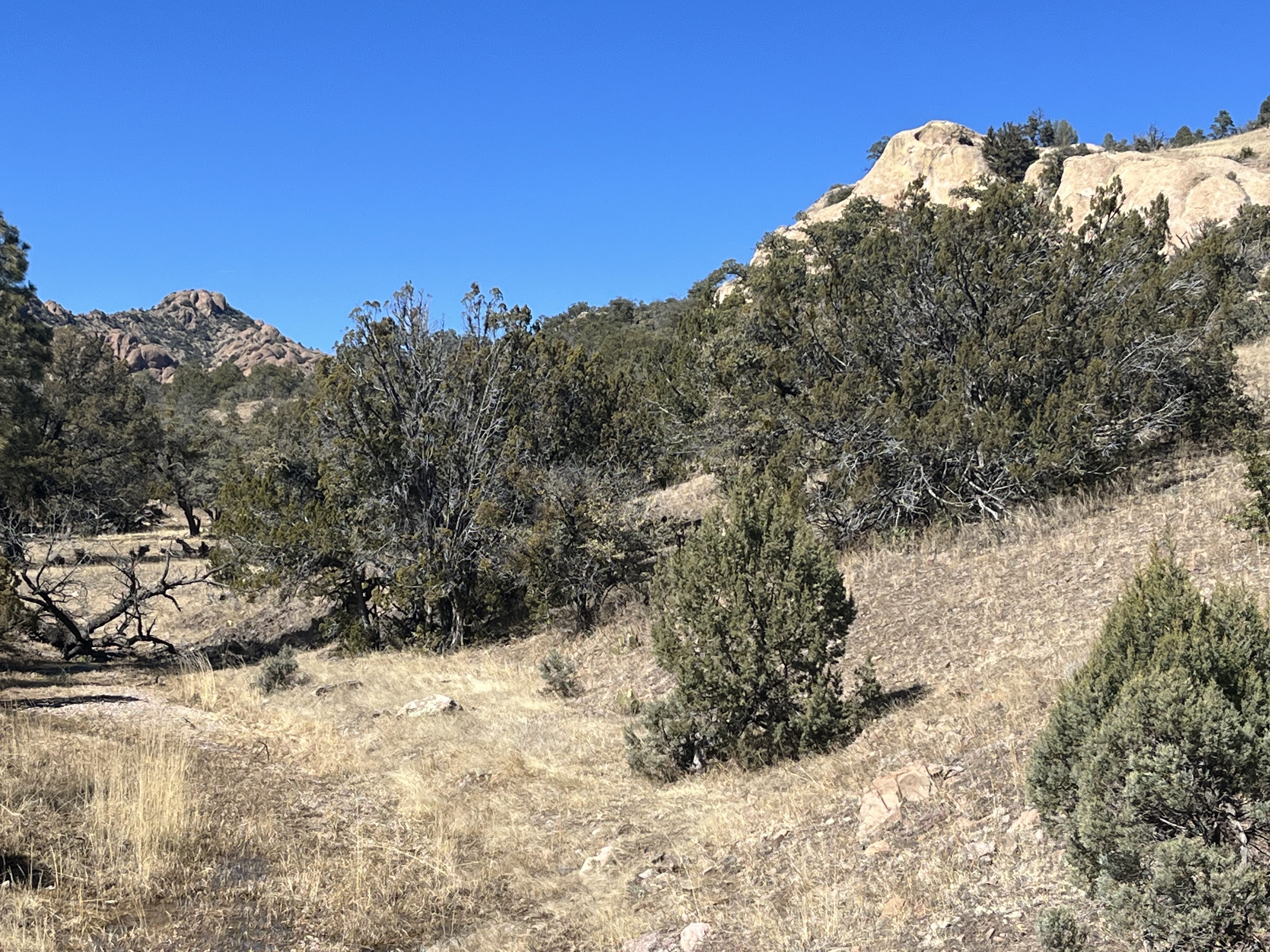
Last year I did a couple of hikes starting off from the Tierra Blanca Road (FR 522) and they were wonderful. This day we used the only other access route into the forest on the southeast side to do our little hike up Pierce Canyon and then on up Cottonwood Creek. Getting there was relatively easy, although once we crossed the Forest Service boundary the road conditions weren't the best, especially at the many creek crossings and where side gullies had gouged channels across the road. Still we made it to my trailhead, where the main route dead-ends at a private inholding and a side road (sometimes called FR 889 on some maps) headed off northeast up Pierce Canyon.
We walked along the road (which is quite drivable, at least in dry conditions it would seem, and could be a nice car camping destination) admiring rock formations and the ponderosa pines that grew in pockets on shady north facing slopes. We actually ended up walking past the rather small and inconspicuous mouth of Cottonwood Creek initially ( it empties into an alternate channel of Pierce Canyon right where an enormous rock tower sits along the bank), but got back on track in short order.


We found some deer carcasses early on that our dogs were very interested in, and then very quickly found water running in the creek. It seemed a little paradise as we walked on along grassy banks and through narrow, rocky passages. Eventually we came to the bare namesake cottonwoods, and immediately after entered one of those bedrock passages with little waterfalls and cascades that are common to many streams in the Black Range.
 |
| Water (and a little ice) in Cottonwood Creek |
 |
| Seamus and Nessie |
 |
| Bedrock section |
I hiked through this section with the dogs while my wife stayed behind. The landscape opened up into even wider meadows and the stream flowed through grass in places similar to the lower end of Rabb Canyon.When the rock formations of Pine Spring Mountain came into view, we turned around.
 |
| Pine Spring Mountain in the distance |
It was shirt sleeve weather throughout day, with blue skies and only a very modest amount of wind. This area has some potential for more exploration. Certainly, Cottonwood Creek could be followed all the to the saddle east of Pine Spring Mountain (where I ended my hike last year), but also if one wants to walk around fence lines ( and has an app like On-X to insure one is not trespassing) several other not too difficult day-hike options come into play. Of course, even a short backpack, could make much more of the area available.
Labels: backpacking, camping, fall colors, hiking, scenic driving, waterfalling
posted by Devon Fletcher at
7:04 PM
0 Comments
![]()
![]()


