Tuesday, July 31, 2012

Morgan Creek- Gila National Forest

Lake Mountain

Morgan  Creek Road


 Mud Spring Mountain

   IMPORTANT UPDATE (6/22): The Black Fire has burned through much of the Morgan Creek valley. It is likely to appear vastly different from what is pictured and described here.
We had beautiful camping trip here back in '04.  We found one of the nice dispersed spots  off of the road that follows Morgan Creek (FR 732 off of FR 157), but if  you go, be careful not to camp in one of the private property inholdings.  We went in mid- September and there were wildflowers everywhere. We did  a hike that  starts out going south from Morgan Creek then follows South Palomas Creek and then on to Marshall Creek on FT 110 where we turned around a ways upstream from the intersection with the Spud Patch Trail (FT 111). Along the way one of my dogs caught a rabbit. Fortunately it was the dog with very few teeth and we were able to convince her to let it go.
It was a pretty warm still and the creeks were already drying out that year, so we were having to  ration water between ourselves and our dogs, luckily the springs  that supply tiny Marshall Creek were flowing on that hot, late summer day. 
The drive here from Las Cruces is at least three and a half hours. FS 157 (the northern half of this road starts near Chloride, the discontinuous southern half starts near Kingston) may not be suitable for some vehicles and/or trailers. We still were using a camper top  with a large tent attached to it at the time, and although I've brought our little trailer to nearby Circle Seven Creek (check out October '07 blog), I'm reluctant to try and get it to Morgan Creek.
IMPORTANT NOTE: Parts of these hikes may be within the Silver Fire burn area (June, 2013) .


 Along South Fork Palomas Creek

Morning Glory


Lake Mountain


Looking down on Morgan Creek valley


Labels: ,

Monday, July 30, 2012

Gila National Forest Trail 307- Cave Creek, Las Animas Creek

Cave Creek

Looking north across Las Animas Creek
 Some recent comments on the blog reminded me of this hike that we did quite a few years ago. We left our campsite on Carbonate Creek and drove north on FR 157 intending to make it to the " trailhead" on Bald Hill.Shortly after crossing North Percha Creek, we got wedged in at very narrow section of the road and couldn't get any traction to go any further, and had a heck of time backing down the road to a place to turn around. We ended up pulling off on the west side and parked at a nice spot used for camping. The road passes through some forested sections but much of it is open chaparral, so  I would not recommend this as a summer hike. I remember one section of the road and it's environs being covered with blinding white quartz from nearby mine tailings. The views from Bald Hill to Granite Peak were  fantastic. Then we descended very steeply  down to Cave Creek( this road here is  not really fit for man, vehicle, or beast) UPDATE: The road was improved greatly for firefighting efforts during the Silver Fire, although it still may be advisable to have four wheel drive.
 A short ways after reaching the  bottom there is a large cairn that marks where Trail 307 turns to the north. The road continues to the east along the creek. Initially the trail crossed the bouldery, dry creek and then began to wind its way up the south side of the scenic Apache Peak. This is open semi- desert here and it was very hot, even in October. There are also some washouts along this section which  were a bit unnerving. We could see the large alcove that gives Cave Creek its name to the west as we neared the the large mesa that extends from the southwest to the southeast flanks of Apache Peak. Here the trail tops out, and we  ate our lunch in the shade of some pines.
   The hiking was much more pleasant as we continued on the south side( north facing) of Las Animas  Creek's canyon.The trail was clear as we walked in the shade of oaks, pine and juniper. Unfortunately there were series of treacherous washouts here as well, and then a long boulder strewn, brushy section which tempered our initial good feelings,but we were now on mission to get to the bottom to see Las Animas Creek. Imagine our disappointment  when there was nary a drop of water as far as the eye could see. We walked upstream a ways, but still saw nothing but the thirsty cottonwoods,willows and alders lining the banks of the dry creek. I had brought my 5 piece fly rod just in case,but my angling destination was missing two key ingredients: water and fish. We didn't want to make our now very long hike even longer so we turned around headed back up.    
  It turned humid and overcast as we trudged back and we would have welcomed the rain, had it ever come. It was really a slog. I'm thinking the whole trip was 12- 14 miles. The last  mile or more was  walked in the dark.  Two or three years ago my wife and I  were day hiking on the North Percha trail when we met two guys from Albuquerque with backpacks and and fly rods. They had intended to be on this route to Las Animas,but either didn't know or hadn't noticed the continuation of the road across North Percha Creek and had mistakenly continued west instead of north. I told them they could reach Holden Prong   on the trail they were on but that it probably wasn't a good idea( the last leg of the route down to Negro Bill Spring is completely gone) and directed them to Railroad Canyon which is the standard route into the Las Animas drainage. They took my advice and I hope they had good luck with their fishing.Note: this hike is from Bill Cunningham and Polly Burke's Hiking the Aldo Leopold Wilderness.IMPORTANT UPDATE: This hike is within the Silver Fire burn area.

Labels:

Monday, July 9, 2012

Echo Amphitheater- Carson National Forest


 I'm sure most people know about this place  already, but if they don't it's worth the short side trip from Highway 84 and the two dollar admission fee. It's a small slice of Utah type red rock landscape right here in North Central New Mexico. A friend told me about it years ago. I admitted I hadn't heard of it,which was odd because not too many places of geographical significance about my home state fly completely under my radar. Oh,well. It was pretty hot the afternoon we walked back to the " amphitheater". It's a short jaunt, luckily for us because we had just finished our 9 mile Canjilon Mountain Loop hike( see blog). There really is an echo.

Labels: ,

Friday, July 6, 2012

El Rito- Carson National Forest


El Rito


El Rito is a  good sized stream running in a parallel valley to the larger Rio Vallecitos on the east. And while I had heard of the Vallecitos from articles in several New Mexico fishing books,El Rito barely rates more than just a mention as a place where one might catch cutthroat trout. On my first inspection of the stream, I began to understand why. First, the  two lower sections of the stream( along NM 111) that are  on Forest Service land have obviously been beaten down for years by  unrestricted grazing and dispersed camping.  The conditions appear better on the upper section, where there is some effort now to restrict the streamside spider web of "roads" on the part of the Forest Service with new regulations and various types of barriers. Second, much of this lower, more easily accessed part of the stream from the town of El Rito all the way to FR106 is on private land.  In the spots I stopped to check, the stream was shallow, warm and filled with muck, but I still spied a few trout right in the  campground amidst the cow pies, beer cans and toilet paper. Mostly like they were browns. I certainly did not want to fish here, especially when the area begins filling up with campers on the weekend. 


Lower section of El Rito

I now had my eye further upstream; past the last section of private property just above FR 106. Here the roads (FR 173 and FR 274), not maintained and not easily traversed, were not within a third to first throw to the stream. This is where the cutthroats should be. We parked our truck  where unmaintained FR 173 and  well maintained FR 106 intersect high above and to the east of El Rito. We began hiking north on FR 173 turning  west on an old ( grass was growing on it) but clearly defined road  that eventually became a trail which brought us to a clearing and a . . . fence.  As I suspected we hadn't walked far enough north to bypass the section of private property. 
We trudged along the cow trail next to the fence until we joyously entered into  a beautiful, unfettered semi -wooded valley with the clean, cool creek burbling along in the  middle. We had our picnic lunch under the shade of a large evergreen.  We hiked on little farther and then I began to fish. The action was fast and fun for the many little cutthroats with a bite at almost every other cast. I threw my dry flies to every spot that looked deep enough to hold a fish and was rewarded with five or six  in less than an hours time. It seemed perfect until I reached the herd of  cattle upstream. I don't how many there were. They were under trees and bushes, in the meadows and in the stream. I couldn't cast without the possibility of hooking one (they weren't going anywhere either). So I turned downstream, trying my luck in all the same spots and few new ones as well, bringing in a couple more small, colorful cutts as I did.
                                            

 My Scottie Seamus followed me at times, explored the woods at others, but never interfered with fishing in the least. My wife lay on a bank and read until I had  had my fill and we hiked out. We had to leash Seamus on the way out for awhile because we had all seen a cow elk on the other side of the stream. We made it back to the truck just as the rain was starting for the second time. Note: this section of El Rito is pretty idyllic, but not completely unknown as there were a few soda and beer cans, and an empty Little Debbie box which attested to fact that others had made the effort before us (perhaps on horseback). There are also multiple ways to at least get close to the stream with a OHV, I later learned when looking at the topo map for this area, so I don't know what  I would've have encountered had I continued upstream. The Forest Service for their part, most likely in effort to discourage  use by vehicles no longer has any of these roads appear on their official map. I would love to return here to hike and fish all day long

Labels: ,

Thursday, July 5, 2012

Rio Vallecitos- Carson National Forest


 I fished the Rio Vallecitos  last Saturday( June 30th). This is a beautiful, medium sized stream in North Central New Mexico.  When I say medium sized, I'm talking about the New Mexico range. So it's not as big as the Pecos in its canyon below Cowles, but has an average flow that's larger than the forks of the Gila. Access is from NM 111( off of US 285 north of Ojo Caliente) and then onto FR 274 just north of the town of Canon Plaza.There are couple stretches of public land(mixed with very private)  further downstream,but upstream from where you cross the bridge on FR 274 it is all Carson National Forest for several uninterrupted miles so this seemed like the least complicated place to try the stream. It also the roughest. After the first few hundred yards, where it's wide enough for people to have beaten down the brush,built rock dams in the stream( I assume to provide bait fishing holes) and leave trashy campsites, there is almost nowhere to be but in the water.The thin strip of flat land along either bank is a real bushwack, so I put aside notions of fishing from the bank even though it would have been more productive given the low water conditions. The current was not strong, and the water wasn't deep but the boulders and stones were very, and I mean very, slippery. I wore some old Cons, and I have  enormous bruise on my foot to show for my mistake. Hip waders or some sort of sturdier footwear like some old hiking boots would be a better choice. The rugged and sometimes painful and wet( you will get dunked) nature of the canyon reminded me of the Rio de Las Vacas( directly above it's namesake campground) but on a larger scale. It was different in one very significant way however,  because of its larger flow and wider channel the Rio Vallecitos is a clear corridor. I could cast away, I mean actual casts, to my heart's content and only rarely got hung up in any vegetation, living or dead.
So, about the fishing:in the morning I did a short recon fish while wife and dog waited patiently and cleaned up other people's messes. I promptly caught two browns in about 20 minutes and quit to help in the clean up. I returned in the afternoon driving into the town of Vallecitos on the winding,but well maintained FR 44(  then to FR 106 to NM 111 to FR 274) from El Rito. Starting at around 3 , I fished for three hours. Counting the two fish I caught in morning, my total number of trout brought to hand for the day was  . . . two. Not that I didn't have my chances. I lost at least three that I had on the hook, including one large one that tore my fly right off. There were a few other takes as well including a couple fish that were either leaping out of the water at my fly or the nearby real thing.
 At the end of day I saw couple of strange things. One was a smaller fish laying itself out on a rock along the bank to catch a bug before sliding back in the water. Another was a larger brown with something brassy and three inches long in it's mouth. On closer inspection, it was, of course, a small trout. I knew that browns were known as cannibals from reading about the phenomena many times,but I had never seen it in action,nor would I have expected to on a smaller stream such as this.There are good sized browns here,and the woman at El Rito Ranger Station said there are rainbows and maybe a few cutthroats as well.  Even though the fishing wasn't fast and it may have seen better days with more fish and more water;with better footwear, I'd definitely would try the Rio Vallecitos again.

Labels:

Wednesday, July 4, 2012

Canjilon Mountain Trail- Carson National Forest


Upper Canjilon Lake

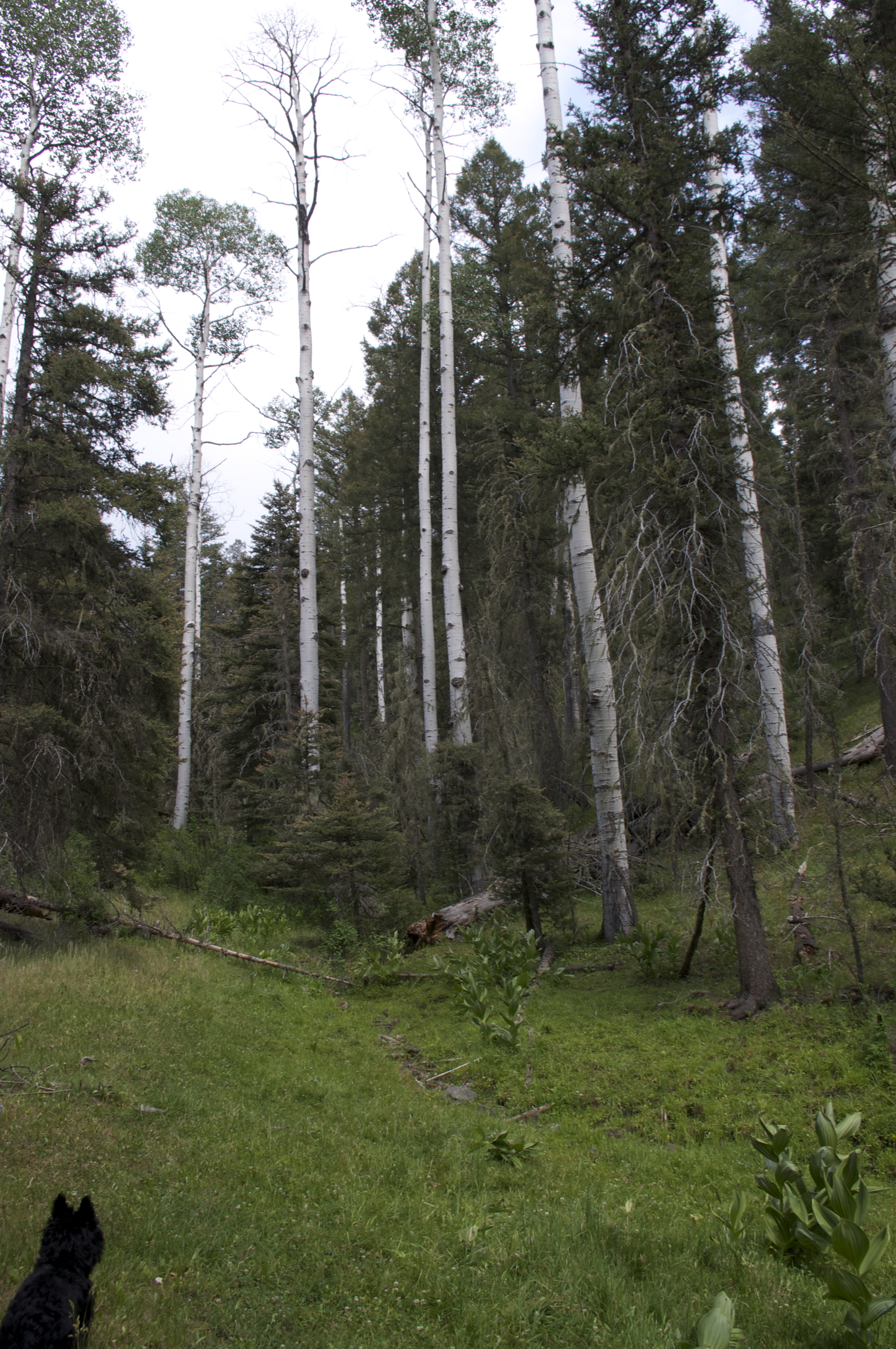
We did this hike our second day of  our stay in El Rito. The drive from town is about 30 miles or so but took about an hour. There are few rough sections along the roads( NM 110 and FR 559) requiring at least high clearance, and if it's wet probably 4 wheel drive. The road up to the lakes however is paved. When we drove back we headed west to make a loop through Canjilon and Abiquiu. The road from this direction is a very good all weather gravel road that is suitable for almost any vehicle. The hike starts out at the popular( relatively speaking) Canjilon Lakes fishing and camping  area. We drove to the very end of the road where there is a parking area at Upper Canjilon Lake. There was an obvious trail at the back of the lot next to the bathroom. There are some brown trail markers, but no sign indicating the trail name or number. We walked through a now off limits picnic area. The reason it's off limits is due to the many dead aspen trees that are liable to topple over when the next strong wind blows through. The forest service is trying to get them cut down here and in the campgrounds along the lakes, but there are so many it's going to take awhile. I can only imagine what this beautiful area looked liked when the aspens were healthy, because during our drive and walk I would estimate that 95% or more were either dead or about to be finished off by web worms.
 

Heading north we came to a fork in the trail after less than a mile. One branch led down to Canjilon Creek, the other went up hill along a tributary (you can go either way as this a lollipop loop type hike). We went up and it was nice getting out of the dead aspen stands into a live green forest of spruce, pine, and fir. This part of the trail is the only steep section. It eventually levels off and then begins to climb 
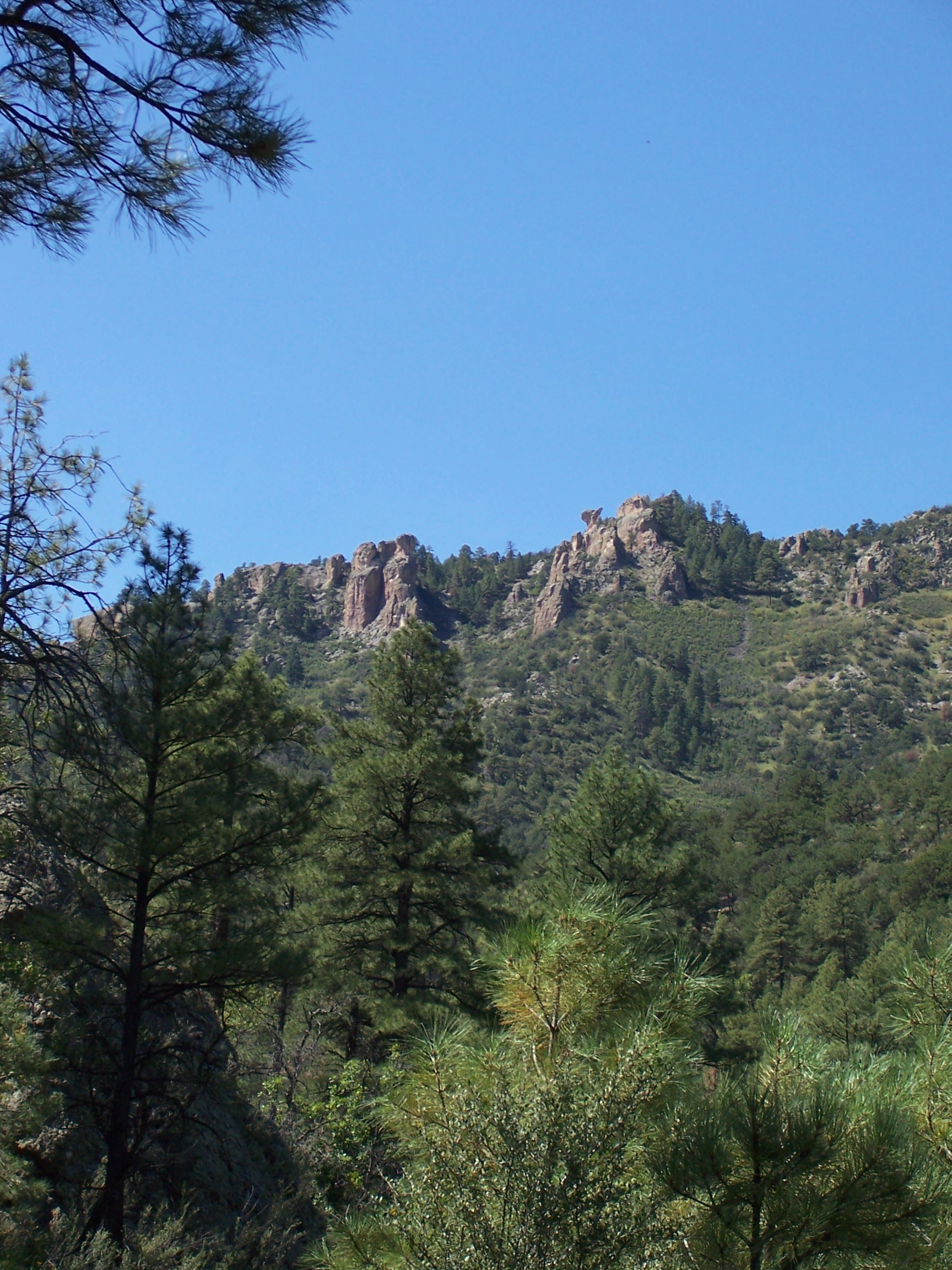
gradually to the the top of Canjilon Mountain. There's definitely a " the hills are  alive . . ." type of feeling when you emerge from the dark forest onto the wide, grassy (dotted with a few clumps of spruce) open mountain top with views swinging from the southeast to the northwest.   We enjoyed our lunch here. We then walked up to the tiny shack at the summit and read the story of the lookout that was killed by lightning in 1922. And if that isn't enough warning, let me just say this isn't a good place to be when the dark clouds start gathering, so try and get this hike over and done early in the summer months.


                                          From the cabin we headed north on an old ( closed, but we noticed it still may be getting some traffic) road. Along this stretch I'd wished I had studied the map on the Carson National Forest site a little more closely. In my mind the trail was like a square, but really it was more like a  trapezoid and we were now on the longest parallel side. I kept looking for and wanting the turn back to the east, and even walked  a ways down one valley hoping it was the route, before spotting the road again on the other side. Note: this entire route is marked with either cairns, brown trail markers  or blazes on trees, there is no need to improvise, although there are a couple spots where the indicators are rather far apart. I wasn't worried about getting lost, so much as missing the turn and walking all the way to Trout Lakes which would have made a much longer hike and probably would have caught us out in the rain. There was, finally, the fork, and we turned east into the Canjilon Meadows  where our hot and thirsty Scottie Seamus promptly laid down on the cool moss growing on top of a muddy spring. Second Note: except for the stretch along mountain top ridge, most of this hike should have water year round, but this area is in a severe drought( hence the dead aspens),so carry plenty of water at least until the area gets soaked ( hopefully) by the summer rains.
 We continued on( quickly now as this was another good spot to become a lightning rod and the clouds were starting to gather) through what should be a large wet meadow and source of Canjilon Creek.  Most of it was dry which made for easier walking,  and eventually  we came to a hillside with small rivulets of water flowing in from the west where Seamus got in and drank, and then we walked down to the creek itself. The trail follows the small stream from here, sometimes closely, sometimes well above, back to the original trail fork. We saw some cutthroat trout in the deeper pools of the very low creek.Wishing them luck, we  made it back just in time to get in our truck and drive out in the pouring rain. This hike is around 8.5-9.0 miles with about 800 feet of elevation gain(10,100ft-10,900ft).
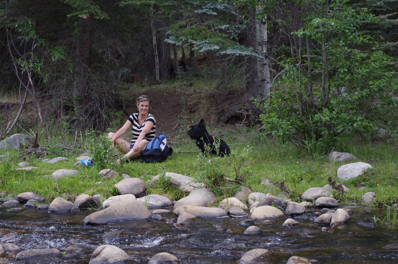


Labels: