Friday, July 31, 2015

Rito Angostura Trail( FT 493)- Carson National Forest
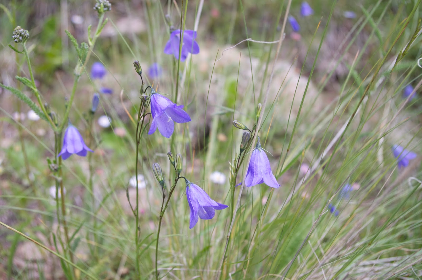


columbine


monkshood


IMPORTANT UPDATE (6/22): Much of this hike appears to be within the Hermit's Peak fire and is mostly like vastly altered from what is pictured and described here.
I'll start by telling you the not so good things about this hike. First,  after not having the easiest time finding the trail head parking off 518 (although it wasn't hard in reality, just a lack of focus to blame) I didn't particularly  like walking along Forest Road 89 for nearly a mile before getting to the actual trail. If I have to road walk, I prefer to do it as the last leg or a middle section of a loop. Doing it at the beginning of a hike set the wrong tone especially in this case where it wasn't very scenic and there was a fair amount of traffic.
 There are many, many dead trees now along the creek and the trail. So many in fact, that the trail, which we  got on a bit late at 10:30, is very open to the sun. This is not good thing on a sunny July day even at altitudes over 9.000 feet. We were hot. It may be better to start much earlier in the morning or later in the afternoon, or during another season, although the wildflowers seem to be at their best  at the height of summer.   In addition  the trail quickly took us out of sight and earshot of the creek, which at least would have kept our spirits cool.The dead trees may be due to the double whammy of prolonged drought conditions  coupled with the  continued water removal high up the creek for an irrigation ditch.
 Past the last stream crossing of the main fork, and the meadow area with it's vast piles of cut but never used trees , the upper section of the hike follows a stagnant slough,  so you get just as many bugs, but without the pleasant sights and sounds of a flowing stream. The trail climbs at a modest, but unrelenting, grade through a less than enchanting forest of  second growth conifers
  I had been hoping to make this hike a loop and follow  Forest Trail 19A back down to the Cutoff Trail 9A. We couldn't find the upper end of 19 A. The signs that were there didn't help. After we had trudged all the way to the ditch crossing. We gave up. There were a few dubious looking  paths that we looked down from the old road, but nothing looked all that promising. So it was back the way we came, a disappointment for sure.


Ok, on to the good stuff. The stream had a prodigious flow. It was much more water than I expected for a "rito." In the few areas of calm water upstream, I could see the orange bellies of fat little cutthroat trout, which made me happy. The rito, flowing over slate-like limestone, had distinctly non-New Mexico look to it as if it belong somewhere in the Appalachians. The flat tiers of a lovely cascade and a  seven or eight foot waterfall close to trail were the highlights. There were many springs flowing over the trail in these section  as well, including  one that made a set of twin waterfalls flowing off a forested cliff a hundred feet above us.  They made for muddy walking, but I always like seeing springs- the more the merrier.  There were tasty wild strawberries where we ate  our lunch. I was hoping for some raspberries as well, but unfortunately the most abundant berry was the bitter tasting twinberry. There are several more waterfalls downstream from the second crossing in the narrow passage or " angostura." I made brief attempt to get down to them. Walking in the swift stream was not an option. Neither was plowing my way through lush undergrowth (due to the lack of conifer canopy, I'm sure) and shin bruising hidden downfall( which I did try). So I retreated. Before the trail descends to that second crossing. There is an unofficial sign with the word "FALLS" pointing toward a  ridiculously steep path in the loose dirt and gravel on the hillside. We didn't take it, but  this is probably the preferred option these days for getting to them. I looked longingly over the precipice, where the falls can be heard but not seen in the slightest.


 I would come back here, but  I would definitely not hike the whole trail again. Ever. Turning around at the falls area or at the meadow with the abandoned lumber would get you the highlights without the drudgery.

 Note: there are even more waterfalls and perhaps better hiking along the West Fork Rito Angostura, although it looks like the trail only intermittently follows the stream there as well, so to see them you might need to do a little scrambling and bushwhacking. If you want to see what the falls at the little slot canyon look like, here's a link to friend Doug Scott's website: http://www.dougscottart.com/hobbies/waterfalls/Angostura%20Falls.htm

Labels: ,

Thursday, July 30, 2015

Water Canyon Trail( FT 76), Mount Taylor- Cibola National Forest


   It was too hot now to do a hike in the Zuni Mountains. It was too late to start my Water Canyon hike on Mount Taylor. So, we drove around the backside of the big mountain to the tiny village of San Mateo, a peaceful place now,but with a very violent past described in Sherry Robinson's  book. We then drove onto Forest Roads 456 and 239. Unfortunately, it wasn't a particularly scenic drive. Views were limited, and the sameness of the miles of second growth forest not very compelling. After killing the requisite amount of time, we headed to Albuquerque.
 The next day we were at it again. This time we were out to tackle the Water Canyon Trail( FT 76) that starts high on the east side of Mount Taylor. We had to get there first. Taking a wrong turn and driving for several miles down the poor quality FR 193 didn't help. The sign for the Mosca Lookout intends for you to not take the  very next right, but the one after that, on the very high quality Forest Road 453. Well, it's high quality up to last mile or so where it becomes  steep, rocky, and rutted with one large hump after another which I guess are there to help channel water away.  Along the way several large jackrabbits crossed in front of us, their ears glowing in the morning light. I  had thought they were strictly a lowland species and was quite surprised, but happy to see them.The vehicle journey flattened out at the trail head, where expansive views of Mount Taylor, and a huge swath of  New Mexico to the east take over. Just to north was Mosca Peak Lookout.

We parked near the large  trail head sign which indicates that this is the trailhead for the upper end of the Gooseberry Springs Trail( FT 77) and Water Canyon Trail. Actually, the Water Canyon trail is back along the road less than hundred yards away marked  with small, plain wooden sign. You may read that Water Canyon Trail follows an old road for first few miles or so. This is no longer the case, although the road is still there and can be used as alternative, a narrow foot trail that switchbacks down the grassy mountainside is now the preferred non-vehicular route.

Those switchbacks brought us down quickly into the forest. Along the way we had views of the spruce forest that grows at these lofty altitudes and the wreck of an automobile laying mutely on its back. I don't know the make or model, however, because it's very steep indeed to leave the confines of the trail.
Down, down we went into  a forest of huge aspen trees, and we soon reached a flat open spot with some pipes, valves and a spigot- no water though- I tried it just out of curiosity. There was also another sign here pointing down the trail. I found out later on the return trip that this where the road comes in and essentially ends. I knew this, because there was group of about  eight people who had driven four ATVs in  and had  a tarp set up over them as they sat in chairs, chatting and laughing  while preparing to cook some steaks( I could see one big beautiful porterhouse as it was lifted up) over a campfire. I must have stood there  5 minutes watching them in plain sight less than 30 yards away, but they never noticed me.


Soon a spring appeared flowing across the trailhead, and from that point on we hiked beside a flowing creek.  We saw a group of tom (or is it jake?) turkeys crossing the trail in front of us, and at our feet were several deposits of fresh bear scat. A stronger spring appeared further down near the remnants of old beaver ponds. These were grassy, boggy areas with few trees, lush stands of ferns and muddy puddles where the many frogs would leap in at our approach.


In places, we could still  see the  piles of sticks, and the old chewed stumps. In one area there was a main dam that was quite wide, and several smaller dams above that created( many years ago) terraces with smaller ponds.Keep an eye out for these, although I had read about them, I had totally missed them on the way down, and only saw them by sticking close to the stream on the way back up.


 It seemed like the trail had barely begun to level out when we came to the end of the forest service  property.

Now we sat and lunched by the stream. The trip back up wasn't as bad as I had expected. The cloud cover that had rolled in helped a lot. On the straightest, steepest stretches we rested quite a bit, but the switchback section was a breeze. A large flock of ravens talked to us much of the time. We admired the many wildflowers. The rain, the lightning and the thunder did not come and we were back at the truck in good enough shape to take a little look around  before heading back down.


Labels: ,

Rice Park,Zuni Mountains- Cibola National Forest


After passing by Bluewater Lake, I got a notion to drive out to Rice Park on FR 569.  I wasn't sure what to expect but some maps showed a large man made lake in this area. I had also read about a hike in Sawyer Creek which is nearby that sounded nice. I thought I could hike down the Rice Park tributary of Sawyer Creek and maybe up Sawyer Creek itself at least for a little ways.
 FR 569 is an excellent road, though not very scenic as it traverses a dry, rocky, somewhat monotonous pinon woodland. Arriving at Rice Park however was worth it. This is a beautiful  open "park" area lush with grasses and wildflowers,rimmed by low hills of deep green pines.


 At first we drove past the park on the road that continues toward Lookout Mountain. This road quickly deteriorated and we  backtracked to the junction with FR 421. There isn't a lot signage out here, so we took off to the north  on a dubious looking set of tracks in the grass. At a fork we went to left and ended up at a Ducks Unlimited project with several earthen dams and mounds that has created some small ponds for wildlife. I parked the truck and we began walking in the direction of the Rice Park Dam. I soon realized that the other fork would have taken me right up to the dam, and wished I had driven it because it was approaching the noon hour and walking across this open area was getting to be rather hot for me and especially for the entirely black Seamus. Still, it was beautiful and  the perfume from the myriad of flowers was quite heady( I kept thinking of Dorothy in the field of poppies).

 We made it down to the dam where there was a small bit water behind it with a few waterfowl paddling about. Closer investigation revealed that the entire area from the upper dams where we started, all the way down to this point was actually a marshy stream  or lake. Seamus got in several times but couldn't figure out  if he should drink or not.

We went over the dam and sat in shade of the pines and ate lunch. There was no water in the stream here and it seemed too hot for Seamus to  embark on what looked to be dry hike( I carry water for him to drink, but he really needs water to get in to keep himself cool).  So we headed back to the truck, taking advantage of the shady tree lined road at least for part of the way.All in all, not exactly what I had wanted to happen, but I wouldn't have missed seeing this place at the height of its summer beauty.

Labels: ,

Bluewater Canyon, Zuni Mountains- Cibola National Forest


This is nice drive along FR 178. We stopped at a little picnic area along the stream. It was mostly brown water slowly moving through thick,tall grass at that juncture, but further down it has a more conventional appeal with small  branches of flowing water between little pools set in a deep rocky canyon. I thought about walking through this section, and now kind of wished we had. I still don't know if there are any resident trout in here.


Labels:

Diener Falls,Zuni Mountains- Cibola National Forest


After eating breakfast, packing up and dousing the morning campfire we were on our way by 8:00, driving on FR 480.We were going in the opposite direction now, heading towards its intersection with Forest Road 50. Narrow Ojo Redondo Canyon had a  little bit of water here and there provided by springs. We passed Post Office Flat, where there is an active logging operation going on( I had heard the chainsaws earlier that morning). It's amazing to me that any logging goes on in the Zuni Mountains at all given the devastation once visited upon the range. Still, it didn't look too bad. Maybe these things proceed with a little more sense nowadays.

 I had in mind two possible outings. One was to visit Cottonwood Canyon,  which,by several accounts, is one of the highlights of the Zuni Mountains: a deep, aspen lined box canyon with an intermittent stream( before  they plowed a railroad through, it was a trout stream according to Sherry Robinson). I also wanted to check out an interesting little side canyon that cuts the Lookout Mountain Rim. My friend Doug Scott had pointed it out to me, and on Google Earth it looked like it had steep sided bare rock walls, and beaver ponds.Here's what it looks like,although the access may be a don't ask, don't tell situation: http://www.dougscottart.com/hobbies/SlotCanyons/Red.htm
 Problems arose when I got to FR 50.  It was not of the quality of road I had been driving on. Instead it was rutted, muddy and with many large puddles of unknown depth. I drove for a ways in the direction of Cottonwood Canyon,but quickly came to the conclusion that  even if the road was not completely impassable at some point, just driving the ten or so miles to the canyon's entrance could take a couple of hours. Disappointed, I now sought to investigate the possibility of accessing the little beaver pond box canyon. Maps indicated that a block of private property blocked access to the canyon's mouth.  This isn't always an obstacle. However, the property here was fenced and posted. In addition the side roads that would get me closer seemed to be saying," you will get stuck deep in our mud." On to plan C. We drove back up FR 480 to its junction with FR 178 and headed out towards Bluewater Canyon and Lake.

 On  the front of the old Cibola National Forest map for the Mount Taylor RD, is a photo of a small stream flowing to a little pond  at the bottom of a rocky canyon. Very picturesque. Perfect. Unlike the several photos inside the map,  I couldn't see where this place was or what it was called. Drving along FR 178, looking briefly down at the map cover  again , in semi- frustration , I  said( maybe even out loud) something like" I want to go there!" And then  within a minute or two, I was looking down  at that very place( or some place very,very similar). A very happy coincidence indeed.
 At first we looked down into the  canyon from above. Then we drove down the road a bit and tried to walk up to it from the bottom. It was beautiful little canyon with running clear water and small waterfalls,but  when we failed to reach the rocky little gorge, I knew we had followed the wrong stream. Now we headed  back up and walked down to the  little stream from above. We were able to climb around and down one tier of the waterfall that was now  running below the silted in pond. The pond had been created by small dam in this narrow juncture of the stream. The lower part of the falls was still a  mystery. Walking back to the truck, I realized I didn't have my keys. After a partially panic- stricken search for the better part of a half-hour, I found them about 5 feet from the truck in plain sight.


Now I was more determined than ever to see the lower waterfall. We drove back down a short ways, and made it happen: first down the loose dirt,rocks and dead trees on the canyon sides and then a short , but very thick bushwhack through redosier dogwood and aspen saplings, walking mainly in the stream itself. Short of stature Seamus definitely had the advantage during this bit of adventure.
The falls were lovely with a deep pool of grayish green water beneath. There was one or two bits of graffiti which made me think there's got to be an easier way of getting in here. That's when I looked to my left to see an obvious path coming down from a dry side drainage. Most likely it can be accessed by climbing a small hill from above.

 Seamus and I both got into the cold water, and  then we tunneled  our way out, back up to the dry mesa and then to the truck. We then had an uneventful,but pretty drive through Bluewater Canyon. There may be trout  that are resident in here still, but I didn't see any.
Note: the labeling of the cover photo is on the back of the map and says it is Bluewater Canyon.However it looks uncannily similar to this area I stopped at which is Diener Canyon, a Bluewater tributary.

Labels: ,