Sunday, October 31, 2010

Black Canyon Revisited-Gila National Forest


IMPORTANT UPDATE (6/22): Much of this area is being burned by the Black Fire.
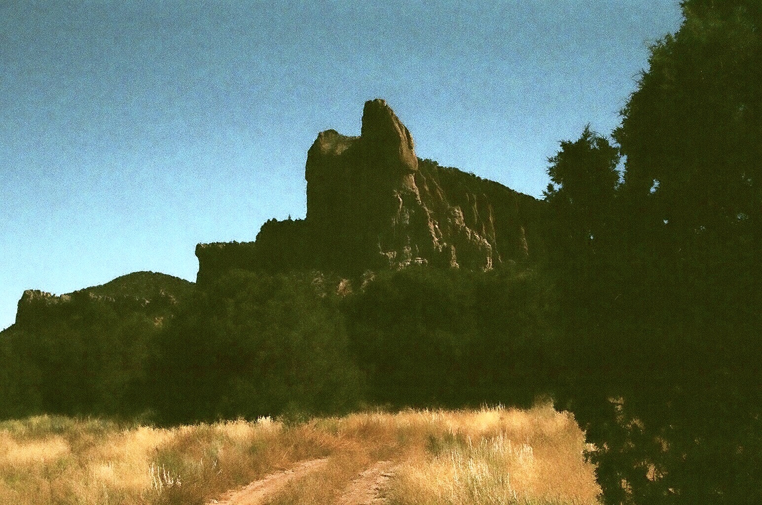
I went back to Black Canyon. The trail situation is still a little murky.The fence is cut now where it enters private property, and the gate is open on the other end where it exits. The "alternate" trails that went up the hillside don't appear used anymore, and yet there is nothing positively indicating, by way of sign, that this is indeed the right course of action(crossing the private section). It probably takes all of 2 minutes or less to cross and re-enter Forest Service land, and yet I'm watching the house, which appears now to be occupied as indicated by the smoke emitting from the chimney, and feeling a bit anxious as I imagine some potential confrontation for that entire 120 seconds. But onto better things. It was cold and very damp still at ten when I arrived. The water was low and the stream bed heavily silted with, I assume, ash from last years Aspen fire. The fish were still there, perhaps a little harder to catch, a dozen or so, all Gilas from about 7 to 10 inches , with one a bit larger and one a bit smaller. The amount of silt stirred up on each release was a bit disturbing. Only sporadic sunshine throughout the day kept it from ever getting warm , which was good and bad. The fall color was at its peak in the canyon with boxelder, oak, grapevine, willow, cottonwood and even a few aspens providing the display. The Gila trout seemed a little duller colored, but still wonderfully willing to take old fashioned dries.This stream is still too open and too wide for its own good in the lower reaches above the road. I walked about four miles in to perhaps a mile below the confluence with Aspen Canyon, but I'd really like to backpack in and see what the fishing is like further upstream.

Labels:

Forest Road 150,Gila National Forest

Forest Road 150, the North Star Mesa Road is in better shape than I've ever seen it.The section through Rocky Canyon( the worst segment) has been plowed of rocks and the surface leveled.Road work is on going, and the worst section right now is up on the Meason Flat( the mesa between Rocky and Black Canyons) where the crew is working putting in culverts. This part was pretty muddy after the previous night's rain(Oct.21),but still easily passable. I drove as far as Black Canyon in my 2 wheel drive,not particularly high clearance pick-up and was fine. It will still take 50 -70 minutes to drive to Black Canyon from the paved NM 35 depending on your vehicle and your degree of caution.Beyond Black Canyon I don't know what the conditions are. NOTE:The crews are working Monday through Thursday right now, and you could encounter a long delay during daylight hours.

Sunday, October 17, 2010

Horse Mountain Wilderness Study Area


Pine "park" at the top of our hike


On our third day we decided to check out the BLM's Horse Mountain Wilderness Study Area. The mountain seems to be really three separate peaks of nearly equal elevation, rising very steeply from the plains of San Agustin about 25 miles southwest of Datil. The turnoff is at the remains of the town of Horse Springs. There are many rugged canyons and lesser summits radiating out from the central high points in a roughly circular pattern. The middle mountaintop is named Horse Peak. The others are nameless.The only "trail" in the range is an old east-west running road.The eastern entrance appears to be blocked by private property. We started on the west side where the BLM has a sign. The road follows a dry stream the entire way until it reaches a large ponderosa pine "park" at a saddle.From there it continues east down another dry stream. We walked down a little ways, but decided we didn't want an uphill both ways hike, and returned to the grassy saddle to enjoy distant views of the Sawtooths and close views of the three high peaks. Since this trail is on the north side of the mountain it had much more diverse vegetation than we'd been seeing, including Douglas Fir and Gambel Oak which had already started to change color. I even spied a few aspen high on a cliff face. We saw fresh bear scat, mountain lion scat, a huge bull elk, several deer and flocks of jays.This is a wild and beautiful place and was the highlight hike of this trip.


Labels:

Sawtooth Mountains - Cibola National Forest

The Tower


Our second day out I wanted to explore the western arm of the Sawtooth Range. Here there several detached mountains with rounded peaks, unremarkable if it weren't for the myriad of erosional forms sculpted in their volcanic tuff. Pinnacles, towers, fins and hoodoos all occur in the bare tan and pink cliffs. We drove down Forest Road 6A this time, and turned off at FR 325 heading east and parked just north of Monument Rock at a fork in the road. Choosing the left fork we hiked toward an amazing tower that must be at least 500 feet high. Later we drove west from FR 6A on very primitive road that took us closer to Castle Dome, Lone Mountain and other formations. It was already pretty warm and we decided that further hiking in this open terrain would be downright hot, so we picnicked under some piñon trees and then headed out to Pie Town. Our last day I wanted to do a drive on Forest Road 66 which connects Highways 25 and 60 and would have made a nice loop through the forest. On the west side the road initially goes through some subdivisions and then enters the forest with great views of the very steep Anderson and East Sugarloaf Peaks that are part of the Crosby Mountains.Unfortunately the road is blocked by a gate just a few miles in. From the east side, the same road becomes very rough and uninviting after only a mile or so.


Monument Rock in the background


Labels:

Datil and Pie Town

Datil has a gas station/grocery/restaurant.There was a vegetable stand outside when we visited. The meat case had some great looking T- Bones, but they don't cut steaks on Sunday.There's another restaurant further east. On US 60 north of town there is the Baldwin Cabin public library-an unusual amenity for such a tiny town. Pie Town has the Pie-O-Neer restaurant and the Daily Pie Cafe. We enjoyed a piece of of chocolate cream and a piece of blueberry a la mode on the porch of the Pie-O-Neer on a Saturday.The latter day hippie clientele and ambiance of this spot is in marked contrast to the prevailing cowboy culture of the region.

Datil Mountains - Cibola National Forest


Datil Mountains
East side of the Sawtooth Mountains

Hay Canyon

Our first day out I had intended to explore Thompson Canyon, known for its rock climbing area, and maybe climb Madre Mountain, the tallest and only named peak in the Datil Range. Unfortunately, the entrance is on private land and when we drove to the locked gate, the message seemed to be keep out. Since there was no one at  home at the nearby ranch house, we headed out for other options. I later learned that the gate may have been just dummy locked, but that it was still necessary to make arrangements with the land owners. We drove on Forest Road 6 first to the turn off for the Davenport lookout. That road, at least on the map, appeared to be a back way into Thompson Canyon. On the ground though, it didn't look like a good option. We continued on FR 6 over Monument Saddle down into Ox Spring Canyon. We parked and hiked to a clearing which had beautiful views of the sheer cliffs on the north side of Madre Mountain and the east side of the Sawtooths. Later, we backtracked on FR 6 to Hay Canyon and did and pleasant but, unremarkable hike down its road without seeing another soul.


Labels: ,

Wednesday, October 13, 2010

Datil Well Campground


This is very nice BLM campground a few miles outside of the small town of Datil. It has a campground host, pit toilets, water from hand pumps and five dollar fee. The sites are well wooded with piñon and juniper, and spacious. On our visit, there were never more than five of the twenty-two spaces occupied. We used it as our base to explore the Datil, Crosby and Sawtooth Mountains of the Cibola National Forest and the BLM's Horse Mountain Wilderness Study Area. An easy three mile loop trail that starts in the campground took us to several nice viewpoints of the San Agustin Plains and the Crosby Mountains.We discovered many potential dispersed sites nearby, but since our camper is very small (no bathroom, limited water storage), we couldn't really beat this place for convenience.

Labels: ,

Tuesday, October 12, 2010

Confessions of a Fly Fisher


I've never seen my backing since I tied it on.
I've never fished a 2 fly set-up.
I tie flies because it's part of the sport,but I rarely enjoy it. My tying table is an old desk and it's absolute mess when I'm tying flies.I'm constantly searching for whatever tool or material that I need, instead of actually tying the fly. I'm not sure why this is because I don't tolerate a lot of chaos in other aspects of my life.
Rather than the Zen-like experience I perhaps yearn for, many of my days on the water are a comedy of frustration infused incompetence.
I hate tying on tippet.
Much of the time I omit the final loop threading on my improved clinch knot; it still holds 99% of the time with the size of fish I'm catching.
I'm not always diligent about making sure my clipped ends end up in my backpack.
I've never really successfully fished a hatch of any sort, and I've only witnessed, maybe, three or four hatches where fish were actively feeding.
I've only fished with a friend once. I have 2 Redington rods and reels. 2 no-name fiberglass rods from the seventies, and my original fly/spin combo from Academy, plus two Shakespeare 1094 reels. I got a fly vest at a junk shop.
All, all of my fishing junk probably cost less than 800 dollars.
I've only used my waders twice. I can't tie a whip finish, lord knows how I've tried, but I can't. I've used a strike indicator once, I mean for one cast. The second cast, it came off and that was that. I have a nice net, but I've never used it.Most of my fishing trips involve a lot of hiking, and I already feel like a Yankee Peddler with all the junk I've got on my back, so the net stays home. Rarely have I felt that it would have been an asset. I like fly fishing, but I'm not trout addicted. Sometimes, I long for the slow moving sandy bottomed Texas creek, where I started using a fly rod, catching bluegill all day- but hoping for, and sometimes getting a jolt from a largemouth. I've never been guided and probably never will be, unless I win a guided trip in a raffle. Sometimes I count those self releases and quick releases. I'm so worried about others getting the perception that I'm exaggerating that I tend to underestimate the size of fish when I tell a tale. Sometimes after 5 or sometimes after 10, I stop counting, but I've had many less than 5 fish days. I've had a few 20 plus days too. At the beginning of a new year, I look in my fly box and usually find several flies that I tied so poorly I can't believe I left them in there. I know I didn't use them. I guess they're absolute emergency flies. I'm very self conscious about my casting technique (which may explain some of these other confessions) because I usually fish such small streams where there's not much opportunity to really cast. Still I like to air it out once in awhile in a slightly bigger stream (as long as no one is watching). I'll add more as they come to me. NOTE: Fellow flyfishers this is not a cry for help. I'm pretty happy with how I've arrived to where I am with only the help of a few books and few conversations.If you have any of your confessions, feel free to litter the comment box, I'd love to hear them.Photo is an Apache Trout caught in KP Creek in Arizona.

Labels: