Thursday, November 28, 2019

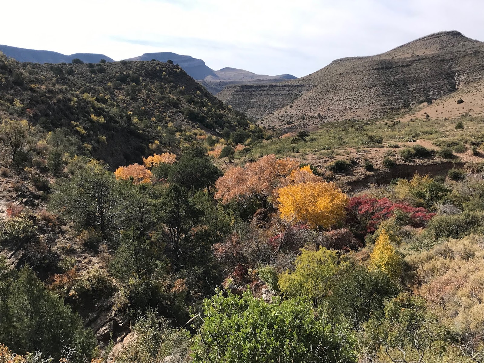
Slot Canyon Access Saga

Back in May someone starting putting  NO TRESPASSING signs on the gate where most folks access the popular Slot Canyon hike. While most of the Slot Canyon itself is on BLM land, I wasn't totally sure to whom the land closest to NM 185 belonged.  Years ago there had been a small sign indicating it was the property of New Mexico State Parks. The sign is gone now.
  I had some concern that the parcel of land had changed hands. Some research turned up that the land had once been owned by the Trust for Public Land, but I couldn't get a response from that organization, so I was still unsure.  Earlier this month, someone had reported on my Facebook page for our book Exploring Organ Mountains Desert Peaks National Monument, that there was now  some sort of substance on the gate that caused burning and irritation if touched.
 I found this new wrinkle more than just annoying and began contacting the State Police, the State Land Commissioner's Office, and the Doña Ana County Sheriff. I also went to our county tax assessors and determined definitively that the gate was on a 664 acre parcel that belongs to . . . State of New Mexico Energy, Minerals and Natural Resources of which NM State Parks is a department. They are the ones who purchased the land in 2009, along with the Broad Canyon Ranch directly across the road.
 I contacted Patrick Nolan of Friends of the  OMDPNM right after first discovering the signs. He then went to work not only periodically removing the signs ( which always went back up), but also, believing the gate was on New Mexico State Trust lands( the State Lands are directly adjacent to the State Parks parcel and this mistake could be easily made), he negotiated a  recreation easement with  them. Two weeks ago we took a student crew( as well the  man who originally did the survey for the state when they acquired the land) from NMSU to survey a  definitive trail route, which is being required by our State Lands commissioner's office.  We also hacked off the NO TRESPASSING sign which had now been secured with a heavier wire.There is an application  and a three thousand dollar fee ( $100 a year for 30 years) to be dealt with in the coming weeks. This initial survey didn't quite work as the equipment in use that morning required a continuous cell signal, but we will be back to complete it in the very near future.
 State Parks has also contacted me and  assured that they are not the ones posting the signs and that they will be meeting with the BLM soon to hopefully workout access through their property as well. Wheels grind slowly, but they are in motion and hopefully the person who foolishly tried to discourage people from visiting their public lands will cease and desist before law enforcement has to get involved.  In the meantime please feel free to climb over the gate and do the hike as people have done for years now. We were glad to see several young families visiting the morning of the 16th who were happy to be photographed for the Friends of the OMDPNM Facebook page which we also hope will discourage the sign posting individual when they see the faces of real people who  are potentially being affected by their negative actions.

Labels:

Saturday, November 23, 2019

West Potrillo Mountains


Visited a small mountain top to look at some rock rings, most likely made by Apaches when constructing temporary shelters. Walked around the entire little flat-peaked hill, which is volcanic, but not a cinder cone as are many peaks in the area. Found more than a dozen of these structures, but little else in the way of artifacts, except for a more recent one: a very old Cuervo Tequila bottle.

Thursday, November 14, 2019

Lincoln National Forest - Caballero Canyon (Forest Trail 103)


I like visiting the trails off the West Side Road ( FR 90) in early November. When it's already feeling like winter up at the higher elevations of the Lincoln, in these canyons, ridges and mesas it still feels like the last of fall.
 I started out around 11:30. There is a primitive road off of FR 90 at the trailhead sign and very limited parking at the trail start itself. The " trail" is a very rocky old road that was  constructed to access the water pipeline in the canyon. The brown sandstone rocks that cover the path  are a bit too big to traverse easily, and my ankles were getting twisted this way and that, as the steep grade of the descent pulled me down and down over the first mile or so.

There was finally some relief as the trail hit a wide grassy meadow on a plateau still well above the stream bottom. The views of massive Hershberger Peak were impressive. The trail skirted the edge of the meadow and then began to descend again alongside a dirt ravine. As I walked along I spied a huge pile of rusty pedestals or supports in the ditch, and had no idea what they were until I reached the pipeline itself later.


Further on the the trail turns sharply to the left at old concrete trough. There is a sign pointing the way Another rough road went to the right. It follows an upper branch of the canyon up to the waterfall near FR 90. Past the trough the trail begins a second descent, this time over slippery limestone gravel, and the pipeline, along with the sounds of trickling water inside, appeared, emerging from the ground and being supported by the same type of metal pedestal I had seen earlier.

The last bit of road is in two segments right before hitting the canyon bottom. One goes straight down following the pipe, the other goes wide to the left and takes a single switch back. I took the left route down and straight one on the way back up. Views of the riparian area's golden cottonwoods and scarlet sumac brought a smile to my face as I knew  that soon the best part of the hike would commence.
The creek,  though dry at the crossing, was shaded with large hackberry trees, the major branches like human limbs in a contortionist pose, the gray skin-like bark pocked with blisters.
On the other side the trail went up into  uninviting shadeless terrain with cactus and mesquite. It wasn't too difficult to decide to head down the creek itself, and lo and behold water appeared very shortly. It flowed for over a mile past cottonwoods and sumac, over layers of shale and sandstone bedrock, and under the pipeline itself.


I came upon a few cattle giving me  the evil eye right near where a spring emerged in the gravel. I cut them a wide berth as I came across the trail again and then a wood and barbed wire section of fence with the gate lying in the grass. Now there would be just remnants of the trail on through the thickets of apache plume on the banks and most of the walking would be in the gravel of the arroyo itself. Grapevine clung to the limestone cliffs and few colorful ash trees popped out here and there, but now it was desert canyon zig-zagging down slowly to the city below. A rusty, smaller diameter pipeline of much older vintage clinging the rock walls followed.

I probably was a little less than a mile from the  where the Caballero Trail meets the Alamo Trail (FT 104), when I decided to turn around. It was slow walk up, but not unpleasant and clouds and fading sun made for much cooler temperatures. I rested a few times, the water in the buried pipeline could be heard in the quiet afternoon, as I sat. Along the way I kept noticing the many pieces of bluish white chert on the road and ground along the roadsides and came across  a large piece of petrified wood as well. I was back at the truck a little after 4, the last autumn light faded quickly.  Perhaps many destinations here in southern New Mexico aren't as spectacular as other parts of the southwest (although some certainly are) but there is something else to be considered: it was a Saturday, during hunting season no less, with a town of  30,000 people just a few miles away, and I never saw another person for close to five hours.

Labels: , ,

Wednesday, November 6, 2019

South Percha Creek, 2019 - Gila National Forest


Highway 70 was going be blocked on that last Sunday of October, so we headed out to Black Range in the Gila instead of the Lincoln. I had two ideas for hikes in mind. If the fall color was still going, rambling down to South Percha Creek would be the ticket. If it wasn't then I thought we could try out the newly rehabilitated Sawyer's Peak trail up on the crest of the mountains.
 We knew pretty quickly once NM152 pass from the rim of Southwest Canyon over onto the rim of South Percha where we'd be going. The steep hillsides, especially in places where the pines and firs had been eliminated by the Silver Fire (2013), were ablaze in oranges, golds, pinks and reds. It looked like a New England scene if you could forgive the fact that oaks and maples that were providing the color were almost entirely  bush and shrub sized, most no more high than I am tall.


 We pulled off a  little over 4 miles from Kingston where there is old road that heads down to the confluence of Drummond and South Percha Creeks and the long abandoned Gray Eagle Mine.
 It was windy enough upon exiting the truck to give pause about the entire operation, but we continued and began our walk. At the start were the bare black branches of scrub oaks and junipers where  the fire had a run up the hillside, but quickly the route was edged by mountain mahogany and silktassel. It seems the road sees little use of any kind now, and in many sections our dogs were having to bound through thick, matted bunch grass that completely concealed the gravel tread.
 I had been down in there two times before the fire. Once in the spring when we followed the creek down stream for couple of miles. The other time was in the fall when we were delighted by the many maple trees in full color. I'm happy say that most of the mature bigtooth maples at the confluence  were still there, and their colors were spectacular again.

 The upstream portion of South Percha was flowing nicely ( a collateral benefit perhaps from the fire) even though it's been pretty dry over the first month of Autumn, so we decided to follow the little creek to places we hadn't been before. It was kind of rough going through the  thick stream side growth and wooden debris, especially with the dogs on leashes and no trail to speak of, but the maples on the hillsides above us kept us in good spirits in spite of the difficulty.
 Much of the creek through this section runs over limestone bedrock, and eventually we came to flowing 20 foot waterfall which had second 12 footer a short ways above it. The sounds were lovely, but unfortunately mineral muck and algae obscured the small flow from view.

 
We had our picnic on little flat bank above the creek in the shade of a couple of maples, just upstream from the darkest section of the canyon with huge alders providing for shady bend.
After lunch I explored a bit above the waterfalls using a wildlife trail to get there. It was a pretty area with a flowing spring, more bedrock pools and more maples. Fairly soon however the way forward was becoming a true scrambling challenge with many large trees having fallen across the creek.
I turned around and we headed back down, stopping to look at the tailings of the mines for samples of azurite and and malachite that could be found. we also peeked at the entrance to an old mine tunnel where the mineralized vein they were following was easily visible.


Back at the bottom we walked up the road in Drummond Canyon until reaching the first washout. We could see up ahead that it soon would enter a heavily burned area that will be a long time in recovering.

We then headed downstream in South Percha a bit, but a veritable forest of goldenrod, the complete loss of the old trail, and the fire damaged scenery had us heading up the hill to our vehicle sooner rather than later.

Labels: , , ,