Lincoln National Forest - Caballero Canyon (Forest Trail 103)


I like visiting the trails off the West Side Road ( FR 90) in early November. When it's already feeling like winter up at the higher elevations of the Lincoln, in these canyons, ridges and mesas it still feels like the last of fall.
I started out around 11:30. There is a primitive road off of FR 90 at the trailhead sign and very limited parking at the trail start itself. The " trail" is a very rocky old road that was constructed to access the water pipeline in the canyon. The brown sandstone rocks that cover the path are a bit too big to traverse easily, and my ankles were getting twisted this way and that, as the steep grade of the descent pulled me down and down over the first mile or so.

There was finally some relief as the trail hit a wide grassy meadow on a plateau still well above the stream bottom. The views of massive Hershberger Peak were impressive. The trail skirted the edge of the meadow and then began to descend again alongside a dirt ravine. As I walked along I spied a huge pile of rusty pedestals or supports in the ditch, and had no idea what they were until I reached the pipeline itself later.


Further on the the trail turns sharply to the left at old concrete trough. There is a sign pointing the way Another rough road went to the right. It follows an upper branch of the canyon up to the waterfall near FR 90. Past the trough the trail begins a second descent, this time over slippery limestone gravel, and the pipeline, along with the sounds of trickling water inside, appeared, emerging from the ground and being supported by the same type of metal pedestal I had seen earlier.

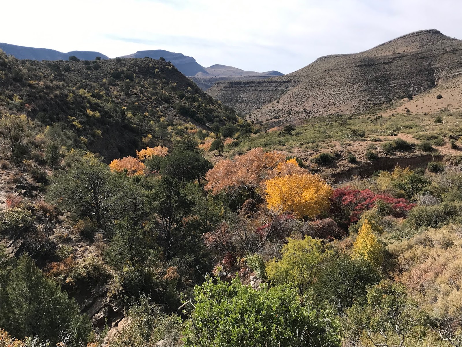
The last bit of road is in two segments right before hitting the canyon bottom. One goes straight down following the pipe, the other goes wide to the left and takes a single switch back. I took the left route down and straight one on the way back up. Views of the riparian area's golden cottonwoods and scarlet sumac brought a smile to my face as I knew that soon the best part of the hike would commence.
The creek, though dry at the crossing, was shaded with large hackberry trees, the major branches like human limbs in a contortionist pose, the gray skin-like bark pocked with blisters.

On the other side the trail went up into uninviting shadeless terrain with cactus and mesquite. It wasn't too difficult to decide to head down the creek itself, and lo and behold water appeared very shortly. It flowed for over a mile past cottonwoods and sumac, over layers of shale and sandstone bedrock, and under the pipeline itself.


I came upon a few cattle giving me the evil eye right near where a spring emerged in the gravel. I cut them a wide berth as I came across the trail again and then a wood and barbed wire section of fence with the gate lying in the grass. Now there would be just remnants of the trail on through the thickets of apache plume on the banks and most of the walking would be in the gravel of the arroyo itself. Grapevine clung to the limestone cliffs and few colorful ash trees popped out here and there, but now it was desert canyon zig-zagging down slowly to the city below. A rusty, smaller diameter pipeline of much older vintage clinging the rock walls followed.


I probably was a little less than a mile from the where the Caballero Trail meets the Alamo Trail (FT 104), when I decided to turn around. It was slow walk up, but not unpleasant and clouds and fading sun made for much cooler temperatures. I rested a few times, the water in the buried pipeline could be heard in the quiet afternoon, as I sat. Along the way I kept noticing the many pieces of bluish white chert on the road and ground along the roadsides and came across a large piece of petrified wood as well. I was back at the truck a little after 4, the last autumn light faded quickly. Perhaps many destinations here in southern New Mexico aren't as spectacular as other parts of the southwest (although some certainly are) but there is something else to be considered: it was a Saturday, during hunting season no less, with a town of 30,000 people just a few miles away, and I never saw another person for close to five hours.
Labels: fall colors, hiking, rockhounding
posted by Devon Fletcher at
8:53 PM
![]()
![]()


4 Comments:
Now I know where to go if I want to see stunning fall colors in mid-November! What a great post.
'he creek, though dry at the crossing, was shaded with large hackberry trees, the major branches like human limbs in a contortionist pose, the gray skin-like bar pocked with blisters.'
For a side detour, one may contemplate turning right at the creek. If I am correct that would take you into Hell's Hole. Foliage there is great, small waterfalls if water is flowing, etc. Be prepared for some scrambling and boulder hopping.
Also, if you have not done so, hiking partway down Alamo Canyon from West Side Road is pleasant.
Continuing on and taking the backside of Round Up would definitely be more interesting than staying in the bottom of Alamo Canyon to exit. If you do that and enjoy a little bouldering type action (or downclimbing small pourovers) I'd recommend descending from Round Up via what is known as Deadman North Canyon, then either continuing down the main Deadman Canyon where it intersects Alamo or taking one of the game trails that parallel Deadman but remain above the bottom. The game trails afford more wide open views and make for quicker hiking.
Thanks for posting. De sting the T104 or T103 from FR90
Post a Comment
Subscribe to Post Comments [Atom]
<< Home