Tuesday, May 12, 2015

Gila National Forest - Lake Roberts Slot Canyons (south side), " Box Elder Canyon"


I spent only short time obsessing about the time wasted climbing up to the ridge twice only to come back down into the same canyon. Blame it on hasty research. When I got back home to check the maps and Google Earth, I could see very clearly the side canyon I climbed up initially  did not head west at all, but paralleled the main channel of  Dam Canyon heading south. My brain had been rotated a full 90 degrees from my body. Luckily, my research, however hasty, had a back-up plan. I headed back out to NM 35, drove around the lake and through a little neighborhood of old summer cabins and small homes on a hill on the south side of Sapillo Creek. At the back of this development, at the top of a small mesa, was a dirt road onto Forest Service land. I drove it for less than a mile, parked, and off we went down into the canyon to the west, which I'm dubbing Box Elder Canyon for the abundance of this tree growing down amongst its shady walls.


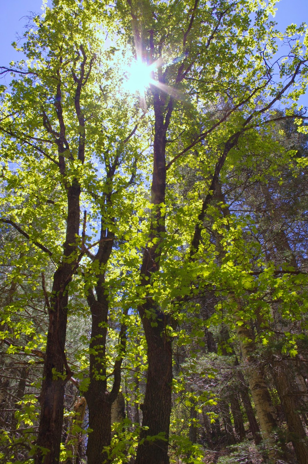
This canyon was bit smaller, but had running  water as well. It was also narrower, with the walls of conglomerate closing in sooner,  the cliffs weren't particularly high at first, nor straight up on both sides of the canyon like a true slot. But after about  40 minutes of walking, the lush canyon, with not only box elder, but also alder, willow, gambel oak, locust, grapevine and yellow columbine transformed as the canyon sides soared upward,  50, 60 70,  to over a 100 feet, into a gorge of nearly bare rock where the sunlight was pouring in.  Each twist alternated dark and light. At one turn we came upon a small pool at the bottom of small muddy waterfall.


 Now deep in the shade, we rested a bit, as I determined that this one would be climbed. I led the way skirting the muddy sides,  Seamus followed, and we were both up easily.  We walked the narrow passage and soon came upon two car sized boulders lodged in between the canyon walls at another small cascade. There was  room to go under and  between them. It was a bit slippery, but we both made it up quickly. Now we were in a more open, though still deeply shady area, where a large side canyon came in from the west. Large oak and box elder filtered the afternoon sun into gold. This seemed  a secret, magical place to me. A  hidden  place where creatures of myth and fantasy might  retreat to  . . .  So I was bit surprised when I spied three rusty metal hoops, the kind that go around an old wooden barrel, laying on the ground. Nearby, I saw a rusty iron pipe emerging from the sand as well. Hmm.


 I went on a short ways further. A fin of conglomerate protruded in the middle of the passage, beyond  which two gigantic boulders blocked it altogether. There may have been a way to climb over, or around, but not through this time.  It had been a long day for both us, and we would not get to see  what the upper canyon held on this trip. We headed back down without incident and with several rests for my tired pup.  I was happy to have another dose of Gila enchantment vibrating within.


Labels:

Gila National Forest - Lake Roberts Slot Canyons (south side)" Dam Canyon"


Despite all the fires and floods, I'm discovering there is still a lot of magic left in the Gila for me. On Sunday( 5/10/2015), we ventured out to the south side of Lake Roberts to explore two box canyons that looked likely to contain sections that would qualify as slot canyons as well. It promised to be  a cool, sunny spring day, and after parking at the end of the road at Upper End Campground, we headed out on the trail that follows the south shore of Lake Roberts. We quickly met some javelinas, bunnies, ducks, coots and a rotting vulture. I was so glad I had kept Seamus on the leash during this part of the walk. The first canyon I was after has its mouth directly  below the new spillway of the new dam, so I'm christening it " Dam Canyon". It is otherwise un-named.
Lake Roberts

 We started walking up the bouldery stream course and Seamus soon found a bit of water flowing to drink from. I got the idea to  leave this canyon to explore the canyon directly over to the west first, which had looked more promising on Google Earth, and quickly began going up a side canyon on my right, which I hoped would bring me to the ridge/mesa between the two where I would hopefully crossover and find my way down into the other canyon. All seemed to be going well.  I thought I had gotten to the mesa top. I thought I had crossed over the divide of the drainages.  I made my way through the pines down a rough, but not particularly  treacherous  ravine to get to the canyon further west, but when I got to the bottom, everything was backwards.  I was thinking, because I've always been so good about keeping a bearing that a left turn would be taking me upstream and south, but the stream was definitely running downstream to my left. I began walking downstream anyway, thinking I was in a side drainage and would hit the main canyon shortly, but after passing a nice little streamside spring, I realized  this canyon was too big to be a side drainage of  what is not a very large canyon to begin with.

 If I had only walked  a little farther I would have realized I was in the same canyon( Dam Canyon) I had started in. I kept puzzling  as I turned and headed up stream( and didn't think to get out the compass until much later). I thought I could  have had a lapse of concentration on the ridgetop and gotten turned around and ended up still in the first canyon. I also  thought perhaps I had hit the second canyon where it makes  an  almost 90 degree turn to the west.  It was a little bit disturbing, because I have always prided myself on my sense of direction and ability to keep my bearings. In the end I  also thought that it'll all work out, and there was little chance of getting lost entirely, because all I would have to do was head downstream  and I would be brought to  the lake or Sapillo Creek and know exactly where I was.
 These north facing  south side canyons are quite a contrast to their counterparts on the north side of Lake Roberts that face south ( see my March blog about those canyons).  Huge pines and firs grow. Box elder and  deciduous oak flourish. Yellow columbine and cress grow out of wet canyon walls. Dam Canyon had quite a few little delights including a huge alcove where we ate lunch, a bedrock section with cress flowers where the stream burbled from tiny pool to tiny pool,  with a perfectly still green toad on a boulder below, plus a few stunning vistas of the towering cliffs overhead.


It eventually narrowed into slot, but quickly thereafter we were brought to a halt, by a very deep pothole filled with very cold water. It was probably about eight feet long, and perhaps nearly that deep. On the other side was a steep, slippery waterfall/ slide at the top of which were several chock stones stuck in the narrow  passage.


That was all she wrote, at least for this visit. Perhaps when I  return, hopefully one day with my friend Doug Scott, we'll figure out a way to explore above this spot.
 We headed  back  downstream and when I got to  back to the spring and the side ravine I decided to try and retrace my footsteps back up to perhaps figure out what I had done. And because, despite the fact that I had been using the compass for awhile now, I was still feeling turned around and was wishing I could shake it. I got  back up on top of the  ridge, but couldn't find the exact place where I had crossed, nor the first side stream I had walked up.  I was hoping to perhaps get view of the lake that  would right my senses but all I could see were the anonymous looking hills that surround the area.I found another side stream and made  way down again this time, having a wee bit of trouble at dry waterfall that had to be maneuvered around. I got to the bottom and Voila! I was looking up at some tall pines and cliffs I had photographed a short while before. I checked around the corner for a boulder I had stood on while taking the shot- and there it was.


I was back in the same canyon I had started in for the second time. This was totally bizarre to me as if in an episode of the Twilight Zone.It was like there was some kind of vortex  or portal on the ridge top which either wouldn't let me cross or kept spitting me out in same place. I now headed downstream hatching plan B for how to get into that canyon to the west.
 Back at the  dam I checked out the algae laden waters of Sapillo Creek at the source of its flowing section ( above the lake there is almost never any flow) - a pipe at the bottom of the gravel part of the dam. We then  retraced our path along the lake shore back to our truck.
Sapillo Creek

 Outlet from the Lake Roberts Dam


Labels:

Monday, May 4, 2015

Apple Tree Canyon( FT 5601,FT 5601A) Hike- Lincoln National Forest


 We did this hike on Sunday. It was going to hit 90 or so in Las Cruces, so  this little forest hike that starts at about 7500 feet and ends at about 9400 promised to be a cool getaway. The trail is about 22 miles south of Cloudcroft on the east side of the Sacramento River Road( Otero County Road 2, also known as  FR 537 ).
 It was barely 60 degrees as we parked the car at the spacious trailhead parking and began walking up the wide mouth of the canyon, which already had  a pleasantly greened up carpet of grass  in contrast to last year's crispy mid-Spring conditions. The  trail becomes more confined and shady  just past an old excavation, and the trailhead for the alternate trail FT 5601A. We stayed left on the main trail and soon entered a beautiful mixed forest of deciduous trees and conifers, highlighted by many large maple trees. I made a note to myself to return in October as this would be a pretty painless place to get a good dose of fall color. I'm beginning to understand now that many canyons in Lincoln have these stands of big tooth maples but they are rarely visible from any of the major roads and highways.


  We saw woodpeckers, kinglets, jays and were approached by hummingbird. In the  peaceful canyon we could hear the heavy wing beats of ravens as they skirted the tree tops a hundred feet above us.We also met a couple of guys making there way slowly down the  now rough and rocky trail on their ATVs. Shortly thereafter we hit the first and worst of many steep uphill sections as the trail began to climb in earnest. Along the way there are sections where it levels out or mostly levels out after taking a nearly 90 degree turn. There was also one brief downhill section after the trail leaves the main canyon and goes around the head of another, only to climb back up to the ridge it was just on.
  A short ways before another climbing stretch and the upper trailhead for FT 5601A is a good-sized level meadow area where we ate our lunch. This would be one of the few really good camping areas along this trail. Past that upper trailhead for the alternate trail is a  lovely aspen grove in a  sloping open meadow.

 Eventually as the trail sidehills and climbs to the top of the mountain, views begin to open up . To the west we could see the lower forested benches and ridges of the Sacramentos, and landmarks such as Gobblers Knob. The views continue all the way out to the Organ Mountains 80 miles away. We could also see dark clouds  and rainstorms in the distance above the mountains at Hueco Tanks 50 miles to  south. It was nice to have these distant vistas to admire, closer at hand in these upper reaches of the trail, spring had not arrived just yet. Extensive  trail side growth of deciduous  oaks were only beginning to bud.


After a long stretch of steady, fairly steep climbing, we finally reached what is more or less the top of the trail where there is a confusing junction. On our left was an abandoned road that although it  was reasonably wide and clear was seeing very little use of any kind. Its continuation on our right had at least a  two track and looked like it saw a fair amount of use. We hiked down it a ways, taking in views now  to the southeast of  slowly recovering burned ridges along the upper tributaries of Scott Able Canyon. When it started to go downhill, we opted out, and backtracked. We didn't  need any climbing for our return trip.


 Directly ahead of us was a  very rocky, well  worn track going up a small hill. I assumed this was the continuation of our trail, but as the only sign was on the trail we just came up and facing downhill, I can't really be sure.
 On the return we used the alternate trail(FT 5601A), which, because it only allows foot and horse travel, was much less well worn. At first, it was more pleasantly rustic as well, with a wide pine needle padded path to walk on, but when it finally began to take us down hill , it was every bit as steep, stony and rough as the main route. It had some nice maples as well,but not nearly as many as the main canyon.


 I'm thinking that our hike was around 6.5 to 7 miles( round trip).  The distance to the very end of the trail on Forest Road 460C would be a little over 5, making for a round trip of around 10 miles. A lollipop loop using the alternate trail would be a nice, less taxing hike.A good downhill shuttle hike could start at the nearby Sacramento Lookout and end at the trail head parking lot which would only make for  drive of about 40 minutes or less between endpoints. Elevation gain is  around 2000 feet,much more than the trails further back up  the Sacramento River road that I did last year( Corral, Thousand Mile, and  Sacramento North), but the elevation gain is reasonably spread out and not anywhere in  the steepness realm of some of the others I did last year( Upper San Andres, Heart Attack).
 This was a nice hike for the spring that would be  spectacular at the peak of fall color. As with many hikes in the Lincoln, it is waterless. What's also true about this one as with many hikes in the Sacramento District is, it's more about just being in  forest than bagging a peak, or making it to some spectacularly scenic destination.  Note: the main trail is open to all uses, and we did have a couple of motorcycle riders pass us going up hill as we went down. However, I do believe the Forest Service is correct in rating this trail's use as light, and I would guess that on a summer's weekday you would encounter very few people. Summer weekends may be a different story.

Labels: