Apple Tree Canyon( FT 5601,FT 5601A) Hike- Lincoln National Forest


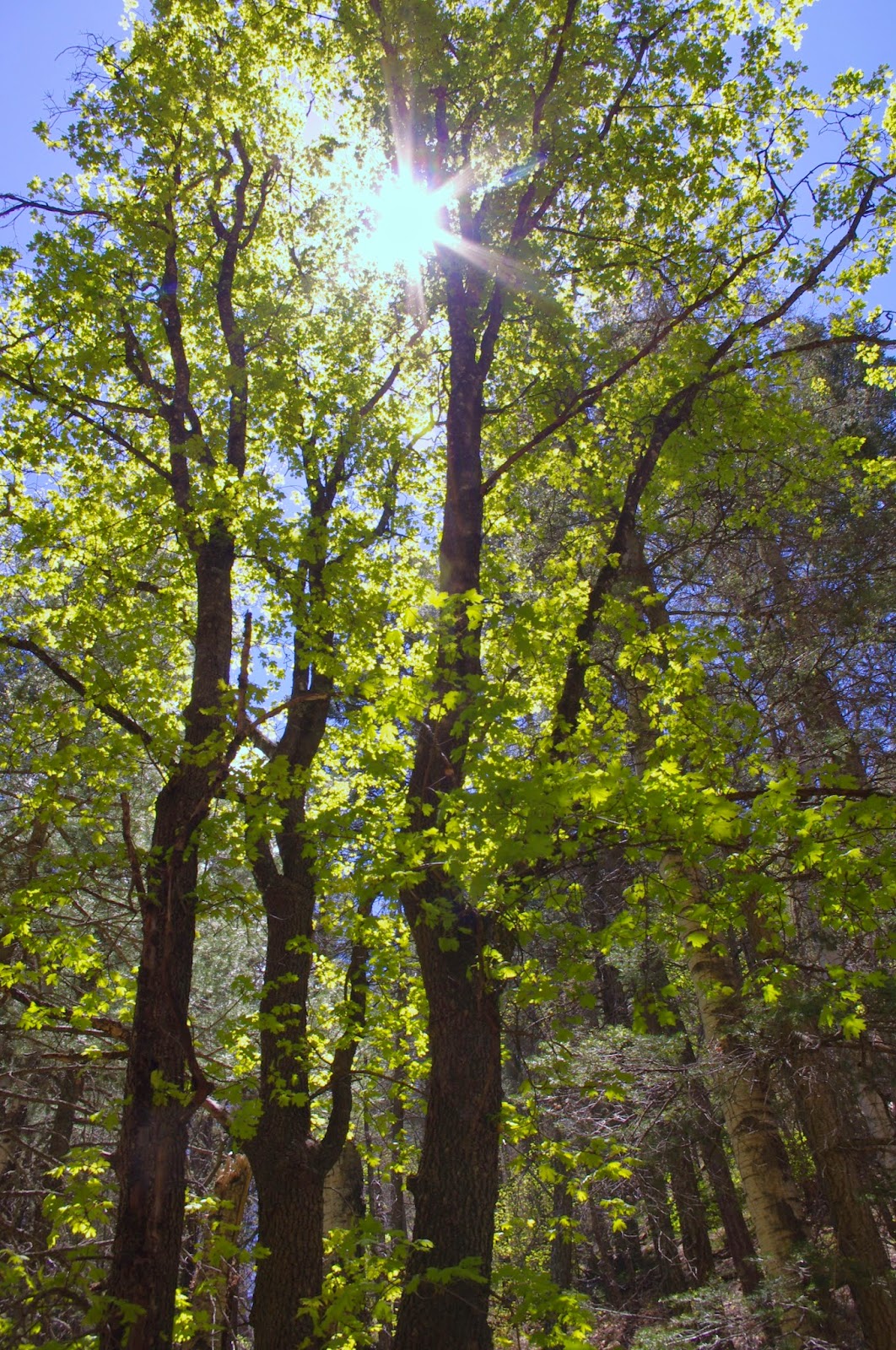


It was barely 60 degrees as we parked the car at the spacious trailhead parking and began walking up the wide mouth of the canyon, which already had a pleasantly greened up carpet of grass in contrast to last year's crispy mid-Spring conditions. The trail becomes more confined and shady just past an old excavation, and the trailhead for the alternate trail FT 5601A. We stayed left on the main trail and soon entered a beautiful mixed forest of deciduous trees and conifers, highlighted by many large maple trees. I made a note to myself to return in October as this would be a pretty painless place to get a good dose of fall color. I'm beginning to understand now that many canyons in Lincoln have these stands of big tooth maples but they are rarely visible from any of the major roads and highways.

We saw woodpeckers, kinglets, jays and were approached by hummingbird. In the peaceful canyon we could hear the heavy wing beats of ravens as they skirted the tree tops a hundred feet above us.We also met a couple of guys making there way slowly down the now rough and rocky trail on their ATVs. Shortly thereafter we hit the first and worst of many steep uphill sections as the trail began to climb in earnest. Along the way there are sections where it levels out or mostly levels out after taking a nearly 90 degree turn. There was also one brief downhill section after the trail leaves the main canyon and goes around the head of another, only to climb back up to the ridge it was just on.
A short ways before another climbing stretch and the upper trailhead for FT 5601A is a good-sized level meadow area where we ate our lunch. This would be one of the few really good camping areas along this trail. Past that upper trailhead for the alternate trail is a lovely aspen grove in a sloping open meadow.

Eventually as the trail sidehills and climbs to the top of the mountain, views begin to open up . To the west we could see the lower forested benches and ridges of the Sacramentos, and landmarks such as Gobblers Knob. The views continue all the way out to the Organ Mountains 80 miles away. We could also see dark clouds and rainstorms in the distance above the mountains at Hueco Tanks 50 miles to south. It was nice to have these distant vistas to admire, closer at hand in these upper reaches of the trail, spring had not arrived just yet. Extensive trail side growth of deciduous oaks were only beginning to bud.


After a long stretch of steady, fairly steep climbing, we finally reached what is more or less the top of the trail where there is a confusing junction. On our left was an abandoned road that although it was reasonably wide and clear was seeing very little use of any kind. Its continuation on our right had at least a two track and looked like it saw a fair amount of use. We hiked down it a ways, taking in views now to the southeast of slowly recovering burned ridges along the upper tributaries of Scott Able Canyon. When it started to go downhill, we opted out, and backtracked. We didn't need any climbing for our return trip.


Directly ahead of us was a very rocky, well worn track going up a small hill. I assumed this was the continuation of our trail, but as the only sign was on the trail we just came up and facing downhill, I can't really be sure.
On the return we used the alternate trail(FT 5601A), which, because it only allows foot and horse travel, was much less well worn. At first, it was more pleasantly rustic as well, with a wide pine needle padded path to walk on, but when it finally began to take us down hill , it was every bit as steep, stony and rough as the main route. It had some nice maples as well,but not nearly as many as the main canyon.


 I'm thinking that our hike was around 6.5 to 7 miles( round trip). The distance to the very end of the trail on Forest Road 460C would be a little over 5, making for a round trip of around 10 miles. A lollipop loop using the alternate trail would be a nice, less taxing hike.A good downhill shuttle hike could start at the nearby Sacramento Lookout and end at the trail head parking lot which would only make for drive of about 40 minutes or less between endpoints. Elevation gain is around 2000 feet,much more than the trails further back up the Sacramento River road that I did last year( Corral, Thousand Mile, and Sacramento North), but the elevation gain is reasonably spread out and not anywhere in the steepness realm of some of the others I did last year( Upper San Andres, Heart Attack).
This was a nice hike for the spring that would be spectacular at the peak of fall color. As with many hikes in the Lincoln, it is waterless. What's also true about this one as with many hikes in the Sacramento District is, it's more about just being in forest than bagging a peak, or making it to some spectacularly scenic destination. Note: the main trail is open to all uses, and we did have a couple of motorcycle riders pass us going up hill as we went down. However, I do believe the Forest Service is correct in rating this trail's use as light, and I would guess that on a summer's weekday you would encounter very few people. Summer weekends may be a different story.

Labels: hiking
posted by Devon Fletcher at
8:53 PM
![]()
![]()


1 Comments:
Devon,
This seems like a nice enough hike. I was searching for your email address, but couldn't find it on the blog, so this comment will have to suffice for communication. My family is going to try to car-camp somewhere outside of Cloudcroft in a couple of weeks. I've never spent any time around the Sacramentos aside from a week spent car camping outside of Ruidoso last summer. Do you have any recommendations for car camping that is good for a roaming dog in the cooler high altitude of the Cloudcroft/Sunspot/Weed region? Dispersed camping is generally preferred, but really sleepy campgrounds can work for a leashed dog as well. My assumption is that weekdays are quiet, but weekends rowdy with people from the big cities of Las Cruces and Alamagordo taking their ATVs, grills, and beers into the woods. Perhaps I'm wrong, but any recommendations on mellow spots to set up a tent and car camp for a handful of days would be greatly appreciated. PS, we only have a Subaru Forester, so no legit high clearance or 4WD for the rough roads in this area that I frequently see you write about. Eric, ultrapayne@gmail.com
Post a Comment
Subscribe to Post Comments [Atom]
<< Home