Thursday, December 29, 2011

Prehistoric Trackways National Monument- Discovery Site Trail


UPDATE (July, 2021): The Ridgeline Trail has been vastly improved and now bypasses the steep climbs over several hills. The Discovery Trail has likewise been improved and actually reconnects with the Ridgeline, so a lollipop loop can be done without any road walking or off-trail hiking.
      Our original idea was to hike Tonuco Peak, but we soon discovered that areas just to the north of Las Cruces were still covered with snow. We could see the very steep "road" to the top of the peak from the highway, and it was looking completely white. So we decided to come up with another idea. We took a few photos and headed over to the Trackways trailhead in the Robledo Mountains. 
     Well, first we drove past the Trackways trailhead and parked in a large open area. I wanted to hike up the road the runs to the south of the quarry and then onto the road the runs along the middle ridgeline of the lower section of the Robledos. We had gotten a short ways when we heard a lot of shooting, saw a bunch of guys with a rifles along side the road, and decided to turn around.Given the observable circumstances, this was the right move. Without going into a lot of detail, let's just say that safety was not their utmost concern and leave it at that. We drove the car back to the new official trail head, now located a short ways east of the old one.
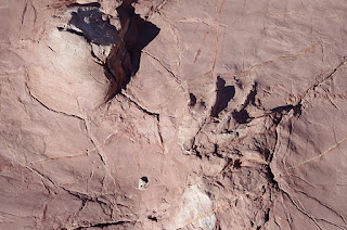
      The trail ( Ridgeline Trail) followed an old road on a mesa top initially, but then took us up steeply over a couple of small peaks, before signs directed us down into the canyon containing the trackways( Discovery Site Trail). The road does continue on for a ways, up and down hills until it dead ends at big canyon. It was obviously made for fun with Jeeps back in the day which is why it goes straight up hills instead of around them.We've been here many times, but it had been quite a few years since our last visit.There is a new, large sign to read, but little else has changed.We decided to walk out down the canyon, which used to be the accepted route to the Discovery site, but since the canyon runs right next to the gravel pit site which is now a closed area, the BLM obviously would prefer visitors to use the new signed trail. We climbed back up to the new official trail eventually and returned to our car. Besides the reptile tracks and conifer impressions, there is abundant marine fossilization here as well. There is also one of the three basaltic plugs( the other two are in Apache Canyon) in the Robledos found here which all have columnar jointing on a small scale more famously recognized on a grand scale in places like Devil's Tower. It was a nice hike for a short winter day. Next time, we'll go a little further afield, the Robledos are at their best when you walk in their more remote corners.


Labels: , ,

Thursday, December 22, 2011

Tortugas( "A") Mountain


We hiked up Tortugas Mountain on Wednesday, taking advantage of what has been a rare commodity lately: blue skies and sunshine. We parked at the main trailhead off of Dripping Springs Road. There is a shelter and some tables,but no bathroom or trashcan. There is also a sign with rules and a trail map with many routes and ways listed. Unfortunately there are no signs on the trails themselves so it's not particularly useful. Once we started up the mountain, we realized there is a virtual maze of use trails, plus the official trails, which can be confusing.I believe we stayed on the actual Turtleback trail all the way up. On the way down, we started out along the "A" and continued straight down a rough way which eventually angled back to the trailhead to complete our little loop. There were good views of the snowy Organs.This is a limestone hill like Bishop Cap and Anthony's Nose to the south, so it supports several different cacti that don't grow on the volcanic soils the dominate our region. I kept a look out for fossils as well, but didn't see much.Total distance for our hike was less than two miles,but it would be easy to extend any hike by using the bike trail that circles the mountain to make any number of loops. Elevation gain was probably around 600 feet, so it's steep. I'd like to hike around the backside and check out the old fluorite mines, or use the bike trail to go all the way around the mountain.On the way back we saw a large raptor( may have been an eagle) fly by at eye level about 40 feet in front of us.That kind of thing is always nice incentive for winter time hiking in the desert.

Labels:

Monday, December 19, 2011

Sierra Vista Trail


We hiked the newest section of the Sierra Vista Trail on Sunday. This trail previously ran from the Texas border near Anthony Gap all the way to Soledad Canyon Rd. We've hiked the section from NM 404 to Webb Gap in the New Mexico segment of the Franklin Mountains. We also hiked south from the Soledad Canyon Rd trailhead.We've used the trail as a part of a loop hike around Bishop Cap Mountain, as well as heading north past Pena Blanca to Massey Tank and returning on a parallel old road which leads back to the county road that runs along Mossman Arroyo. Now the trail has been extended from Soledad Canyon Rd. to Dripping Springs Road,where we started our hike. There is small sign on the south side of the road that says "Sierra Vista". A parking loop is right there,but we continued down the dirt to one of several pullouts and parked. After about a 1/2 mile the road has another loop and more parking where it dead ends in an arroyo. The trail winds in out of several arroyos which start out wide and shallow and but get more narrow and deep as we headed southeast. The ridges have certainly been overgrazed here,but not nearly as badly as some parts of the Organ Mountains foothills.There is still some grass growing with abundant barrel cactus and Mormon tea instead of catclaw, creosote and mesquite. Some large isolated houses came into view as we got closer to the lumpy-bumpy Soledad Rocks and our turnaround point at the Soledad Canyon Rd. trailhead.Distance for the hike is about 2 1/2 to 3 miles one way, with elevation gain of about 200 feet. It's more of trail for exercise or walking the dog,as it has no real destination of any significance. It does have views of the high peaks of the Organs and Squaw Peak,which of course even a long time Las Crucen find hard to take for granted.

Labels: ,

Tuesday, December 6, 2011

Slot Canyons


Robledo Mountains
Redhouse Mountain
Robledo Mountains
Redhouse Mountain
Long Canyon

Long Canyon, Organ Mountains
Broad Canyon
 Note ( 4/14/15): This blog was written before I really began to investigate slot canyons down here in southern New Mexico. Now a whole new world of genuine  slot canyon experiences has opened up for me. I have since written about them over the past 2 years and  continue to research and explore new possibilities.
  A few months back before my free year of HBO ran out, well it actually it might have been after the free HBO ran out as Comcast/xfinity conveniently failed to notify me that it had run out,in order to bilk me for a month of HBO, I watched 127 Hours several times and it put me in mind of our homegrown slot-type canyons here in southern New Mexico. They're not as narrow,deep or dangerous as the ones in Utah,but they do have their charms.
    One of the best ones that I've hiked several times is on Redhouse Mountain in northern Dona Ana County. It starts off in an old manganese mining area about 10 miles northeast of Hatch. It's gets very narrow quickly,and scrambling over bare rock and climbing a few 5-6 foot drops are required. Eventually it levels off and zig -zags along until it opens up and forks at the base of hill. Along the way there are some very thick junipers that I'd be curious to have an expert give me an estimate of their age. The first time I hiked here, we saw a spotted owl in the branches of one of these trees. It was amazingly unconcerned with our presence and only when we approached within 8 feet or so did it lazily flap its wings and drift up to ledge perhaps 10 feet higher and watch us pass.
     There are brief sections of Broad Canyon and Valles Canyon in the Sierra de las Uvas that could almost qualify as slots. Pictograph Canyon at Tonuco Peak also gets very narrow in spots.  Many years ago, on windy winter day, I followed some old roads on the east side of the Robledo Mountains. The road ended( sort of)  overlooking the confluence of two arroyos. I went down, and first investigated a short ways west and north, but then headed down and east where the canyon boxed up, getting  narrow,twisty and deep right before it  opened up onto the bench lands that sit above the Rio Grande. I'd like to revisit this one if only to check my memory, and also check out a similar looking canyon just to north. Also in the Robledos there is a tributary canyon of Faulkner Canyon that gets narrow enough to give a hiker some challenging options at every dry waterfall.
  Probably the most dramatic of any I have visited so far is Long Canyon at the southern end of the Organ Mountains.It is very rugged getting to the mouth of the slot section of this canyon. At the " gate " the walls rise up several hundred feet.There are small ash trees and New Mexico buckeye in the boulder strewn bottom. Golden Eagle nests are on the cliff sides and there's a good chance of seeing one of these huge birds during the winter months. Oddly enough the upper section of Long Canyon is a shallow,grassy depression along the ridge of the southern Organs.Well, these are few that came off the top of my head, if I think of others, I will update.

Labels: ,