White Mountain Wilderness, Water Canyon (FT 53), Crest Trail (FT 25)-Lincoln National Forest
 |
| Nogal Peak |


A Word About " Water Canyons"
There are many stream courses named " Water Canyon " in New Mexico, all named many years ago when our parched state was a little more moist. Nowadays, the name can mean several things. What it doesn't guarantee is year round water. Still, after having found North Seco Creek doing so nicely in this most parched time of year a few weeks ago, I was optimistic.
On with the hiking story.
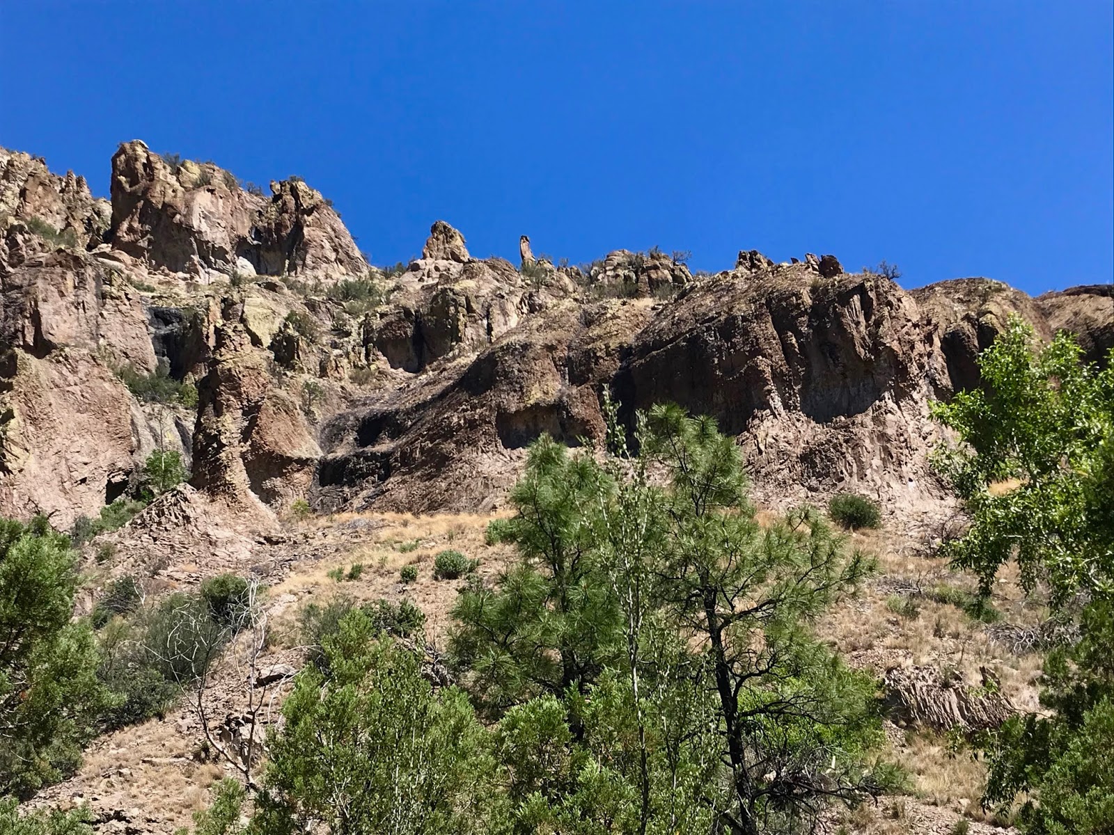
Well, the veil of smoke from fires burning in the Gila, the San Mateos and in Arizona, that hung over the mountains and the Tularosa Valley as I drove out dampened my enthusiasm. I got to the trailhead at a small pass between the Tanbark and Nogal Canyon drainages in good time ( 2 hours 45 minutes ) and was off on the Crest Trail in a flash. I had been out here many years ago, either before we moved to New Mexico or very shortly after making our home here. We only hiked a short ways back then, but I did remember the crooked little deciduous oaks that shade the trail. They must be pretty slow growing, because they didn't seem that much bigger a week ago.


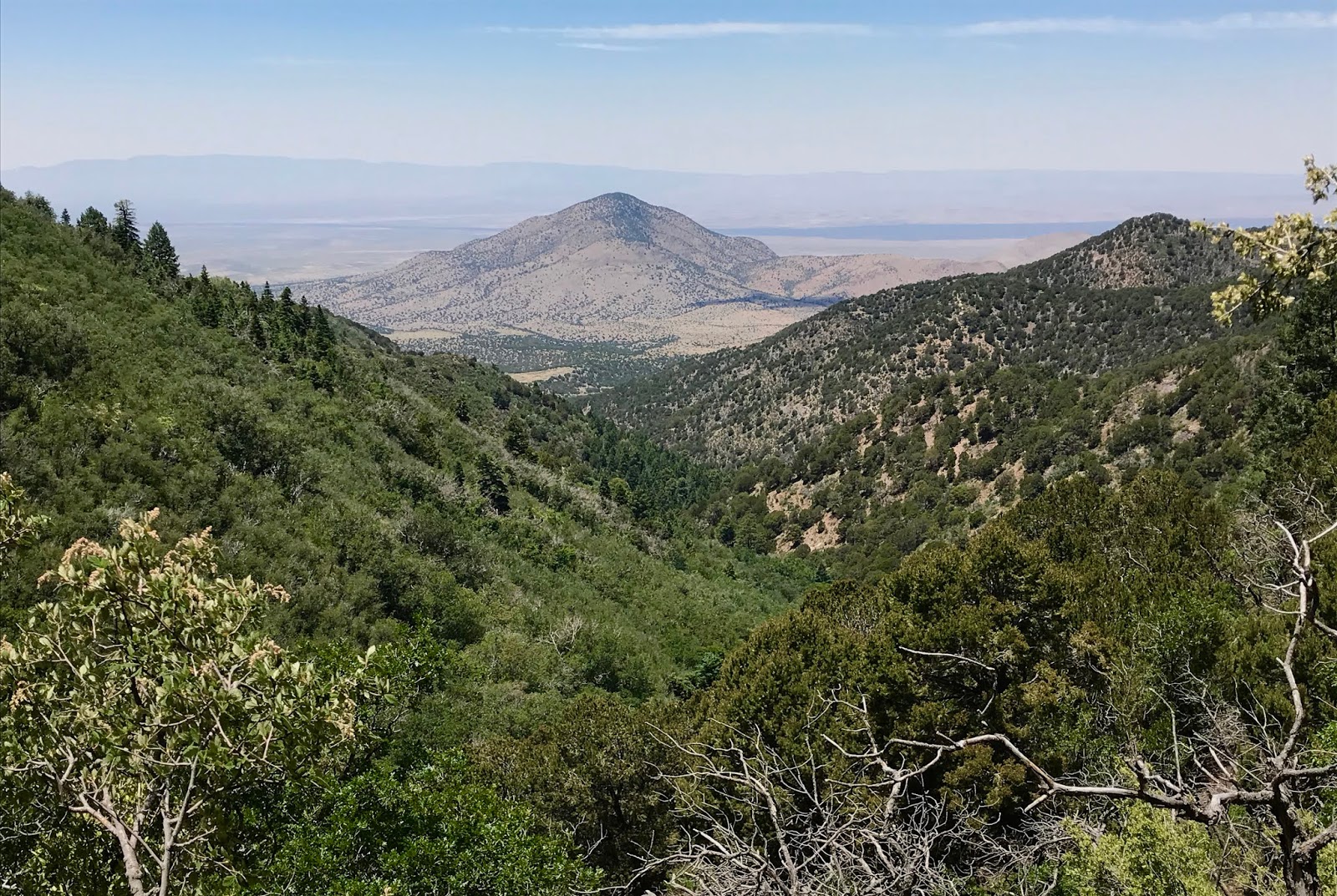
When views opened up, I looked off to the south to get my first sight of the ridges, peaks and canyons that had been burnt over by the Little Bear Fire just little more than 8 years ago. The trail is well designed as it curves around the south side of Nogal Peak with a little elevation change, and I was quickly at the intersection on the crest with the Skull Springs (FT 41) and the Water Canyon (FT 53) trails.


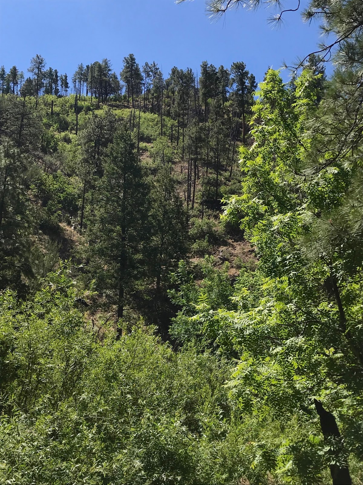
Down I went. The tread was easily visible at first, but then began the first of several sections where the oak brush made it all but invisible. Luckily it was still there down at my feet, so the walking was still pretty easy. A switchback brought me down from the pines and grasses to a thicket of large twisting oaks at the very head the stream.


A second one brought me to a crossing where the trail began to follow the (dry) stream through a grove of aged locust trees. Two bull elk threw me some backward glances as they moseyed up the opposite hillside.


The gradient is pretty high here so I knew I was in for slow going on the way back up. Occasionally the trail tread would evaporate, or there would be several elk paths to confuse things slightly. This section was more problematic on the way back up when I got off on an elk path which was much more heavily traveled than the Forest Service trail. Luckily I realized my mistake pretty quickly, and was back on the trail in a few minutes.
Soon I was hitting the big timber near the confluence with the northern branch of Water Canyon.

Soon I was hitting the big timber near the confluence with the northern branch of Water Canyon.

This had been my planned turnaround point. I figured if there wasn't water here or just downstream, the creek most likely didn't carry any. It was dry. I had made such good time going downhill, however, that I figured I could explore a little further. The canyon leveled out a bit, and I encountered a muddy spring, that, though it was not flowing, was a good sign.


I was just about to give up on finding any water, when ahead of me was a very shady section of canyon bottom, canopied over with oaks, box elder, locust and a few maples, that caught my eye. Sure enough, the stream came to life, where springs seeped out of the black soil. The water trickled over stones and branches and now I was willing to follow along as long as it flowed.

My happiness was twisted a bit when the garish sight of abandoned camping gear (tent, pad, sleeping bag and water jugs) appeared on the opposite bank.


My happiness was twisted a bit when the garish sight of abandoned camping gear (tent, pad, sleeping bag and water jugs) appeared on the opposite bank.

I decided I would check it out more closely on the return, then I continued to see how far the water would continue. It wasn't much, and all told this section probably only flowed a quarter of a mile, if that. Seeing the dry cobbles was my cue to turn around. I don't know if it pops up again further downstream, but I was nearing where the canyon exits its forested confines anyway.
The campsite contained no human remains, which was nice. My theory was that someone backpacked down from the top like I did, and then decided to seriously lighten their load for the return trip back up. By the condition of the stuff, it had to have been fairly recently too.
I re-wet my hat and shirt in the cold water. I filled a liter bottle for purifying if I needed it and began the trudge back up to the crest, 2000 feet above and 2 miles beyond where I stood. It was slow going. What had taken me and an hour and ten minutes to descend, took (with lunch, water breaks and the aforementioned bit of mis-navigation) two hours and twenty minutes to ascend.
The return leg on the Crest Trail went quite fast. Even with the unexpected five minutes of conversation with an outgoing hiker, the two miles only took 45 minutes. I can't really say I would recommend this hike. Lynn Melton's fantastic PDF document about the Smokey Bear RD trails http://lincoln-nf-trails.org/Trails/Smokey_Bear/SB-pdf-main.html , has information about accessing the trail from the bottom which may be more sensible.
 |
| Water Canyon |
The campsite contained no human remains, which was nice. My theory was that someone backpacked down from the top like I did, and then decided to seriously lighten their load for the return trip back up. By the condition of the stuff, it had to have been fairly recently too.
I re-wet my hat and shirt in the cold water. I filled a liter bottle for purifying if I needed it and began the trudge back up to the crest, 2000 feet above and 2 miles beyond where I stood. It was slow going. What had taken me and an hour and ten minutes to descend, took (with lunch, water breaks and the aforementioned bit of mis-navigation) two hours and twenty minutes to ascend.
The return leg on the Crest Trail went quite fast. Even with the unexpected five minutes of conversation with an outgoing hiker, the two miles only took 45 minutes. I can't really say I would recommend this hike. Lynn Melton's fantastic PDF document about the Smokey Bear RD trails http://lincoln-nf-trails.org/Trails/Smokey_Bear/SB-pdf-main.html , has information about accessing the trail from the bottom which may be more sensible.
Labels: backpacking, fall colors, hiking, scenic driving, White Mountain Wilderness, wildflowers
posted by Devon Fletcher at
4:44 PM
0 Comments
![]()
![]()