Wednesday, November 15, 2023

Eagle Nest, Butte Peaks - BLM Lands, Luna County
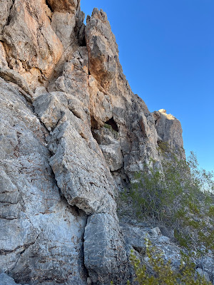
 

There is an archway opening in the cliff here

Eagle Nest


Eagle Nest

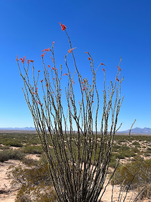
Late blooming ocotillo

Eagle Nest

I visited the Butte Peaks and Eagle Nest in the far southeastern part of Luna County a couple of weeks ago. I've been wanting to visit these little mountains that rise very steeply from the desert plains and playas for awhile now, but until recently I had not really scoped out the best way to get out there. Well, I've got it figured out now and despite the fact that I ended going all the way to Columbus, NM and then backtracking, the roads I used still ended up a time (and anxiety) saver. Only had time for two short hikes, so there's not really much to report. At Butte Peaks there were some prospects, on the east side of the mountain, but since there were no shafts, tunnels or tailings, I believe they may have been for building stone.
Butte Peaks

 In the sand dunes just to the south of Eagle Nest I found a few sherds of brown pottery, and lithic debris of a very dense yellow shale. On the peak just to the east there was a substantial stone tower that could be seen at a distance. My subsequent research leads me to believe it is not border marker from before the Gadsden Strip was purchased. I don't know what it is for, but hope to investigate further on another trip. Hiking back to the 4Runner I noticed tilted sedimentary beds peaking out from the sand and gravel. More research revealed that this area has some complex geology involving thrust faults, overturned beds and older beds lying on top of younger ones.

It was  warm for the last week of October. Recent rains had a few ocotillo blooming. Lizards scurried but no snakes were seen. I was glad in the late afternoon to be hiking in the shadow cast by the massive east facing cliff of limestone at Eagle Nest.

NOTE: After driving through the old POL Ranch and leaving the maintained county road that dead ends there, the roads out here range from the almost okay to the truly miserable. Also, it's best to have a navigator with you and some kind of GPS app like Gaia or On-X, because there will be route finding for sure. Don't count on following tire tracks because this area is so seldom visited in many places there aren't any.

Labels: , , ,

Saturday, November 4, 2023

Ladder Ranch - Emrick Canyon


Although we enjoyed our tour of Las Animas, visiting Emrick Canyon was the highlight of the trip for me. As with our previous trip I wanted to visit  another one of the several slot canyons that are tributaries of South Palomas Creek. Emrick Canyon, on the south side, appears to be the largest with two separated slot sections  that total maybe 2/3 of a mile. It also has a spring at its headwaters which to me meant a more consistent flow of water to erode a larger and more walkable canyon.

 Unfortunately, I had decided to start upstream at the spring. Getting there from Las Animas Creek was a slow and tortuous drive over rough, steep and winding trails, with the last pitch down from narrow ridge to the spring being on road that was no longer there. We did exercise a bit of caution at last and pulled off to the side before reaching the absolute bottom and walked the last couple of hundred yards.

 At the spring was a wonderfully picturesque cabin, more than a hundred years old, I would guess. An absolutely enormous ponderosa  which had fallen over in recent years stood nearby. The spring had good flow and had breached a small dam, made with " bricks" of cement (the time honored technique of wetting the sacks and letting them dry  and then busting them out had obviously been used here).

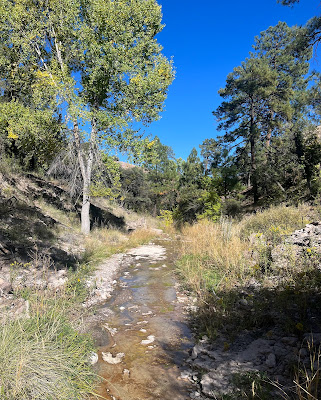
 I knew time was running short now, and that I only had time to visit the upper slot at best, so I headed downstream as fast as I could going through a tanglewood thicket of cottonwoods, junipers, willows, and vines that all rooted themselves right in the tiny perennial stream. There was an occasional clear section that ran over the bedrock, but it was a tough scramble of about 3/4 of a mile just to get the welcome opening and easy walking of the slot section.

 It's was a beautiful walk through the undulating walls of conglomerate rock. The cliffs were anywhere from 30 to 70 feet high and gave way dry, grassy hilltops where sotol stalks shined against the pure blue October sky. Much of the canyon was a bit wider than some would call a slot, but some passages were quite narrow, especially one where a cottonwood was crammed in adjacent to a tiny water fall. I had to walk on the ledge of tree roots that clung to the rock in order to get down to the lower level.

 There was a moss covered spring that dripped from the rock walls of the canyon sides. There were a few lone cottonwoods or box elders in places, but much of the canyon was just the stream, gravel and bare rock.


When I reached a forest of tall deciduous trees that extends for about a 1/4 mile and separates the upper and lower slot sections, I turned around. Another amazing place that few know about and even fewer visit so I was more than satisfied . . . for now.  In my mind I'm already making plans to visit the Ladder Ranch again and to see the lower slot section.

We used every bit of daylight getting back to the ranch house. Everything takes longer and is farther than you think with a place as vast as this, and with a vehicle as slow (and loud) as a side by side ATV.

Much thanks to Ken Stinnett for getting us there.

NOTE: the Ladder Ranch is private property and not open to the public. You must arrange (and pay) for a tour  through Ted Turner Reserves.

Labels: , ,