Tuesday, June 16, 2015

Rim Trail ( FT 105)-Lincoln National Forest


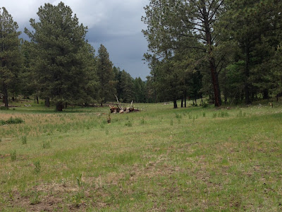
one of the few old growth trees
     This hike is at the beginning of the so called southern section of the nearly 30 mile Rim Trail.  I've done several hikes in the northern and middle sections and thought  this walk would be a good way to get out of the Las Cruces heat on Monday( 6/15/15).
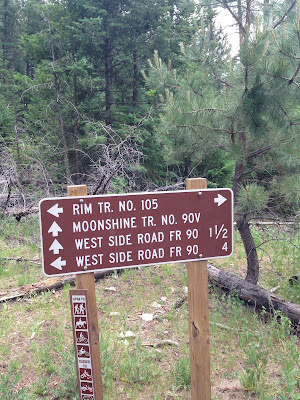
 The trailhead is off the road that goes to Apache Point Observatory, which  is off of the Sunspot Highway(NM 6563) a short ways past the intersection with the Sacramento River Road ( Otero County 2). The trailhead is signed and there is small gravel parking area in front of gate intended to keep larger vehicles out. We parked and quickly saw a small forest service sign with T 105 on it. It's bit a confusing because the sign's little arrow points to the right,but the obvious track is straight head behind the gate.


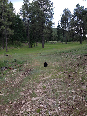
We ambled downhill in a meadow for a short ways where there was another small sign and the track took a sharp turn to the right( southwest). We followed along an old two track, that parallels a small stream bed.  It also had and easier walking cow path alongside it. We had to run the gauntlet of large group on ornery cows as we went around a  well house and small drinking tank.The trail turns again here and heads up hill and more  directly south passing a very high fence on the east. From here the Rim Trail winds it way along the ridge passing hollows  that  are the headwater  meadows of canyons that flow down the mountain to both the east and west.At times it becomes a single track , but mostly it has the feel, like other sections of the trail I've hiked, of a long abandoned road. Early on there is open spot with spectacular views to the forest plateau a thousand feet below where the reddish brown ribbon that is the West Side Road (FR 90) can be seen. The views continued out to the blinding shimmer of the immense dune field of White Sands and beyond to the San Andres and Organ Mountains in the distance.


 After the first mile the hike became a very up and down affair, topping out on a  stony peak mostly bare of trees but covered with blooming wood rose. The descent from here was very steep, and I knew it would be lung buster and a calf burner on the return. Past this point a road paralleled the trail about 15 feet above us as we kept descending. The thunder, which had been with us since we started, was getting louder. I probably should've  turned around but I had my sights set on making it at least to the junction with the Moonshine Trail( FT 90 V) that comes up from the West Side Road. Happily a short ways after another lovely flat meadow area, I was there. We walked a short way down the Moonshine Trail, which didn't look like it receives a lot of use,but turned around as it began to spill down the hillside between a break in the gray cliffs of limestone. Now it was time to burn rubber.


  We had been walking the line between the blue sky to the west and the gray clouds to the east, but  now the storm, which had seemed in the distance and trending away to the east,  backed up and covered us. The rain started falling, and the thunder seem closer still. The steep hills we had walked down were hard going up. The bare peak had the added attraction of the danger of getting hit by lightning.  At least with the dramatic drop in temperature and the steady wind, Seamus and I were cool.I've been in storms on mountaintops before, but it had been a long time and anxiety was creeping in.
We did get a little wet, but I was grateful that the heart of the storm was never that close. The rain and thunder eventually ceased and we walked the last mile or so in a much lighter mood.
 Along the way there rabbits, jays, ravens and nuthatches.Bear and coyote scat were seen, and elk droppings were plentiful along the entire route. Many sections of the trail had numerous dead trees and downfall,but happily a new growth of pines, fir and spruce were coming in. The trail is mostly surrounded by a forest of second growth conifers,but one section was cut through a dense stand of gambel oak. There was even  a growth of maples where the trail crossed the top end of a west flowing drainage. There are many beautiful places for camping with incredible western views never more than a few hundred feet away, plus a few to the east of the highest ridge of the Sacramentos and the  Sacramento Lookout. Unfortunately there are no springs along this part of the route,but just beyond where we turned around there is Pine Spring  very close to the trail.

 On the way back, I drove through several  areas where the road and hillsides were covered with several inches of hail. It looked exactly like it had snowed. I felt lucky.

Labels:

Friday, June 5, 2015

Rio Cebolla- Santa Fe National Forest


I'm not sure why I chose the Rio Cebolla for a day's flyfishing this past Monday(6/1/15).  It could be I wanted to try my hand at some meadow fishing, which I had tried( briefly) only once before on a hike into the San Pedro Parks Wilderness. It could also be the Cebolla, at least the upper reaches where I intended to go, seemed a little more off the beaten path than other Jemez streams. Whatever the reason , I found myself driving out from Albuquerque looking forward to my first day fishing in almost a year.
 The high canyon walls of the Jemez Canyon  had me awestruck. I must have been distracted or something the previous couple of times I've driven up here. I stopped at Battleship Rock to look around and began to have some thoughts of hiking up the East Fork Jemez River instead. I chatted with helpful couple getting ready to embark on a hike, and while the man consulted with me over the Santa Fe National Forest map,  I could feel the abstract (and frequently confusing)  world of the books and maps I'd been consulting make sense and come alive for the first time
 The couple, who were flyfishers, pointed me toward the upper canyon of the East Fork Jemez, and although I gave it some thought, in the end I stayed with my original plan and headed out to the upper meadows of the Rio Cebolla, hoping to catch a few Rio Grand Cutthroats.
 The driving was all paved(NM 4 to NM 126) until I got off on FR 314 at the Seven Springs Fish Hatchery. FR 314 is not good. I'm sure when it's wet it becomes very bad. I ended up bouncing the Tacoma like I was in some lowrider parade. It's quite disconcerting to become airborne in your vehicle for even one second, never mind the stretch of potholes that had me out of my seat for 5 or 10 seconds. My advice to all(and myself should I ever return): take it slow, real slow.
 After parking, I quickly made it down to the stream which was sinuously running it's course through willows and large conifers, and just like that I caught a fish. I was a little disappointed it was a brown trout and not a cutthroat, but happy to have caught a fish so quickly.

Further on was a  small beaver pond, where I tried a few luckless casts. Beyond that began the true meadow stream with its myriad of tight and then even tighter bends, undercut banks and dozens of cattle. Yes, this is a well utilized summer pasture. Even though it is a special trout water, it sometimes felt like a glorified water trough.Don't get me wrong. It's a beautiful place, even if the stream side springs are trampled and the fishing is comprised by the prospect of hooking a calf instead of a fish.
  Along the way I met and talked to one flyfisherman, saw another working a small man made pond upstream, and had a large group of hikers pass by. It was several years worth of people I might encounter in the Gila all in one day, and a Monday at that! I caught another brown too.
  Beyond the pond, the fellow I had talked to told me, is where the cutthroats are. I dutifully marched on, staying far from the stream, crouching, getting my on knees, throwing my fly where the change from brown to gray meant deeper water along the bends and runs. It was only in the seventies, but it fell much hotter in the  shadeless meadow.Eventually the murky water started to really shallow up. The cows began to more densely crowd the stream. And when I spied what looked like  a big old Hereford bull up ahead, I decided it was time to turn around. I plopped down in shade of a spruce and ate a late lunch, getting the stink-eye from a black heifer who stayed about 10 feet away the entire time.
  On my return the wind became more prevalent which, depending on which direction I was casting (which changes often on little curvy little stream like this one) had the effect keeping my fly airborne, or slapping it down hard on surface of the gentle current. Finally a few big raindrops began to fall as I reached my truck back at the picnic ground. I caught three more fish too.
 At  the end of  a six or so hour day of fishing I had caught and released  4 browns and one cutthroat all running between 7 and 9 inches.I had hooked and lost around 5 others. The total might have been a little better had I been willing to get down on my sore knees a few more times. I know I was on a soft surface,but the constant bending down takes it toll.Arriving earlier or being able to stay little later would have helped too.
I spooked my share of fish, but there had only been a handful of approaches without takes,so I don't think the action is super fast here most of the time. Had the water been clear, it could have been much worse.  In the end I was pretty happy with the results. I didn't stink up the place even though I was completely without practice and it wasn't the easiest stream to fish. A good, not great, day.

Labels:

Thursday, June 4, 2015

Fourth of July Trail-Manzano Mountains Wilderness,Cibola National Forest


    This was our first hike ever in the Manzanos. As is often the case when I'm beginning to explore a new area in our state, I turn to one of my two old editions of Laurence Parent's Hiking New Mexico, which I believe is still being published as 95 Hikes in New Mexico.  My journeys to Serpent Lake, San Leonardo Lakes, Trampas Lakes, the 10k Trail, San Pedro Parks, plus a few that I'm forgetting, and now this fantastic hike have all been taken from this very useful guide.This hike of his is a loop with a stem using trails 173, 79, 170 (the stem) and Forest Road 55.
We parked outside of the campground in an area designated as Hiker Parking. Although there was only one group camping on this gorgeous late spring weekend, it is well known, because of the abundant maple trees, that this place sees very heavy use on Fall weekends, hence the need for the extra parking.There is no fee, unless you are camping( or decide to park at a campsite).
 FT 173 ( Fourth of July Trail) starts at the back of the campground and initially feels like an extension of the road. Soon however it begins climbing almost like a staircase on top and through boulders of grayish gneiss. It was little hot and a tad humid ( by NM standards), but I was glad to see mud and then a trickle of water from Fourth of July Spring # 2, so Seamus the Scottie could cool himself down. This section has a very closed- in feeling with many small maples lining the trail.


 Things leveled off bit as we left the narrow little spring canyon. We were now in  a more mixed forest with conifers, oaks and still plenty of maples. The trail turned to the southwest, as we walked in a section deeply shaded by larger conifers. Soon after we hit the junction with FT 79, the Cerro Blanco Trail, and turned back to the northwest. Now we were in a forest made up almost entirely of maples with their electric green spring leaves. Many trees were quite large, but often they were growing in thick stands of smaller trees similar to young aspens. It was truly stunning to be here in late spring, and  I'm sure it is spectacular in the fall. I couldn't believe I'd never made my way over into this gorgeous mountain range before.


 One of the nicest things about this hike is that the little leg that brought us to a saddle on the crest is mostly a lateral move with only moderate elevation gain. There had been no long range views until we reached  that saddle, but as we did  the forest reduced itself to low growing oak scrub which had yet to leaf out, punctuated by a few spruce trees. Now we could see to the west and east.The flat mesas that border the Rio Grande Valley, Los Lunas, and the surrounding little towns were right below us. Towering above us to the north were Mosca and Guadalupe Peaks.To the south  a formidable ridge with limestone cliffs rose up. At our feet, a horny toad blending in so well with the buff colored limestone gravel, gave my wife  little surprise, and then we noticed there were several of the little guys running around.


 There was a stiff little breeze is this open spot, so we retreated to the glade of maples to have our picnic. After lunch we began heading back down to the junction of FT 173 and FT 79, we then proceeded to head south on FT 79. There were now a few open spots where we had views out to  mesas and playa lakes to the east and then as the trail descended  near Cerro Blanco views opened to complex terrain of  forested canyons and  high ridges on the south. FT 79 descends quite steeply beyond here on that loose granitic grus surface which makes the possibility falling almost inevitable. We went slow, very slow and consequently stayed upright.


 Now we  walked in a pretty little hollow with the music of a tiny, rushing stream and the calls of songbirds.We stopped, rested and lingered a bit in the shade of more maples, while Seamus played in the water. After going around a small  waterfall, that was almost completely hidden from view,  and passing some truly enormous ponderosa pines, the trail emerged onto FR 55.


 I'm learning to be a little wary of using road walking to create loop hikes, but in this case this final leg was almost as nice as the trails. Tajique Creek was  flowing at a decent clip, and the riparian area it had created was green with grassy clearings, with the biggest maples of all shading them. This hike is truly a New Mexico classic.

Labels: ,