Salado Canyon Trail-Lincoln National Forest
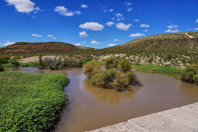
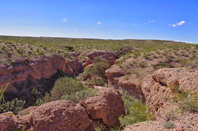
This trail is the alternate hike to Bridal Veil Falls. We used the Bridal Veil Falls trail back in the Spring. It was already a little too late in the year so it was hot. It was still a little early for Salado Canyon, so it was hot again on Sunday(9/29/2013) as well. It was probably only about 80, but these trails are below the transition from desert to the pinon-juniper scrub forest, and are completely open to the sun, except right along the creek where the occasional cottonwood provides shade. Salado Canyon trail, which starts couple of miles west ( and several hundred feet lower down) of the Bridal Veil Falls trailhead on FR 162 C , is just a continuation of the Bridal Veil Falls trail on the same long abandoned railroad grade. There is parking for 3 cars at the trailhead. Initially we hiked down hill and northwest to get to the main trail. We could see the new bridge built upon the old trestle downstream (to the west) from us, but didn't hike to it. It would have been only a short ways, but it's all down hill( which means up hill on the way back) and in the opposite direction of Bridal Veil Falls. The forest service map shows the trail continuing for a little ways beyond the trestle to the west where it dead ends ( I presume) at private property. We headed east and did a steady climb up to the falls. The trail parallels the highway above and the creek( which was flowing) below. It would have been nicer to be down on the creek, and we did detour once the trail brought us down to stream level, so Seamus the black Scottie could take a dip in its cooling waters.
Perhaps because of the railroad, and other hard use of the land, Salado Creek, despite the fact that it carries water most of year, is a far cry from more luxuriant riparian areas nearby such as Fresnal Canyon and Tularosa Creek. There are very few native riparian trees, although the invasive salt cedar is much in evidence. One highlight of the hike was an easily distinguishable anticline( a sign points it out). This is a geologic formation where rock layers are bent upwards. When we arrived at the falls, we had the place to ourselves this time. Oddly enough, the falls seemed to carry only slightly more water than they did back in the very dry spring. Much of our area received heavy rain in September, so I expected a more prodigious flow. The hike to the falls is a little over 3 miles roundtrip, if you tack on a walk down to the trestle, make it 4. It would be a convenient shuttle hike to link it to the Bridal Veil Falls trail if you were using two vehicles.
Perhaps because of the railroad, and other hard use of the land, Salado Creek, despite the fact that it carries water most of year, is a far cry from more luxuriant riparian areas nearby such as Fresnal Canyon and Tularosa Creek. There are very few native riparian trees, although the invasive salt cedar is much in evidence. One highlight of the hike was an easily distinguishable anticline( a sign points it out). This is a geologic formation where rock layers are bent upwards. When we arrived at the falls, we had the place to ourselves this time. Oddly enough, the falls seemed to carry only slightly more water than they did back in the very dry spring. Much of our area received heavy rain in September, so I expected a more prodigious flow. The hike to the falls is a little over 3 miles roundtrip, if you tack on a walk down to the trestle, make it 4. It would be a convenient shuttle hike to link it to the Bridal Veil Falls trail if you were using two vehicles.
Labels: hiking, waterfalling


