Tuesday, March 26, 2013

Dona Ana Mountains- other hikes


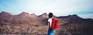
 We've done a lot of exploring in the Dona Anas. One nice hike started out at the Chihuahuan Desert Nature Park. We hiked west along the side of the east-west running ridge immediately adjacent to the park and checked out an old copper prospect that has a lot of  blue-green coated rocks lying around. Be careful here because the shafts are deep enough to injure yourself seriously. We then used the roads to go around the ridge,and completed the loop going cross country on the south side back to the nature park. We've also explored the mines and prospects in the Wagner Canyon area and the surrounding hills. One of mines is very deep and dark and still had a steel cable running down in it. Explore at your own risk. I've also have found my way to the Dona Ana's only legitimate gold prospect. It's not real easy to find, northwest of Cleofas Well, sitting in  an anonymous ravine amongst low hills. There are a couple of shafts and trenches.  I used to have some rocks from the meager tailings piles,but have since misplaced them. From what I've read the initial ore was very rich,but  extremely limited in extent.  It has been in this range where I've managed to end up in a  tight spot with my old 2 wheel drive Izusu Rodeo on more than one occasion, but managed to extricate myself each time. Many of the roads in this small range aren't really roads, but trails suitable for Jeeps, dirt bikes and ATVs. This type of travel is the main recreational use of the mountains. Unfortunately it has led to a concentration of  created roads and trails in certain areas which not only mar the scenery,but also diminishes other wild land values as well. There are also some well known rock climbing walls in the Dona Anas and you may see some folks enjoying this  sport. One time we watched several climbers on a formation called the "Towers."  Note: as with my most recent blog  about the Dona Anas, the "Towers" and other areas mentioned here may be off limits now. Check with NMSU  and BLM regarding accessibility.

Labels: ,

Sunday, March 24, 2013

Rincon petroglyph site

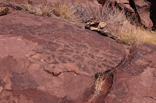
 We revisited the petroglyph site near the small town of Rincon. I wrote about this site back in January of last year in conjunction with the site in Palm Park near Hatch.  I realized that although I had photos of the Palm Park  site, I had none of the one near Rincon. So now I've remedied the situation.  There are many natural hollows carved into the bare rock here that hold water for a long time. Some still had water in them even though our last rain was close to a month ago.  These natural cisterns are also present in several other petroglyph sites such as Broad Canyon. It may have been that the Rio Grande ran dry  for part of the year,or that the water was too salty for consumption , so that these places would have been vital to survival.     


Labels: ,

Monday, March 11, 2013

Buckle Bar Canyon- Selden Canyon


  I tried visiting here once before,but from the upland  side. We drove under I-25 a short ways north of the Radium Springs, and then back under( heading west) a couple miles further north. We parked and began  hiking  down the canyon. For some reason we got side tracked by an old road and ended up at horseshoe shaped excavation. I'm not sure if it had been a barite mine or just a sand and gravel quarry. We wandered around on several old roads and made a loop back to our car, leaving the lower( and more scenic) end of Buckle Bar Canyon unexplored.
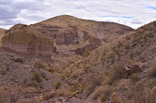
      This time I  took the  dirt road across NM 185 from the Broad Canyon Dam , parked and started walking down to the river. Crossing the mighty Rio Grande was  a little treacherous,but I managed to not get the tops of my boots wet( for those you not from New Mexico, the river has almost no water in the winter time,until they turn on the " faucet" at Elephant Butte Dam in the Spring). We( Seamus the Scottie and I) ducked under the railroad trestle and started walking up the wide, deep mouth of the canyon. Buckle Bar Canyon starts out several miles upstream as a shallow, sandy arroyo in an area of low hills, but in the last half mile or so before it reaches the Rio Grande, it widens and deepens with walls of buff conglomerate towering on either side, several hundred feet high.This is one of the most scenic areas in Selden Canyon( on the river)  as well, along with a second area a little ways north closer to Tonuco Peak. Both have high cliffs with cool rock formations. The Buckle Bar area receives little notice from drivers on the NM 185 because a hill intervenes between the road and river, blocking the views. This may be remedied in the future when the Broad Canyon Ranch(just slightly south of Buckle Bar, along the river) becomes a full fledged state park.
 We walked up side canyons on either side of the main canyon, in vain hope of spying some petroglyphs, as this arroyo was very close in configuration to the one near  Tonuco Peak where a side canyon does contain numerous petroglyphs.  I did find an interesting vein of calcite spar in one. We also climbed up to an intriguing alcove only to find remnants of raptor nests. On the way back, I noticed the many willow slips  that have been planted over the last 2 years amongst the ash and black stumps of the torched salt cedar. I hope they will survive  and thrive.


Labels: