Wednesday, March 28, 2018

Sixmile Canyon, Magdalena Mountains- Cibola National Forest

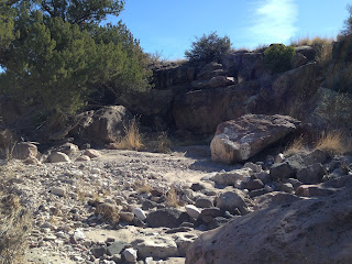
Narrows of Six Mile Canyon


Magdalena Mountains foothills


  I had wanted to do a hike  on our return trip from Albuquerque. Something that wasn't too far off I-25. At first I thought of returning to East Red Canyon and continuing into its tributary slot, Deep Canyon, which I've been itching to see since last summer's visit to East Red's slot (box) section. I also briefly  entertained the idea of  a hike either off of the Quebradas Backcountry Byway,  or on the Chupadera Trail that leaves out the Bosque del Apache. The weather was going to be just a bit too warm for either one of those. Then it occurred to  me that I have  never really done a hike in the Magdalena Mountains, save for some wandering around old mines the morning after doing some dispersed camping off of the Water Canyon Road around 30 years ago.
 I decided on Sixmile Canyon, the closest forest trail to Socorro. The directions seemed simple enough. Find Forest Road 38 off of US 60, drive to where you can't drive anymore, and then start hiking. If I had done just a little more research, I might have saved us a lot time and energy. First, finding FR 38 didn't happen. All we found was  FR 38A , so we drove a little further west  only to find FR 37( which leads to South Canyon, which was another hiking option) with its ominous " Primitive Road" sign, something my wife surely doesn't enjoy seeing right at the outset. So we returned to 38A with the idea that it would surely lead us to FR 38. It did and it didn't.Two times. We eventually got to a parking place on the mesa overlooking Sixmile Canyon on its west side. The"road" had been two bumpy, red gravel tracks in the grass. There had been much discussion and we had gone through the same difficult to close gate twice. We never saw another of those little brown masonite road number signs that the forest service uses, or even a sign to indicate if we were on forest service land( as it turned out we started on a section of state land).
 Second problem. We could see the canyon and what surely was FR 38 in its bottom. We just couldn't get to it all that easily. My wife is not a big fan of rocky, slippery, steep, trail-less descents. I'm not either, but will do it for expediency's sake when I'm alone. So, we found the cow trail that led through two side gullies, up on another mesa where we lost it briefly only to find it and have it take us down hill quite steeply in its own rocky and slippery way.
Now my planned hike could actually begin, sort of. I would have liked to have driven further down the road we were now walking on so I could spent most of my hiking time in the narrower, more forested section of the canyon. As it was, this part of Sixmile Canyon was open, dusty and hot. Live oaks, junipers and piñons looked parched and stunted. The deciduous oaks and walnut trees had yet to even bud.
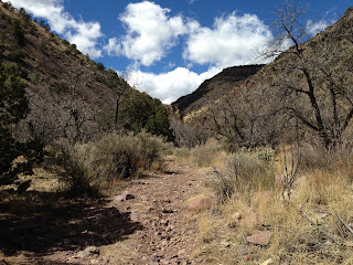

I hadn't worn my big hat, because of the predicted high winds that day, so I knew I was working on a good sunburn. My wife had the wrong socks( she would get at bad blister on one foot by the end of the day). And we hadn't even thought to bring any lunch. It was getting to feel like a trudge as we ambled over a fan of boulders brought down by flooding side canyon and past a very faint old road that went up onto the mesa. The narrower reaches of the canyon were visible ahead but didn't seem to be getting nearer. Finally, after about a mile and a half the walls closed in enough to provide shade. Fire smoke stained the rock walls in shallow shelters created by the seasonal flow of the now dry stream. I was relieved now to be in the more sheltered environment.

Ponderosa  pines appeared in the valley and sparse Douglas firs grew on the margins of the many rock glaciers on the hillsides.  Dried grass, thick along the flanks of streambed,  was an obvious indicator that green grass grows very nicely here in the summer monsoon.


 In just another half mile or so we opened a wire gate and entered a little slot canyon. Once again there were blackened ceilings of shallow alcoves. A rusty pipe peeking out from the gravel, and and old wooden watering trough, that I only noticed on the way back out told me this was the location of Box Spring ( "Box" referring to the little slot canyon). Still there was no surface water flowing, although the spring could still be seeping under all that gravel.


 Upstream of the box, the two track now became a rustic single path through riparian forest habitat. The maps I had indicated there were more springs upstream but no water burbled or trickled in the creek. I wished I could've gone on, but time was now short and hunger would soon be factor. We turned around.
Driving back towards Socorro on US 60, I finally made visual contact with the entrance to FR 38, much further back toward town than I had guessed it would be. When I got back to my maps later that day, I made sense of the whole road situation that had us so confused. It would be a beautiful place to come back to, say in the fall with oaks and walnut turning, but this time with more information and better prepared.

Labels:

Tuesday, March 27, 2018

Doña Ana Mountains ( Rock Climber's Trail, Copper Prospect Ridge)


I did these two hikes on consecutive days during my spring break last week. On Tuesday I headed out early to the trailhead not exactly sure what I was going to do. I had been here many years ago on  my first visit to Doña Anas thinking it was the where I should start my hike to Doña Ana Peak.  I searched in vain for some sort of passage that fit in with the hike description I had,but, as it turned out, that trailhead was actually about 1/3 of a mile to the southwest.
 I parked, looked around at the boulders nearby, and began walking in a northwesterly direction. At first I didn't take the obvious trail, thinking it was for bicycles and wouldn't  take me to the  higher country where I wanted to go, but I soon got on the path and quickly realized that no one would be riding a bike on this route. Soon thereafter it dawned on me that this was the  trail that rock climbers take to the base of the Checkerboard Square wall. Of  course it is,  I thought to myself, and now I was glad to be on it. It was mostly easy to follow through the wonderful terrain of jumbled boulders  below and  steep towers of deeply etched rhyolite above.

Though small in area and less lofty, the Doña Anas are surely the most scenic of the Desert Peaks ranges in our Organ Mountains Desert Peaks National Monument. The steady climbing trail eventually brought me to a hidden basin area below the high ridge with more and more boulders of gigantic size. I headed upward deciding to investigate this lower terrain later after I had reached the end of the trail at the base of the Checkerboad Wall.


 As I went higher the clear channel of  the path faded, and I realized I was  more or less on my own to make it to  the rock climber's jumping off point. I did,  and then took a break to drink, when I spied a couple of climbers coming up the path I had just hiked. I chatted with both a bit as I headed back down to explore the boulders in the basin and check out the dry waterfall that cuts through the lower ridge that conceals it.


 I hiked northeast now through the brushy, but not exceptionally thorny terrain to where I could easily climb over the little ridge and then head south steeply downhill to yet another field of pinkish tan boulders  where I then picked up a nice wide bike trail that nearly took back to my vehicle, walking just a few hundred yards cross country to get there.

 On Wednesday, I got out a little later, and it was bit warmer,but still tolerable. I decided to conquer Copper Prospect Ridge, a very rugged, but significantly lower than highest parts of range, little mountain that runs east to west for about a mile from the Chihuahuan Desert Nature Park to the pass where the powerlines run through. I parked right at the pass on the powerline road and immediately started chugging up steep hill in front of me.
I was probably trying to get away from the crackling sound I could hear in the high voltage wires which always gives me the creeps. Up on top I  found an old mining prospect, and began clambering my way east through the  broken and bouldery surface of the monzonite porphyry dike that makes up the ridgetop. At times I was going through directly on the spine of the ridge, but at others I thought it more prudent to descent a bit and follow deer trails along the flanks right below the exposures of bedrock.
It was quite a scramble, I doubt I could take the same route through there a second time if  I tried. Along the way, I found a dead great horned owl who appeared to have been shot,  and the remnants of someone's lonely campfire at a small clearing on top of the ridge. The hike is very up and down due to several large notches in the ridge line where softer rock intervenes between layers of harder stuff.
The ridge terminates  like it began with  rounded hills of  purplish Cleofas andesite covered with grass, tarbush and broom snakeweed. I peered over the edge of the highest hill and saw the small tailings piles of the old copper prospects below and then set out west investigating the many huge boulders that had tumbled off the mountain.  Some have been down at the bottom a long time as indicated by smooth patches that encircle them at about the 7 to 9 foot interval where  it is believed that mastodons and mammoths rubbed their shaggy heads. Jackrabbits and bunnies materialized and then darted off. A group of deer watched me from the slopes above. I  found another old mining prospect dug out in a gully. Before returning to my car, I decided to wander around the truly huge boulders on the west side of the powerline road hoping to  find some rock art, megafauna rubbings, or grindholes, but all I found was scat, lots and lots of scat in the shadows of every rock of larger size.


Labels:

Sunday, March 25, 2018

Doña Ana Mountains (Around the Peak Loop ) - Organ Mountains Desert Peaks National Monument


 I've done three hikes in the Doña Ana Mountains over the past couple of weeks. The first was leading a group of Las Cruces Public School employees and friends on a loop hike around the high ridge that contains Doña Ana Peak. We started out with 16 people leaving from Mesa Middle School at around 8:15. We made to the trailhead  where there was just enough room for our vehicles less than 1/2 hour later and set out cross country to the southwest. In  short ways we were met with a steep sided ravine that would not let us cross. I had decision to make,  head uphill and hope for crossing spot up high, or downhill where the drainage would shallow up. I chose up, and as it turns out there was no good crossing spot. Instead we scrambled down a rocky deer crossing and then through the thorns on the other side. Soon after  I had four defectors heading back to  their cars. I felt little bad. If we had headed downhill perhaps they would've stuck with it. But, they probably made the best decision for themselves, and that it certainly was better to do it sooner  because as  the hike progressed I would not have felt good( I wasn't real happy about it as it was) about sending them back on their own.
 We continued rounding the mountain on some very faint trails in thick gravel. One hiker's dogs pursued and then wisely retreated from some javelinas trotting along far below us.  Pinhole Cave came into view and we decided to head up to it.

The steep trudge up to cave's entrance was pleasantly interrupted by the sight of half a dozen deer bounding of their hiding place and down the hill side. The smallest of the bunch were barely beyond the fawn stage. We hadn't taken but a few more steps when another 1/2 dozen followed.
 One hiker had pulled a muscle and elected to head downhill with another keeping her company and doling out ibuprofen, vitamin B and electrolytes. The rest of took our rest at the mouth of the cave before heading back down hill.


We passed NarrowArch where folks took photos and then continued on to the gully on the northwest side of  Doña Ana Peak.


 We made a brushy and rocky trek up to the little saddle and then headed down to the Pizza Boulders area, where the hiker with the sore muscle, rather than climb the longest and steepest pitch of the day,  set off down  the road  with a companion to the powerline road intersection, where we agreed to pick her up later. The rest cruised along amongst the enormous  boulders on wildlife trails  up to and then over the saddle between Checkerboard Mountain and  Doña Ana Peak. The canyon running back down to our  trailhead is a rough one, with more boulders and thorny brush and with  a scramble down a slick dry waterfall thrown in for good measure. We got through it and everyone was happy with what they had accomplished. I was proud of everyone who stuck with it, but also wished everyone who had started would've completed the trip.

Labels: ,

Thursday, March 22, 2018

Tajanio Pinto Canyons - Organ Mountains Desert Peaks National Monument


  I've visited this area once before more than 15 years ago. On that trip I was in search of any remaining piñon trees in the Sierra de las Uvas. I did find one at the head of Pine Canyon,but along the way came across two small,but nice petroglyph sites. I later found out those sites were on private property, but for a couple of years now I've been interested in seeing if there is any more rock art to be found on nearby  OMDP National Monument (BLM) lands.
 The problem back then, and the problem now for exploring this southwest quadrant of the Uvas is a locked gate on County Road D-01 where there is narrow stretch of private property across the road.This added  considerable distance( 2.75 miles one way) of pleasant,but less than exciting road walking before reaching Tajanio Pinto Tank, where my real exploring could begin.
On Monday morning I parked and climbed over the gate. It was in the mid thirties and a bit breezy,but beautifully clear and sunny. I set off at a blistering( literally as it turns out) pace, determined to put this first section of walking to the tank behind me in short order. Early on two white horses broke from their indifferent grazing on the meager bunch grass,  to watch me at close range. There were there, in more less than same spot, when I returned seven hours later. It was then that I noticed, that while one seemed thin but mostly alright, its companion was severely emaciated with backbone, ribs and hip bones clearly visible protruding from underneath its skin.
 
 I assumed they were both old, put out here in this distant corner of the range to live out their last days as best they could. Who knows?
 I reached the tank in less than an hour. It still had a  decent amount of water( it may be replenished by a nearby well), in this dry winter. I then headed up the canyon immediately to the southeast.

I moved along, examining all likely looking boulders and cliffs for petroglyphs but found none. The canyon itself was typical of so many in the Uvas;  with stretches of gravel scoured bedrock and lined with junipers and scrub oaks.The day had warmed up and wind had stopped. I removed my windbreaker, ate a bar and drank my first water.
 
I could tell I was approaching that same latitude where the petroglyph sites lay just to the west, when I spied series of fence posts( with no intervening fencing) on the bank above the creek. Soon after, tucked in a low hill,I saw an old chimney with the peak of tin roofed shack laying in front of it. I climbed out of the shallow canyon to investigate. There were some stone walls, a metal vehicle frame with a long hand brake attached,  a steel drum,  and tin cans laying about. I couldn't fined any obvious trace of a road that led to this place, and roads hang around for a long time in the desert which led to believe that the last occupation of this place was many, many years ago. It surely was a remote and lonely place, that I surmised was abandoned not that long after it was established.


A short distance to the east I found two large natural cisterns in the bedrock. One had a rusty iron pipe in the bottom which may have been used to transport water to the homestead,Up above small check dams had been built to retain even more water.


 It was all an exciting find, partially compensating for the complete lack of rock art, grinding holes or any other evidence of ancient Americans. Afterwards, I really wore out my feet searching up a couple more branches of the  canyon and then over some hills to look over to the east from the top of the not  too shabby escarpment that extends like an arm southwards from the main body of the mountains. I did find one spot where the road to the old homestead may have gone through but little else.
 I trudged back toward the tank, investigated more cliffs and alcoves, after a lunch and rest under a juniper. I nearly found myself stepping into the  crevasse that is the main channel where water flows downstream of the tank. It was concealed in the dried bunch grass that grows well over my head.


I made my way mostly cross country back toward my 4Runner waiting by the gate,but got on the road again for the last little bit. It had been a  good, long walk, somewhere between 10 and 12 miles I estimate, the longest one I had done in awhile.
NOTE: this hike crosses private lands.
SECOND NOTE: if anyone out there knows what "tajanio" means let know. I can't find anything, even when factoring in all the possibilities for misspelling.