Tuesday, September 29, 2015

Upper Lucas Canyon( FT 251)- Lincoln National Forest


Last August we hiked the lower end of the Lucas Canyon Trail. We came back on Sunday to hike the upper half starting at the trail head on the Benson Ridge Road( FR 223).  The trail head is no longer directly across from the Benson Canyon Trail but a half mile further east.There is large flat area here for parking and camping.
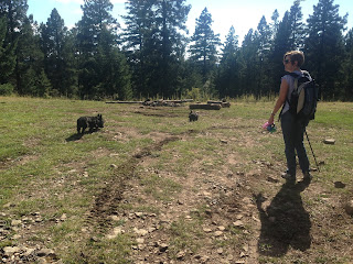
It was a cloudless 70 degrees or so when we started. The trail quickly entered a shady grove of aspens, firs, and spruce(almost no pines to speak of). The aspens, already beginning to change color, shed a few leaves in the breeze.  The smell of their damp comrades already lying on the trail and floating in its many muddy puddles confirmed that Fall had indeed arrived up here at 9,200 feet. It was a heady feeling for me, and I always relish it year in and year out.


 Right from the get go, we heard elk trumpeting, and they continued with very little down time for the entirety of our four and a quarter hour walk. At one point we were startled to realized that one was very close by hiding in  the thicket along the streambed. He was startled too: quickly and loudly breaking branches as he ran up the hillside, I only caught a glimpse of him from behind. This all happened close on the heels of having a huge Brangus bull crash out of woods and across the road just a few steps in front of us. He stayed close to the trail, refusing to take his squinty little eyes off us, the ornery cuss. I didn't take my eyes off him for a long time either. In between these two events, we had several deer, including one buck with an enormous set of antlers ( at least 12 points I would estimate, but probably more like 16) dash across the open meadow in front of us. This was all a bit too much for  our 5 month old puppy Nessie who was only on her second hike.
 The trail cuts steeply down to  and crosses the valley less than a mile in and follows it  closely from that point. They are wonderful open meadows with picture perfect stands of aspen along the way. In a few narrow stretches the valley itself is more forested. Moss grows along the hillsides. Many huge stumps 4 to 5 feet in diameter, some with remnant gigantic, sawn logs nearby, are to be  seen throughout. I can only wonder why the loggers would have left them behind. Thick iron cable, and other iron artifacts were there as well, all left behind from the heyday of logging in this area.

 We began walking along the valley  course, leaving the road for awhile. There were a few puddles where weak springs emerged. We ate lunch under a thick, old, lone aspen in the meadow clearing where a side canyon joined the main. We continued on  along the valley bottom for a ways, but took up the road again when we encountered  our second group of cattle.
Down near the second big hairpin turn of the trail, where we had stopped  our hike from the other direction  a year ago, we did small detour following a grassy, unmarked road up a hill for a little look around. It's an old timber road that's still quite clear on the section we walked. On the map it's numbered 5596 and it hooks up with another road 5598. They both do a lot of aimless meandering over the hills by the looks of it.  They might be nice to explore, but plan on coming back the way you came unless you're really good with GPS, compasses and maps.
 After coming back down we hiked across the large open meadow which is about the halfway point along the trail and made our way down to a trickling, spring up on the side of the valley just below the road, which we had encountered on last years hike. After letting the dogs drink, we began our return leg, little knowing the excitement( the bull, the elk, the deer) in store for us.
 This trail's use is rated light. We saw no one.
Note: Once again I've learned that your dogs usually know better than you do. Right before the close encounter with the bull, both were looking repeatedly to the slope above the trail, but I couldn't discern anything there, only seeing  a few cows gathered on the down slope side. Sure enough, a few seconds  is when ol' Blackie the behemoth  comes trotting out in front of us.


Labels:

Monday, September 21, 2015

Middle Percha Creek Falls,2015- Gila National Forest


I went back to the upper reaches of Middle Percha Creek Sunday(9/20/2015). I was curious to see the effects of fire and flooding on yet another  Black Range road/ trail that I have visited many times over the years.  I also came to revisit the upper waterfall that was almost dry the last time I visited( April,2013 just weeks before the Silver Fire), and check out another couple of waterfalls brought to my attention earlier this year by my friend Doug Scott, the man who knows all and sees all when it comes to waterfalls in New Mexico.
First, let me talk about the driving. Past Kingston, the road is extremely narrow. I made it over the first stream crossing, but the second one gave me pause. There was a three foot berm of sand and gravel across much of it, that would have to be quickly and carefully negotiated around, just to make it to an  opening filled with several boulders to dodge. Did I mention it was very steep down the embankment as well? I parked.  I figured I wasn't going to be able to drive too much farther anyway and was adding maybe 20 extra minutes to my hike.  I was right to do it.Although the road is pretty good and still sees some use over to the next crossing, the one after that is very rough, and by the looks of it few people make it much farther past it nowadays. Not too much further along is where sections of the road are missing altogether, crossings are obliterated and even the old tread is buried in places by the tangled growth of weeds and wildflowers sprouting up from between the branches of downed, charred snags. It becomes a chore just to follow the old road on foot. At times I just stuck to the stream bed. It seemed the easier option.

Walking, there was very little to be seen that was very different at first.The fire and flooding had not changed the shady riparian corridor closest to town. Beyond the Forest Service boundary and the sign warning that I was entering a burn area is where things began to change noticeably. Distant views of bushy mountains could now be seen through remains of burnt pines and junipers. Weeds grew thickly between them. At one point, while looking for the road,we got into some milkweed so high and thick,I decided it was better to walk in the creek bed instead. There, the flooding has scoured out the stream,leaving much of it running over pale green bedrock. Springs I had never seen before were now visible, emerging from cress encrusted cracks.. In other places,the gravel, sand and boulders had been so thickly re- deposited that the surface flow went underground. The once brushy and shady stream was completely unrecognizable from before.The creek had been vastly widened as well, as was the case with Carbonate Creek( which I've visited the last 2 years).


I made it to the first major fork and now headed up this side branch on the south, seeking out the 100 foot waterfall. First I had to scramble around a trickling two-tiered 20 footer. I was disappointed upon reaching the high falls to find that the flow was only a trickle. Still, it's a beautiful spot and someday I'd like to hit it at just the right time.


Now I was ready to return to the upper falls on the main stem of the Middle Fork Percha Creek. The bushwack,scramble and boulder hop I had just done  up to the other falls was a short sweet walk in the park, compared to the slog up to these. It was a very slow half-mile plus , and, having been up here before, it took just as long as I thought it would. but we made it.The reward: seeing the nice little 30 foot cascade flowing and tumbling down and then sculpting its way through smooth chutes and pools  in the bedrock. It wasn't a prodigious flow,but nice enough, that I thought about getting in( Seamus did of course).  I was hot. The terrain I'd been blasting and trudging through is now quite open to the sun, given the  severity of the burn on the hillsides above the stream. We lingered a bit. It's another  special little spot for me, where  almost no one goes. Although, I'd been thinking this might be the last time I'd make this hike, perhaps I could be persuaded in the future for a chance to hit it when the flow is just right.

On the return I was more diligent about following the road, and was able to,except in those places where it was gone entirely. We found the 25 foot waterfall that had changed so much in its appearance. We also saw several more bushy white tails that belonged to some good sized white tail deer( we had seen a bunch on the way in as well). I had to do a lot of talking to Seamus to keep him from chasing. I was very relieved that it worked and he didn't. Although, I suspect on the return trip, at least, that plain old tiredness  was the major factor in keeping him  close by. I also noticed the disconcerting sight of several logjams piled up in branches 15 feet above the present level of the stream. Luckily, there are several areas for the kind of floodwaters  that placed them there to spread out before it reaches the town.

 
Note: where I parked, right before the second stream crossing, may be private property, although it is not posted at this time. There was small garden planted, and tall contraption with solar panels nearby, which I saw on the way out but failed to notice on the way in.


Labels: ,

Tuesday, September 8, 2015

Wilmeth Canyon,Sacramento Mountains- Lincoln National Forest


     Wilmeth Canyon is a tributary to  Dark  Canyon. It is similar in size and appearance to the upper reaches of Dark Canyon above their confluence. I hiked Dark Canyon back in May, and at that time, I became intrigued by the idea of doing a Dark Canyon,Wilmeth Canyon loop. I still haven't made that a reality,but I did get to hike Wilmeth Canyon recently.  We started out, 5 people, 4 dogs, including  our new Scottie puppy, Nessie, on only her second hike, from the end of the road in Dark Canyon and then after less than a half mile angled left into Wilmeth.It's a beautiful place, as lovely and wild as Dark Canyon. The grass was thick and high,as were the last of the blooming thistles. Hillsides covered with second growth firs, spruces and pines. Occasionally there was a larger diameter conifer right in the valley, but it was easy to tell from the many wide stumps on the steep canyon sides that this area had been logged, just like almost every other valley in the Sacramentos . Mosses made the north facing hillsides green and slick, while the south facing ones were stony and gray with the build up of pine needles. There were oaks along edges of the meadow and  a very few boxelder and maple, but almost no aspen to speak of , although there was one very mature grove of locust trees where the leaves were already beginning to turn yellow.
We  followed cow trails when we could, and early on when sun emerged from behind the clouds, began to despair of reaching the springs to cool our dogs off. But we persevered and reached them. First, they were rushing from puddles through the dense grasses. Further up, where the valley narrowed, were sections with an actual  rocky stream bed with  and tiny waterfalls. Beyond this idyllic scene where we rested in the shade of young conifers, the valley opened up again into a huge area of wet meadows.


Raven's wings could be heard flapping above us much of time. We rousted a hawk from his perch just over our heads and watched him fly and float down the canyon. Deer bolted across the trail in front of us on our return and elk sign was everywhere. On the previous day a turkey hen with her 10 or 12 progeny trailing behind crossed the valley in front of us near the confluence with Dark Canyon.
     Watching the clouds cover up all of the blue,we wisely turned around after a little less than 2 miles or so.  It was wisely,because, within about 3 minutes after our return, it began to pour.
Back in May, I speculated on the idea of wilderness area centering on Dark Canyon. After venturing into its companion canyon, Wilmeth, I'm even more convinced of the validity of this.
NOTE: There is no public access, without permission of landowners, to the " trailhead"  at the end of the Dark Canyon Road( FR 232) that allowed us to hike Wilmeth Canyon from its lower end. It can be accessed from above on the Benson Ridge Road (FR 223 ), FT 5700( Dark Canyon Trail),  and  FR 232D . One can also just walk down  Dark Canyon until reaching Wilmeth where there are the remains of an old barbed wire corral.

Labels:

Wednesday, September 2, 2015

Upper Benson Canyon loop hike ( FT 5005,5005A,5006)- Lincoln National Forest


  Seamus and I did this hike this past Sunday( 8/30/15).  I had hiked a sort-of loop on the bottom end of Benson Canyon at the beginning of the month and now wanted to see want the upper half looked like. These three trails all have a heavy use rating by the Forest Service, but on this particular  late summer Sunday afternoon, we saw only one couple on foot and no vehicular traffic whatsoever. Saturdays may be a different story. Holiday weekends will almost certainly be busy.
 The sky between the clouds was a washed out blue as we started steeply down the aspen lined trail. Although the mud wasn't too bad  I could see how it could be problematic in this section of the trail with even a light rain fall. This beginning quarter mile or so is also rather steep, so combined with muddy conditions the whole enterprise could become treacherous. But it really wasn't for us and soon the forest  opened up into park-like area with tall evergreen timber. These were the huge bent over conifers I'm always glad to see in the Lincoln. The stream bed was dry here and Seamus and I forewent the road to follow a cow path alongside it. We came to where trail 5005A  takes off to the southeast, but continued on. I wanted to make it at least to Delworth Spring before turning back. A little farther down, the road made a big bend away from the valley. We stayed on the cow path and soon entered a huge  green meadow. This was the prettiest spot along the upper end of Benson Canyon.Wildflowers and amaranth were dying back. Aspens on the edges had a hint of yellow. Summer was rapidly fading up here in the mountains at 9000 feet.


The road came back in from the east and just below it is where the springs that give flow to the tiny creek emerged. We followed the creek, instead of the road, through a very narrow forested section of the valley. Seamus drank and cooled himself in the waters. Where the valley opened again, there was the remnant of a very small cabin, now grown over with thistle. A short  ways down along the flowing stream was an old corral as well. Beyond that I could see where the road crossed the valley again, which is also close to where I turned back on my hike up the canyon a month ago. We hiked on an elk trail up the hillside and connected with the road and now headed back.


We cut up the valley again to avoid the section of road that detours up the hillside and out of sight. We then headed southeast on FT 5005A( Benson Canyon Spur). This was mostly level walking along an old rail bed through a young forest. In a little less than a mile we were at the intersection with FT 5006, the Benson Canyon/ Bluff Springs Trail. The signage at this intersection seemed a little bit confusing at first, but with the help of compass, and the knowledge that I did not want to go towards Bluff Springs, we were, after a drink, snack and a rest, off in the right direction.This trail was another road, still in good enough shape for larger vehicles, but designated for those less than 50 inches wide.We began climbing and soon were at an open ridge area with nice views down FT 5007C towards Bluff Springs and Rio Penasco Valley. We continued climbing until reaching the trailhead and FR 5007. At the intersection with FR 223 we encountered the herd of ornery cows that we had been hearing bellowing and car horns being honked at. I've never had problems when I've been hiking by myself, but there's something about my dog, or dogs in general, that gets the hackles up on this Lincoln NF beeves.One squinty eyed black cuss trotted a few steps towards us before changing his mind. The others wouldn't take their eyes off of us. When I have my pup with me, I don't take my eyes off of them. If you think they won't charge when your back is turned, think again, because it's happened to me over at Monument Canyon.
It was downhill now for the short walk back to the truck. We arrived about three minutes before the rain started. This was a pretty easy 6 mile hike. I wouldn't really recommend the loop, unless you're someone who just likes loops. FT 5005A and FT 5006 are just  road walking and not particularly charming. We passed several overgrown old rail beds and roads that would make for more interesting exploration for the traveler on foot.


Labels: