Gila National Forest, FT 616- A Walk in the Past
I've know about this hike for a little while. It's been on my list for day trips from our property at Horse Mountain. Last Sunday we got the chance to do it. The drive itself was beautiful: skirting the edge of the vast Plains of San Augustin, passing through ghost and semi ghost towns Horse Springs and Aragon and finally descending down into the tiny Tularosa River valley with its ranchitos and the tiny towns of Cruzville and Apache Creek. Past the store at Apache Creek, there is just a sign for a hiking trail on NM 12. That was our turn-off. The gravel road is good and more signs lead you right to the trail head.
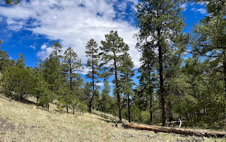
It was a little bit later than I wanted to arrive and a little bit warmer than I would've wanted since we were hiking with our dogs. There was adequate shade for rest stops from the piñons and junipers as we marched the switchbacks that brought us to the top of a small mountain. The downhill leg was more of straight shot, with long stretches in the open, which had me worrying about the return uphill in the sun.
Eventually, when I was beginning to wonder if this trail had any intention of bringing us down to the river, we descended quickly down to the streamside meadows, passing the partially restored remains of the Tularosa Ranger Cabin, built over a century ago.
 We continued on the to the river crossing where the abutments are still in place but the bridge lies on the far bank, a testament to the power of the tiny river when it's in flood stage. It was easily crossed without the stout metal span's help on this sunny day. I rock hopped and my wife just waded through the few inches of water. Our dogs drank and splashed.
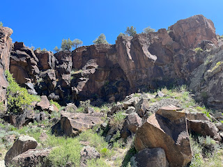
The petroglyphs were further along against the cliffs of volcanic rock. The site is well worth the hike. Many images were so similar to ones here in Doña Ana County where I live, that I couldn't help but contemplate the connectivity of the widespread Mogollon Culture here in southwestern New Mexico.
The river in these Forest Service sections is getting to be in a more natural state here with willows, walnut trees and un-grazed meadows on the banks. The water isn't all that cold and free-floating algae continually floats by,but I know this was once a fishable stream. I didn't see any trout but I wondered if a few may still be surviving in the deeper holes. A bit further downstream from here is another FS section that runs through small box canyon. I'm thinking that might be a good place to check it out.
It was nice to have a least part of our walk on the creek. It had been awhile since we did a hike with flowing water. The dogs played. I wet my shirt and hat. I found a few more petroglyphs on the cliffs on the opposite side of the river. We poured water on the dogs and then began the hike back up. The pups seemed revived from the water and had good energy for most of the trudge back up and once we began going downhill, it was all good.
Labels: archaeology, flyfishing, hiking, history, petroglyphs


