Friday, November 30, 2012

Organ Needle - Organ Mountains-Desert Peaks National Monument

Looking into Fillmore Canyon

Views to  the north

 Looking southeast from the top of Dark Canyon

The first saddle

 On top of Organ Needle
 I climbed Organ Needle with a group of folks back in 2001. I had met most of them through  some Sierra Club hikes, but this was not an official Sierra Club outing. Most of us parked at pullout off Dripping Springs Road near Soledad Canyon Road. We then proceeded in three or four vehicles to Baylor Canyon Road and then up the old road to the Modoc Mine. After parking at some pullouts( well before reaching the mine) we began hiking up to the old mine and beyond.
      It was early March,but was reasonably warm and mercifully without wind. The path turned  back  straight east just a short ways past the mine.To say it was steep going from that point  on would be more than just a slight understatement. We reached a saddle with some junipers and  views of a  hooked prominence of black rock to the north and took our first rest. We met another group leaving for the peak just as we were arriving.  March and October are the optimal windows for making these climbs in the Organs, although many people  attempt them when it's much warmer, so you're bound to see a few folks on any weekend during those months. The section of the hike after the saddle is very brushy and rocky with very little clear tread to follow( at least back then, although I don't expect it's changed much). I was with people who had made the climb several times  before so we didn't get off track,but it's not unusual for  those  on their first try , and even those who have done before to do so, and in so doing derail their chance of summiting due to lost time. If you go make sure you have 10 hours of daylight to complete the hike( from Baylor Canyon Road).
      We kept our bearing by heading toward a good sized Douglas Fir that marks that the entrance to Dark Canyon. We took our second rest at that tree and then  started trudging up the very narrow canyon in the two foot  deep snow. There  are many shrubby maples that grow here as they do in many other cool, out of the way places in the Organs. One of our group who was making the hike in some beat up Cons decided his hike was ending here and would wait for us to return. At the top of Dark Canyon we took in the views to the other side of the range. Strangely enough there is concrete marker up here that has something like "  Organ Needle 100 yards" written in it. As I contemplated the idea of hauling a sack of ready mix up this mountain, we went on to the 2 maneuvers that are the crux of the climb. The first requires an awkward straddling of a  rock like a roof peak. Next, there is the small wall with some exposure that  must actually be climbed. We went one by one.When it was my turn I threw my backpack up to those already on the ledge, took off my gloves and made the pitch  with no problems. I don't know why  but I wasn't nervous or afraid, even though our leaders had the full expectation that those who hadn't done it before would be. I had every confidence in them and they didn't let me down.
       From the ledge it's a short walk to the peak. We had our lunch.  It's actually quite roomy on top and there was about 20 people from 2 or 3 groups.I walked along the boulders and signed the the small notebook that sat in jar on the  high point. We were on top of the world. On the  way back down we couldn't find our way to the ledge and wall initially, but as there isn't really too many places to go up on top,  we found them in fairly short order. Going down the wall was definitely more difficult than going up and I was a little nervous, but not distractedly so. I opted to bypass the re- straddling of the roof peak rock altogether. The walk down became a  slide on six points- two hands, two feet and two butt cheeks- with the occasional  bowling bowl sized boulder kicked loose from above and tumbling toward my head to add  excitement. It was nearly dark when we got to the cars. I was exhausted, but I had done it. I had been obsessing about making to the the top of the Needle since  I had moved here 3 years earlier, worrying that it would never happen. But now it had,and I was satisfied.

Labels: ,

Sunday, November 11, 2012

Indian Hollow Trail- Organ Mountains-Desert Peaks National Monument


  I had several misadventures trying to find my way into Indian Hollow during the first few years I lived in Las Cruces. One hiking guide book had us starting out at a pullout a short ways east of the group use area. We went cross country over a hill, across a cattle pasture and eventually ended up at a fence as we struggled through the brush. Another book had us branching off the southwest corner  of the Pine Tree Trail, going high on the slopes and then dropping down into, a brushy, rocky drainage.When we came to a high waterfall we had to climb up the slope just to continue our way down, and in the process  found  an actual trail on a dividing ridge. I fell hard on the ice high in the canyon on that trek, but at least now I knew a trail existed- and where it began because I followed it all the way back to the group camping area. Now things aren't so hard.There's one of those yellow  WARNING signs on the south side of the group area  parking lot at Aguirre Springs that will clue you in to where the trail is. It goes through the fence and continues down the arroyo before taking you up the slope on the south side. There is a section that goes over some bare rock as it sidehills toward a bouldery pass where one has to perform some minor climbing on bedrock.This part of the trail might seem slightly daunting to those less experienced. It does get better. After going over a saddle where there is a large vein of rusty quartz that may be has just a tiny trace of gold. The trail continues along  the side of the hill, up and down and in and out of some minor drainages. At  one of these it may be easy to lose it, unless there are some thoughtful cairns  to guide you. Just keep a southwest bearing though, and you'll probably find the path again.


Eventually the trail parallels and then crosses the major stream bed out of Indian Hollow and begins to climb very steeply on a dividing ridge.There are many small delights along the way especially if there is running water. In the fall, it's fun to get a peek at some of the very few aspens in the Organ Mountains. They grow in a gully on the northeast slope of Sugarloaf Peak. I've taken the short but somewhat treacherous side trip several times to get a closer look. The trail keeps going higher and higher, steep, then steeper on loose granite grus that's even less fun to walk on on the way down.At the highest point amongst the pines, Gambel's Oaks, and Douglas Firs,  I've frequently heard voices high up on the exfoliation dome that is Sugarloaf. I've also seen the climbers, so tiny, on the gray-white stone maneuvering their way to the top.  From this highpoint the trail continues down hill to cross a branch of the creek and then enters one of the most enchanted areas of the Organs. Here, there are large pines that we've picnicked under and a few huge old cottonwoods, that dazzle in the fall, lie along  the stream which frequently has water. Organ Needle and the other high peaks seem tantalizingly close, but just out of reach.The trail continues back following the other branch of Indian Hollow, but eventually just peters out in the cool shadows of the ridgeline. Once we followed some old cairns, there was no tread, and somehow scrambled back to the Pine Tree Trail. It wasn't easy or particularly fun, although we did see some fantastic waterfalls that literally gushed right out of the rock. It's a toss-up between this trail and Fillmore Canyon as to which is my favorite. Both used be to be enjoyed in perfect quiet as well, but the last time we came through here, we met a woman with unfriendly, unleashed dogs( she didn't have a leash either) and had to listen to some geocachers shouting at each other every time they lost the trail, which was frequent enough that I was tempted to walk back down and guide them just to not have to listen to them. Oh, well I guess I was in their shoes once, I just didn't do a lot of shouting.


Labels: ,

Wednesday, November 7, 2012

Pine Tree Trail- Organ Mountains-Desert Peaks National Monument


 I haven't written about the Organ Mountains very much in this blog, even though I've hiked there,on and off trail, more than any other locality- after all they're only a dozen or so miles from my house. The reasons I haven't written about them more are several. As stated a sentence ago. I've hiked there a lot. I've done all the official trails, Pine Tree,Baylor Pass, Dripping Springs, Soledad, Sierra Vista, many times each. I've also done all the semi-official( well known,easy to follow but not signed or  publicized by the BLM) trails; Upper Fillmore Canyon, Indian Hollow, Rabbit Ears Canyon, Achenbach, at least as much if not more than some of the official trails.  I've climbed the major peaks that don't require equipment: Organ Needle, Organ Peak, Rabbit Ears Plateau and Baylor Peak. The only one left in my sights that I'm interested in is Baldy Peak.  I've also done completely off trail hikes to Windy Gap Pass, Lower  Long Canyon, Middle Spring and Texas Canyon, just to name a few. If this comes off as bragging a bit, well maybe it is,but the ultimate point is: it's taken about 13 years or so,but I believe I've reached the saturation point.  I used to have a long list of destinations and invented hikes for the Organs-many of them have been accomplished. Many more are just too remote, too harshly off- trail( what off trail in the Organs means is a chapter unto itself),too scary or logistically unfeasible because of private or military property issues, and the daylight constraints of the optimal hike season( roughly October to April ). The other reason I've become estranged from these mountains I've spoken about once before here. The official trails have become like a city park on the weekends with large groups, shouting kids, untrained, unleashed, unfriendly and unpicked up after dogs( Dogs aren't allowed at all at Dripping Springs yet people bring them in anyway),six packs, plastic bottles and trash.It's even spreading to some of the semi- official trails as well. I've seen graffiti at Aguirre Springs, and the old Hayner Mine, and I've seen kids lugging  a case of beer up the road to the old Minehouse Spring building. I'm not a dog hater, and I may be a curmudgeon( I've been avoiding crowds since I was a kid so it didn't come with age),but I just don't understand the point of coming out in nature, just to act exactly the same way you would back in the city in your house or yard.
     That all being said, my Election Day hike on the Pine Tree Trail was a pleasure. I didn't see another soul. The quiet was outstanding. I did hear some shouting down the canyon at one point,but it didn't last long. Perhaps the trail, which is rocky and steep, was too much for them and they gave up. I was a little hot on the south branch of the loop when we started,but soon we were in the shadow of the ridgeline.
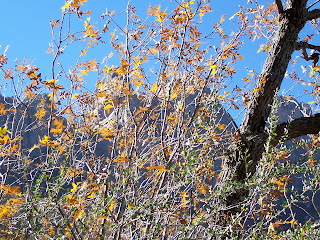
     Where the path dips back toward the ridge in the  many drainages it crossed-we could feel the pockets of colder air. Fall color was provided by willows, cottonwoods, ash,oaks, grapevine and shrub like maples in the folds of the mountain way up high. There were also some very colorful weeds and shrubs( names unknown to me) as well. There wasn't a drop of flowing or standing water anywhere,but  this little northeast facing indentation that is encompassed by the trail has it's own mini-climate, and seems to be doing well enough and not ravaged by drought and disease especially when compared to areas I hike in the Gila. The Abrams Fire had little effect here, although obviously burned areas on the ridge line near Sugarloaf were visible. So, I was glad to get out, and be awed by these massive, majestic crags of igneous rock.  It may be possible to get jaded about them from a distance,but up close they never fail to impress.

Labels: ,

Thursday, November 1, 2012

Grandview Trail-FT 146, Gila National Forest


 I had hiked down this trail, which starts off at  a saddle about two miles in on the Sawyer's Peak trail (FT 79), with my wife several years ago. The first thing we noticed was the abundant bear feces all along the trail. Upon my return last Saturday, let me say that the observation still holds- and then some. If you're out on this trail too late in afternoon, or too early in the morning, you will most likely see a bear. This trail only goes down and fairly steeply at that, so it was an entirely uphill trudge on the way back. There are two lovely clearings along the way. The first, a short ways in, is where I ate my lunch. There was an iced over spring nearby which my desert dwelling dog didn't know what to make of. 
The forest here is  mostly Douglas fir and pine, with a few oaks here and there. The second clearing, which is right before the stream plunges  through some limestone cliffs, is  where the trail seemed to end. I  followed a sketchy path ( probably not human created) up the hill on the south side of the stream to no avail. No blazes, cairns- nothing other than a steep hillside with lots of downfall, although I did catch a glimpse of a cave that intrigued me. On the north side( south facing) it was juniper and scrub, but with views all the way to the Kneeling Nun and the Santa Rita Mine. 
A bit of water was seeping out in the stream here, but it would be great to come back in the spring to see these waterfalls and cascades, that tumble down the mountain at this juncture, in action. I had planned to hike all the way to the Silver Creek Road(FR 523), which is less than a mile away from this point, but the only way to do it that I could see would be to work my way carefully down the  stream course-not knowing if there were some sheer drop-off that would end my progress anyway.I started thinking about that bear crap, and decided I wanted to make my return while the sun was still reasonably high- so I headed back.
There was a nice patch of aspens visible from FT 79. On the drive back down the mountain, the maples in South Percha Canyon appeared to be only slightly past peak color. It seems  the last few years that the autumn display is more than week later than when I first moved here. IMPORTANT NOTE: This trail was ground zero in the Silver Fire (June, 2013).( The fire was named for Silver Creek which this trail follows). It may be closed or no longer visible. Many hazards exist.

Labels: ,