Monday, January 25, 2021

Rincon Hills - Castle Tank Arroyo


The first couple of hours of this trip were an exercise in " How not to get to  your destination." This is a fun little game I play sometimes where I scope out some highly questionable roads on Google Earth and wonder if they can be used to access an alternate trailhead for hiking to a previously visited spot  or even  to a new starting point for an unvisited location.  In either case the  idea is always to cut down distance and time, because, let's face it, long miles over monotonous terrain, short miles over really rough terrain, or even just a route that I've been over several times can get a little old  as the years go by. In this case,  I wanted to see the upper canyon branches of Castle Tank Arroyo ( a major tributary to the Rincon Arroyo) but didn't want to start out from Johnson Spring Arroyo where I had  hiked very close to Castle Tank on a outing a few weeks ago and wondered if I could manage a starting point much closer.

 My friends David and Nancy were willing to take chance with me so off we went on Sunday morning. The roads were good and ones I'd traveled on before and then came the moment to turn off into the unknown. First bad sign: we took off on wrong road and then had to backtrack. The one we wanted, I had studied as best I could on the satellite images  and could see not one but several places where faint paths ( mostly likely made be ATV's) wandered off in order to circumvent nonexistent  crossings of the steep-sided gullies and really in hindsight should probably have never even thought about doing. But, there we were coming upon the first of these quicker than expected ( and I already banged the rear end of the pickup crossing some lesser creases already!). We hem and hawed, debated and did not decide for quite awhile. I opined that it would be nice to have our bicycles for occasions such this and David agreed. David did a little shoveling and I did some more surveying, and then Nancy said while looking at On-X that this wasn't event the worst crossing we would face. Then we came to the conclusion that while we could make this one happen ( maybe) there was no point in doing it without seeing how bad the "bad" one was. We were about to start walking to it when Nancy said it was over a half mile away, and that's when I called it and we turned around. We had wasted enough time already. Or, so  I thought.

 Plan B had us driving on what was at first  a good county road on the east side of the railroad tracks toward a trestle that goes over Castle Tank Arroyo close to its confluence with Rincon Arroyo. I had hoped to drive on the good road right next to the tracks, but alas, some very unfriendly signage ( even though the gate was unlocked) put us on parallel road on our side of the fence near the rails. It was questionable from the get-go and really it was  no great surprise when it disappeared altogether still quite a distance from the hoped for trestle.  Off we were, back around to Johnson Spring Arroyo.

Soon after we parked I found a piece of ancient pottery right in the old road. Up on the mesa  I headed for the ridge while my friends studied an area of incredibly dense debitage.  I found a few pieces of the coarsest type of brown pottery on the ridge( I failed to find any a few weeks, so that was good), re- located the petroglyphs for my companions and then headed southeast, first to confirm the location of the second artifact site I had found previously, and then to head to Castle Tank Arroyo. I was a little worried, but then some bright sherds told me I was in the right place. I had hoped that Nancy and David would come out to this spot, but when I talked to David they were already headed north to a different part of the mesa.

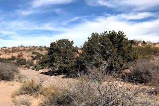
 The land lies really flat on both sides of Rincon Arroyo and the branches of Castle Tank were invisible as I headed toward them. I found more pottery and of course more lithics on the way.


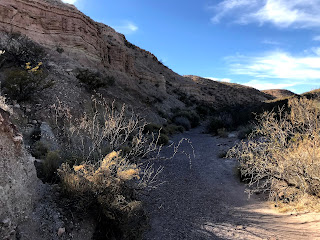
A gate for an invisible road made going through the fence line easy and then I was in the shallowest reaches of the south branch.  Seamus the Scottie and I were walking on bedrock much of the time from here. It appeared to be limestone, but whether it was a Paleozoic layer similar to outcrops in the  main Caballos or perhaps a more recent ( as in a just a couple of million years ago) freshwater expression, I don't  know. I do know we found no grinding holes in it anywhere. 

We saw more javelina ( we had seen a few on our ascent to the mesa earlier). Their heavy black forms trotting off unhurriedly on a path out of the brushy, deepening canyon. There were scrub oaks, hackberries, junipers, squawbush and just about every kind desert shrub you might find, say up in the Organ Mountains,  down here in the micro-climate of the this narrow desert canyon.

 The going was very thick, and because I had to keep Seamus leashed up due to the javelina, awkward and even slow at times. He likes to play a game on me  by lagging behind, or acting like he can't possibly see the best way to go through low growing brush in the hopes  that I will  get frustrated and take him off the leash, which I frequently do. This time, though, I wanted to play it safe for as long as I could stand it. There were a few overhangs and alcoves in the white rock layers that yielded only packrat nests upon investigation. We finally arrived at the confluence with the north branch where huge, pale boulders had tumbled from the cliffs and into the creek bed. 

This is probably the deepest part of the canyon and I would've liked to have explored just little bit further down stream, but instead we headed up the north branch as planned. It was warm for a winter afternoon, and I had to give Seamus  a long rest, plus lots of treats ( dipped in the oil from my canned oysters) and water while I ate my lunch, but he came through like the champ that he is. 

Eventually we got out of the arroyo and  followed a cow path to the tank where we rested a bit more at the mesquite trees there. Now we made the push back to our truck, as the sun dimmed and shadows lengthened. Our friends had gotten back much earlier and were well on their way home, by the time we arrived. It had been long day.  In retrospect I wished I had not decided to try the roads that led to so much frustration. I may have also left off exploring the canyon to another day after getting such a late start, but that's what happens when you get turned away, you get more determined.


Labels: , , , ,

Wednesday, January 20, 2021

Sierra de las Uvas exploring - Organ Mountains-Desert Peaks National Monument, New Mexico State Trust Lands


Scrub oak in the hidden valley


Another a couple of trips to the southwest side of the Sierra de las Uvas. The first was to an interstitial southwest to northeast running canyon in the northern half of Magdalena Ridge. One of the reasons I end up exploring this section of the Uvas so much is that the good county-maintained roads can be used to access remote areas and sometimes the actual starting points of my hikes. Unfortunately, other starting points, like the one for this hike north of Vail Tank, require short, but rough, trips on "roads" that are now being left to the whims of the elements. I went out to do this one on a Sunday afternoon and was rewarded with sunshine and mostly blue skies: a nice escape from the cloudy, dreary conditions that persisted over Las Cruces. Typical Uvas scenery dominated this walk: steep, flat-topped hills, with boulder strewn slopes sporting a sparse growth of juniper. The valley also had the desert crevasse type topography, which forced Seamus and I ever higher on the slopes on the way out in order to find a reasonable place to cross. I would like some insight into this phenomena if anyone has it. I'm sure overuse by livestock has something to do with it. 

I had parked at one tank, and further upstream at a second dam, there was a small foundation and early twentieth century debris scattered about. 

We walked and walked until the canyon got so narrow and the going got thick way back nearly at the very head, then we turned around and walked on the side opposite to the one we mostly came in on.  We were getting close to our vehicle, at the end of a long afternoon of steady hiking, when Seamus saw some deer before I did and was off over hill and dale despite my loud protestations. I always panic when I see him get so far away, so fast. He always returns of course, and these days, at nearly 11 years old, he comes sooner rather than later. He was a sore and stiff boy the next day.

The second trip was with friends to a small archaeological site with grindholes and a very few artifacts that is mostly on state land.  

 I got bored with puttering around  after awhile and so took off exploring around the flanks of Massacre Peak, on the return trip I stumbled into an area with all manner of cryptocrystalline quartz that had washed out of the cracks and crevices in the andesitic basalt and been deposited in the sandy flats. Whether this was a source area for stone point and tool makers, I don't know, but maybe. 

The trucks made plumes of dust like smoke from a prairie fire as we drove home at sunset.  I thought, it's got to rain someday soon. As easy as this area is to visit, I think I've overdone it a bit lately, so I may need to give a little rest, for the sake of variety.

Labels: , ,

Monday, January 11, 2021

Rincon Hills - canyon exploring


I had forgotten my hiking poles which was awkward at first,
 but eventually found a nice sotol stalk.


Climbing a small ridge just east of the pullout where I parked, I began seeing many large pieces of fossilized coral and realized I'd been here before, many years ago when still in my rockhound days, and had collected one of those same pieces. We had also found strange chunks of opalized twigs. I still have the coral, but I wish I could find those weird twigs again. That day we didn't venture too far from the road, but on this warm winter Sunday I was headed for one of the larger feeder stream courses that empty into the Rincon Arroyo from the north.

 In and  out of a couple of short ravines and then I was looking down on the rocks and sand of the canyon of  my plans 70 feet below. I slipped and slid to the bottom and then headed upstream. I was enjoying the cross bedding of sandstones and pebbly conglomerates in the enormous boulders that had tumbled down from the cliffs and just enjoying the look of a landscape of sedimentary rock. It was easy walking and a pleasant day to be down in a desert canyon. I was in a long sleeved tee shirt and never felt cold the whole afternoon.

Before the canyon opened up into a wide shallow wash, it went through very narrow section that took some minor scrambling to get out of at its back end. 

Now the scenery wasn't quite as nice but I  ambled along, spotting a buck deer darting off on the low mesas above me. Junipers and huge javelina bushes appeared. I walked up on the dark hills on the west side, but quickly realized two things: first there was another narrow, deep section of the canyon in the distance and second; walking in the canyon itself was the fastest way to get there despite its winding ways.

 Cliffs of layered rock rose above me when I arrived. I climbed up one dry cascade, and then negotiated my way through the boulders of very narrow section and made it up a second one.

 I realized I was getting close to my turnaround point from a hike several weeks ago where I had explored the uppermost reaches of the canyon  I was in. I saw a doe make her way up a rocky ravine to the top of a narrow mesa and shortly after I did the same. I'm not sure why. I walked out to a point and then made my way very, very carefully down the steep slopes on the other side. From the there I decided to make my way across the mesa of dark rock just below the Rincon Hills highpoint where the various communications towers are installed. The broken, rocky terrain wasn't the best for cross- country walking but along the way there were interesting rock formations in red and nuggets of jasper to keep the mood light. 

 Three buck deer headed off in the distance back down to the canyon. It was plain, as the last one turned, that he had an enormous set of antlers, like two human arms attached to his head. Eventually I got onto a road that has long ago fallen into disuse, which led directly back to my truck.

Labels: , , ,

Monday, January 4, 2021

Sierra de las Uvas exploring - Organ Mountains-Desert Peaks National Monument, New Mexico State Trust Lands


Out in the winter sun and wind again. Four trips to the Sierra de las Uvas, a range that covers more than 100,000 acres ( by my conservative estimate) in Doña Ana County and yet is mostly unknown except by a few hunters and those who run agricultural operations there. Two walkabouts were exploring Magdalena Ridge, that paper chain of mesas, buttes and valleys extending southwest from the main mass of the mountains.  One was on the flanks of the nearby Massacre Peak. The other was in a tributary of  Silva Canyon (which originates in the high peaks of the Uvas) in the huge basin that is bordered by the Uvas, Robledos, and the Cedar, Rough and Ready, Sleeping Lady Hills. I'm never really sure which range to assign places that aren't really part of any of them.

 A lot of walking/wandering on the boulders that form the rims of the mesas or small peaks was the formula for the walks on Magdalena  Ridge.  We went up and down some shallow ravines at Massacre Peak and looked at some boulders on the slopes as well.The other hike was a straight shot  from the Corralitos Road over some low hills to eventually walk through a small un-named box canyon along the Ward Canyon fault with colorful layers of sedimentary rocks revealed.

 None were exceptionally long treks. All were begun in the late morning or just after lunch, when earth had already warmed sufficiently.  A few pick-ups stirred up the dust. Jackrabbits and cottontails ran through the creosote. Shaggy brown calves shuffled along roadsides. Javelinas crossed through the yellow grasses. Peace and long shadows reigned at each returning in the late afternoon. Chalcedony, agate, carnelian and jasper brightened the ground at our feet and in places I could feel something like gentle ghosts from centuries past in the breezes.

Labels: , , ,