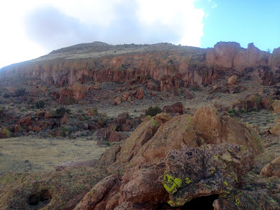
Here are some photos from a second walkabout done in the same territory as the most recent post. This area is very rugged, and although not too far from the paved Corralitos Road, it quickly gives one the feeling of being somewhere extremely remote. There are no roads, or trails and with the exception of pasture fences, virtually no evidence of modern man.
 |
metate
|
 |
| Alcove dwelling or cache structure in upper center. |
 |
petroglyph of a gar fish
|
Labels: hiking, Organ Mountains/Desert Peaks National Monument


3 Comments:
Hello. Been looking through your blog as it's a great guide. Could you provide coordinates to the scattered rock fields in this post or better directions than BLM site. I'd be coming from Cruces (Talavera). Thank you.
Since there are archaeological sites scattered through this area, I am reluctant to post very specific directions to specific areas on the blog. I will say that the Corralitos Rd (County Rd D12), beginning at about 16 miles north of I-10 is the western border of the Broad Canyon Wilderness for appoximately 4 miles. Boulder fields abound in this area, and some are visible from the road, but more are available after fairly short hikes.
Exit 127 off of I -10. Then drive back to the east for about 1.3 miles to get on the Corralitos Rd. Stay with the paved road at every turn,
Post a Comment
Subscribe to Post Comments [Atom]
<< Home