Quebradas Backcountry Scenic Byway


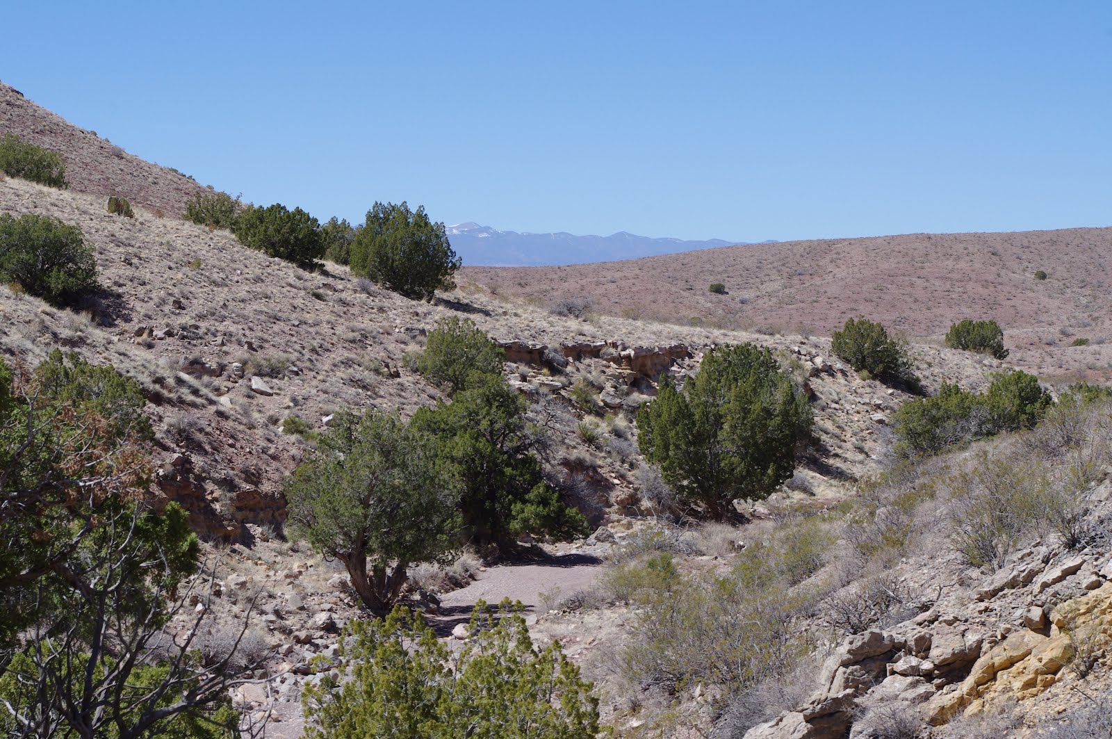
We drove west from Valley of Fires through the juniper studded Chupadera Mesa and the foothills of the Oscura Range to reach the Quebradas Byway about 11 miles east of San Antonio on NM 380. This is a well maintained dirt road that skirts the edge of the BLM's Sierra de las Canas Wilderness Study Area. For 24 miles it winds in between steep peaks of colorful sedimentary rock,climbs narrow ridges, and dives in and out several arroyos, until it finally brings you back down to the Rio Grande just north of Socorro. The mountains are reminiscent of Caballos near T or C, the Robledos here in Las Cruces, and the San Andres Mountains . There are many of the same Paleozoic sedimentary formations. The green shales, the gray and blue limestones,the yellow , brown and red sandstones make an extensive pallet, and I wished as I drove that I was seeing it all in the last light of a winter day instead of the bright sun of a spring afternoon. We got out and walked to one small box canyon and saw a snake's path, a tiny kinglet, a vicious,bubbly low growing cactus and bluish limestone streaked with a myriad of white calcite(or maybe quartz?) veins. The junipers were bright and it was already hot,but there were still few signs of spring. There are no trails here but almost all of the land is open to exploring. The larger arroyos we crossed( one even had flowing water) looked especially interesting. Make no mistake though, these are desert mountains, best visited between October and April.We might have been able to walk more ,but the afternoon sun soon took its toll on our very black Scottie dog. Later, as we got back in the truck and drove on ,we saw several areas of reddish sand dunes, nearly vertical sedimentary beds, and the long ,steep wall like main ridge of the Sierra de las Canas. If I lived in Socorro, I know I would be out exploring this area every winter, just like I do with the desert ranges closer to home. As it was , it was nice outing in an area, that with so many larger more well known mountain ranges nearby, is an all but forgotten little pocket of our state. I only discovered it when I happened upon an old BLM map that I had filed away.Note: The BLM has a brochure and geologic guide to this drive available online
Labels: hiking, scenic driving
posted by Devon Fletcher at
8:14 PM
![]()
![]()


5 Comments:
Just doing some research about Quebradas as I hope to visit the area this month. What I am especially looking for are sand dunes? Did you happen to notice any when you were there? Thanks.
Yes, they were a couple of areas of rusty hued sand dunes. I'll look through my other photos to see if I took any pictures of them.
Okay, Thanks.
I thought I saw a clip on YouTube about Gordy's Well that looks like a really sandy area?
No photos,but we stayed mostly on the byway route, so I know they're visible from the main road through there. I tried retracing our drive using google earth but couldn't be sure of what I was looking at.
Okay, that sounds good. Thanks for checking for me.
Best wishes, ...
Post a Comment
Subscribe to Post Comments [Atom]
<< Home