Apache Canyon Update (1/30/21), Robledo Mountains- Prehistoric Trackways National Monument

 |
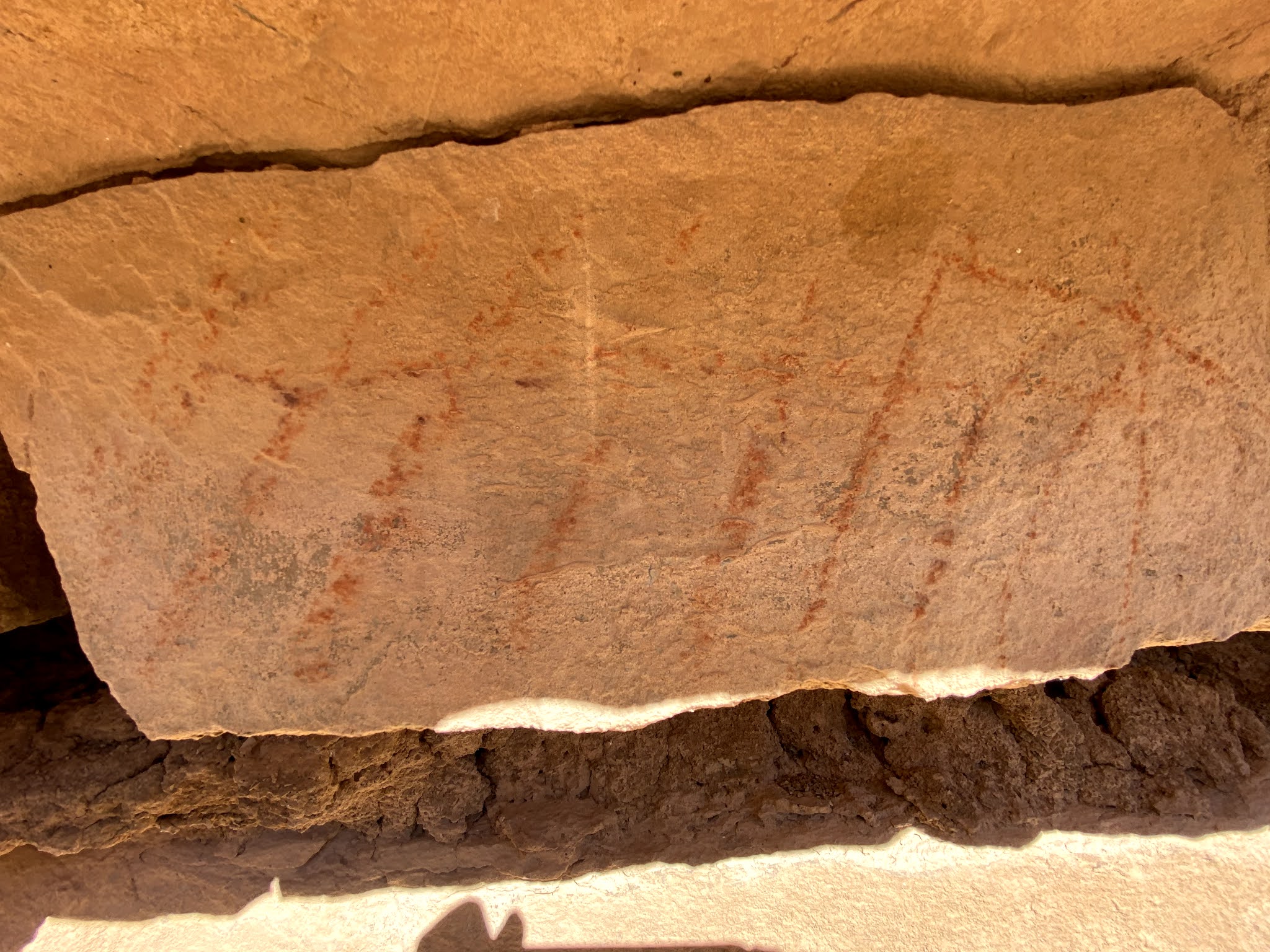
| Atl atl thrower (?) and turtle pictographs |
 Just a few more photos from our Apache Canyon hike. UPDATE (1/30/21): Revisited this site after 9 years with friends David and Nancy Soules, only this time took a shorter route starting from the west, where we ended up hitting the canyon upstream from the jeep road crossing near an old tank and then hiked downstream about a mile. I had forgotten, as I walked over limestone bedrock, gazed up at impressive cliffs, and marveled at huge juniper trees, what a beautiful canyon experience this was, and is. I highly recommend it.


Labels: fossils, hiking, Organ Mountains/Desert Peaks National Monument, pictographs, Pre-historic Trackways National Monument
posted by Devon Fletcher at
4:49 PM
![]()
![]()


2 Comments:
This looks like an interesting alternative route into Apache Canyon. Could you share directions. Thanks, Devon.
About a tenth of a mile before the paved Corralitos Road takes a 90 degree turn to the west, take a right onto a very primitive road heading off to the east. Remember to stay left at the first fork. At a little over 2.5 miles you should pass a livestock tank. Continue on up the hill. There is an arroyo crossing about 1 mile past the tank and the road will turn to the north. Continue on for another third of a mile and then turn right and drive about a tenth of a mile to a parking area where the side road dead ends. Be forewarned: this road is extremely slow due to washouts, deep ruts, loose rocks, slippery gravel and rough bedrock surfaces. You may need four wheel drive even in dry weather and make sure you have decent spare (or maybe two).
Post a Comment
Subscribe to Post Comments [Atom]
<< Home