Good Sight Well Canyon - Good Sight (Goodsight) Mountains
I had an idea last year that this canyon could be accessed from the flatlands to the west, instead of the tortuous roads that creep along the top of Good Sights. I had a route planned out, too, but shortly after leaving I -10 I was met with a locked gate. So much for that. There still could be a way from the southeast or the north, but I will leave it up to someone else.
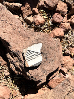
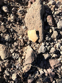
So I found myself back on the crappy road that heads to Stinson Well and beyond, a couple of Sundays ago. I had hoped to drive past the well off of the private parcel, make it to BLM land and park closer to my destination. I didn't succeed and had to backtrack. There is a way to do it, but it involves five more miles of driving on a stretch of road potentially as hideous and slow as the section I had just come over. I parked (on BLM land) and set out at rapid pace, knowing my day was a short one. I marched cross- country over a couple of grassy swales and then down through the creosote to the upper reaches of a canyon I explored a few years ago. At the shallow crossing, I found what looked to be some grinding holes (cupules really) and one small piece of pottery, nearby.
Up on the other side I found, according to plan, the good road that would take me nearly to the rim of Good Sight Well Canyon. Arriving, I opted out of descending the branch below me, when I spied a faint trail off to my right. I stumbled over to it. In a very short time, it was my good fortune now to see that the trail continued, nearly invisibly, down to the canyon bottom. There was no doubt that the cut in the canyon side, however hard to see at this point, had been made by humans, but to what purpose, I'm not sure.
Once down at the bottom, I moved over to the dry waterfall that was in the north branch and my reason for wanting to look at this canyon in the first place. I saw a very few petroglyphs on the face of one tier, but continued exploring up to the base of the highest drop.
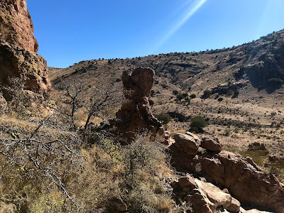
Now I turned around, and continued down the canyon. There was very little in the way of wildlife or livestock paths to aid me, so the going was a bit rough. I'm never really sure if it's a good or bad thing to have the pair of rubbery ankles that I do when covering terrain like this, but I somehow make it through. The depth of the canyon, the rocky cliffs on the south side, and alcoves carved in the pink rock on the north side served up a scenic experience ( once again) better than what most would expect from these " mountains" that are barely more than hills.
Before getting to the old windmill, which no longer spins, there was a grove of hackberry trees, those lovers of shade and water in the desert, which made me think perhaps at one time there may have been a natural spring here ( ranchers were fond of installing wells near springs way back when) This is the location of the original well constructed hand dug well. At any rate, as this not a particularly narrow section of canyon, it appears the soil here stays moist due to a shallow water table.
Some bedrock at the windmill had a few grinding holes and grooves left by prehistoric people.Other evidence of ancient occupation is nearby as well. I had gone further than I had planned too, and now it was time for the long haul back out with the sun dropping quickly in the west, as the noon hour came and went.
 |
| Above 2 photos by Nancy Soules |
I ate my lunch in the alternate upper branch, after which, when I climbed out of the canyon, I found this large pile of rocks, that I hadn't noticed earlier, right near the trail I used for my descent. Right now my working theory for these mystery trails and cairns that are to be found in the Good Sights and other desert ranges like the Doña Anas , is that they are remnants from the CCC days ( 1930's) when crews worked building dams and doing other conservation projects in New Mexico.
I explored the top of the dry waterfall before leaving, and then took a route back that was a variation (slight) of the route I had taken on the way out. All in all it was a tough ( because of the relentless rocks of the cross country sections) little 6 to 7 mile jaunt, that I enjoyed very much. NOTE: The area around Goodsight Well is a small ( probably a 1/16 section) parcel of private land that is not posted. Please be respectful if you are passing through.
Labels: camping, hiking, petroglyphs, waterfalling


0 Comments:
Post a Comment
Subscribe to Post Comments [Atom]
<< Home