Magdalena Ridge, Gap - Organ Mountains Desert Peaks National Monument


Long valleys penetrate the mesa, aligned with both the long and short dimensions, so that when viewed from air the entire ridge looks like a jellyfish or some other dendritic coral reef dwelling creature.
Rocky cliffs rim most of the mesa, and many a large boulder has tumbled down into the lowlands as well. Both are ripe for exploring for rock art, and I've been doing quite a bit in this area starting back in the spring and continuing this summer. I explored this area many years ago in the days before Google Earth looking for and eventually finding the petroglyph sites in Apache Flats, with only those two words to go on.
Magdalena Gap ( which isn't really much of break in the mesa) was where the Butterfield Stage Trail steeply continued through the mountains. On the last of the three hikes, I realized there is much gentler pass just to south, which really has me puzzled now as to why they chose this route.There is a lovely, semi- circular hidden valley on the east side of the Gap which was very scenic, even in June, but would be better enjoyed sometime between November and March.
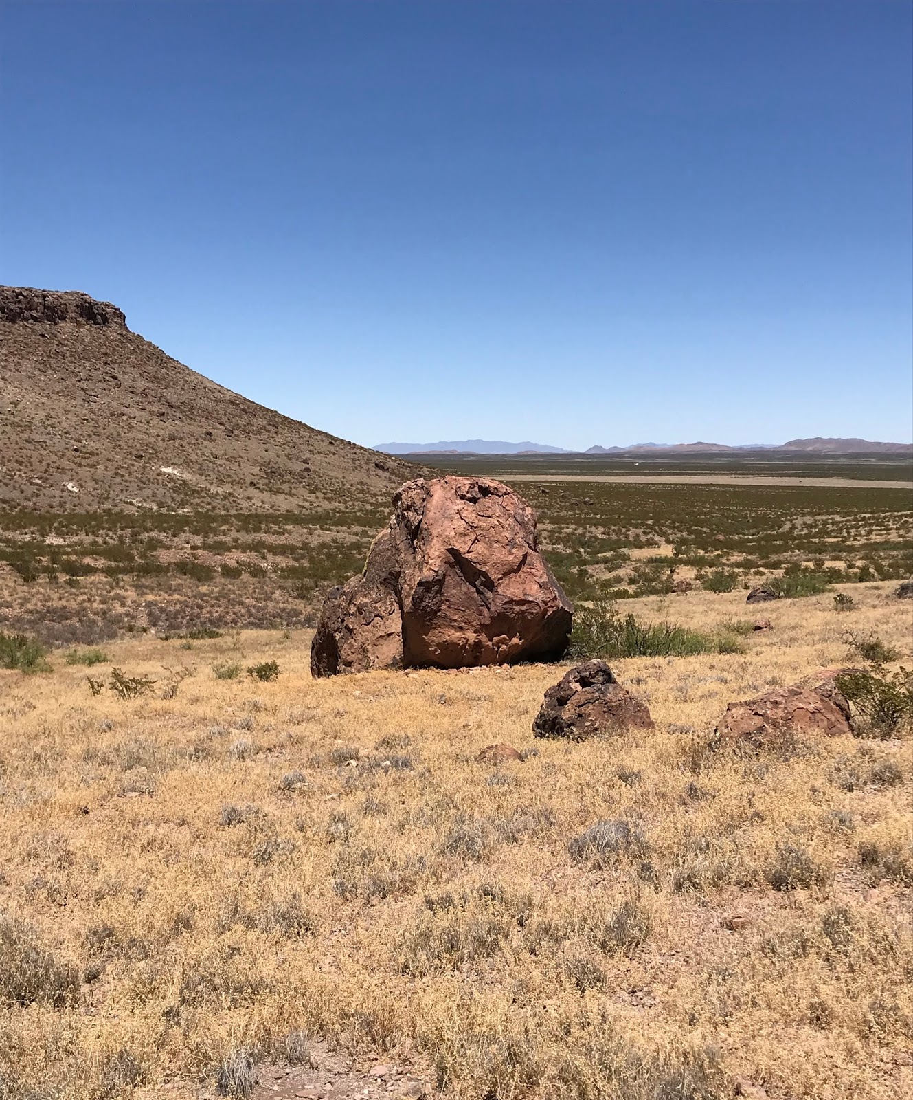
Walking up on top, or down low, the views, though not spectacular, both near and into the distance, pleased me.


On the first two of these three trips I couldn't see the faint smoke around Sugarloaf Peak from the Uvas Fire, the persistent wind dissipating it and pushing it on to the east.

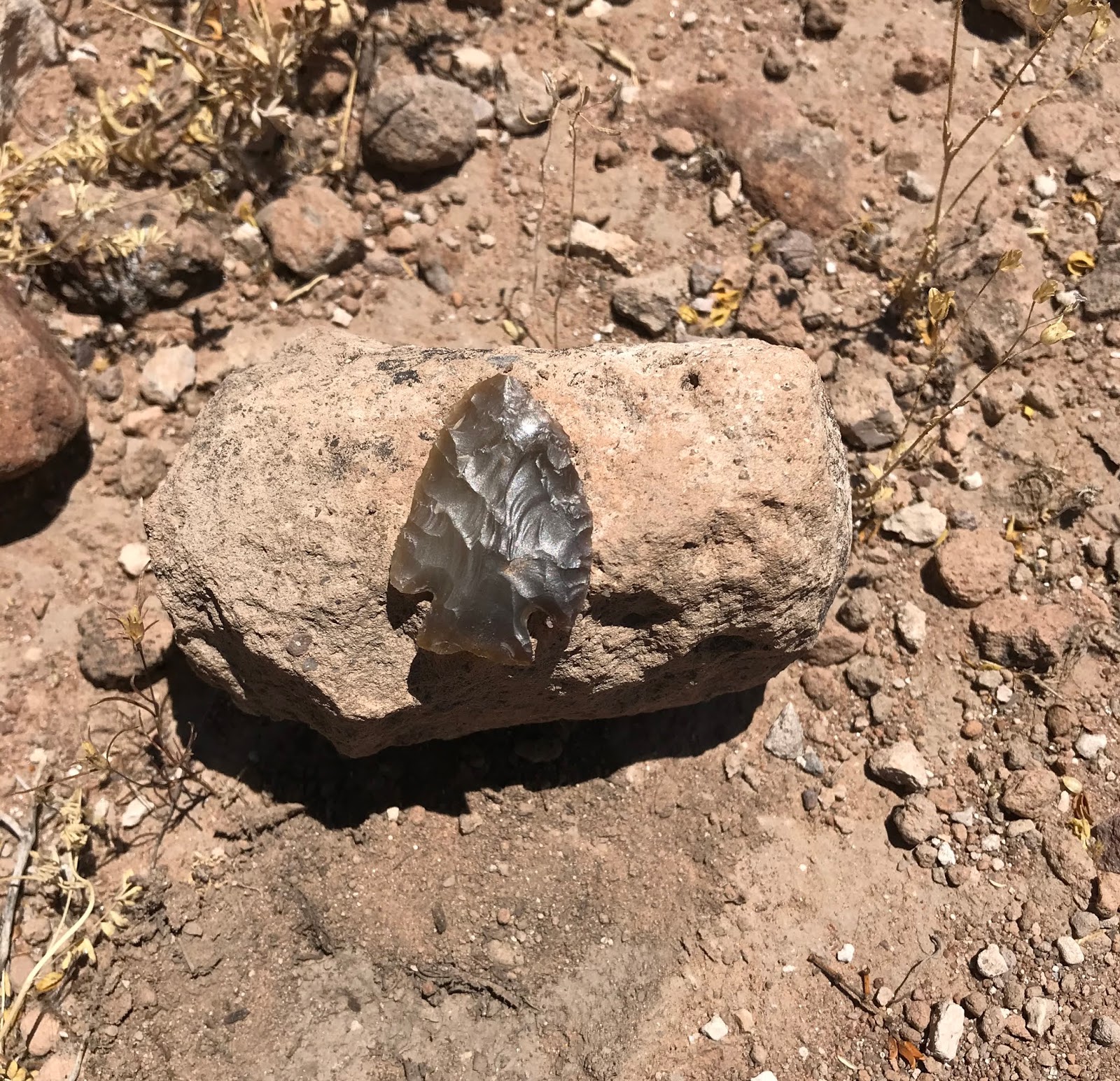
For my trouble, my hours in the desert yielded: Coyotes trotting away silently from their resting place at my approach; pronghorn dashing across the flats; a perfect projectile point; a circle of rocks of unknown purpose( perhaps a survey marker) and a pile of fire- cracked rocks ( I knew I was looking at something done by humans, not naturally occurring, I just didn't know what until doing some research back at home); a small, lonely petroglyph, greening up sotol, ever present lizards and plans for future trips.


Labels: hiking, Organ Mountains/Desert Peaks National Monument
posted by Devon Fletcher at
3:12 PM
![]()
![]()


2 Comments:
Hello Devon,
I just returned from the Gap and also noticed the cross you have photographed.
Would you happen to know specifically how to access Georgie Tank?
The hike from Blackburn? tank is easy enough, I would just like to spend more time in the gap.
Thank you,
Manuel
Las Cruces
hike2find@yahoo.com
You can access Georgie Tank more easily from the west side using the good County Rds C001 and DOO1 and then right before a cattleguard( about 13 miles from I-10) there is a "road" that follows a fence line initially heading to Georgie Tank. I walked most of it but I remember thinking I could have drove in further than I did. You might be able to drive all the way to the tank, just not in wet weather. This is the blog from that day. I didn't go to the tank that day but was looking at the rocks and cliffs on the south side and then proceeded down a southwest draining valley and over a ridge making a kind lollipop loop back to the truck.
https://southernnewmexicoexplorer.blogspot.com/2020/09/magdalena-ridge-again-sierra-de-las.html
Post a Comment
Subscribe to Post Comments [Atom]
<< Home