Cibola National Forest - The Gorge, San Mateo Mountains


The driving was all good, even though I got onto NM 1 an exit early, until the descent into Nogal Canyon on FR 86 when things slowed down considerably. There was spot of water at the road crossing, and downstream was a dark and narrow box section that I would love to visit. Unfortunately it is on a section of private land which several signs I had passed attested to, although passing through on the road is allowed. Up out of the canyon, FR 86 follows a fence, that separates public and private land for awhile as it descends through a vast area of open grasslands.

Right after opening and closing the last of one of three gates through this section, there were three hawks, less than 30 feet off the ground, actively engaged in some sort of squabble above the shallow arroyo just below me. A love triangle was my suspicion, but I don't really know. I initially passed the road I needed to turn on to head west toward the mountains, and then passed the road I needed to turn back to the north to go around the west side of Bell Hill. In the first instance I just had my mileage wrong, but in the second, the roads, which are very seldom used, had greened over with plant life from our spring and winter rains so much, that dirt two track was hard to see. After backtracking I did find this very rough un-numbered and un-maintained road where soon enough I put the truck into 4 wheel drive.
I made it out to Steel Tank where there were cows hanging around the water supply. This was where I was supposed to turn to the west again to drive to Dick Spring but I really couldn't see the road very far past the intersection. Wildflowers, weeds and even a few center line, sawed off mesquites were almost completely concealing the tread which I'm sure in dryer years would be easily visible. I headed out, concentrating, much more than I anticipated, on staying with the trace of the road, and hopefully not making a new one. Once it began ascending, and then descending the hill that eventually brought me into the vicinity of Dick Spring, the ruts were plainly visible which was a relief.
I parked at the intersection with an old mine road that heads up into the mountains and before two more stream crossings which after looking at them while traveling on foot was glad I omitted. I saw an old metal storage tank, some black hose, abandoned troughs and twentieth century trash on the short trip across a rocky mesa. Three, good sized, shaggy looking deer popped out from behind the shrubbery, gave me a look and then went on their way. I found a place to walk down to the canyon bottom and then off I went upstream. I weaved through the boulders following a bleached, algae strewn trail where water had flowed only a few weeks earlier. The wet stuff popped up in few stagnant puddles in a couple of places as well.
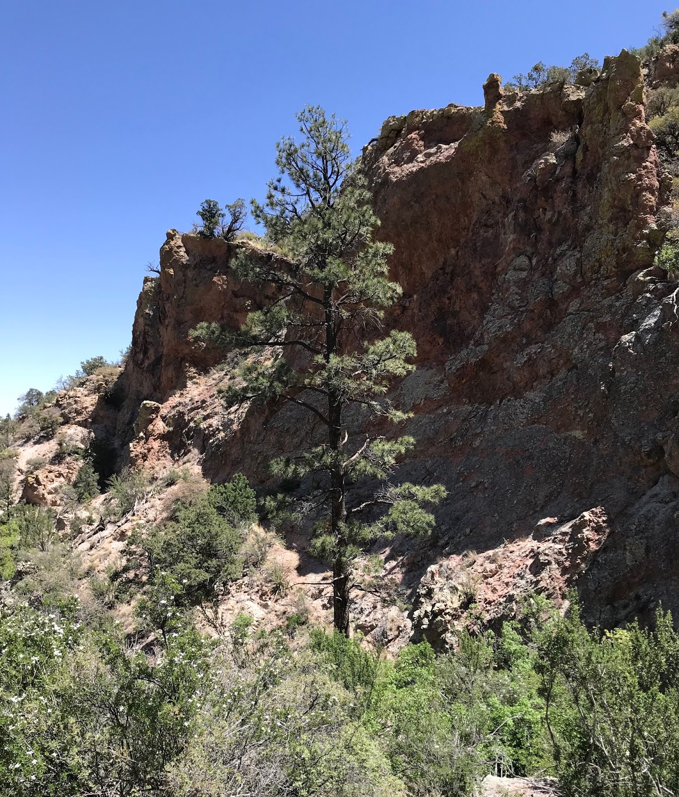
I made it to the fork where The Gorge separates into north and south branches. I went for the north first. Quickly I was in a deeply shaded tunnel- like passage where a huge old walnut tree was still managing to survive.


I passed under an archway created by a large chockstone wedged in the narrow walls of the canyon above me. A small amount of water was trickling over bedrock into sandy pools through this continuing shady and skinny section, but eventually as I emerged into the sun the surface flow disappeared beneath the boulders and gravel. Up above on my right was tall alcove with a steep apron of gravel and boulders coming out of its entrance and reaching all the way to the stream bed.

On my left I thought I had seen a natural arch high in the rusty cliffs earlier on, and now in the bottom of the creek, I couldn't see up there at all to confirm. Later while checking out the cave and alcove on the opposite side I would realize it had been just a trick of the shadows and morning light.
It was very thick going through the blooming apache plume and I had to climb several boulders that clogged the passage, but I made it to the waterfall I knew would be there. It was just dripping, but the big cold drops felt good on my head. I reached out to steady myself on rock and felt something odd. On closer inspection, it was a chubby toad, almost invisible, with skin completely matching the texture and color of the rock on which he sat.


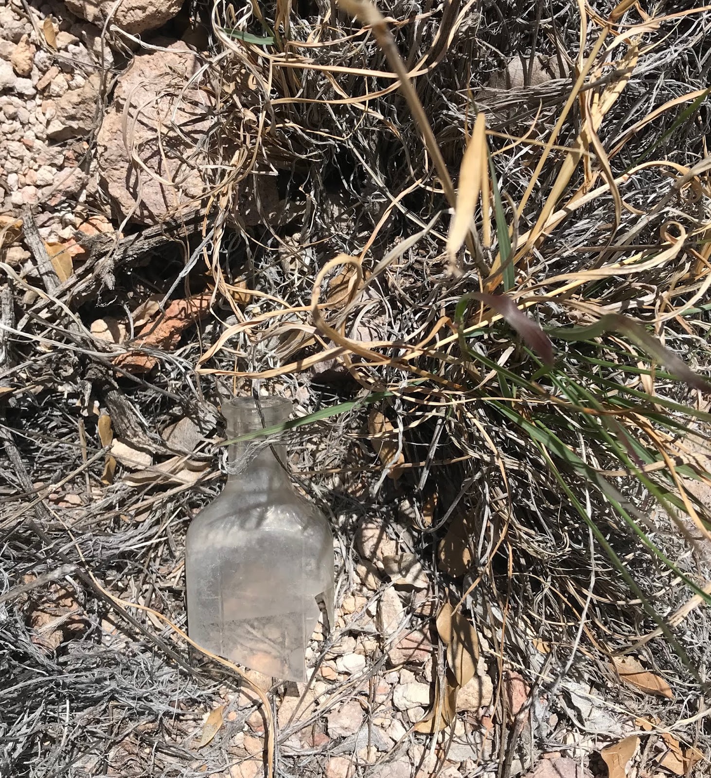
As I headed down, I angled out onto the north side of the canyon heading for the alcove I had seen earlier. On my way I found an old broken bottle which assured me I was not the first person stupid enough to come here. Scrub oak tree leaves glowed orange in the sun. Dried grass and gravel crunched beneath my boots. I arrived at a cave, not visible from below, where two juniper limbs were propped up from ceiling to floor. It was large and high enough to easily walk in and had a flat floor where a metate sat dumbly with several rusty paint cans nearby.


I examined the gravel as best I could for other artifacts. My eyes were having trouble adjusting to the dark of the cave from the intense sunshine immediately outside it. All I could see was anonymous gray gravel. Leaving, I saw an aluminum tin with a pull top ( probably bean dip) that let me know someone had been here in the last 50 years. Then I spotted a piece of ancient pottery, black with incised lines, just for contrast.

Now I headed over to the big alcove, but was immediately disappointed to see that it had no flat floor, just that steep talus slope. Somehow I crossed over where sotol and grass clumps stabilized (hopefully) the loose rock, to the far side and tried creeping along the bedrock wall to get a closer look. A rattler that I never saw gave me a brief shake of his tail as I went, not an encouraging sign. I ran out of hard rock, and nerve. My only choice now would to be get on the gravel slide itself, but I had strong sense that doing so would have me at the creek bottom in short order. There seemed to be flat bench-like surfaces at the back of the cave tempting me to continue, but I carefully changed my direction and crawled back, gave the snake a wide berth and walked out onto a navigable prow of grass and rock to make my way downward. Eventually, much closer to the bottom, I had to step lightly over the large rocks at the edge of the slide and onto the loose gravel where I did the first of two involuntary glissades that day.


Now I was off to the south branch, which, since it faces slightly northeast is thickly filled with abundant, dwarfish greenery such as chokecherry, deciduous oak, mountain mahogany, cliff fendler bush and walnut.


Like a giant among them was very tall, very straight fir tree looking quite out of place at 6400 feet elevation.

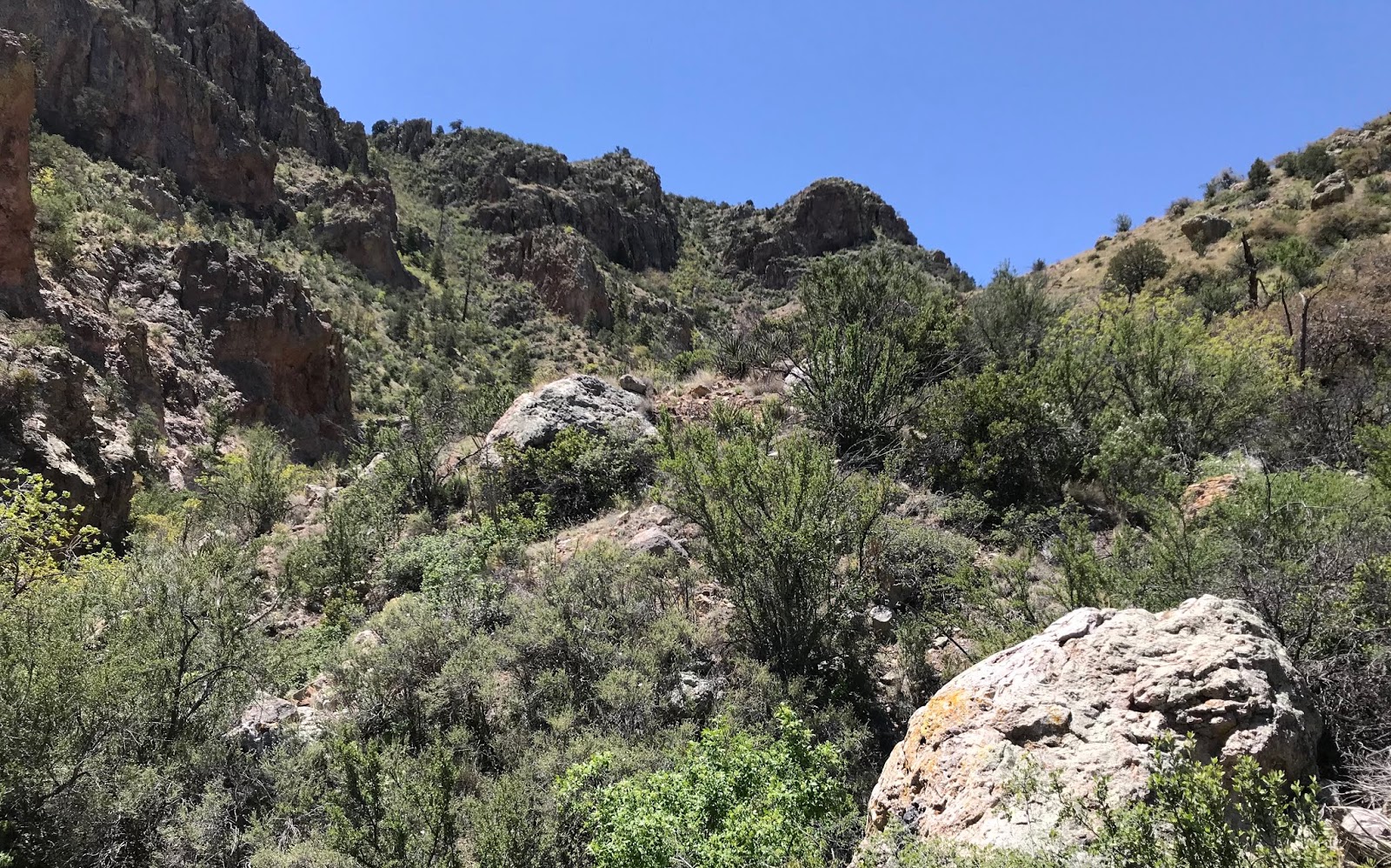
The going was so tough that I lugged myself up on the hot north side of the canyon just to have some clear walking for awhile.Water ran in a few spots. I drank my own in the shade of cliffs. Big circles of recently deposited bear scat cropped up every 100 yards or so. I had heard a creature kicking the gravel loose escaping up the hillside early on, but never saw it. The disturbance seemed too small to have been a bear, but who knows, from experience I know they can be very light on their feet when they want to be.
I thought there would be more water in this branch, but there wasn't. I also thought I might encounter another waterfall, but I didn't. It really wasn't that much fun, with one hard fall emphasizing the point. The constant appearance of butterflies of all kinds, and the canyon wrens laughing at their foolhardy visitor kept the mood mostly light throughout though.
I headed back, and before the slow drive, poked around the spring area a bit. It had been a tough little 3 mile scramble. So much so, I put it into the "do as I say, not as I do " category of hikes. It's highly unlikely I will return, but it was a good day in the mountains. Better than some, worse than others. At the "Welcome to Cibola National Forest sign on 225 I ate lunch and then headed home.
Labels: camping., hiking, waterfalling, wildflowers
posted by Devon Fletcher at
9:19 PM
![]()
![]()


0 Comments:
Post a Comment
Subscribe to Post Comments [Atom]
<< Home