Sierra de las Uvas Canyons - Organ Mountains Desert Peaks National Monument


The trailhead for our hike on Sunday was the little pass at the very end of the paved Corralitos Rd.(County Road D 012 ) Well, the pavement doesn't actually end there. The black top does continue up onto Mesa Azur all the way to Magdalena Peak, however it is gated and locked down at the bottom, which is where we parked and started walking northeast down the dirt road in Choases Canyon toward Choases Tank. My original plan was to access Piña Peak from this direction, eventually using Road Canyon to reach a saddle on the north side and then continue up, but the windy conditions took peak bagging out of the picture for this trip, and threatened to cancel our hiking altogether. Still, we forged ahead down the road (a continuation of County Road E 006) past Choases Tank, now with idea of turning back at Road Canyon rather than using it to hike up the western flank of Pina Peak. A little ways past the tank is a signed intersection, where many years ago on our first trip to the Sierra de las Uvas, we made the turn to the northwest and hiked all the way to Big White Gap.
At the junction with Kerr Canyon, where the road climbs a small hill, we opted to walk in the canyon (Kerr Canyon, at this point, I believe) itself. Shortly thereafter, we found the what seemed like the only windless spot on our whole hike, tucked against some low cliffs beneath some scrub live oak, to have a lovely picnic. Some other oaks with respectable trunks grow pressed up against the north facing cliffs nearby. Walking in the bouldery streambed wasn't too difficult, but the persistent wind with occasional gale force gusts kept us from getting too complacent.


At the confluence with White Gap Canyon (which I think is the beginning of Broad Canyon proper, although Google Maps shows this section as still being Kerr Canyon, with Broad not beginning until after the confluence with Road) there were pools of water in the smooth bedrock, and a small dry waterfall that we decided to negotiate our way around, although we probably could've climbed down it. This part of the hike is a little sketchy with regards to private property, as there is a small rectangular section of it here containing the Alamo Well (named for a very large, but now dead cottonwood nearby) and corral and continuing up the hillside to the north. We stayed in the stream bottom, going under a couple of fences, but it may be best to bypass this area altogether by staying on the public access road.
 |
| Corral at Alamo Well. Pina Peak left center. |
The angular, orange cliffs began to rise up in earnest now on the south side, with enormous slabs of rock forming impressive talus piles at their base. Soon we were approaching a narrow bend of the canyon with high cliffs not just on the south side but the north as well. The wind howled in this funnel- like section. On the other side of this passage, it wasn't long before we were at the mouth of Road Canyon. I could see the road (Barksdale Road or Dona Ana County E 006) coming down a hill to where it crossed Broad Canyon, which is where we used to begin our hikes, first down Broad, and up Valles Canyon.


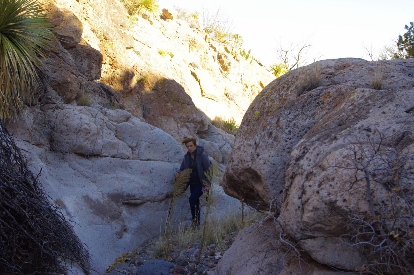
I couldn't tell from Google Earth or my topo maps, but the first part of Road Canyon is a kind of a little slot carved in soft, gray volcanic ash derived rock. There were many pools with a veneer of ice that had to be side stepped or climbed around. Seamus, and expert rock hopper, handled the situation easily. Nessie, our puppy, didn't, and ended breaking the ice in one, and sliding off a rock into the cold water at another. We climbed out at the first reasonable opportunity and now trudged over a hill in a stiff steady wind.

 We couldn't find a road I thought would be there. We encountered fences, which although not posted, I presume delineate the same section of private property. We crossed an arroyo that is Chivatos Canyon and went up a second hill. Finally, we went through a little used gate (it had small juniper growing in it) where the " road" on either side was all but invisible. We were back near Alamo Well and now opted to stay on the road, first the section we didn't use on the way down, and then retracing our route all the way back to the truck. The topographic bowl around the confluence of Kerr and Choases had milder winds, but otherwise it was steady stiff breeze in the valleys. We were glad we hadn't tried to climb any peaks as we listened to the wind accelerating to even greater speeds on the mountain ridges above.
I looked for rock art, bed rock mortars and other signs of prehistoric people on this hike, but was disappointed not to find any, even though there are several places where they can be found nearby. It might be nice to do this hike in the early spring or fall because of the variety of deciduous trees (hackberry, soapberry, ash, desert willow) to be seen with leaves still attached. If I return to climb Piña Peak, I will drive to a point much closer. The road is drivable with two wheel drive in dry weather.The worst part is the initial descent into Choases Canyon, after which it improves considerably.
Labels: hiking, Organ Mountains/Desert Peaks National Monument, rockhounding, scenic driving
posted by Devon Fletcher at
2:40 PM
![]()
![]()


0 Comments:
Post a Comment
Subscribe to Post Comments [Atom]
<< Home