Green Canyon Box- Caballo Mountains


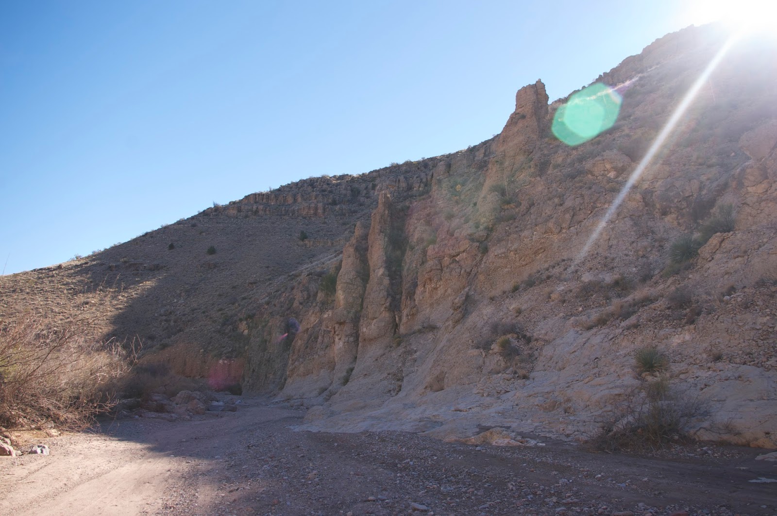


Off we went on Sunday, Andrea, Seamus, Nessie and myself, also known as " the pack," driving north on I-25. Arriving at exit 51 we got off and immediately headed east on what is initially a very good dirt and gravel road ( good enough that I had driven quite a ways on it several months ago in the Corolla). Further on, the crossings of several small arroyos weren't so great, and we stopped and parked just before reaching a heavily eroded, steep hill that seemed to be whispering: " you need four wheel drive." We walked up it with the no problem and as is often the case the road quality thereafter was greatly improved. We passed several rough roads that went off to mining prospects on the hillsides, as the road wound around and up and down through contrasting sedimentary beds of gray and deep rusty red. Some of the red layers had blue gray veins running through them. We passed an easy walking side canyon that, we found out later, would have brought us out right at the upper end of the box. Instead, we chose to climb up and over another small hill.

Finally, we reached the wide upper arroyo of Green Canyon and began heading downstream. I saw a bobcat cross the streambed in front of us ( only my second time to see one of these shy animals in New Mexico) so we leashed up the usually free roaming Seamus. We came to the above mentioned side canyon on the south, which I would use if I did this loop again and soon after we were in the box proper, where the first thing we saw was this double arch formation.There was also what may have been a grinding hole, but no rock art as far as I could see. We had our lunch on a limestone boulder, sitting in the sun on this cool winter afternoon.


 We passed through a gate ( actually under) in a barbed wire fence across the stream bottom.The canyon narrowed and deepened and was quite impressive as we continued on. Rough limestone bedrock, now worn smooth and polished a whitish gray, was ample evidence, along with sand deposited by floods well above channel bottom, that this canyon has significant flow at times.This may be why it has a large flood control dam, just to the east of the highway. Puddles lingered in the bed rock and through the narrowest section, water seemed to trickle through sand, both were remnants of the previous day's storm.
Through some sections were veins and infilled cracks thick with clear, white and black crystals similar to some I'd seen over in Buckle Bar Canyon. I didn't see much in the way of fossils, but I wasn't looking real hard either. After coming out of the second big turn, I saw the remnants of an old plank bridge( at least I think it was from a bridge) above us on the north side that crossed a rough, narrow and intriguing little side canyon. A short ways down, we saw a rusty old chute and the scattered lumber that once held it in place laying on the south hillside.Unlike many desert canyons in our area this one had very few of those large junipers clinging to its sides. Perhaps it's too wide and open to sun. It was similar to Broad Canyon in that respect.There were a very few deciduous trees like hackberry, mesquite and soapberry, however.

 A pair of ravens( or were they crows?) that had been following us along finally sat in some bare branches below the cliffs like a couple of lovebirds, as we bid farewell to the box.We took an arroyo that was intermingled with a very old road as our exit to the south. Coming to the top of a small hill, we could see that we were on a beeline for our red truck.We crossed over several small rills, a little difficult with Nessie on a leash through the low thorny brush and cactus. Seamus chased a jackrabbit, but soon realized the futility and returned quickly.Climbing one last hill, we completed our day in the desert. Our loop was somewhere between 5 and 6 miles I estimate. Another potential hike out here is climbing the peak about a mile north of the box using old mining roads.
Note: I enjoyed this hidden little canyon, although it may not have enough to recommend it in the way of highlights for some folks. I did see some tire marks on a few boulders, but I don't think this canyon sees a lot of vehicular recreation, except for a once a year get together of rock crawlers that usually occurs in October.

Labels: fossils, hiking, rockhounding
posted by Devon Fletcher at
8:25 PM
![]()
![]()


5 Comments:
That's the kind of hike we enjoy. One of these days we'll get back to New Mexico and check out some of the hikes you write about. Thanks!
This comment has been removed by the author.
Just browsing and found your blog, good stuff! I have the exact same photos looking in and out of that little grotto, that's too cool. We hiked in there last year
Hey Devon: These hikes in the Caballos are something we've never done. Pictures make Green Canyon Box look interesting. Getting
off at exit 51 and then heading east on an unnumbered dirt road,
I was just wondering about how far you went before you encountered the hill you left your car at the bottom of. Thanks again.
A little over 3 miles.
Post a Comment
Subscribe to Post Comments [Atom]
<< Home