Florida Mountains- Spring Canyon State Park


 |
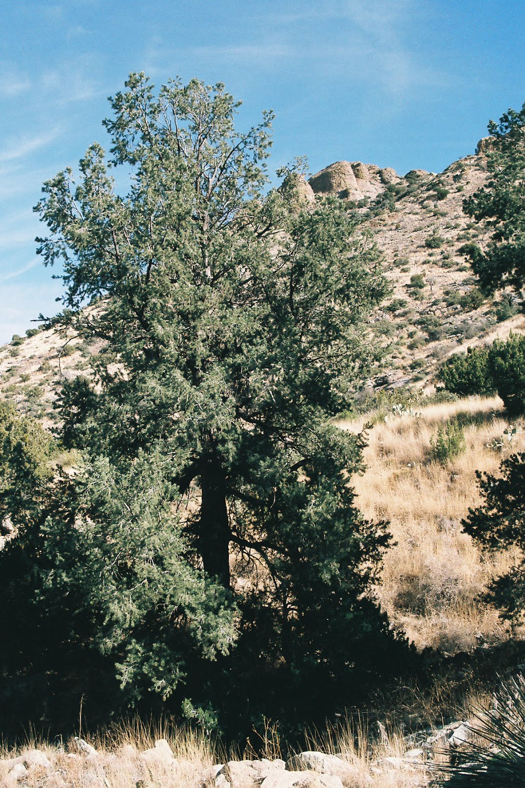
| Heading back down Spring Canyon |
There are two "trails" that leave from the state park onto BLM land. One is in Lover's Leap Canyon. The other is in Spring Canyon.The one in Lover's Leap Canyon, the better of the two, starts out past the last of the picnic spots. We've hiked it a couple of times up to a saddle that overlooks to the other side of the Floridas and beyond to the Cedar Mountain Range.Total distance is about 1.5 miles. Elevation gain is 600 to 800 feet depending on where in the picnic area your hike commences. It is very steep and slippery the last 1/4 mile or so.We've lost the path both times we've walked here. Just keep going till you find it again. It stays close to the stream bed on one side or the other. There is enough moisture here for piñons, scrub oak and the occasional ash tree, but the real draw here is the many formations in the friable volcanic rock on display on the north side of the trail.
Lover's Leap Canyon is to your right(southwest) as you enter, Spring Canyon is straight ahead(south). Since it runs almost straight north, it retains even more moisture. There are some very large piñons along the way and the stream bottom is very dense with vegetation, which eventually blocked our progress after only a mile or so of steep hiking.This trail is harder to follow with very rocky sections along the steep sides of the canyon. I looked and looked for some kind of continuation along those grassy hillsides but saw nothing. It could be there. I don't know. I do know that the bushwhacking in the stream bottom was not at all practical or enjoyable, so we turned around.This experience with lightly used use trails repeats itself in other areas of the Floridas. It strikes me as strange that a very scenic mountain range with good sized town nearby has no official hiking trails. These two, the one in Windmill Canyon, plus a few old mine and ranch roads will have to suffice for the present.


Labels: hiking
posted by Devon Fletcher at
4:33 PM
![]()
![]()


13 Comments:
Hi Devon - I'm not a hiker and have not been very far in the Floridas, but I am from Deming and have friends who are hikers, photographers and archeologists. It may seem strange that there are no posted hiking trails in the Floridas. There are "secret" sites (caves, petroglyphs - probably Apache) that the locals want to KEEP secret because of the danger of graffiti, etc. should someone not respect these treasures. I have one friend who grew up in Deming (he's around 50) and he did tell me there's a well-worn trail that actually goes over the biggest peak that he hiked as a high school senior -- it was the thing to do then. I don't know if that trail is still there or if it is still a tradition for high school kids to hike over the mountain. Should you be interested in some of the "secret" areas, I think I can put you in touch with someone who can tell you how to get to them.
I'm always interested in hikes in the Floridas.
I have a pretty good idea where some of the caves are.
This winter I want to hike up the Mahoney Park Road on the west side or check out Bradley,Lobo or
Victorio Canyons on the east. Gym Peak looks interesting as well. A couple of years ago I tried to go up to Baldy Peak from the Three Little Hills area, but it was too steep and too rugged and would have taken too long without some kind of trail. I'd love to know of special areas and would be careful to leave out explicit directions if that is what is wanted.
I sent the link to your "Spring Canyon State Park" blog to one of my hiking friends and hopefully he will post something for you soon.
If you don't see something within a reasonable time (his name is Dave), please email me directly (thyladyr@gmail.com) and I'll put you in touch with someone else who is a local hiker. :)
Dave here. I now live in California and really miss the Floridas. There are trails all over the Floridas if you know how to look. I agree that the Spring Canyon trail needs improvements--because of poor marking and maintenance there is now a network of bootleg trails that are a real mess. I offered to fix-up and mark real trail but the ranger didn't buy it.
Let me tell you about the trails out here. They tend to be well used, often deep hard grooves in the land and there are trail signs. They are walked by lots of people many of whom shouldn't be there. They exercise walk never seeing the birds or smelling the flowers. They are dependent on the trail signs which are not always clear or accurate and they get lost regularly. They have no idea where they are because they are not paying attention to their surrounds and they fear getting off the trail. Why encourage such use beyond the areas that are heavily used already.
With good trail sense and a bit of preparation most of the Floridas are open to you. Will you ever try a route that doesn't work? Yep, but so what.
Hi Devon, I'm interested in climbing the Florida peaks and starting at this park. My date is this Monday, which is Columbus Day, and I've seen that the park is closed then. Is the entrance gated if you remember? Or can you just drive in and pay and park? Thank you,
Zachary Teich
You can probably just park outside the gate, but you should ask the folks over at nearby Rockhound State Park, what's the best thing to do. I haven't done the Florida Mountains highpoint, but I know it is also accessible from Windmill Canyon which is about 3 1/4 miles south of the turn-off for Rockhound. Windmill Canyon is all BLM land. There is no fee or hours or gate. You can drive up the road in Windmill as far you dare and then start hiking up the steep canyon and then onto the steeper slopes straight up to the highpoint. It's very brushy back there. So maybe ridge line walk from Lovers Leap saddle, or catching the ridge to the west of Spring Canyon might be preferable. Whatever you do stay out of the bottom of Spring Canyon.
Zachary - I just found a state park site that said "Spring Canyon day use area is closed Monday & Tuesday. 12/30/2014 - ongoing." It lists this phone number: 575-546-6182. Here's the main Rockhound State Park site, which says the same thing at the bottom:
http://www.emnrd.state.nm.us/SPD/rockhoundstatepark.html
Hi Ruth, thanks for the info. I emailed the guy from Rockhound but no response yet. Thanks for taking the time to answer.
I called Rockhound - Margaret at the Visitor Center there said she hadn't received an email today. But she said that you can park at the "fence" (it's not actually a gate) and pay and use Spring Canyon on Monday, even though the park isn't officially open. Hope that answers your question. Enjoy your hike.
Hi Ruth, wow, thank you for the call and the info. I thought about calling today but thought it might be too late. I figured you might be able to use it since I know certain parks allow you to drop your money in a box and start before or after hours. That sounds great, and hopefully I will be able to summit Florida north peak next Monday.
Devon, thank you very much for the info. My problem is that I will be driving a U-Haul while towing my car, so I want to stay off any dirt roads if possible, especially if they are rough. Anyway, do you think a U-Haul could make it at least to the turnoff road for Windmill Canyon? It seems like if I go that way it will shorten the hike, but I don't want to take a chance down there if the road is too rough or narrow. It seems like at Spring Canyon the road is still paved and wider. I appreciate your help!
You can make it to the turn-off with your U-Haul. There is a parking area a few hundred feet down the Windmill Canyon Road that should be big enough to turn around.
The Spring Canyon area was open yesterday (Jan 18). We drove to the end of the road, where you can turn around and/or park. We hiked up the trail 1/4 mile or so but it started to rain so we came back down.
We talked with a couple of guys (hunters, I think) that were looking for Persian ibex. They said they've seen them here. We didn't see any ibex but we'll definitely be coming back to hike - and look for wildlife - when the weather is better.
It's a spectacular area - definitely worth a visit.
Post a Comment
Subscribe to Post Comments [Atom]
<< Home