 |
| Looking back toward Berrenda Creek |
| Volcanic rock with many nodules giving it the look of fossilized limestone. |
 |
| Sotol forest |
 |
| Dummy bomb like the ones I've found at Doña Ana County target sites |
For some reason I completely spaced out and didn't put this trip on the blog. Well, maybe not for just some reason. Maybe I was subconsciously blocking it out because it wasn't the best of days in the outdoors.
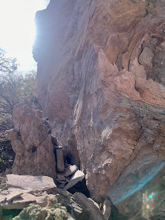
I had been trying to figure out a way over into Macho Canyon from Berrenda Creek (while avoiding trespassing on any of the several private inholdings in the area), but let me say before I get too far into this that the route we started out this day on is definitely not it. We parked on the left very shortly after entering forest service land. At first we followed a livestock/wildlife trail back along the little side creek headed west. Easy stuff except for low branches and loose soil and gravel. Pretty quickly though the mostly dry creek became a steep-sided gully cut into the whitish-gray (volcanic ash?) bedrock. Then it branched, then it branched again. The side branches were much the same as the main one with only the narrowest of little ridges in between. We would go out of ravine to avoid a small drop-off only to realize the ravine was way safer than the loose gravel and steep slopes above. It became more than chore, especially given we had to keep lifting our short legged dogs to get them up to the next level of the tight canyon. We weren't making much progress, or having much fun, and we couldn't see where we were going.
 |
| Narrow passage below a waterfall |
We got up out of the canyon to look up at a maze of formations in front of us with absolutely no clear cut way to proceed. This whole little boondoggle reminded me once again of folly (sometimes) of letting satellite images be my guide to unknown places. Google Earth images compress the verticality of any terrain and can't let me see through trees. Elevation changes of less than 25 feet can't really be discerned either and can be mighty inconvenient on the ground when confronted with a 15 foot drop-off in a canyon that's only six feet wide.
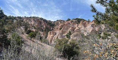
The formations of white and orange were pretty cool though and we took our pictures and began our treacherous descent. I had a back up plan though. We drove a little further down Pierce Canyon, past where we had parked on our last trip out here to where I had seen an old road following a side canyon.
 |
| Cool rock formations. |
 |
| The kinder, gentler terrain of my back-up plan. |
The walking was pretty easy for little while, but when it started to get steep we retreated. I explored up another road that was barely there that appeared to go to a mining prospect, while my wife and the dogs stayed put in the shade of juniper. High on hill that seemed to be extraordinarily proficient at growing agave, I realized the mine tailings were farther away than I expected. I gave up and descended. In the end the day amounted to a weird outing that was teetering on the edge but luckily didn't fall completely into disaster.
 |
| Agave |
Labels: archaeology, camping, geology, hiking, rockhounding


0 Comments:
Post a Comment
Subscribe to Post Comments [Atom]
<< Home