Florida Mountains - Florida Mountains Wilderness Study Area


As it turns out, as is frequently the case, I could've driven farther than I did, in fact all the way up to an old miner's shack at 5400 feet, but I don't like to push my luck and the possibility of getting stuck or other vehicle problems when I'm alone in remote areas. That decision cost me several hundred feet of elevation gain, but with the hike being so short, it wasn't that big of a deal.
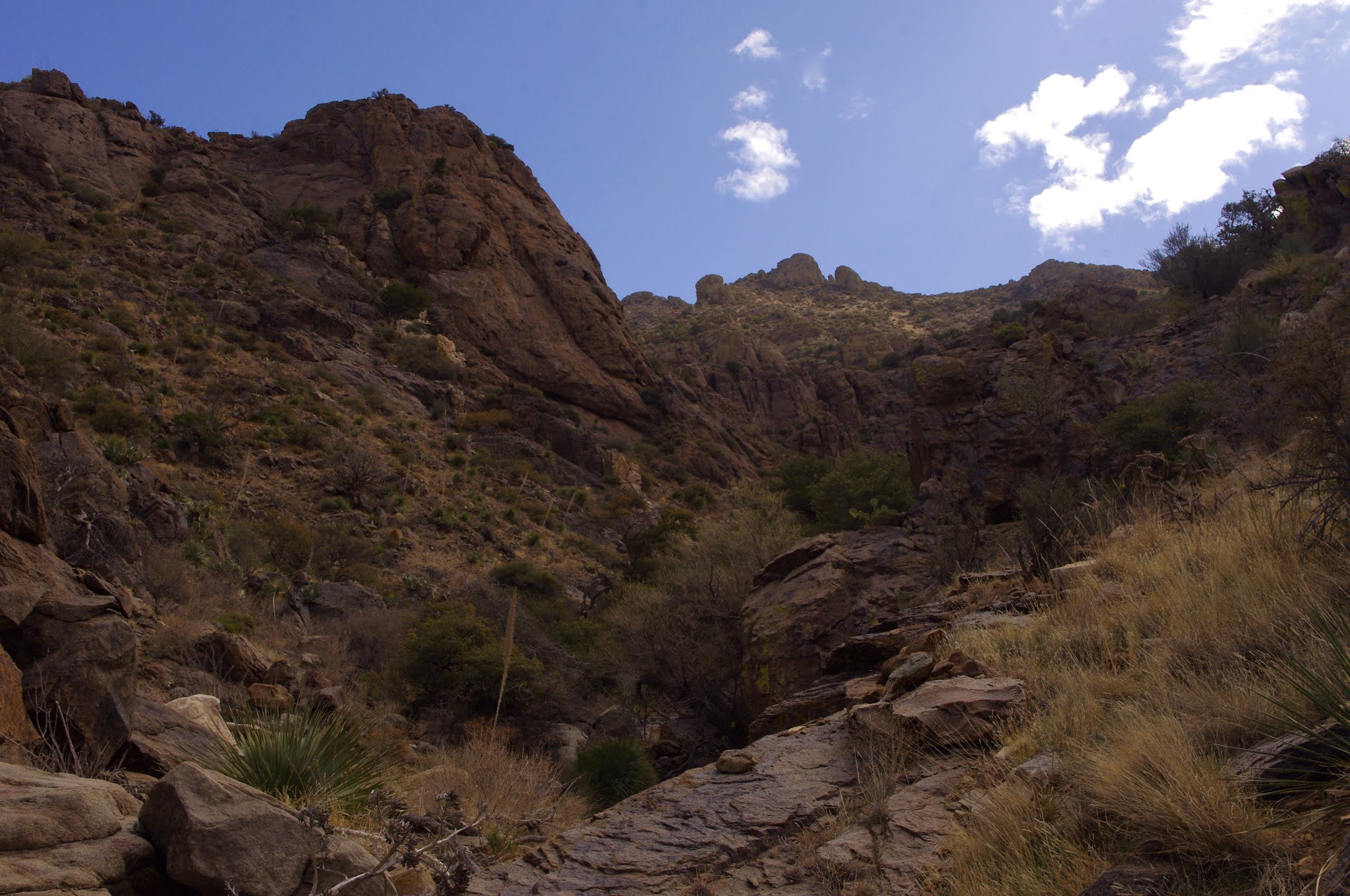
There I was trudging up along a fence line, breathing heavy and hoping the forecast dust storm could hold off until I was back in Las Cruces. I contemplated Capitol Dome and the myriad of towers along the ridge just to south as I went. A couple mines, a dry cascade were up in the foot hills above me. Once arriving at a gate, which I went through the strands of barbed wire, rather that deal with the maniacal twisting of wire that held it closed. I headed cross- country toward my planned destination: the steep-walled, un-named canyon directly below Florida Peak.


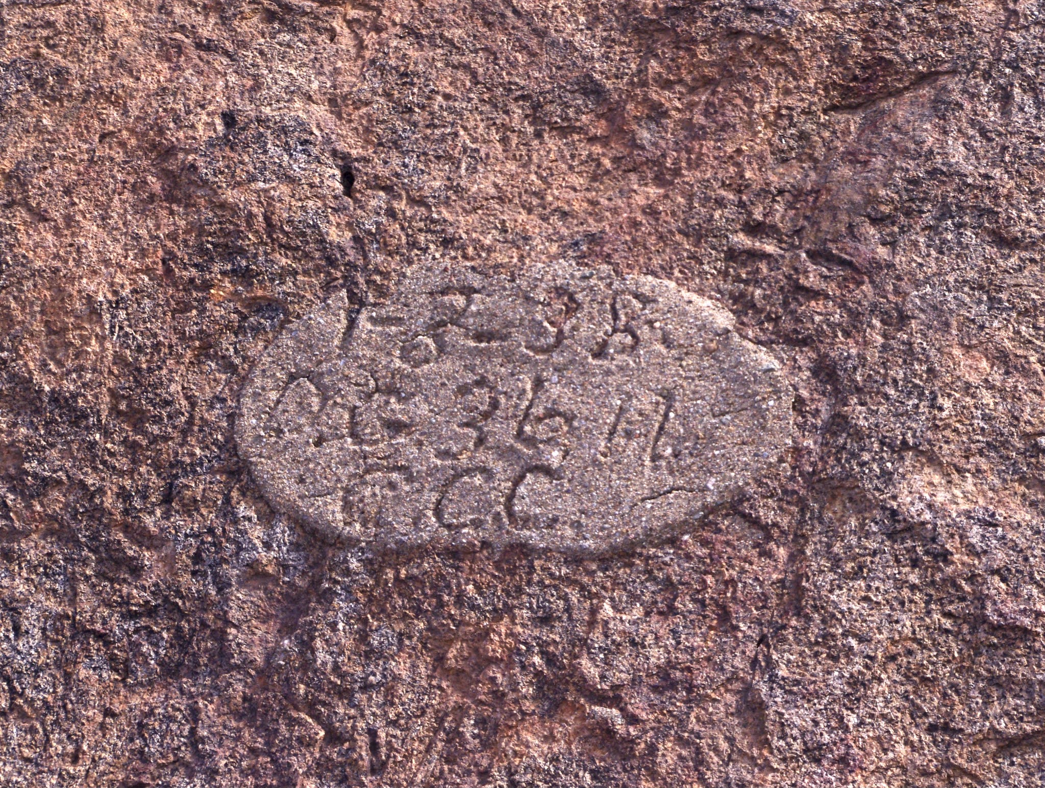
At times I picked up a wildlife trail, which aided my ascent. I could see that the summit tower of south Florida Peak has its own natural arch on the south side ( if you're someone who's been up there, confirm or correct this notion) The wind was blowing steady in the 20's I guess, with much stronger gusts, but I continued on. I finally reached a CCC constructed concrete and stone water trough, and then a short ways further upstream, a dam with water trickling onto the bare bedrock from pipe at the bottom. The original concrete channel, and the latter day hoses used to divert water were no longer functional.


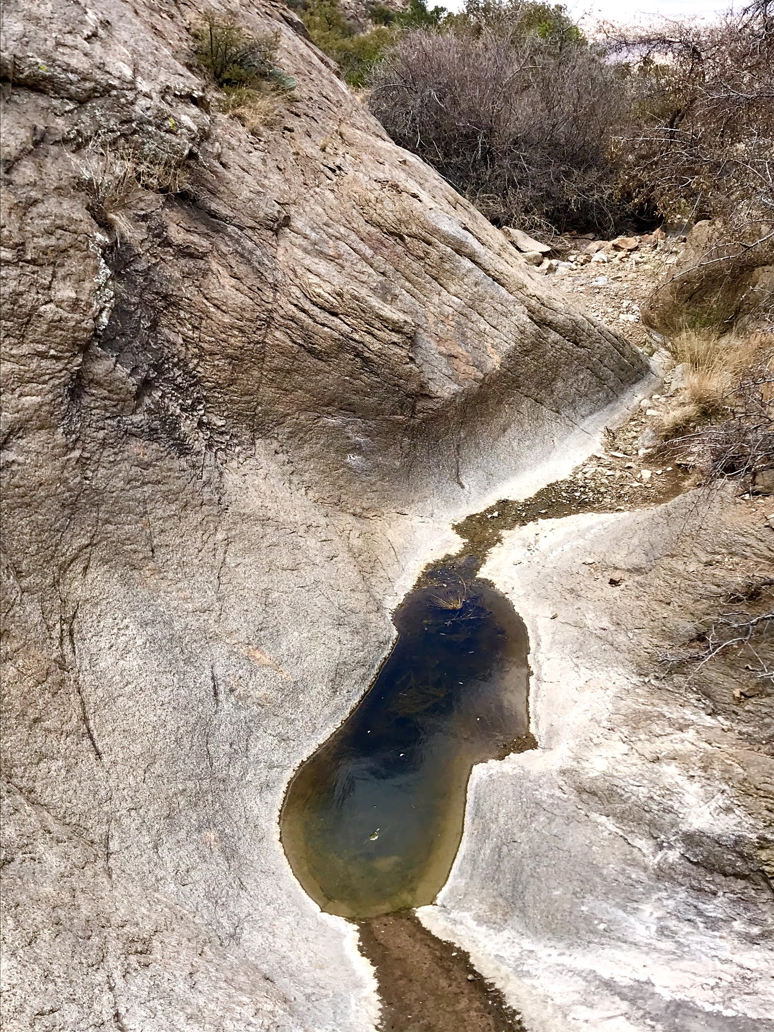

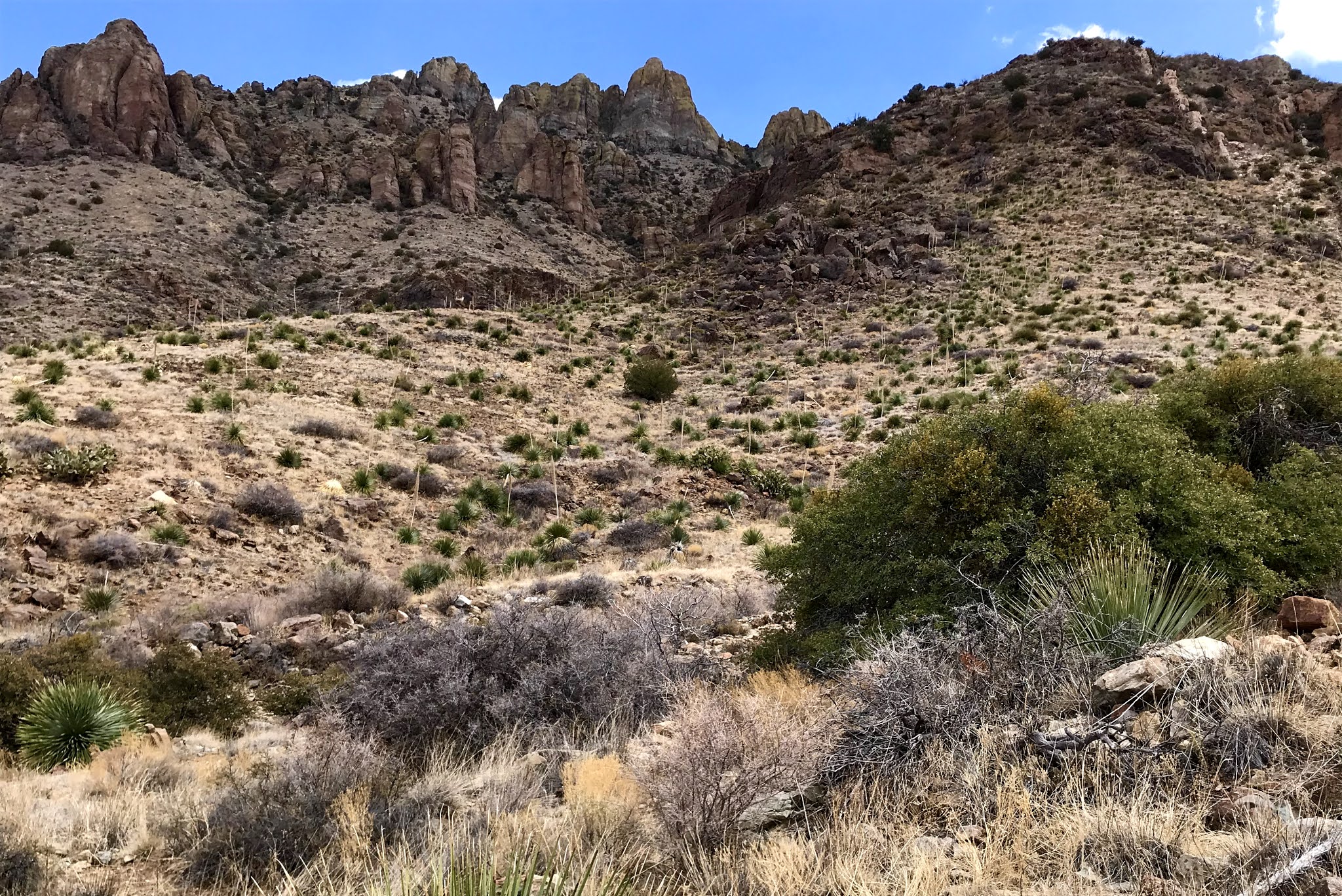
I climbed above the dam, into the area behind, which had completely filled, of course. How many years after its construction circa 1935, I don't know. The walking, with and without the wildlife trail, was much easier than I had experienced when visiting the uppermost reaches of Lobo Draw ( above the Atir Mine buildings) last year, so that shortly, after going around a few big junipers and live oaks, I was at the base of the left hand waterfall. The visible four falls or cascades were each around 15-20 feet high and smooth, with white staining on the gray rock. They were also bone dry. Not a big surprise, given the dry winter and spring we have had.

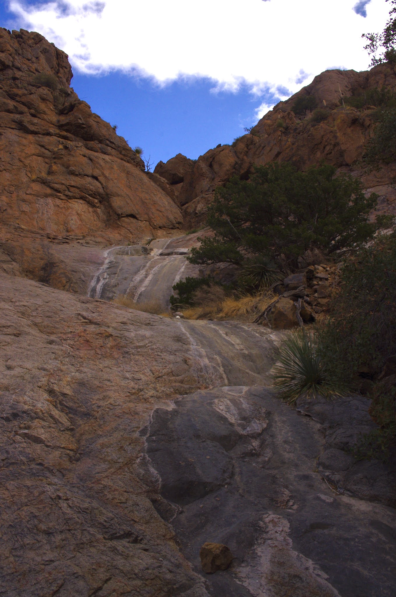
Above them, the canyon appeared to zig-zag through the red rock pock marked with small caves and alcoves. There were probably more drops to see, so I climbed up the first level easily enough, but it availed me no greater view into the secrets above. Climbing any further was not really an option, as I would be stopped at the very next level by an extremely steep and narrow chute. I carefully descended to try my luck over at the right hand branch.
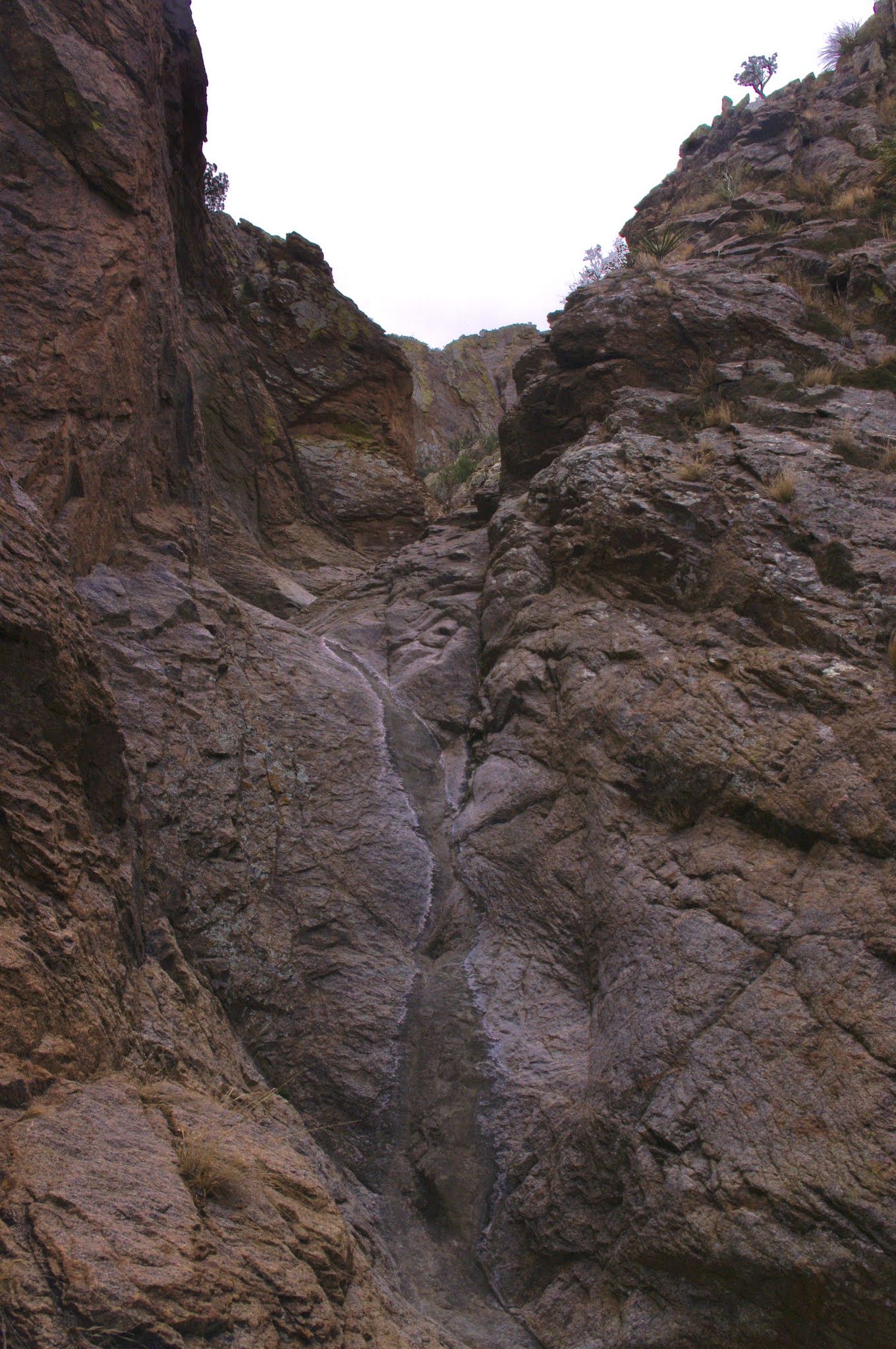
I reached the base of this second falls, after some mild bushwhacking, which had only the thinnest veneer of water on the rock. That in itself was a little miracle. I decided to climb up, avoiding the water which would've given treacherous lubrication to my boots while trying to traverse this slick rock. I knew I would be scooting down on my rear on the way back, but that was okay, as I crossed the stream and made it to a flat area with a very old and large ( for the Floridas) deciduous tree ( probably a soapberry). In front of me was a fairly straight( and dry) drop of more than 15 feet, with enough bumps and lumps to perhaps be climbable but not when hiking solo as I was. It appeared that beyond and above were several more like it.


I carefully got back down to the base without getting my boots or my butt wet. I continued now quickly out of the canyon, as the wind, which had never subsided even while back at the falls, began to wear on me as I contemplated fantasies of vehicle malfunctions that would leave me stranded.
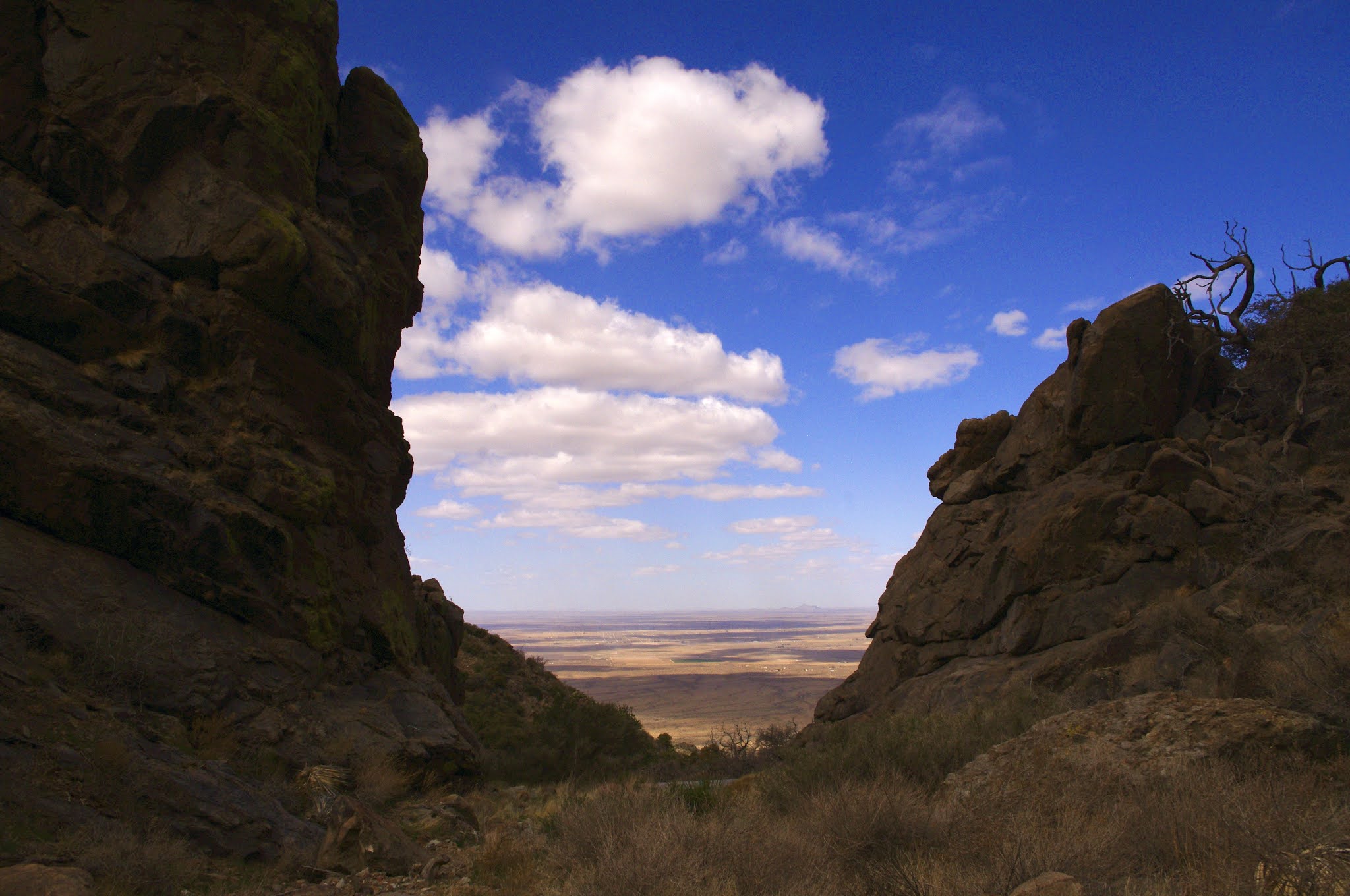
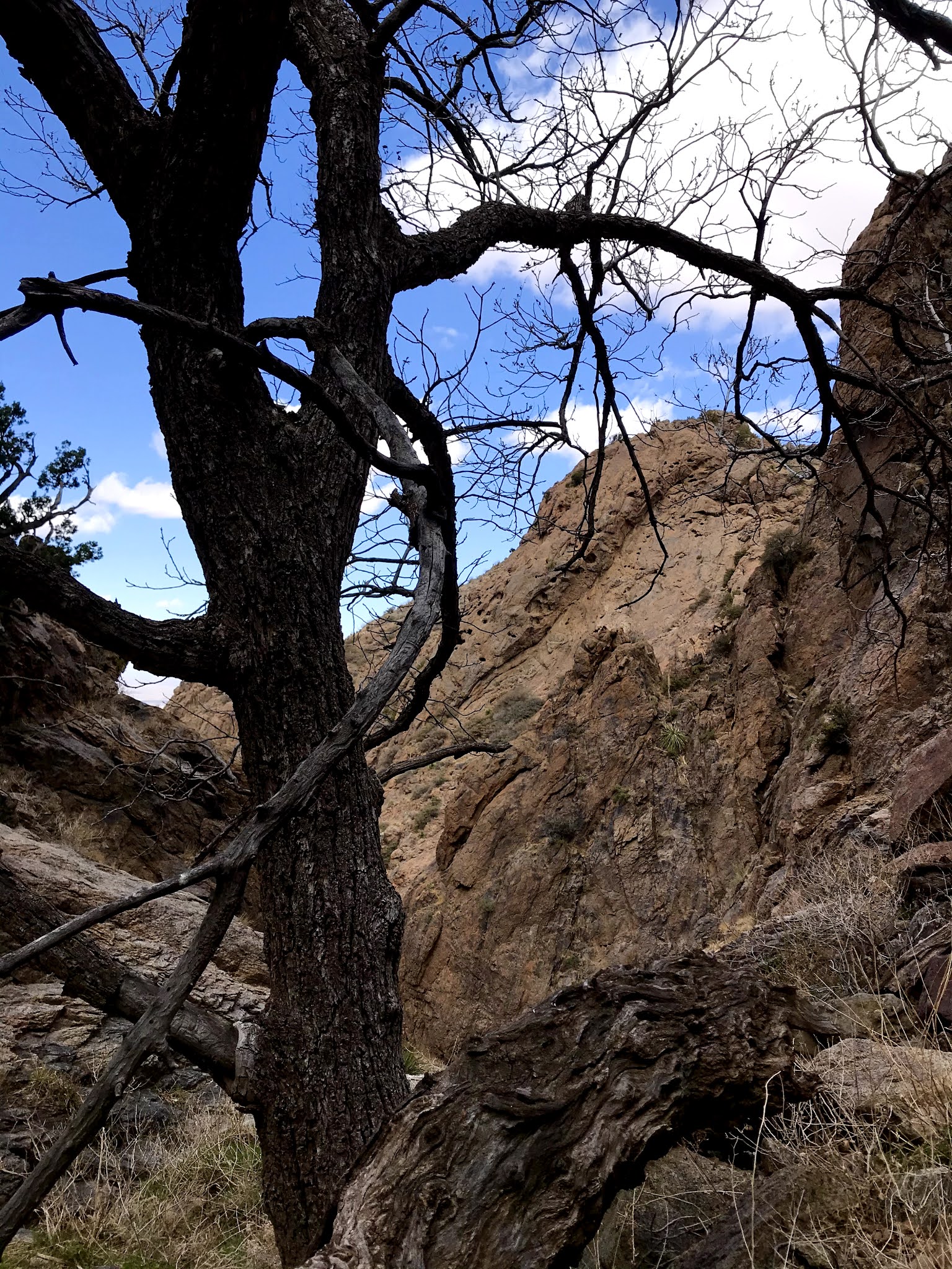
I did deviate slightly when I caught a glimpse of the ruins of the old miner's shack, which people, perhaps hunters, still use as a shelter of sorts with old metal car body parts strung as a roof between the soon to crumble walls of stone with wood framing. I took in the views to the immediate south of Baldy Peak and various ridges and other towers and then further to South Peak


From there I walked entirely on the road back to my vehicle, gusts of wind whipping my ears sore, as I gazed into the distance at the rising dust from the farm fields that surround Deming.

Labels: camping, geology, hiking, natural arches, waterfalling, wildflowers
posted by Devon Fletcher at
7:33 PM
![]()
![]()


2 Comments:
What an amazing article! I recently bought 10 acres on the east side of the Florida mountains near freedom field. Im so excited to explore this area and what a perfect tour guide you were. Thank you for taking the time to post this.
I have a quite a few more blogs about the Floridas and Little Floridas. Just go to the home page and search through the archives. Many are from within the last 2 years.
Post a Comment
Subscribe to Post Comments [Atom]
<< Home