Wednesday, January 29, 2025

Cibola National Forest, San Mateo Mountains - Monica Cabin

Monica Cabin


We stopped by here on the way home from the cabin on Horse Mountain on the Sunday before Christmas. I'd been wanting to visit Monica Cabin for a while now, and I was also curious to see if FR 52 to NM 107 was a viable back way home. It's not, but at least I can say I've driven the whole thing now. 

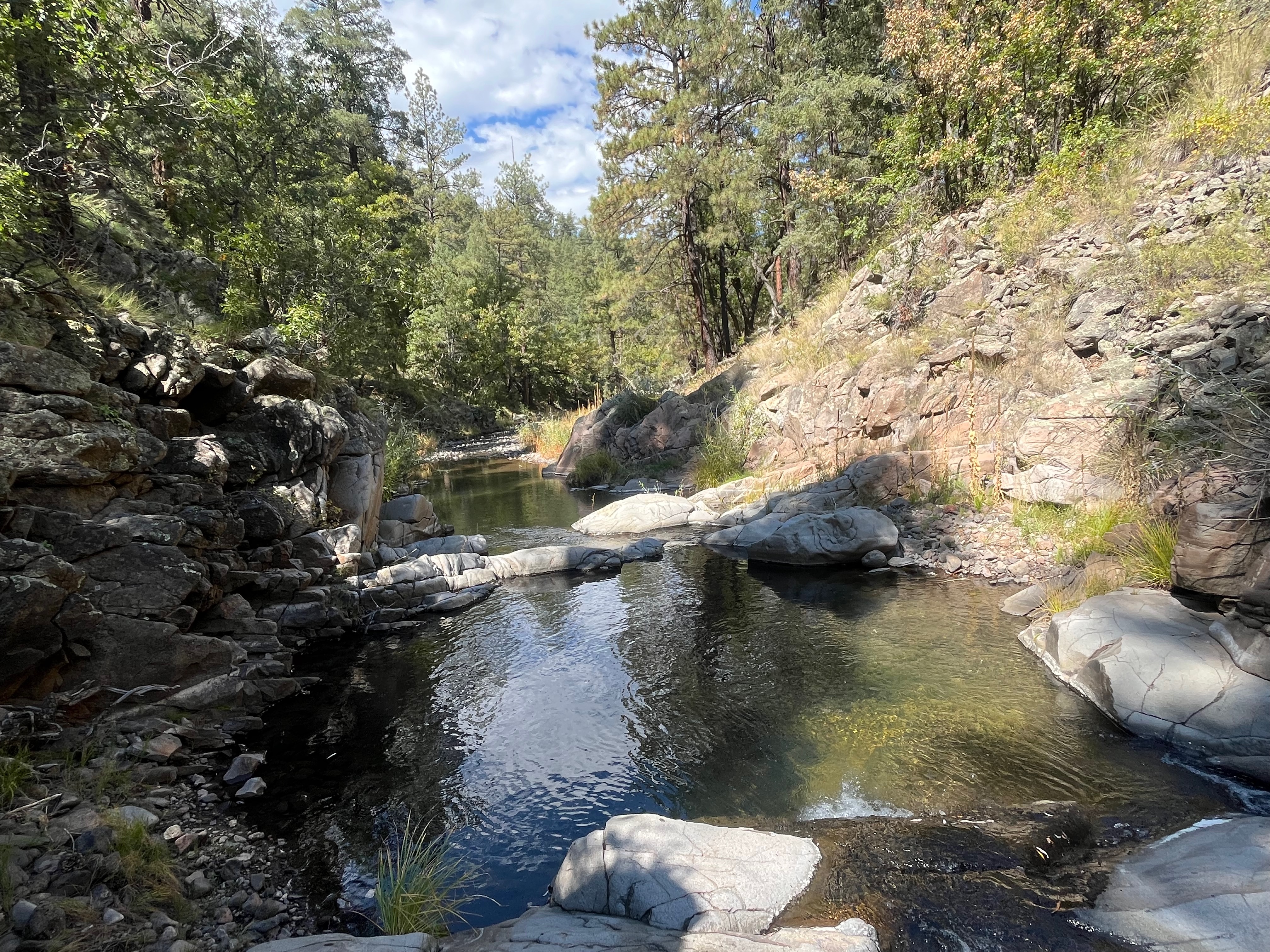
We turned off of  US 60 onto FR 549 that morning around 11. It's more or less a straight shot as this good dirt road heads for the northwest corner of the San Mateos. Eventually we came up to some railroad tracks seeing that there were several more components of the Very Large Array out here which can't be seen from US 60 or NM 107. After 5 more miles is the turn-off to the east on FR 52. The road quickly brought us down into the pretty little valley that is Monica Canyon. The stream is dry here but lined with mature oaks that likely make a lovely display in late October. The cabin, several outbuildings and a windmill  are just past the creek crossing. I can't find much about the cabin's history but it looks to be built sometime after WW II I would guess. I read that it was for  Forest Service personnel who were doing field work, so that they wouldn't have to drive all the back to Magdalena everyday. It reminded me very much of the stuccoed  Forest Service cabin we saw last year of FR 522 in the Black Range, except this one was not encumbered with the accumulated junk of fifty or more years which made it quite a bit more scenic.

 We wondered around the environs a little bit, ate our lunch and then we were on our way. I had tentative plans to do short hike on an old road in Little Monica Canyon, but it was getting late on a very short day and we didn't relish the though of driving for several hours after dark. 

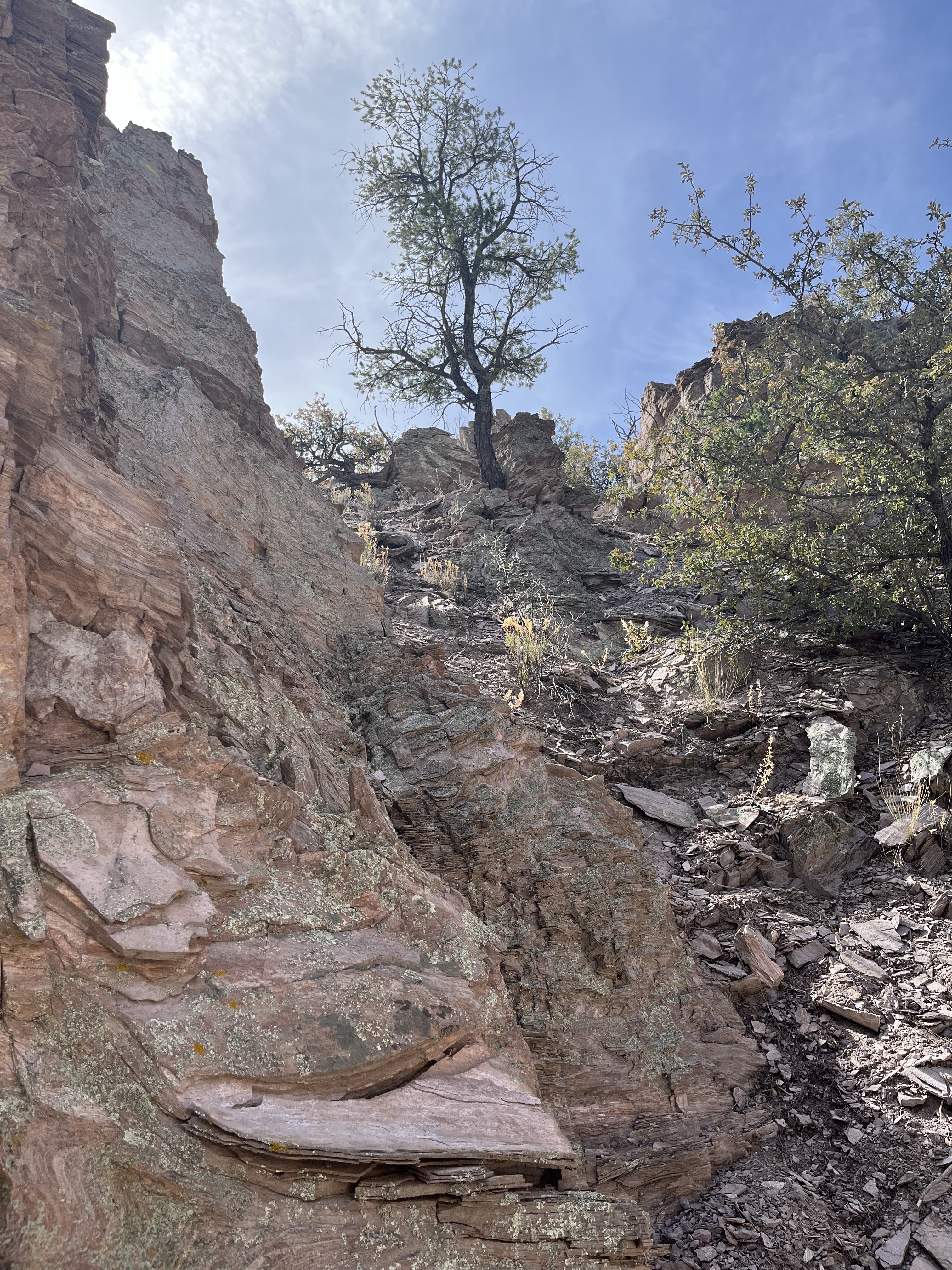
 FR 52 was okay for a mile or two past the cabin but then it got very, very rough and stayed mostly rough most of the way back to NM 107. If one could forget about getting one's bones constantly rattled, one might notice that it's a very scenic little drive with views down in to the rugged Estaline Canyon and beyond to the peaks and canyons on the east side of the Withington Wilderness.

Labels: , , ,

Tuesday, October 29, 2024

Gila National Forest - South Fork Negrito Creek

South Fork Negrito Creek


A place like this, the box canyon of the South Fork Negrito Creek, is the essence of the magic of the Gila. Driving for an hour on FR 141 after leaving  Reserve, up and over mountains, crossing canyons and around many treacherous bends  all through dry (and logged) pine forest monotony to finally descend to a live stream seemed utterly impossible. But there it was, a little sickly and shallow at first, but as it got squeezed between red cliffs hundreds of feet high, it became an unquestionable delight as it rushed over bedrock cascades and pulsed with tiny waterfalls. 

The pines, of much greater stature than on the hills, are still here, but there are also granddaddy Douglas-firs, and  young aspens. A few immense oaks and cottonwoods. Grapevines with grapes (!) wove themselves into the rocks. I hadn't seen wild grapes in so many years at first I didn't know what I was looking at. Streamside willows brightened the picture in places and in the one intervening meadow, waist high grasses and dying wildflowers dominated the scene. It was the first day of October and fullness of summer was just beginning to fade into the beginnings of autumn with many leaves sporting just a touch of gold, while others had completely given over.

 There is no trail, and I had to do quite a bit of scrambling through narrow passages that cut the bedrock. Early on, there were pools with fish. Alas, all of them suckers. Much lower down, though there were many deep and cool pools intervening, there were a few more fish: suckers and one other species, but no trout. It hardly mattered, as fishing just ended up being an excuse to be somewhere with water. And it's the water that makes this place and others like it in the Gila precious to my soul.

 I kept going farther and farther. I would tell myself I was going to turn around, and then go farther downstream still. It was far too warm for October as far as I was concerned, and even though elevation drop wasn't particularly significant, I did turnaround when the summer heat still lingering in the lower canyon sifted into my pores and I came to terms with my fatigue and the realities of time.

 On the way back, a bee (or some other stinging insect) got me on the arm as I crossed over some deadfall branches. The effects were more annoying than painful in the long run. Some days what I really want, more than anything, is more time to just be in the place of my choosing. This was one of those days.

 A note on FR 141. This was once a paved road, but these days there seems to be no will or means to either maintain it as a paved road or convert it completely to a gravel road. So, we end up with paved sections that are about fifty percent potholes, along with gravel sections that are so washboarded steering at any speed is compromised. In the shadows of the morning and then again in the shadows of the afternoon, I did my best to dodge the biggest and deepest of the depressions. I was mostly successful, but when I wasn't  it was  quite disconcerting. About twenty miles in from the Lower San Francisco Plaza it mercifully changes to a decent all gravel affair.


Labels: , , , , , ,

Saturday, June 29, 2024

Gila National Forest - Berrenda Creek, Pierce Canyon area


Looking back toward Berrenda Creek


Volcanic rock with many nodules giving it the look of fossilized limestone.


Sotol forest


Dummy bomb like the ones I've found at Doña Ana County target sites


For some reason I completely spaced out and didn't put this trip on the blog. Well, maybe not for just some reason. Maybe I was subconsciously blocking it out because it wasn't the best of days in the outdoors. 

 I had been trying to figure out a way over into Macho Canyon from Berrenda Creek (while avoiding trespassing on any of the several private inholdings in the area), but let me say before I get too far into this  that the route we started out this day on is definitely not it. We parked  on the left very shortly after entering forest service land. At first we followed a livestock/wildlife trail back along the little side creek headed west. Easy stuff except for low branches and loose soil and gravel. Pretty quickly though the mostly dry creek became a steep-sided gully cut into the whitish-gray (volcanic ash?) bedrock. Then it branched, then it branched again. The side branches were much the same as the main one with only the narrowest of little ridges in between. We would go out of ravine to avoid a small drop-off only to realize the ravine was way safer than the loose gravel and steep slopes above. It  became more than chore, especially given we had to keep lifting our short legged dogs to get them up to the next level of the tight canyon. We weren't making much progress, or having much fun, and we couldn't see where we were going. 

Narrow passage below a waterfall

We got up out of the canyon to look up at a maze of formations in front of us with absolutely no clear cut way to proceed. This whole little boondoggle reminded me once again of folly (sometimes) of letting  satellite images be my guide to unknown places. Google Earth images compress the verticality of any terrain and can't let me see through trees. Elevation changes of less than 25 feet can't really be discerned either and can be mighty inconvenient on the ground when confronted with a 15 foot drop-off in a canyon that's only six feet wide.

 The formations of white and orange were pretty cool though and we took our pictures and began our treacherous descent. I had a back up plan though. We drove a little further down Pierce Canyon, past where we had parked on our last trip out here  to where I had seen an old road following a side canyon.

Cool rock formations.
The kinder, gentler terrain of my back-up plan.

 The walking was pretty easy for little while, but when it started to get steep we retreated. I explored up another road that was barely there that appeared to go to a mining prospect, while my wife and the dogs stayed put in the shade of juniper. High on hill that seemed to be extraordinarily  proficient at growing agave, I realized  the mine tailings were farther away than I expected. I gave up and descended.  In the end the day amounted to a weird outing that was teetering on the edge but luckily didn't fall completely into disaster.

Agave

Labels: , , , ,