Florida Mountains - Bradley Mines and beyond, Florida Mountains WSA


 |
| old juniper |

 |
| Green mineral blebs ( maybe glauconite?) |


 |
| Rear view of mine building with many small windows |


 |
| Bill Birchfield was operator of the mine for awhile |


 |
| Looks like some manganese ore |


 |
| Many dead junipers at lower elevations |


I had intended to visit Victorio Canyon on the north side of Gym Peak. A well forested side canyon coming off the peak flanked by cliffs on two sides intrigued me while looking at Google Earth. Well, that plan didn't come about due to a severe washout on the unmaintained primitive road that is an extension of County Road BO-23 (also known as Gap Road). It must have happened in the month or so since my last trip to the Floridas when it was passable all the way to the Byer's Spring area at least.
Now, there was a "way" being beaten down by vehicles ( most likely OHVs and ORVs) veering off on the west side and crossing the arroyo a bit further upstream. I inspected it, but in the end left it for another day. I might have made it okay, but it had been a late start and I just felt like getting started walking and not messing around with more "adventure" driving. So I backtracked a little ways, parked, and started walking up the old road to the Bradley Mines, a location I've had way on the back-burner for many years.
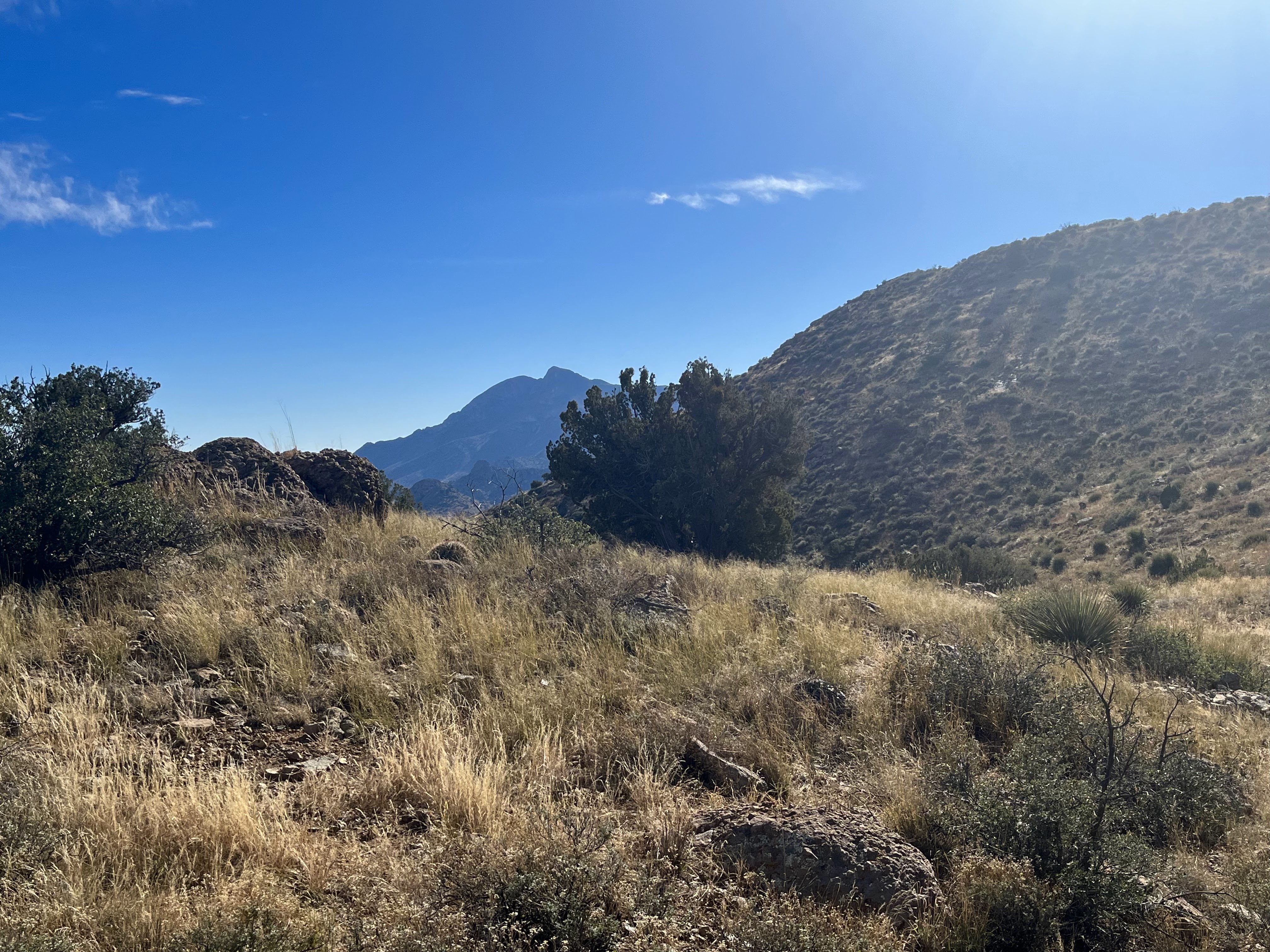
The building ruins come into view in less than 3/4 of a mile. Further on, after crossing the arroyo and climbing a small hill are trenches, tailings and collapsed head-frames. I headed past and up in between two rocky defiles, making a saddle on the ridge above my first destination. It was slow cross- country walking in the tall grasses, ankle-high rocks and prickly brush. And of course there was the semi- treacherous winding in and out of a side ravines which seems nearly to be the rule in rugged country like this. It's never a straight shot anywhere I go.


At the top I looked directly over the Lobo Draw canyons, Gym and Baldy Peaks in the distance and the formations on the highest ridge of the Floridas, more closely at hand. I then decided to meander over to the north and come down a different canyon. Along the way, just to get my heart rate up, I accidentally flushed a large owl ( I couldn't tell exactly which kind, only seeing its back) from its hiding spot in the rocks. I've done this many times, but it never gets old ( or less startling), especially when it has been a few years since the last close encounter.

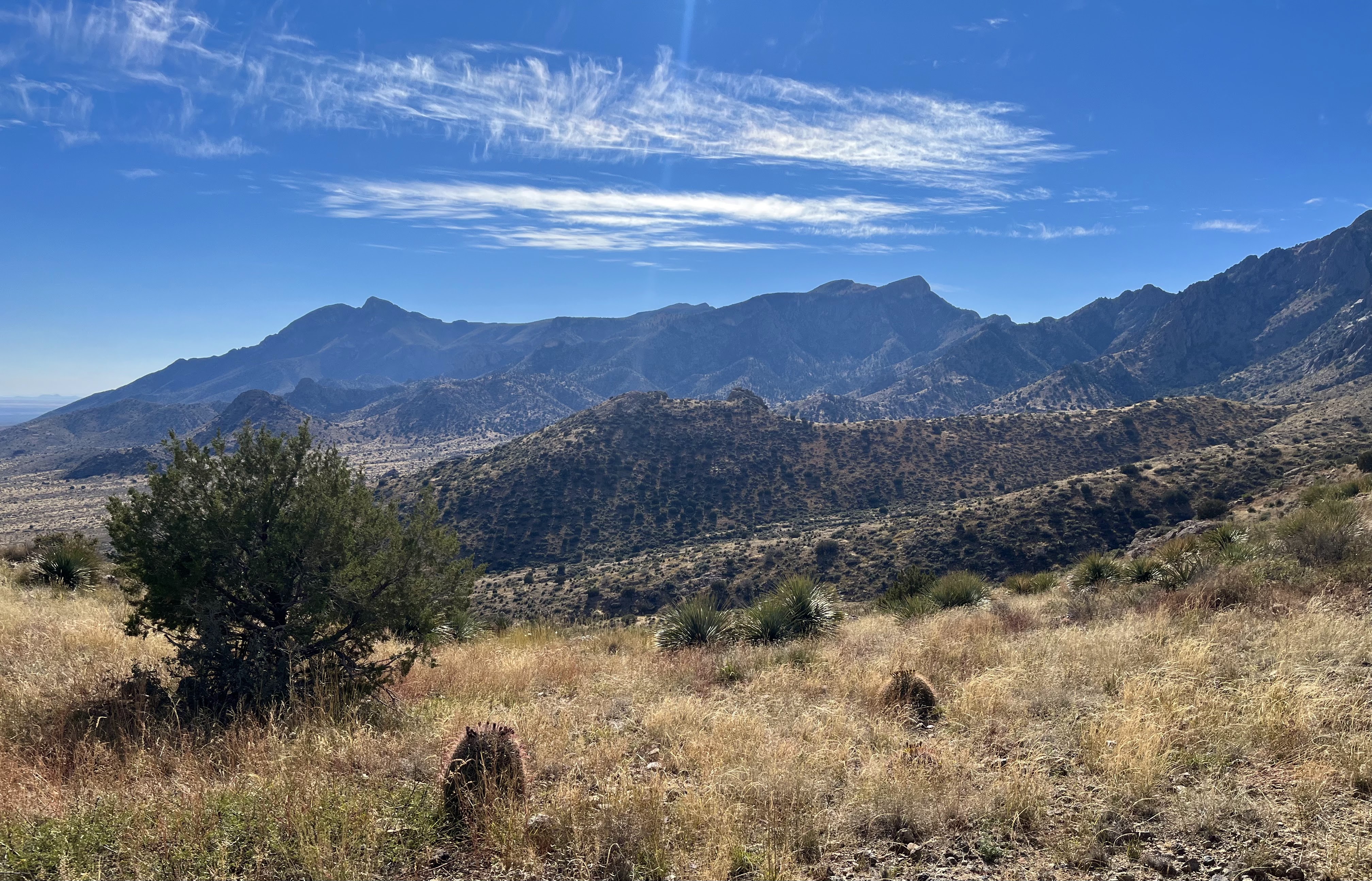

I reached a second saddle, where I could hear rocks tumbling to my left and high above me. I could also hear an annoyed "meh" sound sent out for my benefit. I looked and looked and then finally saw an ibex nimbly ascend a large boulder amidst some scree slopes. There were a few shaggy piñons about as I made the very rough descent to nearly the canyon bottom, before working my around back to the mine area. I found a shaft with a heavy grate of rusty iron pipe across and then the very faint remnants of a road leading downhill.


Back at the mines, I felt compelled to investigate what I had thought was a natural arch on a hillock above them that I had spied when I was on the way up. I was pretty sure this time (this has happened to me several times), but. . . on closer inspection realized I was fooled again.
I was doing well time-wise, so I decided to return via a narrow canyon just to the south that made its way between two large hills. It was a pretty rocky scramble. There were a few soapberry saplings here and there with a touch of fall color and wildflowers to boot, but little else to report.


Crossing over the main wash from the ruins area and coming up the far bank, I heard the tiny rattle of a small, but lively western diamondback who wriggled away at my approach. Soon I was at the fence line that runs along Gap Road and soon after that I was back at the gate and my truck.
The Floridas continue to impress.
posted by Devon Fletcher at
9:23 PM
![]()
![]()


2 Comments:
I continue to enjoy your adventures. How do you get to the departure point off Gap Road? I could probably find your approximate hike with the proper topo. Trying to come up with 10 days worth of hooking using your book and this website as a guide. Thanks, Devon
Take I-10 to the Deming exit on the far east side of town. On the south side, you will head east on NM 549 and then turn to the south on NM 143 toward Rockhound State Park.You will head east briefly and then turn right on NM 198. Stay left where it splits so you will be on a dirt road now, called something like Gap Rd. (it also has a county number). In about 2.5 miles there is the primitive road that ascends Windmill Canyon on the right. Drive another 2 miles to the Bradley Mines Rd. It should be noted that past the last ranch house ( about 1 mile from Windmill Canyon), the road becomes very primitive.
Post a Comment
Subscribe to Post Comments [Atom]
<< Home